Category:Okanogan County, Washington
Jump to navigation
Jump to search
Counties of Washington (state): Adams · Asotin · Benton · Chelan · Clallam · Clark · Columbia · Cowlitz · Douglas · Ferry · Franklin · Garfield · Grant · Grays Harbor · Island · Jefferson · King · Kitsap · Kittitas · Klickitat · Lewis · Lincoln · Mason · Okanogan · Pacific · Pend Oreille · Pierce · San Juan · Skagit · Skamania · Snohomish · Spokane · Stevens · Thurston · Wahkiakum · Walla Walla · Whatcom · Whitman · Yakima
county in the state of Washington, United States   | |||||
| Upload media | |||||
| Instance of | |||||
|---|---|---|---|---|---|
| Named after | |||||
| Location | Washington, Pacific Northwest, Washington, Pacific States Region | ||||
| Capital |
| ||||
| Inception |
| ||||
| Population |
| ||||
| Area |
| ||||
| Different from | |||||
| official website | |||||
 | |||||
Subcategories
This category has the following 46 subcategories, out of 46 total.
A
- Aeneas, Washington (5 F)
- Alta Lake State Park (3 F)
B
C
- Carlton Complex Fire (12 F)
- Conconully State Park (5 F)
- Conconully, Washington (5 F)
- Crawfish Lake (2 F)
E
- Gary Eagle (1 P, 8 F)
F
L
- Lake Pateros (4 F)
- Lone Fir Campground (1 F)
M
- Mazama, Washington (4 F)
- Methow, Washington (8 F)
- Minerals of Washington Pass (9 F)
- Mount Annie Lookout (2 F)
O
P
- Palmer Lake (6 F)
- Patterson Lake (2 F)
R
- Lawney Reyes (1 F)
- Riverside, Washington (7 F)
S
- Slate Peak Lookout (5 F)
T
- Tonasket, Washington (3 F)
- Twisp, Washington (29 F)
W
Media in category "Okanogan County, Washington"
The following 108 files are in this category, out of 108 total.
-

-
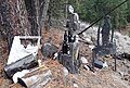
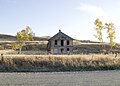 Abandoned House near Chesaw WA.jpg 2,653 × 1,895; 3.16 MB
-
 Aerial Panorama of Wannacut Lane.jpg 3,011 × 1,080; 2.77 MB
-
 Air was less smoky as I started the hill climb up Washington Pass. (36910982301).jpg 2,048 × 1,536; 1.02 MB
-
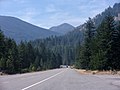
 Along Highway 20 (36881550822).jpg 2,048 × 1,536; 1.49 MB
-
 Antennae Forests near Brewster , Washington (1) (9659650950).jpg 4,608 × 3,456; 5.52 MB
-
 Antennae Forests near Brewster , Washington (2) (9656421353).jpg 4,608 × 3,456; 5.64 MB
-
 Antennae Forests near Brewster , Washington (9656416611).jpg 4,608 × 3,456; 5.57 MB
-

-
 BREWSTER, "The Start", Columbia River - NARA - 298819.tif 3,000 × 2,272; 6.5 MB
-
 Brewster, Washington - Summer 2016.jpg 7,360 × 4,300; 27.47 MB
-
 Building in Havillah WA.jpg 2,782 × 1,987; 3.64 MB
-
 Burnt forest, Tiffany Mtn, Okanogan NF.JPG 4,608 × 3,456; 3.32 MB
-
 Cliffs near Nighthawk WA.jpg 2,419 × 1,728; 3.24 MB
-
 Climbing east side of Washington Pass (36910976101).jpg 2,048 × 1,536; 1,020 KB
-
 Constitutional No Trespassing Sign - Flickr - brewbooks.jpg 2,099 × 1,925; 1.35 MB
-
 Early morning Methow Valley (1649971724).jpg 941 × 534; 36 KB
-
 False Front Building in Chesaw WA.jpg 1,886 × 2,836; 2.55 MB
-
 Farm near Chesaw.jpg 7,290 × 1,999; 2.89 MB
-
 FMIB 34440 Taking Spawning Salmon in Okanogan County.jpeg 854 × 524; 69 KB
-
 Forde Lake Sinlahekin Valley Area - panoramio.jpg 1,280 × 960; 428 KB
-
 Forde Lake Spillway 2010 - panoramio.jpg 1,280 × 960; 425 KB
-
 Going down east side from Washington Pass (1771730264).jpg 1,095 × 728; 125 KB
-
-
-
-
 Highway 20 east of Washington Pass (1649106909).jpg 941 × 534; 35 KB
-

-
 Hotel ives pateros.jpg 474 × 329; 55 KB
-

-
 Liberty Bell (1649107111).jpg 941 × 534; 33 KB
-
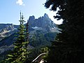 Liberty Bell Mountain (36917833251).jpg 2,048 × 1,536; 1.86 MB
-
 Lingering snow just east of Washington Pass (1771730988).jpg 1,095 × 728; 143 KB
-
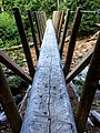 Log Bridge (19800161048).jpg 1,875 × 2,500; 1.79 MB
-

-

-
 Man holding a lecture to people using the bulletin board.jpg 3,504 × 2,336; 421 KB
-
 Many dying trees - on the road to Lyman Lake - Flickr - brewbooks.jpg 4,288 × 2,416; 2.78 MB
-
 McLoughlin Canyon (28606119996).jpg 3,264 × 1,944; 4.65 MB
-
 Me at South Slope Hoodoo Peak - Flickr - brewbooks.jpg 4,128 × 3,096; 6.68 MB
-
 Memorial - on the road to Lyman Lake - Flickr - brewbooks.jpg 3,565 × 2,416; 2.52 MB
-

-

-

-
-
 Methow River Fishing (218124261).jpeg 2,048 × 1,365; 1.49 MB
-
 Methow Valley - Flickr - brewbooks.jpg 4,128 × 3,096; 7.45 MB
-
 Methow Valley SE of Twisp WA.jpg 11,786 × 1,842; 5.98 MB
-
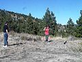
 Michael and Tanya - Outback Trail - Flickr - brewbooks.jpg 3,895 × 2,875; 2.93 MB
-
 Michael hitting a golf ball with coach Pete - Flickr - brewbooks.jpg 4,288 × 3,216; 3.87 MB
-

-
 More scenes from Washington Pass (36662301740).jpg 2,048 × 1,536; 1,009 KB
-
 Nearing Washington Pass (36881541902).jpg 2,048 × 1,536; 1.06 MB
-
 NOAA finalized information for the 2023 Crater Creek Wildfire.jpg 2,064 × 1,522; 840 KB
-
 North Omak aerial view.jpg 768 × 768; 124 KB
-
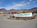 NPLD 2016 at Split Rock (30057179386).jpg 4,608 × 3,456; 6.32 MB
-
 Okanogan Complex Fire - USFS.jpg 5,248 × 2,952; 1.21 MB
-
 Okanogan County, WA, USA - panoramio.jpg 2,560 × 1,920; 2.79 MB
-
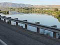
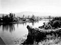
 Okanogan River at Riverside WA.jpg 2,443 × 1,745; 3.03 MB
-
-
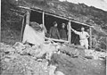
 Old Stagecoach Stop on Twisp-Conconully Route, Okanagon, Washington. - NARA - 299099.jpg 3,000 × 1,746; 1.24 MB
-
-
 One of many sculptures on the grounds of Twisp Works (36655612100).jpg 2,048 × 1,536; 1.42 MB
-
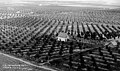 Orchards, Okanogan County, Washington, ca 1928 (WASTATE 1123).jpg 768 × 457; 89 KB
-
 Organic Apples Pateros WA.JPG 3,261 × 1,216; 858 KB
-
 Outcrop near Riverside WA.jpg 2,216 × 1,583; 2.35 MB
-
 Outcropping near Riverside WA.jpg 1,478 × 1,055; 1.12 MB
-
 Pain in the grass sign (37059049485).jpg 2,048 × 1,536; 1.4 MB
-
 Pasture near Chesaw.jpg 3,008 × 2,000; 3.98 MB
-
 Pateros Washington.jpg 1,318 × 595; 147 KB
-
 Pete and Lone Pine - Flickr - brewbooks (1).jpg 4,288 × 2,416; 4.56 MB
-
 Pete and Lone Pine - Flickr - brewbooks.jpg 4,288 × 2,416; 2.98 MB
-
 Pete hitting a golf ball, Michael coaching - Flickr - brewbooks.jpg 4,288 × 2,567; 2.94 MB
-
 Pete, Michael and Tanya on Outback Trail - Flickr - brewbooks.jpg 3,583 × 2,517; 2.56 MB
-
 Photograph of a Cabin in Chesaw WA.jpg 2,774 × 1,844; 3.11 MB
-

-
 Raven Ridge - Flickr - brewbooks (1).jpg 4,128 × 3,096; 6.31 MB
-
 Richard at South Slope Hoodoo Peak - Flickr - brewbooks.jpg 4,128 × 3,096; 6.07 MB
-
 Richard exploring for plants - Flickr - brewbooks.jpg 3,921 × 3,096; 6.01 MB
-
 Richard taking a break - Flickr - brewbooks.jpg 4,128 × 3,096; 6.53 MB
-

-
 Riverside, Washington city hall.jpg 1,024 × 768; 203 KB
-
 Road to Wauconda Pass east of Omak, WA. (1701631471).jpg 1,074 × 701; 91 KB
-

-
 Side of a False Front Building in Chesaw WA.jpg 2,763 × 1,970; 3.19 MB
-
 Silver Star Mtn from Slate Pass.JPG 4,608 × 3,456; 3.44 MB
-
 Similkameen River near Nighthawk WA.jpg 5,043 × 1,727; 7.02 MB
-

-

-
 Some of the artistic buildings on the campus of Twisp Works (36655651380).jpg 2,048 × 1,536; 999 KB
-

-
 Southwest from Hoodoo - Flickr - brewbooks.jpg 4,128 × 3,096; 5.12 MB
-

-
 Traverse route - Flickr - brewbooks.jpg 4,128 × 3,096; 6.22 MB
-

-
 USA Okanogan County, Washington age pyramid.svg 520 × 600; 7 KB
-
 View from Loomis WA.jpg 2,504 × 1,789; 2.88 MB
-
 View from Upper Echo Ridge - Flickr - brewbooks.jpg 4,288 × 2,416; 4.02 MB
-
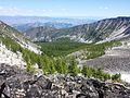
 Views east from Tiffany Mountain, WA.JPG 2,836 × 756; 420 KB
-
 Views north from Tiffany Mountain, WA.JPG 2,700 × 716; 393 KB
-
 Washington Pass (36224365924).jpg 2,048 × 1,536; 1.52 MB
-
 Washington Pass (36917824031).jpg 2,048 × 1,536; 1.34 MB
-
 Washington Pass (37059067685).jpg 2,048 × 1,536; 1.53 MB
-
 Whitebark pine, Okanogan NF.JPG 3,456 × 4,608; 4.55 MB
-
 Winding mountain road (Unsplash).jpg 2,749 × 3,436; 3.64 MB
-
 Winthrop, WA. (36224362184).jpg 2,048 × 1,536; 1.45 MB
-
-

.jpg)

.jpg)
.jpg)
_(9659650950).jpg)
_(9656421353).jpg)
.jpg)
_track_at_the_Hidden_Lakes_of_the_Pasayten_Wilderness..jpg)


.jpg)

.jpg)


.jpg)
.jpg)
.jpg)
.jpg)
.jpg)
.jpg)

.jpg)
.jpg)
.jpg)
.jpg)
.jpg)
.jpg)
.jpg)


.jpg)


.jpg)
.jpg)
.jpg)
.jpg)
.jpeg)


.jpg)
.jpg)
.jpg)


.jpg)


.jpg)

.jpg)
.jpg)


.jpg)


.jpg)


.jpg)
.jpg)


.jpeg)

.jpg)
.jpeg)


.jpg)
.jpg)
.jpg)

.jpeg)

.jpg)


.jpg)
.jpg)
.jpg)

.jpg)
.jpg)
.jpg)

.jpg)