Category:Chermside, Queensland
suburb of Brisbane, Queensland, Australia  | |||||
| Upload media | |||||
| Instance of | |||||
|---|---|---|---|---|---|
| Named after | |||||
| Location |
| ||||
| Population |
| ||||
 | |||||
Chermside is a suburb in the City of Brisbane, Queensland, Australia. In the 2016 census Chermside had a population of 9,315 people. The suburb is situated 9.8 kilometres (6.1 mi) by road north of the Brisbane CBD.
Chermside is the Country of the Turrbal people since time immemorial. The Chermside area was first settled by Europeans in the late 19th century. The first plot of land was sold on 23 May 1866, and the population has progressively increased since with a significant increase with the post-war residential development.
When the Gympie goldrush started in 1867, many travellers heading north would run into trouble at a creek in present-day Chermside. Because of this waterway, Chermside was first known as Downfall Creek.
Subcategories
This category has the following 21 subcategories, out of 21 total.
7
A
B
C
- Carousels and Cupcakes Cafe (11 F)
- Chermside bus stops (168 F)
- Chermside Hills Reserve (16 F)
- Chermside Police Station (1 F)
F
H
- Houses in Chermside, Queensland (32 F)
M
- Milne Bay Research Centre (1 F)
P
- People in Chermside (32 F)
W
Media in category "Chermside, Queensland"
The following 68 files are in this category, out of 68 total.
-
 After the rain in Chermside Hills (6946021878).jpg 1,000 × 750; 406 KB
-
 Back yards Gympie Rd Chermside P1290208.jpg 4,000 × 3,000; 7.37 MB
-
 Brisbane North Eye Centre, (old Dawn Theatre) Gympie Rd Chermside DSCF0465.jpg 3,264 × 2,448; 2.89 MB
-
 Chermside Kedron Community Church, 2007.jpg 3,264 × 2,448; 6.46 MB
-
 Chermside SC aisle.jpg 1,600 × 1,200; 492 KB
-
 Dawn Theatre curtain Gympie Rd Chermside P1020200.jpg 3,000 × 4,000; 8.72 MB
-
 Gelignite Jack on his scooter Hamilton Rd Chermside L1000843.jpg 4,112 × 3,088; 10.17 MB
-
 Gelignite Jack on his scooter Hamilton Rd Chermside L1010162.jpg 4,112 × 3,088; 10.86 MB
-
 Gelignite Jack on his scooter Hamilton Rd Chermside L1010163.jpg 4,112 × 3,088; 10.58 MB
-
 Gelignite Jack on his scooter Hamilton Rd Chermside L1010165.jpg 4,112 × 3,088; 10.25 MB
-
 Gelignite Jack on his scooter Hamilton Rd Chermside L1010166.jpg 4,112 × 3,088; 8.99 MB
-
 Gelignite Jack on his scooter Hamilton Rd Chermside L1010167.jpg 4,112 × 3,088; 9.35 MB
-
 Gelignite Jack on his scooter Hamilton Rd Chermside L1010168.jpg 4,112 × 3,088; 9.05 MB
-
 Gelignite Jack on his scooter Hamilton Rd Chermside L1010169.jpg 4,112 × 3,088; 8.93 MB
-
 Gelignite Jack on his scooter Hamilton Rd Chermside L1010170.jpg 4,112 × 3,088; 8.86 MB
-
 Gelignite Jack on his scooter Hamilton Rd Chermside L1010171.jpg 4,112 × 3,088; 8.52 MB
-
 Gelignite Jack on his scooter Hamilton Rd Chermside L1010172.jpg 4,112 × 3,088; 8.45 MB
-

-

-

-

-

-

-

-

-

-
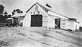
 Queensland State Archives 1545 House at View Street Chermside c 1950.png 720 × 288; 147 KB
-

-

-

-

-

-

-
 StateLibQld 1 107300 General view of artillery camp at Chermside, 1916.jpg 1,000 × 632; 106 KB
-
 StateLibQld 1 108232 Military training camp, Chermside, 1916.jpg 1,000 × 636; 92 KB
-

-
 StateLibQld 1 120708 Suburb of Chermside, 1916.jpg 1,000 × 630; 120 KB
-

-
 StateLibQld 1 273355 Artillery in action, Chermside, 1916.jpg 1,000 × 646; 85 KB
-

-
 StateLibQld 1 294659 Horse and trainer, Chermside, ca. 1930.jpg 1,000 × 570; 64 KB
-
 StateLibQld 1 294663 Traction engine at Chermside, ca. 1930.jpg 1,000 × 580; 74 KB
-
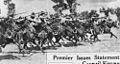
 StateLibQld 1 294671 Sheep mustering at Chermside, ca. 1931.jpg 1,000 × 589; 79 KB
-
 StateLibQld 1 294675 Pigs in the paddock at Chermside, ca. 1930.jpg 1,000 × 586; 97 KB
-
-
 StateLibQld 1 294687 Welcoming the first tram to Chermside, 1947.jpg 1,000 × 574; 46 KB
-

-

-

-

-
 StateLibQld 1 295787 Gympie Road Chermside, 1947.jpg 1,000 × 508; 96 KB
-

-

-

-
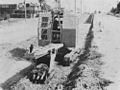
 StateLibQld 2 202471 Dual carriage road at Chermside, 1950.jpg 1,000 × 754; 74 KB
-

-

-

-

-
-
 StateLibQld 2 296655 Chermside Army Camp during WWI, 1914.jpg 1,000 × 617; 145 KB
-

-
 StateLibQld 2 296663 Morning parade at the Chermside Army Camp, 1916.jpg 1,000 × 614; 105 KB
-
 StateLibQld 2 296667 YMCA amenities hut at Chermside Army Camp, 1916.jpg 1,000 × 622; 119 KB
-

-
-
 Supercheap Auto Store.jpg 1,551 × 813; 134 KB
-
 Winter morning Newman Rd Chermside P1000679.jpg 4,000 × 3,000; 8.72 MB
.jpg)

_Gympie_Rd_Chermside_DSCF0465.jpg)


