Category:Chinley, Buxworth and Brownside
Jump to navigation
Jump to search
English: Chinley, Buxworth and Brownside is a civil parish in the High Peak, England. It lies between Whaley Bridge and Chapel-en-le-Frith, and is about eighteen miles southeast of Manchester. It contains the villages of Chinley and Buxworth, and rises up the summit of Brown Knoll.
civil parish in High Peak, Derbyshire, England | |||||
| Upload media | |||||
| Instance of | |||||
|---|---|---|---|---|---|
| Location | High Peak, Derbyshire, East Midlands, England | ||||
 | |||||
Subcategories
This category has the following 7 subcategories, out of 7 total.
Media in category "Chinley, Buxworth and Brownside"
The following 200 files are in this category, out of 297 total.
(previous page) (next page)-
 A bench with a view - and a poem - geograph.org.uk - 5520547.jpg 800 × 600; 151 KB
-
 A bit of a makeshift job. - geograph.org.uk - 2254743.jpg 1,969 × 1,312; 1.82 MB
-
 A new house in the woods - geograph.org.uk - 4265083.jpg 640 × 430; 80 KB
-
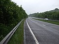
 A6 Bypass - geograph.org.uk - 2966089.jpg 640 × 480; 82 KB
-
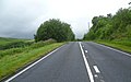
 A6 heading east - geograph.org.uk - 3995102.jpg 640 × 480; 72 KB
-
 A6 towards Buxton - geograph.org.uk - 3995104.jpg 640 × 480; 70 KB
-
 A624 and lay-by at Chinley Head - geograph.org.uk - 3362464.jpg 4,320 × 3,240; 4.82 MB
-
 A624 at Chapel Milton village boundary - geograph.org.uk - 6305150.jpg 1,024 × 768; 192 KB
-
 A624 at Chinley Head - geograph.org.uk - 2509608.jpg 3,939 × 2,454; 2.92 MB
-
 A624 Hayfield Road - geograph.org.uk - 2509603.jpg 3,984 × 2,730; 3.64 MB
-
 A624 Hayfield Road at Bole Hill - geograph.org.uk - 1479804.jpg 640 × 480; 62 KB
-
 A624 Hayfield Road at New Smithy - geograph.org.uk - 6305153.jpg 1,024 × 767; 142 KB
-
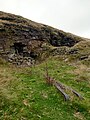
 Abandoned stone quarries on Cracken Edge - geograph.org.uk - 5515233.jpg 800 × 600; 100 KB
-
-
 Abandoned stone quarry on Cracken Edge - geograph.org.uk - 5515238.jpg 800 × 555; 157 KB
-
 Abandoned stone quarry on Cracken Edge - geograph.org.uk - 5520575.jpg 800 × 600; 159 KB
-
 Abandoned winding gear on Chinley Churn - geograph.org.uk - 5562663.jpg 800 × 600; 178 KB
-
 Above the A6 - geograph.org.uk - 3125598.jpg 800 × 600; 108 KB
-
 Above The Roych in the High Peaks - geograph.org.uk - 5251102.jpg 640 × 640; 60 KB
-
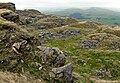
 Access Moorland near The Chinley Churn - geograph.org.uk - 2800764.jpg 3,296 × 2,472; 1.08 MB
-
 Ancoats - geograph.org.uk - 4202377.jpg 1,600 × 1,067; 307 KB
-
 Approaching White Knowl Farm - geograph.org.uk - 3703943.jpg 5,184 × 3,888; 6.3 MB
-
 At Higher Ashen Clough - geograph.org.uk - 3703916.jpg 5,017 × 3,763; 4.6 MB
-
 At Shireoaks Farm - geograph.org.uk - 3703846.jpg 5,184 × 3,888; 5.66 MB
-
 Autumnal Sunshine at Green Head - geograph.org.uk - 3134928.jpg 4,000 × 3,000; 3.95 MB
-
 Barn conversion at Hull End Farm - geograph.org.uk - 5051421.jpg 1,024 × 768; 221 KB
-
 Beet Farm - geograph.org.uk - 5051343.jpg 1,024 × 768; 280 KB
-
 Beet Farm - Stone Inscription - geograph.org.uk - 340966.jpg 640 × 480; 101 KB
-
 Beet Lane at Beet Farm - geograph.org.uk - 4061314.jpg 800 × 600; 187 KB
-
 Beet Lane meets the Pennine Bridleway - geograph.org.uk - 4061318.jpg 800 × 600; 123 KB
-
 Big Stone, a gritstone outcrop on Cracken Edge - geograph.org.uk - 4202342.jpg 1,600 × 1,067; 261 KB
-
 Black Lane Head Farm on Charley Lane - geograph.org.uk - 6100735.jpg 1,600 × 1,065; 530 KB
-

-
 Breckend - geograph.org.uk - 3168228.jpg 640 × 480; 473 KB
-
 Breckend - geograph.org.uk - 3520050.jpg 3,998 × 2,244; 5.38 MB
-
-
 Bridleway to New Allotments - geograph.org.uk - 1066806.jpg 640 × 480; 109 KB
-
 Brierley Green Farmhouse 01.jpg 4,000 × 3,000; 6.23 MB
-
 Brierley Green Farmhouse 02.jpg 4,000 × 3,000; 6.4 MB
-

-
 Brierleyfields at Chinley Head - geograph.org.uk - 3703921.jpg 3,732 × 4,976; 5.6 MB
-
 Brookside Bridge over the A6 - geograph.org.uk - 3995098.jpg 640 × 480; 74 KB
-
 Cairn at quarry near Chinley Churn - geograph.org.uk - 5051274.jpg 1,024 × 768; 169 KB
-
 Cast iron wheel - geograph.org.uk - 4968410.jpg 3,648 × 2,736; 3.25 MB
-
 Cattle grazing near Dewsnaps - geograph.org.uk - 2490474.jpg 3,648 × 2,736; 5.44 MB
-
 Chinley Churn - geograph.org.uk - 3303561.jpg 1,600 × 1,200; 830 KB
-
 Chinley Churn - geograph.org.uk - 4029058.jpg 1,280 × 919; 146 KB
-
 Chinley Churn - geograph.org.uk - 4968317.jpg 3,648 × 2,736; 3.33 MB
-
 Chinley Churn landscape - geograph.org.uk - 5257369.jpg 4,362 × 2,557; 2.17 MB
-
 Chinley Moor from Lyme Park - geograph.org.uk - 4651011.jpg 4,558 × 2,669; 2.82 MB
-
 Clappersgate - geograph.org.uk - 3703922.jpg 5,085 × 3,632; 5.18 MB
-
 Coming down from Peep-o'Day - geograph.org.uk - 2333004.jpg 2,272 × 1,704; 755 KB
-
 Cotebank Farm - geograph.org.uk - 4202203.jpg 1,600 × 1,067; 526 KB
-
 Cotebank from the northeast - geograph.org.uk - 4202237.jpg 1,600 × 1,067; 417 KB
-
 Cottage on a steep lane, south of Peep-O-Day - geograph.org.uk - 2491857.jpg 3,648 × 2,736; 5.8 MB
-
-
 Cow and calf on a green lane - geograph.org.uk - 2490487.jpg 3,648 × 2,736; 4.83 MB
-
 Cracken Edge - geograph.org.uk - 2937119.jpg 640 × 480; 70 KB
-
 Cracken Edge - geograph.org.uk - 3690725.jpg 3,648 × 2,736; 1.18 MB
-
 Cracken Edge - geograph.org.uk - 4202330.jpg 1,600 × 1,067; 336 KB
-
 Cracken Edge - geograph.org.uk - 4498017.jpg 3,648 × 2,736; 5.1 MB
-
 Cracken Edge beckons - geograph.org.uk - 5051265.jpg 1,024 × 768; 242 KB
-
 Cracken Edge Quarry - geograph.org.uk - 4033860.jpg 2,736 × 3,648; 5 MB
-
 Cracken Edge to Kinder - geograph.org.uk - 2936695.jpg 640 × 480; 54 KB
-
 Crags north of Cracken Edge, Chinley Churn - geograph.org.uk - 2730970.jpg 1,024 × 768; 168 KB
-
 Cross Keys Row - geograph.org.uk - 5007274.jpg 6,400 × 4,267; 6.25 MB
-
 Dimpus Clough - geograph.org.uk - 3703902.jpg 5,002 × 3,752; 4.54 MB
-
 Dolly Lane - geograph.org.uk - 5538705.jpg 4,896 × 3,672; 7 MB
-
 Dolly Lane - geograph.org.uk - 5538707.jpg 4,896 × 3,672; 6.66 MB
-
 Down the lane from Beet Farm - geograph.org.uk - 4051176.jpg 4,000 × 2,248; 2.32 MB
-
 Downhill in Chapel Milton - geograph.org.uk - 5007290.jpg 5,100 × 3,400; 7.8 MB
-
 Dry stone wall - geograph.org.uk - 5538721.jpg 4,896 × 3,672; 6.87 MB
-
 Eastbound A6 - geograph.org.uk - 4202390.jpg 1,600 × 1,067; 321 KB
-
 Edge of the Pennines - geograph.org.uk - 3703954.jpg 5,184 × 3,888; 6.17 MB
-
 Entrance to White Knowle Farm - geograph.org.uk - 5051425.jpg 1,024 × 768; 270 KB
-
 Farm track below White Knowl Farm - geograph.org.uk - 4849840.jpg 6,000 × 4,000; 3.9 MB
-
 Farmhouse and barn - geograph.org.uk - 2490498.jpg 3,648 × 2,736; 5.31 MB
-
 Farmland and pylon near Dolly Lane - geograph.org.uk - 3345615.jpg 800 × 519; 60 KB
-
 Farmland near Roych Farm - geograph.org.uk - 3345594.jpg 640 × 521; 54 KB
-
 Farmland with stone walls, Breck End - geograph.org.uk - 3345596.jpg 640 × 471; 48 KB
-
 Field below White Knowl Farm - geograph.org.uk - 4849833.jpg 6,000 × 4,000; 4.8 MB
-
 Field Boundary Wall - geograph.org.uk - 2937046.jpg 640 × 480; 66 KB
-
 Field on top of the Naze - geograph.org.uk - 2937437.jpg 640 × 480; 65 KB
-
 Fields above Buxworth - geograph.org.uk - 4846179.jpg 6,000 × 4,000; 5.59 MB
-
 Fields above Chinley - geograph.org.uk - 4847233.jpg 6,000 × 4,000; 4.61 MB
-
 Fields above White Knowl Farm - geograph.org.uk - 4849847.jpg 6,000 × 4,000; 4.58 MB
-
 Fingerpost for Beet Lane on South Head - geograph.org.uk - 5051332.jpg 1,024 × 768; 159 KB
-
 Footbridge over A6 - geograph.org.uk - 4202386.jpg 1,600 × 1,067; 360 KB
-
 Footbridge over Black Brook - geograph.org.uk - 4202164.jpg 1,600 × 1,067; 595 KB
-
 Footbridge over Blackbrook near Buxworth - geograph.org.uk - 4887986.jpg 1,024 × 768; 346 KB
-
 Footpath above Brierley Green - geograph.org.uk - 4847214.jpg 6,000 × 4,000; 4.6 MB
-
 Footpath above Cotebank - geograph.org.uk - 4202268.jpg 1,600 × 1,067; 423 KB
-
 Footpath from Oven Hill Road - geograph.org.uk - 4202277.jpg 1,600 × 1,067; 313 KB
-
 Footpath in Brierley Green - geograph.org.uk - 4202174.jpg 1,600 × 1,067; 553 KB
-
 Footpath in the middle of the A6 - geograph.org.uk - 3125603.jpg 800 × 600; 131 KB
-
 Footpath sign at Dimpus Clough - geograph.org.uk - 4061327.jpg 800 × 600; 83 KB
-
 Footpath to Cracken Edge - geograph.org.uk - 4202325.jpg 1,600 × 1,067; 385 KB
-
 Footpath, Fields and Dry Stone Walls - geograph.org.uk - 2975772.jpg 3,296 × 2,472; 1.09 MB
-
 Forge Mill - geograph.org.uk - 4456187.jpg 2,538 × 4,208; 1.49 MB
-
 Former telephone kiosk on Green Lane, Chinley - geograph.org.uk - 6099430.jpg 1,065 × 1,600; 421 KB
-
 Former telephone kiosk, Wash - geograph.org.uk - 6103003.jpg 1,600 × 1,065; 898 KB
-
 Former Victorian postbox - geograph.org.uk - 6100700.jpg 1,065 × 1,600; 786 KB
-
 From one viaduct to another - geograph.org.uk - 5007297.jpg 6,400 × 4,267; 6.64 MB
-
 Garden glory at Alder Brook - geograph.org.uk - 5051439.jpg 1,024 × 768; 270 KB
-
 Gate across footpath - geograph.org.uk - 4968361.jpg 3,648 × 2,736; 3.89 MB
-
 Georgian post box, Breckend - geograph.org.uk - 6102981.jpg 1,065 × 1,600; 902 KB
-
 Georgian post box, Breckend - geograph.org.uk - 6102983.jpg 1,600 × 1,065; 492 KB
-
 Gnarled remains of a Pennine hawthorn tree - geograph.org.uk - 3703861.jpg 3,702 × 5,182; 4.88 MB
-
 Graveyard near Chapel Milton - geograph.org.uk - 6100898.jpg 1,600 × 1,065; 741 KB
-
 Grazing land on Chinley Head - geograph.org.uk - 1479799.jpg 640 × 480; 55 KB
-
 Green Head - geograph.org.uk - 5538723.jpg 4,896 × 3,672; 7.11 MB
-
 Gully - geograph.org.uk - 5538715.jpg 4,896 × 3,672; 6.68 MB
-
 Hairpin bend - geograph.org.uk - 1066813.jpg 640 × 480; 59 KB
-
 Hawthorn trees north east of New Hall Farm - geograph.org.uk - 3703868.jpg 5,125 × 3,661; 5.27 MB
-
 Hayfield Road at Greenacre Farm - geograph.org.uk - 2509599.jpg 3,934 × 2,334; 3.03 MB
-
 Hayfield Road near Chapel Milton - geograph.org.uk - 6100739.jpg 1,600 × 1,065; 461 KB
-
 Head of track on to moors from Beet Farm - geograph.org.uk - 4051185.jpg 4,000 × 2,248; 5.24 MB
-
 Heading towards Furness Vale - geograph.org.uk - 6254103.jpg 768 × 1,024; 239 KB
-
 Hidden bridge - geograph.org.uk - 4051166.jpg 4,000 × 2,248; 5.64 MB
-
 High level sheep - geograph.org.uk - 2289604.jpg 2,430 × 1,824; 744 KB
-
 High Nightam.jpg 4,000 × 3,000; 1.06 MB
-
 High Peak council offices - geograph.org.uk - 2850373.jpg 3,872 × 2,592; 4.39 MB
-
 High Peak moorland - geograph.org.uk - 4061338.jpg 600 × 800; 139 KB
-
 Hills Farm - geograph.org.uk - 4456114.jpg 4,976 × 3,317; 1.91 MB
-

-
 Hollins Wood Cottages, Brierley Green.jpg 4,000 × 3,000; 6.35 MB
-
 House at Breckend - geograph.org.uk - 6102984.jpg 1,600 × 1,065; 560 KB
-
 House on Hayfield Rd - geograph.org.uk - 4265095.jpg 640 × 430; 49 KB
-
 Houses, Brierley Park - geograph.org.uk - 3345607.jpg 800 × 507; 85 KB
-
 Hull End farm with Mount Famine in distance - geograph.org.uk - 4051175.jpg 4,000 × 2,248; 5.81 MB
-
 Lamppost detail - geograph.org.uk - 5543125.jpg 3,672 × 4,896; 5.36 MB
-
 Lane to open country above Beet Farm - geograph.org.uk - 4051178.jpg 4,000 × 2,248; 1.94 MB
-
 Laneside Farmhouse - geograph.org.uk - 4202375.jpg 1,067 × 1,600; 376 KB
-
 Laneside Farmhouse.jpg 4,000 × 3,000; 4.96 MB
-
 Llama, sheep and chickens - geograph.org.uk - 2289624.jpg 3,648 × 2,736; 5.13 MB
-
 Looking down to Andrews Farm - geograph.org.uk - 2491740.jpg 3,648 × 2,736; 5.45 MB
-
 Looking over Furness Vale - geograph.org.uk - 5538635.jpg 4,896 × 3,672; 7.08 MB
-
 Looking over Furness Vale - geograph.org.uk - 5538637.jpg 4,896 × 3,672; 6.78 MB
-
 Looking over Otter Brook Valley - geograph.org.uk - 5515229.jpg 800 × 372; 74 KB
-
 Looking over Otter Brook Valley - geograph.org.uk - 5515252.jpg 800 × 600; 180 KB
-
 Low cloud over Kinder - geograph.org.uk - 3531390.jpg 4,608 × 3,072; 6.51 MB
-
 Malcoff Farmhouse 01.jpg 4,000 × 3,000; 4.85 MB
-
 Malcoff Farmhouse 02.jpg 4,000 × 3,000; 4.71 MB
-
 Marker post for the Peak Forest Tramway Trail - geograph.org.uk - 4887995.jpg 1,024 × 768; 347 KB
-
 Meadow below Alders Farm - geograph.org.uk - 4051161.jpg 4,000 × 2,248; 6.83 MB
-
 Mill Pond at Bridgeholm Green - geograph.org.uk - 2613792.jpg 3,296 × 2,472; 1.09 MB
-
 Millpond at Bridgeholm Green - geograph.org.uk - 3524901.jpg 800 × 450; 105 KB
-
 Minor Clough viewed from the Pennine Bridleway - geograph.org.uk - 2975779.jpg 3,144 × 2,254; 1.06 MB
-
 Minor road at Breckend, Wash - geograph.org.uk - 6102875.jpg 1,600 × 1,065; 659 KB
-
 Minor road at Breckend, Wash - geograph.org.uk - 6102928.jpg 1,600 × 1,121; 615 KB
-
 Minor road near Breckend, Wash - geograph.org.uk - 6102823.jpg 1,600 × 1,065; 790 KB
-
 Minor road near Breckend, Wash - geograph.org.uk - 6102849.jpg 1,600 × 1,065; 1,005 KB
-
 Minor road to Wash - geograph.org.uk - 6102986.jpg 1,600 × 1,065; 920 KB
-
 Minor Road, Wash - geograph.org.uk - 6102992.jpg 1,600 × 1,065; 981 KB
-
 Moorland path with rook taking off - geograph.org.uk - 2289560.jpg 3,648 × 2,736; 4.32 MB
-
 More cars than houses in Wash? - geograph.org.uk - 3520042.jpg 4,000 × 2,248; 5.18 MB
-
 Moseley House from the Naze - geograph.org.uk - 2937468.jpg 640 × 480; 78 KB
-
 Near a minor road by Cloughhead - geograph.org.uk - 2289600.jpg 3,648 × 2,736; 5.13 MB
-
 New House Farm - geograph.org.uk - 4456208.jpg 5,184 × 3,456; 1.96 MB
-
 New House Farm and Chapel-en-le-Frith - geograph.org.uk - 2491831.jpg 3,648 × 2,736; 5.48 MB
-
 North of The Roych - the old sheepfold - geograph.org.uk - 4440209.jpg 4,979 × 3,716; 5.32 MB
-
 Northeast from the Naze - geograph.org.uk - 2937451.jpg 640 × 480; 76 KB
-
 Old barn at Hill Farm (detail) - geograph.org.uk - 4202358.jpg 1,067 × 1,600; 430 KB
-
 Old barn at Hill Farm - geograph.org.uk - 4202366.jpg 3,456 × 2,304; 3.2 MB
-
 Old Mill at Bridgeholme Green - geograph.org.uk - 3520072.jpg 3,960 × 2,172; 5.88 MB
-
 Old sheepfold north of The Roych - geograph.org.uk - 4440199.jpg 3,888 × 5,184; 6.02 MB
-
 Old wall on The Roych - geograph.org.uk - 3703885.jpg 5,184 × 3,888; 5.73 MB
-
 On Over Hill Road - geograph.org.uk - 6254100.jpg 768 × 1,024; 155 KB
-
 On the Pennine Bridleway - geograph.org.uk - 3703888.jpg 4,858 × 3,886; 5.07 MB
-
 Outside curve - geograph.org.uk - 5007296.jpg 6,480 × 4,320; 6.87 MB
-
 Oven Hill Road - geograph.org.uk - 4202293.jpg 1,600 × 1,067; 434 KB
-
 Over Hill Road - geograph.org.uk - 4456196.jpg 4,525 × 3,456; 1.71 MB
-
 Over Hill Road - geograph.org.uk - 4498149.jpg 3,648 × 2,736; 6.18 MB
-
 Overhill Road - geograph.org.uk - 4447929.jpg 4,562 × 2,232; 1.61 MB
-
 Parish notice board - geograph.org.uk - 5539610.jpg 4,896 × 3,672; 6.82 MB
-
 Path above Buxworth - geograph.org.uk - 4846217.jpg 6,000 × 4,000; 4.75 MB
-
 Path across the A6 - geograph.org.uk - 4847193.jpg 6,000 × 4,000; 5.1 MB
-
 Path below White Knowl Farm - geograph.org.uk - 4849843.jpg 6,000 × 4,000; 4.51 MB
-
 Path down The Naze - geograph.org.uk - 4849814.jpg 6,000 × 4,000; 4.38 MB
-
 Path of the stream - geograph.org.uk - 5538719.jpg 4,896 × 3,672; 6.77 MB
-
 Path to Breckend - geograph.org.uk - 3703958.jpg 3,888 × 5,184; 6.27 MB
-
 Path towards Buxworth - geograph.org.uk - 4847254.jpg 6,000 × 4,000; 4.45 MB
-
 Path towards Chinley Churn - geograph.org.uk - 4847240.jpg 6,000 × 4,000; 4.52 MB
-
 Peaceful scene at Bugsworth Basin - geograph.org.uk - 4888058.jpg 1,024 × 768; 174 KB
-

-

-

-

-
 Peak Forest Canal - geograph.org.uk - 4027287.jpg 1,600 × 1,064; 489 KB
-
 Peak Forest Canal, Canal Side Cottages - geograph.org.uk - 1817265.jpg 2,816 × 2,112; 1.72 MB
-
 Peep o Day - geograph.org.uk - 340960.jpg 640 × 480; 100 KB
-
 Pennine Bridleway - geograph.org.uk - 3531396.jpg 4,608 × 3,072; 4.14 MB
-
 Pennine Bridleway - geograph.org.uk - 4051194.jpg 4,000 × 2,248; 4.48 MB
-
 Pennine hawthorn tree - geograph.org.uk - 3703851.jpg 5,050 × 3,788; 4.85 MB
-
 Pennine hawthorn tree with view to Whitemoor - geograph.org.uk - 3703857.jpg 5,182 × 3,702; 5.02 MB
-
 Pointing the way to Peep O'Day - geograph.org.uk - 4061306.jpg 600 × 800; 132 KB
-
 Ponies on Over Hill Road - geograph.org.uk - 5517699.jpg 800 × 600; 148 KB
-
 Post box in Maynestone Road - geograph.org.uk - 4593112.jpg 640 × 480; 104 KB
-
 Public footpath near Wash - geograph.org.uk - 6102990.jpg 1,600 × 1,065; 955 KB
-
 Public transport information - geograph.org.uk - 5539611.jpg 4,896 × 3,672; 7.05 MB


_-_geograph.org.uk_-_4202358.jpg)


