Category:Chipping Campden
Jump to navigation
Jump to search
town in Gloucestershire, England  High Street | |||||
| Upload media | |||||
| Instance of | |||||
|---|---|---|---|---|---|
| Location | Cotswold, Gloucestershire, South West England, England | ||||
| official website | |||||
 | |||||
Subcategories
This category has the following 13 subcategories, out of 13 total.
A
- Almonry, Chipping Campden (6 F)
B
C
- Campden House, Chipping Campden (27 F)
E
F
H
J
K
M
- Market Hall, Chipping Campden (25 F)
O
V
Media in category "Chipping Campden"
The following 200 files are in this category, out of 482 total.
(previous page) (next page)-
 Chipping Campden Post Office, June 2009 - Flickr - sludgegulper.jpg 1,200 × 1,600; 410 KB
-
 Chipping Campden wheel wash - geograph.org.uk - 552249.jpg 640 × 480; 64 KB
-
 Cotswold Cottage with topiary - geograph.org.uk - 235184.jpg 640 × 480; 130 KB
-

-
 Ordnance Survey Drawings - Chipping Campden, Gloucestershire (OSD 221).jpg 2,966 × 4,000; 3.85 MB
-
 'Frankie Doodle' - geograph.org.uk - 3669749.jpg 2,845 × 1,873; 900 KB
-
 ...on the run^ - geograph.org.uk - 893293.jpg 640 × 426; 123 KB
-
 A farm on Hoo Lane, Chipping Campden - geograph.org.uk - 3424073.jpg 800 × 600; 134 KB
-
 A footpath along The Cam - geograph.org.uk - 3438583.jpg 800 × 600; 160 KB
-
 A footpath along The Cam - geograph.org.uk - 3438588.jpg 800 × 600; 156 KB
-

-
 A plethora of paths - geograph.org.uk - 1951018.jpg 4,000 × 3,000; 3.79 MB
-
 A view of the church - geograph.org.uk - 1951023.jpg 4,000 × 3,000; 3.49 MB
-
 A424 near Peter's Farm - geograph.org.uk - 2054213.jpg 640 × 480; 44 KB
-
 A44 - geograph.org.uk - 208418.jpg 640 × 480; 78 KB
-
 A44 at the junction for Blockley - geograph.org.uk - 2381151.jpg 640 × 480; 92 KB
-
 A44 curving along Five Mile Drive - geograph.org.uk - 2381155.jpg 640 × 480; 99 KB
-
 A44 east of Broadway Hill - geograph.org.uk - 2381244.jpg 640 × 480; 94 KB
-

-
 A44 Five Mile Drive Turning For Blockley - geograph.org.uk - 5330319.jpg 640 × 480; 126 KB
-
 A44 looking eastwod from Handy Cross - geograph.org.uk - 4242268.jpg 1,600 × 1,064; 666 KB
-
 A44 milestone - geograph.org.uk - 1780649.jpg 4,000 × 3,000; 5.08 MB
-

-
 A44 nears Cross Hands junction - geograph.org.uk - 3132693.jpg 640 × 481; 95 KB
-
 A44 northeast of Happy Lands Cottage - geograph.org.uk - 3471659.jpg 3,378 × 2,481; 1.28 MB
-
 A44 road junction - geograph.org.uk - 1780637.jpg 4,000 × 3,000; 3.35 MB
-
 Access land east of Chipping Campden - geograph.org.uk - 4588897.jpg 6,000 × 4,000; 5.29 MB
-
 Access road - geograph.org.uk - 4273207.jpg 640 × 480; 102 KB
-
 Across the Cam - geograph.org.uk - 1638879.jpg 640 × 480; 117 KB
-
 Across the field - geograph.org.uk - 1638839.jpg 640 × 480; 93 KB
-
 Across the fields - geograph.org.uk - 1779030.jpg 4,000 × 3,000; 4.57 MB
-
 Across the pasture - geograph.org.uk - 1949721.jpg 4,000 × 3,000; 4.39 MB
-

-
 Along the bridleway - geograph.org.uk - 1587316.jpg 640 × 480; 90 KB
-
 Alongside the road - geograph.org.uk - 1912617.jpg 4,000 × 3,000; 3.34 MB
-
 Alongside the school - geograph.org.uk - 1638907.jpg 640 × 480; 138 KB
-
 Altar frontals, Chipping Campden Church - geograph.org.uk - 5121771.jpg 480 × 640; 110 KB
-
 Approaching Broad Campden - geograph.org.uk - 1950298.jpg 4,000 × 3,000; 4.25 MB
-
 Aston Road, Chipping Campden - geograph.org.uk - 6237340.jpg 1,920 × 1,280; 1.57 MB
-
 Autumn colours by a cattle grid - geograph.org.uk - 4251217.jpg 2,048 × 1,536; 1.57 MB
-
 Awaiting the seed - geograph.org.uk - 1779017.jpg 4,000 × 3,000; 4.05 MB
-
 B4081 - geograph.org.uk - 4273212.jpg 640 × 480; 90 KB
-
 B4081 - geograph.org.uk - 4273215.jpg 640 × 480; 81 KB
-

-
 Back Ends, Chipping Campden - geograph.org.uk - 3271744.jpg 2,592 × 1,944; 1.29 MB
-
 Badgers Hall, Chipping Campden - geograph.org.uk - 3438469.jpg 800 × 600; 157 KB
-
 Barley field near Whaddon Grange - geograph.org.uk - 4588866.jpg 6,000 × 4,000; 5.5 MB
-
 Barley in a Cotswold landscape - geograph.org.uk - 5040674.jpg 800 × 600; 101 KB
-
 Beauchamp Clump - geograph.org.uk - 4493357.jpg 800 × 531; 128 KB
-
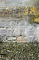 Benchmark on St Catherine's Parish Church - geograph.org.uk - 4102554.jpg 672 × 1,024; 326 KB
-
 Blind Lane in Westington joining B4018 - geograph.org.uk - 5594798.jpg 4,000 × 3,000; 3.26 MB
-
 Blind Lane, Chipping Campden - geograph.org.uk - 3517403.jpg 2,592 × 1,944; 1.39 MB
-
 Brassica crop above Chipping Campden - geograph.org.uk - 4583501.jpg 6,000 × 4,000; 5.44 MB
-
 Bridleway and farm road - geograph.org.uk - 4486216.jpg 800 × 531; 131 KB
-
 Broad to Chipping or vice versa - geograph.org.uk - 1950362.jpg 4,000 × 3,000; 3.23 MB
-
 Broadway Tower - geograph.org.uk - 5397678.jpg 3,456 × 5,184; 6 MB
-
 Broadway Tower from the east - geograph.org.uk - 3113811.jpg 4,752 × 3,168; 2.57 MB
-
 Broadway Tower in May - geograph.org.uk - 5397680.jpg 5,184 × 3,456; 5.61 MB
-

-
 Buckle Street - geograph.org.uk - 5325203.jpg 640 × 480; 134 KB
-
 By Chipping Campden Baptist Church - geograph.org.uk - 3690716.jpg 747 × 750; 147 KB
-
 Campden Hill Farm - geograph.org.uk - 1587371.jpg 640 × 480; 96 KB
-
 Campden Hill Farm - geograph.org.uk - 1949771.jpg 4,000 × 3,000; 3.97 MB
-
 Campden Hill Farm - geograph.org.uk - 890953.jpg 640 × 426; 116 KB
-
 Campden House Estate access road - geograph.org.uk - 4584792.jpg 6,000 × 4,000; 4.37 MB
-
 Campden Wood - geograph.org.uk - 6194148.jpg 1,600 × 1,200; 339 KB
-
 Cart wash - geograph.org.uk - 1990627.jpg 426 × 640; 120 KB
-
 Carters Barn - geograph.org.uk - 1950400.jpg 4,000 × 3,000; 2.94 MB
-
 Castle Gardens, Chipping Campden - geograph.org.uk - 4588850.jpg 6,000 × 4,000; 4.88 MB
-
 Cereal Crop - geograph.org.uk - 980278.jpg 640 × 480; 53 KB
-
 Charles Taylor-1719 St James Chipping Campden.png 425 × 600; 86 KB
-
 Chipping Campden - geograph.org.uk - 2840484.jpg 640 × 480; 98 KB
-
 Chipping Campden - Gloucestershire.jpg 1,020 × 679; 464 KB
-
 Chipping Campden Banner.jpg 2,831 × 405; 933 KB
-
 Chipping Campden Baptist Church - geograph.org.uk - 4583210.jpg 6,000 × 4,000; 3.31 MB
-
 Chipping Campden Church - geograph.org.uk - 2026641.jpg 640 × 480; 85 KB
-
 Chipping Campden conveniences - geograph.org.uk - 4029216.jpg 1,600 × 1,068; 437 KB
-
 Chipping Campden High Street - geograph.org.uk - 2033691.jpg 640 × 480; 74 KB
-
 Chipping Campden High Street - geograph.org.uk - 2127119.jpg 640 × 480; 119 KB
-
 Chipping Campden High Street - geograph.org.uk - 3199139.jpg 4,320 × 3,240; 4.95 MB
-
 Chipping Campden High Street - geograph.org.uk - 3286081.jpg 1,024 × 768; 187 KB
-
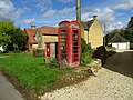
 Chipping Campden Post Office - geograph.org.uk - 2033725.jpg 640 × 480; 94 KB
-
 Chipping Campden seen from Dover's Hill - geograph.org.uk - 2228935.jpg 640 × 480; 105 KB
-
 Chipping Campden shields - geograph.org.uk - 3593887.jpg 1,500 × 1,084; 489 KB
-
 Chipping Campden, 1962, St James Church from Church St. - geograph.org.uk - 4590019.jpg 2,412 × 1,441; 1.72 MB
-
 Chipping Campden, St. James Church - geograph.org.uk - 5467620.jpg 3,883 × 2,589; 1.79 MB
-
 Chipping Campden, St. James Church - geograph.org.uk - 5467623.jpg 3,919 × 2,612; 2.11 MB
-

-

-
-

-
 Chipping Campden- Church Street - geograph.org.uk - 2029931.jpg 640 × 480; 61 KB
-
 Chipping Campden-Leysbourne - geograph.org.uk - 2029952.jpg 640 × 552; 78 KB
-
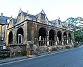
 Chipping Campden-The Old Market Hall - geograph.org.uk - 2029969.jpg 640 × 550; 69 KB
-
 Chipping Campden-The Square - geograph.org.uk - 2033738.jpg 640 × 480; 68 KB
-
 Chipping Campden-Victorian Post box - geograph.org.uk - 2070799.jpg 480 × 640; 85 KB
-
 Chipping from Broad - geograph.org.uk - 561522.jpg 640 × 480; 77 KB
-
 Church and view - geograph.org.uk - 1949780.jpg 4,000 × 3,000; 2.49 MB
-
 Church fields near Chipping Camden - geograph.org.uk - 718861.jpg 640 × 480; 119 KB
-
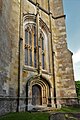
 Church of St James, Chipping Campden - geograph.org.uk - 3684661.jpg 563 × 750; 91 KB
-
 Church of St James, Chipping Campden - geograph.org.uk - 5551843.jpg 2,592 × 1,944; 2.96 MB
-
 Church Street, Chipping Campden (1) - geograph.org.uk - 3939698.jpg 640 × 427; 357 KB
-
 Church Street, Chipping Campden (2) - geograph.org.uk - 3939704.jpg 640 × 434; 369 KB
-
 Church Street, Chipping Campden (geograph 6967243).jpg 3,910 × 2,640; 1.06 MB
-
 Church Street-High Street junction - geograph.org.uk - 2079301.jpg 640 × 480; 64 KB
-
 Church tower - geograph.org.uk - 2378223.jpg 4,288 × 3,216; 3.52 MB
-
 Churchyard, Church of St James - geograph.org.uk - 3375469.jpg 2,000 × 1,500; 554 KB
-
 Churchyard, Church of St James - geograph.org.uk - 3376724.jpg 1,500 × 2,426; 550 KB
-

-
 Communication facilities in Broad Campden - geograph.org.uk - 5552552.jpg 1,600 × 1,200; 661 KB
-
 Concrete railway sleeper - geograph.org.uk - 3778683.jpg 1,024 × 680; 318 KB
-
 Conduit Hill - geograph.org.uk - 1950397.jpg 4,000 × 3,000; 3.79 MB
-
 Conduit Hill-Blind Lane junction - geograph.org.uk - 2079305.jpg 640 × 480; 86 KB
-
 Conduit House - geograph.org.uk - 2859327.jpg 640 × 480; 71 KB
-
 Cotswold Cottages - geograph.org.uk - 1912555.jpg 4,000 × 3,000; 2.82 MB
-
 Cotswold fields and hedgerows - geograph.org.uk - 4584803.jpg 6,000 × 4,000; 4.18 MB
-
 Cotswold stone houses by Izods Close (geograph 3593868).jpg 1,500 × 999; 267 KB
-
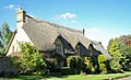 Cotswold stone, thatched house - geograph.org.uk - 235183.jpg 640 × 388; 86 KB
-
 Cotswold Way 001 (Start-Finish) - geograph.org.uk - 3636196.jpg 640 × 517; 174 KB
-
 Cotswold Way 002 - geograph.org.uk - 3636202.jpg 480 × 640; 150 KB
-
 Cotswold Way 004 - geograph.org.uk - 3636213.jpg 640 × 480; 124 KB
-
 Cotswolds-wall-new1.JPG 2,592 × 1,944; 2.61 MB
-
 Cottage formerly occupied by Graham Greene - geograph.org.uk - 4583483.jpg 6,000 × 4,000; 4.4 MB
-
 Cottages in Broad Campden - geograph.org.uk - 1949320.jpg 4,000 × 3,000; 2.94 MB
-
 Cottages in Chipping Campden - geograph.org.uk - 894324.jpg 640 × 426; 65 KB
-
 Cottages, Chipping Campden (geograph 6966495).jpg 3,959 × 2,285; 936 KB
-
 Cotterells Alley, Chipping Campden - geograph.org.uk - 3438557.jpg 800 × 600; 152 KB
-
 Country road near Seven Wells - geograph.org.uk - 4493343.jpg 800 × 531; 124 KB
-
 Cows on the edge of Chipping Campden - geograph.org.uk - 4590069.jpg 6,000 × 4,000; 5.56 MB
-
 Cricket match at Chipping Campden Cricket Club - geograph.org.uk - 4588891.jpg 6,000 × 4,000; 5.52 MB
-
 Cross Hands - geograph.org.uk - 4492556.jpg 800 × 531; 154 KB
-
 Crumpet, the Hobby Horse - geograph.org.uk - 2982559.jpg 532 × 800; 116 KB
-
 Cyclists on the market place - geograph.org.uk - 4583223.jpg 5,569 × 3,712; 7.04 MB
-
 Daffodils by the cottage entrance - geograph.org.uk - 4446718.jpg 1,600 × 1,066; 606 KB
-
 Disused camp - geograph.org.uk - 1780602.jpg 4,000 × 3,000; 3.13 MB
-
 Disused quarry by Lapstone Farm - geograph.org.uk - 4447245.jpg 1,600 × 1,066; 726 KB
-
 Dover's Hill - geograph.org.uk - 559761.jpg 640 × 428; 112 KB
-
 Down Campden Hill - geograph.org.uk - 1950258.jpg 4,000 × 3,000; 3.9 MB
-
 Downhill to Broad Campden - geograph.org.uk - 3517252.jpg 2,592 × 1,944; 1.21 MB
-
 Driveway to Attlepin Farm - geograph.org.uk - 176888.jpg 640 × 480; 71 KB
-

-

-
 Edward Stokes Cotterell-1834 St James Chipping Campden.png 425 × 600; 125 KB
-
 Entrance to Broadway Tower Country Park - geograph.org.uk - 3430094.jpg 2,000 × 1,500; 590 KB
-
 Entrance to Lapstone Cottage - geograph.org.uk - 4446717.jpg 1,600 × 1,066; 480 KB
-
 Entrance to Springhill Industrial Estate - geograph.org.uk - 1780605.jpg 4,000 × 3,000; 4.09 MB
-
 Ernest Wilson Memorial Garden - geograph.org.uk - 6104140.jpg 1,024 × 768; 342 KB
-
 Farm machinery - geograph.org.uk - 1638939.jpg 640 × 480; 77 KB
-
 Farm road to Campden House - geograph.org.uk - 4486113.jpg 1,024 × 680; 327 KB
-
 Farm track towards the spring - geograph.org.uk - 4447264.jpg 1,600 × 1,066; 302 KB
-
 Farmland above Chipping Campden - geograph.org.uk - 5041589.jpg 1,024 × 768; 249 KB
-
 Farmland above Chipping Campden - geograph.org.uk - 5552532.jpg 1,600 × 1,200; 250 KB
-
 Farmland at Seven Wells - geograph.org.uk - 4293050.jpg 2,592 × 1,944; 1.91 MB
-
 Farmland near Ebrington - geograph.org.uk - 3778696.jpg 1,024 × 680; 305 KB
-
 Farmland near Seven Wells - geograph.org.uk - 4293047.jpg 2,592 × 1,944; 1.35 MB
-
 Farmland near Severn Wells - geograph.org.uk - 4493352.jpg 1,024 × 680; 325 KB
-
 Farmland track - geograph.org.uk - 3778685.jpg 1,024 × 680; 246 KB
-
 Farmland track - geograph.org.uk - 5041586.jpg 1,024 × 768; 279 KB
-
 Field - geograph.org.uk - 4273209.jpg 640 × 480; 51 KB
-
 Field by Campden Wood - geograph.org.uk - 6193682.jpg 1,600 × 1,069; 315 KB
-
 Field by Conduit Hill Chipping Campden beyond - geograph.org.uk - 4447280.jpg 1,600 × 1,066; 505 KB
-
 Field edge path - geograph.org.uk - 1638916.jpg 640 × 480; 89 KB
-
 Field near Bank Farm seen from the train - geograph.org.uk - 3709066.jpg 640 × 480; 112 KB
-
 Field near Grey stone Farm - geograph.org.uk - 5040647.jpg 1,024 × 768; 226 KB
-
 Field of sheep by Chipping Campden - geograph.org.uk - 4588907.jpg 5,622 × 3,748; 3.9 MB
-
 Field seen from the train - geograph.org.uk - 3709077.jpg 640 × 480; 87 KB
-
 Field south of Chipping Campden - geograph.org.uk - 4588916.jpg 6,000 × 4,000; 5.76 MB
-
 Fields at Seven Wells Farm - geograph.org.uk - 3517181.jpg 2,592 × 1,944; 1.05 MB
-
 Fine topiary at Broad Campden - geograph.org.uk - 3517383.jpg 2,592 × 1,944; 1.31 MB
-
 Fingerpost at the foot of Hoo Lane, Chipping Campden - geograph.org.uk - 2558137.jpg 1,944 × 2,592; 2.33 MB
-
 Fir plantation by Campden Hill Farm - geograph.org.uk - 4447238.jpg 1,600 × 1,068; 510 KB
-
 Fire station - geograph.org.uk - 1950372.jpg 4,000 × 3,000; 2.3 MB
-
 Five Mile Drive - geograph.org.uk - 236324.jpg 640 × 480; 94 KB
-
 Footbridge over the Cam - geograph.org.uk - 3376660.jpg 2,000 × 1,333; 590 KB
-
 Footpath by the stream - geograph.org.uk - 1951003.jpg 4,000 × 3,000; 4.55 MB
-
 Footpath junction - geograph.org.uk - 1951036.jpg 4,000 × 3,000; 3.55 MB
-
 Footpath leaves road - geograph.org.uk - 1951002.jpg 4,000 × 3,000; 5.29 MB
-
 Footpath meets road - geograph.org.uk - 1951008.jpg 4,000 × 3,000; 2.5 MB
-
 Footpath off the B4081 - geograph.org.uk - 4447286.jpg 1,600 × 1,065; 435 KB
-
 Footpath to Chipping Campden - geograph.org.uk - 1638857.jpg 640 × 480; 129 KB
-
 Footpath to Haysum's Close - geograph.org.uk - 3376697.jpg 1,500 × 2,000; 565 KB
-
 Former Silk Mill - geograph.org.uk - 6029161.jpg 1,024 × 768; 270 KB
-
 Formerly magnificent - geograph.org.uk - 1482802.jpg 640 × 428; 78 KB
-
 Frederick Landseer Maur Griggs (4932980622).jpg 2,169 × 1,629; 1.5 MB
-
 Frederick Landseer Maur Griggs and New Street Lights (4932978906).jpg 1,839 × 1,381; 1.2 MB
-
 Friends Meeting House (geograph 7030039).jpg 1,600 × 1,069; 455 KB
-
 Gatehouse on Church Street - geograph.org.uk - 3610190.jpg 1,500 × 999; 208 KB
-
 George Lane - geograph.org.uk - 1951017.jpg 4,000 × 3,000; 3.9 MB
-
 George Lane, Chipping Campden - geograph.org.uk - 3438592.jpg 800 × 600; 137 KB
-
 Gloucestershire farmland - geograph.org.uk - 1912563.jpg 4,000 × 3,000; 2.29 MB
-
 Gloucestershire farmland - geograph.org.uk - 1912567.jpg 4,000 × 3,000; 2.63 MB
-
 Grass and fields - geograph.org.uk - 5902331.jpg 2,048 × 1,536; 963 KB
-
 Grassy field (1) - geograph.org.uk - 1951005.jpg 4,000 × 3,000; 4.24 MB
-
 Grassy field - geograph.org.uk - 1951006.jpg 4,000 × 3,000; 4.77 MB
-
 Grazing sheep - geograph.org.uk - 4251251.jpg 2,048 × 1,536; 1.57 MB
-
 Great gate - geograph.org.uk - 1638590.jpg 640 × 480; 50 KB
-
 Green Dragons - geograph.org.uk - 1990662.jpg 640 × 426; 87 KB
-
 Grevel's House, Chipping Campden (geograph 7343985).jpg 3,647 × 2,305; 929 KB
-
 Grevel's House, High Street, Chipping Campden - geograph.org.uk - 5354116.jpg 2,338 × 1,567; 906 KB
-
 Gri 33125015636471 0158.jpg 1,025 × 1,300; 147 KB


.jpg)


_-_geograph.org.uk_-_3939698.jpg)
_-_geograph.org.uk_-_3939704.jpg)
.jpg)


.jpg)

_-_geograph.org.uk_-_3636196.jpg)


.jpg)


.jpg)
.jpg)
.jpg)


_-_geograph.org.uk_-_1951005.jpg)


.jpg)

