Category:Chipstead, Surrey
Jump to navigation
Jump to search
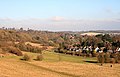
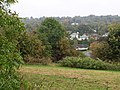
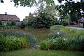
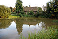
English: Chipstead, Surrey is an elevated commuter village primarily in the north-eastern corner of the county, on the North Downs. Informally it spreads into the boundary of the much larger ancient and ecclesiastical parish of Coulsdon in the London Borough of Croydon: for example Chipstead Valley Primary School. The other neighbouring settlements (which are buffered) are Woodmansterne, Banstead and Kingswood.
village in Reigate and Banstead, Surrey, United Kingdom  | |||||
| Upload media | |||||
| Instance of | |||||
|---|---|---|---|---|---|
| Location | Reigate and Banstead, Surrey, South East England, England | ||||
| Area |
| ||||
 | |||||
Subcategories
This category has the following 5 subcategories, out of 5 total.
Media in category "Chipstead, Surrey"
The following 79 files are in this category, out of 79 total.
-
 Beeches on edge of Banstead Wood - geograph.org.uk - 583794.jpg 640 × 480; 141 KB
-
 Chipstead Downs - geograph.org.uk - 1100029.jpg 640 × 413; 110 KB
-
 Chipstead Golf Course - geograph.org.uk - 1227120.jpg 640 × 360; 55 KB
-
 Chipstead Golf Course - geograph.org.uk - 1227136.jpg 640 × 480; 82 KB
-
 Chipstead Golf Course - geograph.org.uk - 1227142.jpg 640 × 480; 58 KB
-
 Chipstead Lane, Lower Kingswood - geograph.org.uk - 362324.jpg 640 × 481; 89 KB
-
 Chipstead Signpost - geograph.org.uk - 1160063.jpg 360 × 640; 84 KB
-
 Chipstead Station Parade - geograph.org.uk - 1854100.jpg 3,072 × 2,304; 2.24 MB
-
 Chipstead Station Parade - geograph.org.uk - 583754.jpg 640 × 406; 102 KB
-
 Chipstead v Eastbourne Town (8517480124).jpg 640 × 480; 275 KB
-
 Chipstead valley - geograph.org.uk - 583775.jpg 640 × 480; 130 KB
-
 Chipstead Valley Road - geograph.org.uk - 639392.jpg 640 × 570; 83 KB
-
 Chipstead Way - Steep Hill 12^ - geograph.org.uk - 1427096.jpg 640 × 400; 85 KB
-
 Cottage at Chipstead - geograph.org.uk - 1169761.jpg 640 × 480; 112 KB
-
 Crossing Point - geograph.org.uk - 1225939.jpg 360 × 640; 103 KB
-
 Daffodils at Chipstead - geograph.org.uk - 1227118.jpg 640 × 427; 106 KB
-
 Daffodils at Chipstead - geograph.org.uk - 1227150.jpg 640 × 427; 108 KB
-
 Deep in leafy Surrey a Southern off-peak commuter train nears Kingswood. - panoramio.jpg 3,888 × 2,592; 3.46 MB
-
 Duck pond,Chipstead (1259851551).jpg 2,592 × 3,872; 4.79 MB
-
 Duck pond,Chipstead (1259865975).jpg 3,872 × 2,592; 6.55 MB
-
 Duck pond,Chipstead (1259878735).jpg 2,592 × 3,872; 5.28 MB
-
 Duck pond,Chipstead (1259951169).jpg 3,872 × 2,592; 8.4 MB
-
 Duck pond,Chipstead (1260684746).jpg 3,872 × 2,592; 6.27 MB
-
 Duck pond,Chipstead (1260694418).jpg 3,872 × 2,592; 4.13 MB
-
 Duck pond,Chipstead (1260747296).jpg 3,872 × 2,592; 5.75 MB
-
 Duck pond,Chipstead (1260768646).jpg 3,872 × 2,592; 9.03 MB
-
 Duck pond,Chipstead (1260785920).jpg 3,872 × 2,592; 7.38 MB
-
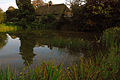
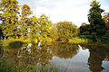
 Elmore Pond, Chipstead, Surrey - geograph.org.uk - 390983.jpg 640 × 520; 128 KB
-
 Fames Rough - geograph.org.uk - 584059.jpg 640 × 480; 113 KB
-
 Footpath along the edge of Banstead Wood - geograph.org.uk - 583783.jpg 640 × 480; 161 KB
-
 Footpath crossroads - geograph.org.uk - 583745.jpg 640 × 480; 155 KB
-
 Footpath in Chipstead Valley - geograph.org.uk - 1566532.jpg 640 × 428; 92 KB
-
 Footpath sign, Chipstead Downs - geograph.org.uk - 583771.jpg 640 × 480; 138 KB
-
 How Green Cottages, Chipstead - geograph.org.uk - 1227108.jpg 640 × 427; 89 KB
-
 Looking Over the Gate - August 2008 - geograph.org.uk - 1444443.jpg 640 × 428; 89 KB
-
 Looking Over the Gate - July 2008 - geograph.org.uk - 1444440.jpg 600 × 337; 36 KB
-
 Markedge Lane and Boarsgreen Shaw - geograph.org.uk - 1012138.jpg 640 × 427; 91 KB
-
 P.A.Ewart Butchers, Chipstead - geograph.org.uk - 1561629.jpg 640 × 428; 93 KB
-
 Park Downs - geograph.org.uk - 1097818.jpg 640 × 427; 98 KB
-
 Park Downs, Chipstead - geograph.org.uk - 1386583.jpg 640 × 480; 101 KB
-
 Park Downs, Chipstead - geograph.org.uk - 1386595.jpg 640 × 480; 113 KB
-
 Park Downs, view to Banstead Wood - geograph.org.uk - 1097685.jpg 640 × 427; 97 KB
-
 Parkland by Banstead Woods - geograph.org.uk - 583741.jpg 640 × 480; 99 KB
-

-
 Railway bridge, Chipstead Bottom - geograph.org.uk - 584075.jpg 640 × 480; 131 KB
-
 Road Near Chipstead - geograph.org.uk - 1226758.jpg 640 × 360; 98 KB
-
 Shabden Park - geograph.org.uk - 18581.jpg 640 × 480; 161 KB
-
 Stile Near Chipstead - geograph.org.uk - 1238470.jpg 360 × 640; 102 KB
-
 Telephone Box at Chipstead - geograph.org.uk - 1566495.jpg 640 × 428; 125 KB
-
 The 'White Hart', Chipstead Village - geograph.org.uk - 1044959.jpg 640 × 480; 84 KB
-
 The Long Plantation (1) - geograph.org.uk - 1561741.jpg 640 × 428; 157 KB
-
 The Long Plantation (2) - geograph.org.uk - 1561750.jpg 640 × 428; 148 KB
-

-
 View Across the Chipstead Valley - geograph.org.uk - 1225932.jpg 640 × 360; 55 KB
-
 View Down the Chipstead Valley - geograph.org.uk - 1225928.jpg 640 × 360; 49 KB
-
 View Towards Chipstead Bottom - geograph.org.uk - 1226711.jpg 640 × 360; 55 KB
-
 View Towards Fanny's Farm Shop - geograph.org.uk - 1563902.jpg 640 × 428; 93 KB
-

-
 Alongside Ruffett Wood - geograph.org.uk - 1098344.jpg 640 × 427; 100 KB
-
 Bridleway to Eyhurst Farm - geograph.org.uk - 364125.jpg 640 × 481; 114 KB
-
 Chipstead Bottom - geograph.org.uk - 583797.jpg 640 × 480; 126 KB
-
 Chipstead Lane viewed from White Hill - geograph.org.uk - 361850.jpg 640 × 481; 119 KB
-
 Chipstead Lane, Eastern End - geograph.org.uk - 361980.jpg 640 × 481; 104 KB
-
 Chipstead Valley - geograph.org.uk - 12852.jpg 640 × 480; 198 KB
-
 Chipstead Way - Steep Hill 12^ - geograph.org.uk - 1427054.jpg 640 × 400; 116 KB
-
 Exchange House Inn - geograph.org.uk - 22924.jpg 640 × 480; 138 KB
-
 Houses in Chipstead valley - geograph.org.uk - 583832.jpg 640 × 480; 113 KB
-
 Housing in Chipstread - geograph.org.uk - 26412.jpg 640 × 480; 149 KB
-
 Park Downs - geograph.org.uk - 593344.jpg 640 × 303; 51 KB
-
 Park Farm House - geograph.org.uk - 12070.jpg 640 × 481; 149 KB
-
 Path above Chipstead Bottom - geograph.org.uk - 583909.jpg 640 × 480; 131 KB
-
 Public Footpath - geograph.org.uk - 22928.jpg 640 × 480; 169 KB
-
 Shepherd's Lawn - geograph.org.uk - 12063.jpg 640 × 480; 198 KB
-
 Southerns Lane - geograph.org.uk - 364127.jpg 640 × 481; 104 KB
-
 The 19th Hole - geograph.org.uk - 20957.jpg 640 × 480; 94 KB
-
 The Third Tee - geograph.org.uk - 20445.jpg 640 × 480; 109 KB
-
 White Hill from Pigeonhouse Lane - geograph.org.uk - 361955.jpg 640 × 481; 115 KB
-
 White Hill from Southerns Lane - geograph.org.uk - 364128.jpg 640 × 481; 103 KB
-
 White Hill from Southerns Lane - geograph.org.uk - 364129.jpg 640 × 481; 106 KB


.jpg)


.jpg)
.jpg)
.jpg)
.jpg)
.jpg)
.jpg)
.jpg)
.jpg)
.jpg)


_-_geograph.org.uk_-_1561741.jpg)
_-_geograph.org.uk_-_1561750.jpg)


