Category:Chipstead, Kent
Aller à la navigation
Aller à la recherche
English: Chipstead, is a small village in the parish of Chevening, near Sevenoaks, Kent and just off the A21 and A25 roads. It is rapidly becoming part of the built up area of Sevenoaks. It is also within a short distance of the M25 motorway, though not visible from it.
village britannique (Kent) | |||||
| Téléverser des médias | |||||
| Nature de l’élément | |||||
|---|---|---|---|---|---|
| Lieu | Chevening, Sevenoaks, Kent, Angleterre du Sud-Est, Angleterre | ||||
 | |||||
Média dans la catégorie « Chipstead, Kent »
Cette catégorie comprend 11 fichiers, dont les 11 ci-dessous.
-
 Bridge over mill stream, Chipstead - geograph.org.uk - 805845.jpg 640 × 426 ; 107 kio
-
 Chapel of the Good Shepherd, Chipstead - geograph.org.uk - 805840.jpg 640 × 426 ; 73 kio
-
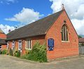 Chapel of the Good Shepherd, Chipstead.JPG 2 200 × 1 800 ; 1,21 Mio
-
 Chevening Road, Chipstead, Kent - geograph.org.uk - 1440064.jpg 640 × 480 ; 78 kio
-
 Chipstead Lake, Kent.jpg 3 402 × 1 944 ; 1,52 Mio
-
 Chipstead Village Sign - geograph.org.uk - 1450245.jpg 480 × 640 ; 78 kio
-
 Former Bible Christian Chapel, Chipstead.JPG 1 800 × 2 000 ; 1,06 Mio
-
 River Darenth in Chipstead - geograph.org.uk - 1450269.jpg 640 × 480 ; 127 kio
-

-
 The Bricklayers Arms, Chipstead - geograph.org.uk - 805846.jpg 640 × 426 ; 84 kio
-
 A21 near Chipstead - geograph.org.uk - 1060153.jpg 640 × 427 ; 61 kio


