Category:Chittering, Cambridgeshire
Jump to navigation
Jump to search
English: Chittering is a hamlet about 8 miles (13 km) north of Cambridge in Cambridgeshire, England. For administrative purposes it is part of the parish of Waterbeach.
Nederlands: Chittering is een gehucht in het Engelse graafschap Cambridgeshire. De stad ligt in het district South Cambridgeshire en telt ca. 120 inwoners.
Norsk bokmål: Chittering er en liten landsby i Cambridgeshire i England, ved Ely Road (A10) omkring 13 km nord for Cambridge. Den tilhører det verdslige sognet Waterbeach.
village in Cambridgeshire, England, UK  | |||||
| Upload media | |||||
| Instance of | |||||
|---|---|---|---|---|---|
| Location | Waterbeach, South Cambridgeshire, Cambridgeshire, East of England, England | ||||
 | |||||
Subcategories
This category has only the following subcategory.
M
Media in category "Chittering, Cambridgeshire"
The following 25 files are in this category, out of 25 total.
-
 Cattle by Great Ouse - geograph.org.uk - 1138803.jpg 640 × 480; 123 KB
-
 Derelict barn by track to Chittering - geograph.org.uk - 1447129.jpg 640 × 480; 124 KB
-
 Dog training area - geograph.org.uk - 1140616.jpg 640 × 480; 139 KB
-
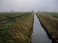 Engine Drain - geograph.org.uk - 1138463.jpg 640 × 480; 86 KB
-
 Fenland soil - geograph.org.uk - 1447034.jpg 640 × 480; 103 KB
-
 Field View Farm near Chittering - geograph.org.uk - 1447139.jpg 640 × 480; 83 KB
-
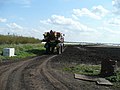
 Game rearing - geograph.org.uk - 1140582.jpg 640 × 480; 86 KB
-
 Let us spray - geograph.org.uk - 799396.jpg 640 × 480; 74 KB
-
 New housing - geograph.org.uk - 1140590.jpg 640 × 480; 83 KB
-
 Old Milestone by the A10, Ely Road (geograph 5622630).jpg 295 × 448; 112 KB
-
 Old Milestone by the A10, north of Chittering (geograph 5622631).jpg 295 × 448; 93 KB
-
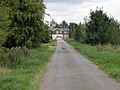 Road to Chittering - geograph.org.uk - 1447148.jpg 640 × 480; 103 KB
-
 Sign of the Traveller's Rest - geograph.org.uk - 1448219.jpg 480 × 640; 92 KB
-

-
 The Old Schoolhouse, Chittering - geograph.org.uk - 1448243.jpg 640 × 480; 90 KB
-
 The Traveller's Rest, Chittering - geograph.org.uk - 1448143.jpg 640 × 480; 65 KB
-
 Track to Chittering - geograph.org.uk - 1447116.jpg 640 × 480; 95 KB
-
 Twenty Pence Marina - geograph.org.uk - 1140605.jpg 640 × 480; 112 KB
-
 Vicarage farm, Chittering - geograph.org.uk - 1448135.jpg 640 × 480; 105 KB
-
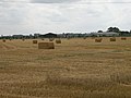 A field of bales near Chittering - geograph.org.uk - 1448140.jpg 640 × 480; 77 KB
-
 Chittering Farm - geograph.org.uk - 588182.jpg 640 × 480; 97 KB
-
 Fields at Chittering - geograph.org.uk - 271790.jpg 640 × 427; 72 KB
-
 Reeds at Chittering - geograph.org.uk - 271791.jpg 640 × 427; 99 KB
-
 Sugar beet field at Chittering - geograph.org.uk - 271788.jpg 640 × 427; 76 KB
-
 The Undertakers - geograph.org.uk - 271787.jpg 640 × 427; 70 KB


.jpg)
.jpg)


.jpg)


