Category:Cho Oyu
Zur Navigation springen
Zur Suche springen
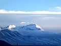
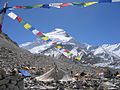
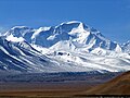
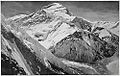
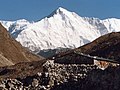
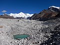
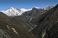
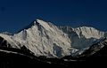
Berg im Himalaya und mit 8188 m der sechsthöchste Berg der Erde  Čo Oju | |||||
| Medium hochladen | |||||
| Ist ein(e) | |||||
|---|---|---|---|---|---|
| Ist Teil von | |||||
| Liegt in Schutzgebiet | |||||
| Ort | Sagarmatha, Entwicklungsregion Ost, Nepal | ||||
| Gebirgszug | |||||
| Schartenhöhe |
| ||||
| Dominanz |
| ||||
| Höhe über dem Meeresspiegel |
| ||||
 | |||||
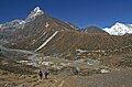
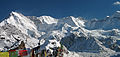
English: Cho Oyo, located on the Nepal-Tibet (China) border, is the sixth highest mountain in the world.
Unterkategorien
Diese Kategorie enthält folgende Unterkategorie:
In Klammern die Anzahl der enthaltenen Kategorien (K), Seiten (S), Dateien (D)
E
Medien in der Kategorie „Cho Oyu“
Folgende 98 Dateien sind in dieser Kategorie, von 98 insgesamt.
-

-
 ( TIBET HIMALAYA CHO-OYU 8201mts).jpg 8.390 × 5.760; 3,56 MB
-
 -Nepal - Sagamartha Trek - 065 - valley up to Gokyo and Cho Oyu (497609738).jpg 2.592 × 1.944; 1,11 MB
-
 8,201m Cho Oyu Pang La Tibet China 西藏 卓奥友峰 - panoramio (2).jpg 2.400 × 1.800; 3,18 MB
-
 8,201m Cho Oyu Pang La Tibet China 西藏 卓奥友峰 - panoramio.jpg 2.400 × 1.800; 2,98 MB
-
 8,201m Cho Oyu Tingri Tibet China 西藏 定日 卓奥友峰 - panoramio (1).jpg 2.400 × 1.800; 2,53 MB
-
 8,201m Cho Oyu Tingri Tibet China 西藏 定日 卓奥友峰 - panoramio (2).jpg 2.400 × 1.800; 2,18 MB
-
 8,201m Cho Oyu Tingri Tibet China 西藏 定日 卓奥友峰 - panoramio (3).jpg 2.400 × 1.800; 2,15 MB
-
 8,201m Cho Oyu Tingri Tibet China 西藏 定日 卓奥友峰 - panoramio.jpg 2.400 × 1.800; 2,53 MB
-
 Big old Ngozumpa.jpg 3.072 × 2.304; 1.019 KB
-
 Carlos pauner Chooyu01.jpg 800 × 635; 95 KB
-
 Cho La-50-Gletscher-2007-gje.jpg 3.072 × 2.048; 2,29 MB
-
 Cho Oyu - North face.jpg 3.264 × 2.448; 1,77 MB
-
 Cho Oyu - Northwest face.jpg 800 × 600; 187 KB
-
 Cho Oyu Camp 1.jpg 1.536 × 2.048; 662 KB
-
 Cho Oyu Camp I.jpg 2.592 × 1.944; 634 KB
-
 Cho Oyu depuis Ngozumpa Tse.jpg 3.072 × 2.048; 1,6 MB
-
 Cho Oyu from Machermo.jpg 3.648 × 2.736; 4,01 MB
-
 Cho Oyu Tenzing Gyachung Kang Hungchhi From Macheramo.jpg 2.794 × 1.787; 2,03 MB
-
 Cho Oyu upper slopes.jpg 2.592 × 1.904; 583 KB
-
 Cho Oyu, Nepal - round.jpg 394 × 395; 60 KB
-
 Cho Oyu, Nepal - round.png 440 × 440; 124 KB
-
 Cho Oyu, Nepal.jpg 701 × 467; 378 KB
-
 Cho Oyu.jpg 3.840 × 2.880; 2,98 MB
-
 Cho-Uyo.jpg 500 × 315; 144 KB
-
 ChoOyu-fromGokyo (3to4).jpg 1.275 × 956; 190 KB
-
 ChoOyu-fromGokyo.jpg 1.400 × 990; 213 KB
-
 Chooyu.jpg 2.016 × 1.134; 853 KB
-
 Crossing Ngozumpa Glacier.jpg 4.608 × 3.456; 3,42 MB
-
 Crossingngozumpaglacier2.jpg 4.608 × 3.456; 3,24 MB
-
 Dhole to Machhermo-08-Dudh Koshi-2007-gje.jpg 3.072 × 2.048; 2,75 MB
-
 Dhole to Machhermo-20-Dudh Koshi-Weg-2007-gje.jpg 3.072 × 2.048; 2,67 MB
-
 Dhole to Machhermo-34-Alm-2007-gje.jpg 2.805 × 1.852; 1,93 MB
-
 Everestpanoram.jpg 6.384 × 1.556; 1,5 MB
-
 Flight Kathmandu-Himalayas-10-2014-gje.jpg 5.184 × 3.037; 3,37 MB
-
 Flight Kathmandu-Himalayas-12-2014-gje.jpg 5.184 × 3.456; 4,01 MB
-
 Flight Kathmandu-Himalayas-14-2014-gje.jpg 5.184 × 2.939; 2,98 MB
-
 Geology of Everest region, 1921.jpg 6.084 × 3.888; 5,51 MB
-
 Gokyo 01.JPG 4.000 × 3.000; 4,13 MB
-
 Gokyo 04.JPG 4.000 × 3.000; 4,25 MB
-
 Gokyo Lakes, Langponga Tsho, Nepal, Himalayas.jpg 4.032 × 2.688; 8,33 MB
-
 Gokyo Ri and Mt Cho Oyu - panoramio.jpg 3.872 × 2.592; 4,19 MB
-
 Gokyo Ri-04-Dauerfrostbulte-2007-gje.jpg 3.072 × 2.048; 3,47 MB
-
 Gokyo Ri-44-Gipfel-Gebetsfahnen-2007-gje.jpg 2.838 × 1.726; 2,45 MB
-
 Gokyo Ri-46-Berge-Ngozumpa-Gletscher-2007-gje.jpg 3.072 × 1.920; 3,02 MB
-
 Gokyo Ri.jpg 4.256 × 2.832; 12,12 MB
-
 Gokyo surroundings-10-auf der Moraene-Gletscher-2007-gje.jpg 2.796 × 1.779; 1,88 MB
-
 Gokyo surroundings-16-auf der Moraene-2007-gje.jpg 3.072 × 2.048; 2,24 MB
-
 Gokyo surroundings-18-auf der Moraene-2007-gje.jpg 2.880 × 1.965; 2,25 MB
-
 Gokyo surroundings-30-Aufstieg-2007-gje.jpg 3.072 × 2.048; 3,45 MB
-
 Gokyo surroundings-32-Geroell-Berge-2007-gje.jpg 2.772 × 1.881; 2,64 MB
-
 Gokyo surroundings-34-Moraene-Berge-2007-gje.jpg 3.072 × 2.048; 2,76 MB
-
 Gokyo surroundings-38-Ngozumpa-Gletscher-2007-gje.jpg 2.907 × 1.926; 2,41 MB
-
 Gokyo surroundings-44-Mulde-2007-gje.jpg 3.072 × 2.048; 2,99 MB
-
 Gokyo surroundings-46-Berg-2007-gje.jpg 3.072 × 2.048; 2,83 MB
-
 Gokyo surroundings-48-Randmoraene-Ngozumpa-Gletscher-2007-gje.jpg 2.808 × 1.863; 2,52 MB
-
 Gokyo surroundings-54-Ngozumpa-Gletscher-Berge-2007-gje.jpg 7.370 × 2.273; 4,7 MB
-
 Gokyo surroundings-78-Geroell-Yak-2007-gje.jpg 2.826 × 1.876; 2,51 MB
-
 Gokyo village-20-Himalayan Panorama Lodge-2007-gje.jpg 3.072 × 2.048; 2,81 MB
-
 Himalaya annotated.jpg 1.000 × 662; 413 KB
-
 Himalaya, aéreas 1999 01.jpg 1.030 × 652; 494 KB
-
 Himalaya, aéreas 1999 02.jpg 1.062 × 707; 574 KB
-
 Himalaya, aéreas 1999 03.jpg 1.062 × 707; 522 KB
-
 Himalaya, aéreas 1999 04.jpg 1.002 × 674; 453 KB
-
 Himalayas-Lhasa13.JPG 2.048 × 1.536; 678 KB
-

-

-

-
 ISS066-E-86203 - View of Earth.jpg 5.568 × 3.712; 2,93 MB
-

-

-
 ISS066-E-86263 - View of Earth.jpg 5.568 × 3.712; 3,32 MB
-

-
 ISS066-E-86267 - View of Earth.jpg 5.568 × 3.712; 3,36 MB
-
 Juan Carlos González en la cima del Cho Oyu.jpg 3.072 × 2.304; 1,08 MB
-
 Labuche Kang (4to3).jpg 614 × 460; 43 KB
-
 Labuche Kang and Shishapangma from Cho Oyu.jpg 2.592 × 1.944; 365 KB
-
 Local village at Everest region.JPG 4.320 × 3.240; 5,11 MB
-
 Machhermo to Gokyo-06-Alm-2007-gje.jpg 3.072 × 2.048; 2,79 MB
-
 Machhermo-02-2007-gje.jpg 2.667 × 1.759; 2 MB
-
 Machhermo-44-Gebetsfahnen-Tal-2007-gje.jpg 3.072 × 2.048; 2,67 MB
-
 Machhermo-48-Tal-2007-gje.jpg 3.072 × 2.048; 2,56 MB
-
 Mt. Choyu.jpg 2.000 × 1.295; 2,05 MB
-
 Na vrcholu Cho Oyu.jpg 2.848 × 1.602; 2,7 MB
-
 Nepal - Sagamartha Trek - 072 - Cho Oyu (4435471332).jpg 2.592 × 1.944; 1,22 MB
-
 Nepal - Sagamartha Trek - 100 - Cho Oyu from Gokyo Ri (497679097).jpg 2.592 × 1.944; 1,44 MB
-
 Nepal - Sagamartha Trek - Cho Oyu and prayer flags from Gokyo Ri (493502192).jpg 5.293 × 1.751; 1,82 MB
-
 Nepal - Sagamartha Trek - Cho Oyu from Gokyo Ri (493560441).jpg 3.992 × 1.901; 1,79 MB
-
 Ngozumpa glacier viewed from Gokyo.jpg 4.256 × 2.832; 11,05 MB
-
 NH-45-14 Nyalam China.jpg 8.576 × 6.584; 7,52 MB
-
 Olivier-Racine-cho-oyu-2012.jpg 4.000 × 2.664; 3,01 MB
-
 Preliminary map of Mount Everest Expedition, 1921. Map I.jpg 6.284 × 3.900; 2,22 MB
-
 Routes near Mount Everest, 1950 and 1951.svg 1.080 × 810; 177 KB
-
 Sarmet Cho Oyu 1998.jpg 2.338 × 1.633; 515 KB
-
 Shadow of a walking man on Cho oyu.jpg 2.845 × 1.827; 2,4 MB
-
 Sommet du Ngozumpa tse.jpg 10.847 × 1.263; 6,6 MB
-
 Vetta del Cho Oyu.jpg 1.152 × 864; 156 KB
-
 中国地质大学(武汉)登山队登顶卓奥友峰.JPG 3.264 × 2.448; 1,76 MB
-_Map_China_1-250,000_Tile_NH_45-14_Tingri_Dzong_(cropped).jpg)
.jpg)
.jpg)
.jpg)

.jpg)
.jpg)
.jpg)


.jpg)


.jpg)
.jpg)
.jpg)

.jpg)
.jpg)

_-_Siguang_Ri_Shar_-_Siguang_Ri_-_Siguang_Ri_Northwest_(cropped).jpg)


.jpg)


.jpg)
.jpg)
.jpg)


.jpg)