Category:Chouteau County, Montana
Vai alla navigazione
Vai alla ricerca
Counties of Montana: Beaverhead · Big Horn · Blaine · Broadwater · Carbon · Carter · Cascade · Chouteau · Custer · Daniels · Dawson · Deer Lodge · Fallon · Fergus · Flathead · Gallatin · Garfield · Glacier · Golden Valley · Granite · Hill · Jefferson · Judith Basin · Lake · Lewis and Clark · Liberty · Lincoln · Madison · McCone · Meagher · Mineral · Missoula · Musselshell · Park · Petroleum · Phillips · Pondera · Powder River · Powell · Prairie · Ravalli · Richland · Roosevelt · Rosebud · Sanders · Sheridan · Silver Bow · Stillwater · Sweet Grass · Teton · Toole · Treasure · Valley · Wheatland · Wibaux · Yellowstone
contea statunitense   | |||||
| Carica un file multimediale | |||||
| Istanza di | |||||
|---|---|---|---|---|---|
| Prende il nome da | |||||
| Luogo | Montana, Stati Uniti d'America | ||||
| Capitale | |||||
| Data di fondazione o creazione |
| ||||
| Popolazione |
| ||||
| Superficie |
| ||||
| sito web ufficiale | |||||
 | |||||
Sottocategorie
Questa categoria contiene le 11 sottocategorie indicate di seguito, su un totale di 11.
F
- Fort McKenzie, Montana (2 F)
M
R
S
- Square Butte (Montana) (10 F)
T
- Teton River (Montana) (12 F)
U
File nella categoria "Chouteau County, Montana"
Questa categoria contiene 32 file, indicati di seguito, su un totale di 32.
-
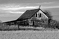 Abandoned Homestead in Montague, MT - panoramio.jpg 2 048 × 1 357; 561 KB
-

-
 Bearpaws.jp.jpg 360 × 158; 13 KB
-
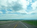 Chouteau County, MT, USA - panoramio.jpg 3 264 × 2 448; 1,72 MB
-

-

-

-
 Fig 10 Section showing the pre-Glacial valley.jpg 1 503 × 1 008; 238 KB
-
 Fig 11 Cross section showing the drift in the valley.jpg 1 432 × 314; 55 KB
-
 Fig 9 Valley of the Missouri.jpg 1 345 × 807; 66 KB
-
 Fort Campbell in 1865. A trading post in Montana.jpg 687 × 396; 86 KB
-

-
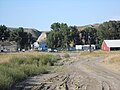 Loma, Montana USA 06.JPG 4 608 × 3 456; 7,1 MB
-
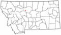
 Map of Montana highlighting Chouteau County.svg 2 043 × 1 178; 100 KB
-
 Montana's eye of the needle its history.jpg 4 174 × 5 999; 3,97 MB
-
 MTMap-doton-BigSandy.PNG 300 × 175; 12 KB
-
 MTMap-doton-BoxElder.PNG 300 × 175; 12 KB
-
 MTMap-doton-Carter.PNG 300 × 175; 12 KB
-
 MTMap-doton-Highwood.PNG 300 × 175; 12 KB
-

-

-

-

-
-

-

-
-

-
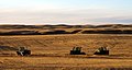 Tractors in field - panoramio.jpg 2 048 × 1 086; 474 KB
-
 USA Chouteau County, Montana age pyramid.svg 520 × 600; 7 KB
-
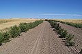 Windbreaks42 (24216473677).jpg 2 032 × 1 354; 850 KB
-
 Windbreaks43 (38367813284).jpg 2 032 × 1 354; 1 005 KB

.jpg)


_-_panoramio.jpg)


.jpg)
.jpg)