Category:Flathead County, Montana
Jump to navigation
Jump to search
Counties of Montana: Beaverhead · Big Horn · Blaine · Broadwater · Carbon · Carter · Cascade · Chouteau · Custer · Daniels · Dawson · Deer Lodge · Fallon · Fergus · Flathead · Gallatin · Garfield · Glacier · Golden Valley · Granite · Hill · Jefferson · Judith Basin · Lake · Lewis and Clark · Liberty · Lincoln · Madison · McCone · Meagher · Mineral · Missoula · Musselshell · Park · Petroleum · Phillips · Pondera · Powder River · Powell · Prairie · Ravalli · Richland · Roosevelt · Rosebud · Sanders · Sheridan · Silver Bow · Stillwater · Sweet Grass · Teton · Toole · Treasure · Valley · Wheatland · Wibaux · Yellowstone
county in Montana, United States   | |||||
| Upload media | |||||
| Instance of | |||||
|---|---|---|---|---|---|
| Named after |
| ||||
| Location | Montana | ||||
| Capital | |||||
| Inception |
| ||||
| Population |
| ||||
| Area |
| ||||
| official website | |||||
 | |||||
Subcategories
This category has the following 27 subcategories, out of 27 total.
B
- Bore Creek (6 F)
C
- Creston National Fish Hatchery (25 F)
F
- Flathead Indian Reservation (59 F)
- Flathead Irrigation Project (21 F)
G
- Glacier View Dam (3 F)
H
- Hungry Horse Reservoir (13 F)
L
M
N
P
Q
- Quartz Lake (1 F)
S
- Sunburst Lake (Montana) (1 F)
T
W
- Whitefish Lake (Montana) (12 F)
Media in category "Flathead County, Montana"
The following 108 files are in this category, out of 108 total.
-
 13th Annual Canyon Kid's Christmas Fund Fishing Derby at Lion Lake, FNF (6929964915).jpg 3,872 × 2,592; 3.64 MB
-
 A family of mountain goats walking down the rocks - panoramio.jpg 2,048 × 1,536; 498 KB
-
 A Marmot - panoramio.jpg 2,048 × 1,536; 1.47 MB
-
 Aerial - North Fork Flathead River (MT) 01 (10322830073).jpg 4,288 × 2,848; 4.69 MB
-
 Aerial - North Fork Flathead River (MT) 01 - white balanced (10322018694).jpg 4,288 × 2,848; 7.52 MB
-
 Aerial - North Fork Flathead River (MT) 02 (10323362326).jpg 2,848 × 4,288; 4.67 MB
-
 Aerial - North Fork Flathead River (MT) 02 - white balanced (10322010826).jpg 2,848 × 4,288; 6.19 MB
-
 Aerial - Whitefish Lake (MT) 01 (10322715514).jpg 4,288 × 2,848; 4.73 MB
-
 Aerial - Whitefish Lake (MT) 01 - white balanced (10322170696).jpg 4,288 × 2,848; 6.62 MB
-
 Aerial - Whitefish Lake (MT) 02 (10322694124).jpg 4,288 × 2,848; 4.52 MB
-
 Aerial - Whitefish Lake (MT) 02 - white balanced (10322115975).jpg 4,288 × 2,848; 5.2 MB
-
 Aerial - Whitefish Lake (MT) 03 (10322673274).jpg 4,288 × 2,848; 5.13 MB
-
 Aerial - Whitefish Lake (MT) 03 - white balanced (10322103656).jpg 4,288 × 2,848; 11.27 MB
-
 Bad Rock Volunteer Fire Department Montana.jpg 2,160 × 1,128; 985 KB
-
 Bennett 000169 172466 517720 4578 (35949064464).jpg 1,920 × 1,080; 375 KB
-

-
 Bigfork Street View.jpg 2,492 × 1,585; 862 KB
-
 Bridge Over Swan River Bigfork MT.jpg 1,836 × 2,116; 936 KB
-
 CALF ROBE MOUNTAIN - Glacier Park MT - panoramio.jpg 2,813 × 1,902; 1.04 MB
-
 Click here to view tunnel area on an interactive map - panoramio.jpg 1,759 × 2,543; 871 KB
-
 Coal Creek Cabin - panoramio.jpg 2,592 × 1,936; 1.9 MB
-
 Comeau Pass - panoramio.jpg 3,072 × 2,304; 3.1 MB
-
 Coram Montana Sign Looking Westerly on US2.jpg 2,160 × 1,351; 976 KB
-
 Dancing Lady Mountain - Glacier park, MT - panoramio.jpg 3,872 × 2,592; 4.56 MB
-
 Eastbound Empire Builder , Glacier Park MT - panoramio.jpg 2,680 × 1,858; 976 KB
-
 Eastbound Empire Builder Enters Flathead Tunnel - panoramio.jpg 2,492 × 1,659; 847 KB
-
 Eastbound Empire Builder-Whitefish Montana - panoramio.jpg 2,588 × 1,756; 1.16 MB
-
 Flathead County Montana Sign US2 Looking West.jpg 2,160 × 1,440; 844 KB
-
 Flathead River.jpg 4,032 × 3,024; 2.88 MB
-
 Flowers Of The Continental Divide (179483645).jpeg 2,048 × 1,365; 1.02 MB
-
 Glacier Park International Airport.jpg 1,600 × 1,200; 353 KB
-
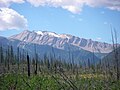 Great Northern Mountain 2009.JPG 2,816 × 2,112; 2.18 MB
-
 Harvest time, Flathead Valley, Montana LCCN2006686989.jpg 1,536 × 1,224; 234 KB
-
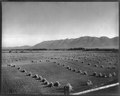 Harvest time, Flathead Valley, Montana LCCN2006686989.tif 1,536 × 1,224; 1.8 MB
-
 Hay18 (39411553194).jpg 6,120 × 4,084; 2.57 MB
-
 Hay20 (40090627932).jpg 6,120 × 4,084; 2.78 MB
-
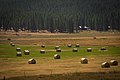 Hay21 (40090626042).jpg 6,120 × 4,084; 3.07 MB
-
 Hay22 (40090622992).jpg 6,120 × 4,084; 2.97 MB
-
 Hidden Lake pano - panoramio.jpg 4,000 × 1,056; 2.16 MB
-
 Hungry Horse Dam (29319815175).jpg 5,173 × 3,317; 10.19 MB
-
 Hungry Horse Montana Panorama looking east on US2.jpg 2,160 × 1,440; 1.23 MB
-
 Hungry Horse Volunteer Fire Department.jpg 2,160 × 1,440; 807 KB
-
 John F. Stevens Monument @ Summit MT. - panoramio.jpg 1,609 × 1,618; 370 KB
-
 Kalispell, MT, MT, USA - panoramio (1).jpg 1,200 × 674; 1,009 KB
-
 Kalispell, MT, MT, USA - panoramio (2).jpg 2,000 × 1,124; 1.79 MB
-
 Kalispell, MT, MT, USA - panoramio (3).jpg 2,000 × 1,090; 2.7 MB
-
 Kalispell, United States (Unsplash KyFm-uhCAZI).jpg 5,184 × 3,456; 11.35 MB
-
 Les Mason (51268167018).jpg 4,032 × 3,024; 4.87 MB
-
 Licoln Peak - panoramio.jpg 1,536 × 2,048; 1.32 MB
-
 Lincoln Peak - panoramio.jpg 2,304 × 3,072; 2.22 MB
-
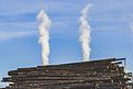 Logging Industry Plum Creek Northwest Plywood Montana (29151969320).jpg 5,352 × 3,612; 7.56 MB
-
 Map of Montana highlighting Flathead County.svg 9,194 × 5,303; 122 KB
-
 McDonald Creek - panoramio.jpg 2,048 × 1,536; 675 KB
-
 McDonald Creek Valley Glacier NP1.jpg 3,888 × 2,316; 7.06 MB
-
 McDonald Creek Valley Glacier NP2.jpg 3,818 × 2,186; 6.58 MB
-
 Mixed Breed Dog- German Shepherd-Wolf Mixed with American Pitt.jpg 2,448 × 3,264; 2.5 MB
-
 Montana Raceway Park layout.jpg 2,118 × 979; 663 KB
-
 Montana Ranch Outbuilding (50323270).jpeg 2,048 × 1,365; 424 KB
-
 Mount Saint Nicholas 2009.jpg 2,816 × 2,112; 2.19 MB
-
 Mountain Road (245669351).jpeg 2,048 × 1,229; 677 KB
-
 MTMap-doton-ColumbiaFalls.PNG 300 × 175; 12 KB
-
 MTMap-doton-Coram.PNG 300 × 175; 12 KB
-
 MTMap-doton-Lakeside.PNG 300 × 175; 12 KB
-
 MTMap-doton-Niarada.PNG 300 × 175; 12 KB
-
 MTMap-doton-Somers.PNG 300 × 175; 12 KB
-
 MTMap-doton-Whitefish.PNG 300 × 175; 12 KB
-
 N Fork.jpg 4,000 × 6,000; 8.69 MB
-
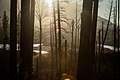
 Nachdemfeuer (229960883).jpeg 2,048 × 1,365; 2.18 MB
-
 North Fork Flathead River (50323268).jpeg 2,048 × 1,365; 667 KB
-
 Oh God here comes a thunderstorm - panoramio.jpg 2,048 × 1,536; 330 KB
-
 PatrickAryee Headshot Montana 02.jpg 4,096 × 3,070; 2.16 MB
-
 People hiking on the rocks - panoramio.jpg 2,048 × 1,536; 778 KB
-

-

-
 Pika - panoramio.jpg 3,072 × 1,728; 3.2 MB
-
 Plat of Public Highway - DPLA - c738bfadeb535362127bfab3be960ed4.jpg 2,248 × 2,784; 883 KB
-
 Pocketstone Cafe in Bigfork, MT.jpg 3,264 × 1,836; 1.87 MB
-
 Rainbow Trout underwater - panoramio.jpg 1,536 × 2,048; 1.4 MB
-
 Reflections (178913809).jpeg 2,048 × 1,365; 365 KB
-
 Ripples - panoramio (1).jpg 4,608 × 3,014; 3.99 MB
-

-
 South of Comeau Pass - panoramio.jpg 1,536 × 2,048; 1.62 MB
-
 Sperry Glaicer - panoramio.jpg 2,048 × 1,536; 1.33 MB
-
 Spot the Goats^ - panoramio.jpg 1,880 × 2,795; 1.67 MB
-
 Stillwater State Forest Headquarters in Montana on US93.jpg 2,048 × 1,365; 1.61 MB
-
 Summer Shed (40916662).jpeg 2,048 × 1,360; 1.23 MB
-
 Summit Nature Center is open weekends. (8388551442).jpg 2,560 × 1,920; 1.08 MB
-
 Sunrise On Hidden Lake (132883145).jpeg 2,048 × 1,367; 732 KB
-
 The Divide at Sunset - panoramio.jpg 2,592 × 1,936; 1.22 MB
-
 The Giant Stimpson - panoramio.jpg 1,936 × 2,592; 1.44 MB
-
 The Izaak Walton Inn @ Essex Montana - panoramio.jpg 2,409 × 1,632; 1.04 MB
-
 The Ocean Floor at 5500 ft - panoramio.jpg 3,072 × 1,728; 3.34 MB
-
 The Rockies (5093840002).jpg 4,272 × 2,848; 5.86 MB
-

-
 Threesuns Mountain - panoramio.jpg 2,592 × 1,936; 1.69 MB
-
 Trail Head Bridge View - panoramio.jpg 2,976 × 3,968; 1.89 MB
-
 U.S. Route 93 in Montana near Lower Stillwater Lake 01 (10323372474).jpg 2,848 × 4,288; 4.95 MB
-
 U.S. Route 93 in Montana near Lower Stillwater Lake 01 - white balanced (10322243725).jpg 2,848 × 4,288; 7.72 MB
-
 U.S. Route 93 in Montana near Lower Stillwater Lake 02 (10323530903).jpg 2,848 × 4,288; 4.84 MB
-
 U.S. Route 93 in Montana near Lower Stillwater Lake 02 - white balanced (10322367463).jpg 2,848 × 4,288; 9.55 MB
-
 US 2 im Flathead County (Montana) DSCF5698.JPG 4,256 × 2,848; 5.96 MB
-
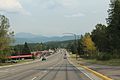
 US 2 in Flathead County Montana.jpg 2,160 × 1,440; 1.4 MB
-
 USA Flathead County, Montana age pyramid.svg 520 × 600; 7 KB
-
 View from a dam (Unsplash).jpg 5,068 × 3,379; 10.54 MB
-

-
-
 Westbound Empire Builder (9191443517).jpg 5,878 × 3,889; 11.71 MB
-
 Wetland39 (25210260468).jpg 3,296 × 2,472; 1.9 MB
.jpg)


_01_(10322830073).jpg)
_01_-_white_balanced_(10322018694).jpg)
_02_(10323362326).jpg)
_02_-_white_balanced_(10322010826).jpg)
_01_(10322715514).jpg)
_01_-_white_balanced_(10322170696).jpg)
_02_(10322694124).jpg)
_02_-_white_balanced_(10322115975).jpg)
_03_(10322673274).jpg)
_03_-_white_balanced_(10322103656).jpg)

.jpg)
_(14767475361).jpg)


.jpeg)


.jpg)
.jpg)
.jpg)
.jpg)
.jpg)


.jpg)
.jpg)
.jpg)
.jpg)
.jpg)


.jpg)


.jpeg)

.jpeg)


.jpeg)
.jpeg)


.jpeg)
.jpg)


.jpeg)
.jpg)
.jpeg)


.jpg)


.jpg)
.jpg)
.jpg)
.jpg)
_DSCF5698.JPG)


.jpg)
.jpg)
.jpg)