Category:Christ the King church in Kozielice
Jump to navigation
Jump to search
| Object location | | View all coordinates using: OpenStreetMap |
|---|
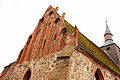
Polski: Kozielice - zespół kościoła p.w. Chrystusa Króla:
- rzymskokatolicki kościół parafialny p.w. Chrystusa Króla, XIV-XVI (658548)
- cmentarz, XIV (749011)
- ogrodzenie z bramkami, XIX (749012)
church building in Kozielice, Kamień County, Poland  | |||||
| Upload media | |||||
| Instance of | |||||
|---|---|---|---|---|---|
| Location | Kozielice, Kamień County, Gmina Golczewo, Kamień County, West Pomeranian Voivodeship, Poland | ||||
| Heritage designation |
| ||||
 | |||||
Subcategories
This category has only the following subcategory.
Media in category "Christ the King church in Kozielice"
The following 13 files are in this category, out of 13 total.
-
 Kozielice - kościół - 16.07.2023 17-53-24.jpg 1,875 × 2,853; 2.18 MB
-
 Kozielice - kościół - 16.07.2023 17-53-55.jpg 3,008 × 2,000; 2.26 MB
-
 Kozielice - kościół - 16.07.2023 17-54-01.jpg 2,000 × 3,008; 2.49 MB
-
 Kozielice - kościół - 16.07.2023 17-54-50.jpg 3,008 × 2,000; 2.87 MB
-
 Kozielice - kościół - 16.07.2023 17-55-20.jpg 2,000 × 3,008; 2.48 MB
-
 Kozielice - kościół - 16.07.2023 17-55-24.jpg 2,000 × 3,008; 2.56 MB
-
 Kozielice - kościół - 16.07.2023 17-56-56.jpg 1,253 × 2,746; 1.83 MB
-
 Kozielice - kościół - 16.07.2023 17-57-24.jpg 2,000 × 3,008; 2.49 MB
-
 Kościół par. p.w. Chrystusa Króla, XIV-XVI , Kozielice.JPG 5,184 × 3,456; 7.66 MB
-
 Kościół parafii p.w. Chrystusa Króla, XIV-XVI w. -2.jpg 5,184 × 3,456; 8.16 MB
-
 Kościół parafii p.w. Chrystusa Króla, XIV-XVI w. -4.jpg 5,184 × 3,456; 11.42 MB
-
 Kościół parafii p.w. Chrystusa Króla, XIV-XVI w..JPG 5,184 × 3,456; 4.81 MB
-
 Wieża kościoła parafii p.w. Chrystusa Króla, XIV-XVI w..JPG 3,456 × 5,184; 4.88 MB


