Category:Christian Alliance Cheng Wing Gee College
Jump to navigation
Jump to search
| Object location | | View all coordinates using: OpenStreetMap |
|---|
中文:宣道會鄭榮之中學
secondary school in Hong Kong  | |||||
| Upload media | |||||
| Instance of | |||||
|---|---|---|---|---|---|
| Location | Hong Kong, PRC | ||||
| Inception |
| ||||
| official website | |||||
 | |||||
Media in category "Christian Alliance Cheng Wing Gee College"
The following 16 files are in this category, out of 16 total.
-
 2022年8月-鄭榮之中學A.jpg 9,248 × 6,936; 10.26 MB
-
 2022年8月-鄭榮之中學B.jpg 9,248 × 6,936; 11.79 MB
-
 2022年8月-鄭榮之中學C.jpg 9,248 × 6,936; 13.74 MB
-
 2023年11月-鄭榮之中學A.jpg 3,923 × 2,942; 2.53 MB
-
 2023年11月-鄭榮之中學B.jpg 3,939 × 2,954; 3.22 MB
-
 Che Kung Temple Station Site 201011.jpg 2,769 × 2,058; 5.29 MB
-
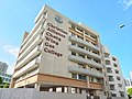
 Cheng Chia Ju Lan Building of Christian Alliance Cheng Wing Gee College.JPG 2,736 × 3,648; 1.78 MB
-
 Cheng wing gee colegel.jpg 1,632 × 1,224; 832 KB
-
 Chik Wan Street 01.jpg 2,560 × 1,536; 1.44 MB
-
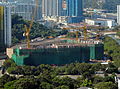
 Festival City Overview 201106.jpg 2,160 × 1,620; 3.37 MB
-
 GCC & ITKD Lau Pak Lok Secondary School 05.jpg 2,560 × 1,536; 1.75 MB
-
 HK STD 大圍 Tai Wai 美田路 Mei Tin Road MTR Station December 2022 Px3 01.jpg 4,000 × 3,000; 3.43 MB
-
 IMHS New Campus 201001.jpg 1,583 × 1,181; 1.5 MB
-
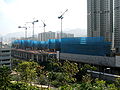
 Tai Wai Station & Tai Wai Maintenance Centre Site 200708.jpg 2,816 × 2,112; 5.3 MB
-
 Tai Wai Station ERL Platform 2015.jpg 2,560 × 1,536; 1.32 MB
-
 TaiWaiview 20071201.jpg 2,761 × 2,050; 4.43 MB


