Category:Church in Garzau
Jump to navigation
Jump to search
| Object location | | View all coordinates using: OpenStreetMap |
|---|
church building in Brandenburg state, Germany  | |||||
| Upload media | |||||
| Pronunciation audio | |||||
|---|---|---|---|---|---|
| Instance of | |||||
| Made from material | |||||
| Location | Garzau-Garzin, Märkisch-Oderland District, Brandenburg, Germany | ||||
| Heritage designation | |||||
 | |||||
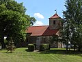
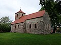
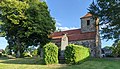
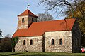
English: Pictures of the church in Garzau , Garzau-Garzin municipality, Märkisch-Oderland district, Brandenburg state, Germany
Deutsch: Bilder der Kirche in Garzau , Gemeinde Garzau-Garzin, Landkreis Märkisch-Oderland, Land Brandenburg, Deutschland.
Français : Photos de l'église à Garzau , commune de Garzau-Garzin, arrondissement de Märkisch-Oderland, état fédéral de Brandebourg, Allemagne
This is the category of the Brandenburger Baudenkmal (cultural heritage monument) with the ID 09180443 (Wikidata)
|
Subcategories
This category has only the following subcategory.
I
Media in category "Church in Garzau"
The following 15 files are in this category, out of 15 total.
-
 Dorfkirche Garzau Chor Nordansicht.JPG 2,592 × 1,944; 3.62 MB
-
 Dorfkirche Garzau Chor Ostansicht.JPG 2,592 × 1,944; 2.99 MB
-
 Dorfkirche Garzau Chor Südansicht.JPG 2,592 × 1,944; 3.52 MB
-
 Dorfkirche Garzau Chor Südpforte.JPG 2,592 × 1,944; 3.52 MB
-
 Dorfkirche Garzau Dorfanger mit WK I Denkmal.JPG 2,592 × 1,944; 3.3 MB
-
 Dorfkirche Garzau Hinweisschild.jpg 1,944 × 2,592; 2.05 MB
-
 Dorfkirche Garzau Nordansicht.jpg 2,588 × 1,940; 2.63 MB
-
 Dorfkirche Garzau Südansicht.JPG 2,592 × 1,944; 3.09 MB
-
 Dorfkirche Garzau Südostansicht.jpg 2,552 × 1,890; 2.22 MB
-
 Dorfkirche Garzau Westturm.JPG 1,944 × 2,592; 2.44 MB
-
 Garzau - Mittelalterliche Feldsteinkirche - panoramio.jpg 640 × 480; 69 KB
-
 Garzau, Kirche.jpg 3,368 × 2,566; 2.4 MB
-
 Garzau.jpg 4,032 × 2,308; 4.71 MB
-
 Kirche in Garzau IMG 0651-be.JPG 3,888 × 2,592; 9.68 MB
-
 Kirche in Garzau.JPG 3,270 × 2,368; 7.61 MB


