Category:Church in Krewelin
Jump to navigation
Jump to search
| Object location | | View all coordinates using: OpenStreetMap |
|---|
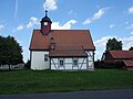
church building in Zehdenick, Brandenburg state, Germany   | |||||
| Upload media | |||||
| Instance of | |||||
|---|---|---|---|---|---|
| Location | Krewelin, Zehdenick, Oberhavel District, Brandenburg, Germany | ||||
| Heritage designation | |||||
 | |||||
This is the category of the Brandenburger Baudenkmal (cultural heritage monument) with the ID 09165220 (Wikidata)
|
Deutsch: Dorfkirche in Krewelin, Stadt Zehdenick, Landkreis Oberhavel, Land Brandenburg, Deutschland
Français : Église de Krewelin, ville de Zehdenick, arrondissement de Haute-Havel, état fédéral de Brandebourg, Allemagne
Subcategories
This category has only the following subcategory.
I
Media in category "Church in Krewelin"
The following 7 files are in this category, out of 7 total.
-
 Krewelin church 2016 NE.jpg 4,864 × 3,648; 5.43 MB
-
 Krewelin church 2016 portal W.jpg 3,602 × 4,830; 5.08 MB
-
 Krewelin church 2016 S.jpg 4,864 × 3,648; 4.98 MB
-
 Krewelin church 2016 SE.jpg 4,864 × 3,648; 5.46 MB
-
 Krewelin church 2016 SW.jpg 4,864 × 3,648; 4.58 MB
-
 Krewelin church.jpg 2,448 × 2,200; 690 KB
-
 Krewelin-Kirche-24-01-2008-641c.jpg 800 × 614; 348 KB


