Category:Church of Leegkerk
Jump to navigation
Jump to search
| Object location | | View all coordinates using: OpenStreetMap |
|---|
church building in Groningen, Netherlands  | |||||
| Upload media | |||||
| Instance of | |||||
|---|---|---|---|---|---|
| Location | Leegkerk, Groningen, Netherlands | ||||
| Street address |
| ||||
| Heritage designation |
| ||||
| Inception |
| ||||
| Significant event |
| ||||
 | |||||
Nederlands: De kerk van Leegkerk, gemeente Groningen
|
This is a category about rijksmonument number 18755
|
| Address |
|
Media in category "Church of Leegkerk"
The following 56 files are in this category, out of 56 total.
-
 Avondmaalsbeker - Leegkerk - 20129592 - RCE.jpg 1,200 × 820; 172 KB
-
 Groningen -152.jpg 2,304 × 1,728; 1.51 MB
-
 Groningen -156.jpg 1,728 × 2,304; 1.53 MB
-

-
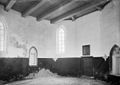 Inwendig naar het noord-oosten - Leegkerk - 20129589 - RCE.jpg 1,200 × 851; 140 KB
-

-
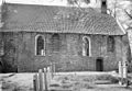
 Kerk naar het noordoosten - Leegkerk - 20129585 - RCE.jpg 922 × 1,200; 223 KB
-
 Kerk vanuit het noord-oosten - Leegkerk - 20129580 - RCE.jpg 1,200 × 886; 308 KB
-
 Kerk vanuit het noord-westen - Leegkerk - 20129581 - RCE.jpg 1,200 × 894; 285 KB
-

-

-
 Leegkerk - kerk (1).jpg 4,842 × 3,026; 14.48 MB
-
 Leegkerk - kerk (2).jpg 4,896 × 2,754; 12.78 MB
-
 Leegkerk - kerk - ampullennis.jpg 3,182 × 4,773; 6.9 MB
-
 Leegkerk - kerk - avondmaalsbord.jpg 3,239 × 3,494; 6.36 MB
-
 Leegkerk - kerk - boogpaneel (rechts).jpg 2,606 × 4,170; 9.15 MB
-
 Leegkerk - kerk - doorkijk koor.jpg 2,413 × 2,481; 3.21 MB
-
 Leegkerk - kerk - doorsneden toppen in noordmuur.jpg 3,923 × 2,615; 7.74 MB
-
 Leegkerk - kerk - gouden kubus.jpg 4,559 × 3,264; 8.29 MB
-
 Leegkerk - kerk - grafzerk Abelus Lamberti van Bolhuis.jpg 2,851 × 3,690; 5.71 MB
-
 Leegkerk - kerk - grafzerk Harmannus Teophilus.jpg 2,791 × 4,466; 7.57 MB
-
 Leegkerk - kerk - grafzerk Jan Sinninghe.jpg 2,961 × 3,506; 7.93 MB
-
 Leegkerk - kerk - graven.jpg 3,264 × 4,896; 14.01 MB
-
 Leegkerk - kerk - Hagioscoop binnenzijde.jpg 3,264 × 4,896; 7.37 MB
-
 Leegkerk - kerk - hagioscoop.jpg 3,264 × 4,896; 13.21 MB
-
 Leegkerk - kerk - interieur naar het koor.jpg 3,202 × 4,803; 8.43 MB
-
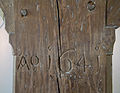 Leegkerk - kerk - jaartal standvink.jpg 4,224 × 3,264; 8.91 MB
-
 Leegkerk - kerk - kerkhof.jpg 4,896 × 3,264; 15.7 MB
-
 Leegkerk - kerk - oostzijde koor.jpg 3,264 × 4,896; 13.24 MB
-
 Leegkerk - kerk - ornamentale versieringen.jpg 4,686 × 2,636; 7.55 MB
-
 Leegkerk - kerk - piscina.jpg 3,189 × 3,835; 6.94 MB
-
 Leegkerk - kerk - preekstoel (links).jpg 3,100 × 4,555; 9 MB
-
 Leegkerk - kerk - preekstoel (rechts).jpg 2,292 × 4,075; 5.41 MB
-
 Leegkerk - kerk - preekstoel - boogpaneel (midden).jpg 3,264 × 4,416; 9.79 MB
-
 Leegkerk - kerk - preekstoel - klankbord.jpg 3,406 × 3,113; 6.94 MB
-
 Leegkerk - kerk - preekstoel - opschrift Blickman.jpg 4,521 × 2,582; 7.21 MB
-
 Leegkerk - kerk - preekstoel - vooraanzicht.jpg 3,155 × 4,732; 8.48 MB
-
 Leegkerk - kerk - sacramentsnis - gleuven.jpg 4,767 × 3,178; 10.17 MB
-
 Leegkerk - kerk - sacramentsnis.jpg 3,075 × 4,795; 9.22 MB
-
 Leegkerk - kerk - tekeningen op standvink.jpg 2,754 × 4,896; 9.13 MB
-
 Leegkerk - kerk - tiengebodenbord.jpg 4,034 × 3,049; 7.45 MB
-
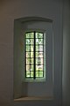
 Leegkerk - kerk - vensters in de westmuur.jpg 4,896 × 3,264; 13.64 MB
-
 Leegkerk - kerk - vensters westmuur.jpg 4,357 × 3,062; 7.33 MB
-
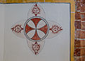 Leegkerk - kerk - wijdingskruis.jpg 4,483 × 3,264; 9.41 MB
-
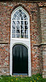 Leegkerk - kerk - zuidingang.jpg 2,374 × 4,220; 7.9 MB
-
 Leegkerk - kerk.jpg 4,896 × 3,264; 15.32 MB
-
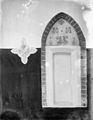
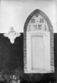 Nis met wijdingskruis - Leegkerk - 20129590 - RCE.jpg 827 × 1,200; 151 KB
-
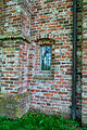
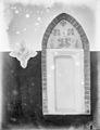 Nisje met beschildering in het koor - Leegkerk - 20129591 - RCE.jpg 922 × 1,200; 141 KB
-
 Nisje met beschildering in het koor - Leegkerk - 20408412 - RCE.jpg 929 × 1,200; 150 KB
-
 Noord-gevel - Leegkerk - 20129584 - RCE.jpg 1,200 × 828; 322 KB
-
 Noord-oost zijde exterieur - Leegkerk - 20129594 - RCE.jpg 1,200 × 809; 275 KB
-
 Overzicht noordoostgevel met kerkhof - Leegkerk - 20365452 - RCE.jpg 1,200 × 955; 312 KB
-
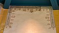
 Poetry in Leegkerk (14480100641).jpg 3,328 × 1,872; 3.34 MB
-
 Toren - Leegkerk - 20129595 - RCE.jpg 800 × 1,200; 170 KB
-
 West-gevel - Leegkerk - 20129593 - RCE.jpg 813 × 1,200; 266 KB
-
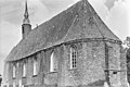 Zuid-oost gedeelte - Leegkerk - 20129596 - RCE.jpg 1,200 × 805; 293 KB


.jpg)
.jpg)


.jpg)


.jpg)
.jpg)
.jpg)


.jpg)


