Category:Church of Saint Mary and All Saints, Whitmore, Staffordshire
Jump to navigation
Jump to search
| Object location | | View all coordinates using: OpenStreetMap |
|---|
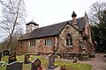
church in Whitmore, Staffordshire, United Kingdom  | |||||
| Upload media | |||||
| Instance of | |||||
|---|---|---|---|---|---|
| Dedicated to | |||||
| Location | Whitmore, Newcastle-under-Lyme, Staffordshire, West Midlands, England | ||||
| Diocese | |||||
| Heritage designation |
| ||||
| Religion or worldview | |||||
 | |||||
Media in category "Church of Saint Mary and All Saints, Whitmore, Staffordshire"
The following 3 files are in this category, out of 3 total.
-
 Church of St Mary and All Saints, Whitmore.jpg 1,200 × 799; 419 KB
-
 Henry George Mainwaring.jpg 2,939 × 2,251; 4.38 MB
-
 Whitmore Church - geograph.org.uk - 2254.jpg 640 × 480; 103 KB


Categories:
- 12th-century churches in Staffordshire
- All Saints churches in Staffordshire
- Anglican churches in Staffordshire
- Churches in the Diocese of Lichfield
- Grade II* listed churches in Staffordshire
- Saint Mary and All Saints churches in England
- Saint Mary churches in Staffordshire
- Sandstone churches in Staffordshire
- Aisleless churches in Staffordshire
- Whitmore, Staffordshire