Category:Church, Lancashire
Jump to navigation
Jump to search
English: Church is a large village in Hyndburn, Lancashire, England; situated a mile west of Accrington. The local travel links are located less than a mile from the village centre to Church and Oswaldtwistle railway station and to Blackpool Airport. Also, the main road running through the village is the A679. The village has a population of 3,988 according to the 2001 census. (→Church, Lancashire)
Nederlands: Church is een plaats en civil parish in het bestuurlijke gebied Hyndburn, in het Engelse graafschap Lancashire met 3.988 inwoners. (→Church (plaats))
Polski: Church – wieś w Anglii, w hrabstwie Lancashire, w dystrykcie Hyndburn. Leży 34 km na północ od miasta Manchester i 293 km na północny zachód od Londynu. W 2001 miejscowość liczyła 3988 mieszkańców. (→Church (Lancashire))

village in Lancashire, United Kingdom  | |||||
| Upload media | |||||
| Instance of | |||||
|---|---|---|---|---|---|
| Location | Hyndburn, Lancashire, North West England, England | ||||
| Different from | |||||
| official website | |||||
 | |||||
Subcategories
This category has the following 5 subcategories, out of 5 total.
C
L
Media in category "Church, Lancashire"
The following 37 files are in this category, out of 37 total.
-
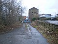
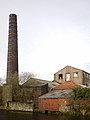 Aero Mill - geograph.org.uk - 1226887.jpg 480 × 640; 58 KB
-
 Aero Mill - geograph.org.uk - 1226891.jpg 640 × 480; 61 KB
-
 Aero Mill - geograph.org.uk - 1228308.jpg 640 × 480; 72 KB
-
 Baptist Chapel - geograph.org.uk - 1218517.jpg 640 × 305; 64 KB
-
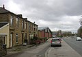
 Blackburn Road, Church - geograph.org.uk - 1218522.jpg 640 × 480; 64 KB
-
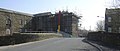
 Bridge Street - geograph.org.uk - 1118944.jpg 640 × 480; 49 KB
-
 Bridge Street, Church - geograph.org.uk - 1219010.jpg 640 × 273; 44 KB
-
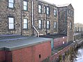 Canalside Factory - geograph.org.uk - 1218987.jpg 640 × 480; 98 KB
-
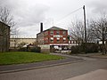
 Church Street, Church - geograph.org.uk - 655567.jpg 640 × 480; 170 KB
-
 Church Street, Church - geograph.org.uk - 655569.jpg 640 × 480; 147 KB
-

-
 Either way its the same - geograph.org.uk - 1226893.jpg 640 × 479; 120 KB
-
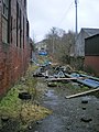
 Entrance to the mill off Kirk Road - geograph.org.uk - 1228304.jpg 640 × 480; 57 KB
-

-
 Ernest Street Baptist Chapel - geograph.org.uk - 1219006.jpg 640 × 480; 87 KB
-
 Former Commercial Hotel - geograph.org.uk - 1118947.jpg 640 × 480; 77 KB
-
 Hargreaves Warehouse, Church, Accrington.jpg 1,632 × 1,109; 443 KB
-
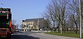
 Hyndburn Road - geograph.org.uk - 1243085.jpg 640 × 443; 54 KB
-
 Oswaldtwistle - DSC03917.JPG 3,648 × 2,736; 3.55 MB
-
 Out of sight out of mind - geograph.org.uk - 1226889.jpg 480 × 640; 99 KB
-
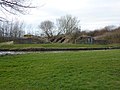
 Pasture to the west of Dill Hall Lane - geograph.org.uk - 1738086.jpg 640 × 480; 118 KB
-
 Remains of Aspen Colliery, Church (geograph 2301946).jpg 640 × 480; 151 KB
-
 Road to Plowlalgh Farm - geograph.org.uk - 1228292.jpg 640 × 480; 66 KB
-
 Roofscape - geograph.org.uk - 1228300.jpg 640 × 480; 75 KB
-
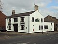
 The Crossed Guns, Church Street, Church - geograph.org.uk - 655565.jpg 640 × 480; 231 KB
-
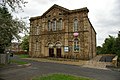
 The Maden Street Clock Tower - geograph.org.uk - 1226880.jpg 480 × 640; 58 KB
-
 The Maden Street Clock Tower, Plaque - geograph.org.uk - 1226882.jpg 640 × 480; 90 KB
-

-
 Thorn Inn, Church - geograph.org.uk - 655563.jpg 640 × 480; 216 KB
-

-

-
 Victoria Street - geograph.org.uk - 1226884.jpg 640 × 480; 79 KB
-

-
 Wood Street - geograph.org.uk - 1117851.jpg 640 × 480; 86 KB
-
 Wood Street - geograph.org.uk - 1117852.jpg 480 × 640; 88 KB
-
 Church Kirk Bridge Farm - geograph.org.uk - 154732.jpg 640 × 480; 115 KB
-


.jpg)


