Category:Cirencester
Jump to navigation
Jump to search

market town in east Gloucestershire, England  | |||||
| Upload media | |||||
| Instance of | |||||
|---|---|---|---|---|---|
| Location | Cotswold, Gloucestershire, South West England, England | ||||
| Located in or next to body of water | |||||
| Population |
| ||||
| Said to be the same as | Cirencester (Wikimedia duplicated page, civil parish) | ||||
| official website | |||||
 | |||||
Subcategories
This category has the following 11 subcategories, out of 11 total.
A
- Alexcars (bus company) (24 F)
B
C
- Cirencester Town railway station (11 F)
- Cirencester War Memorial (14 F)
P
- Plaques in Cirencester (38 F)
R
S
Media in category "Cirencester"
The following 200 files are in this category, out of 407 total.
(previous page) (next page)-
 Aerial view of Cirencester.jpg 4,368 × 2,912; 5.12 MB
-
 9 of 'History of Cirencester and the Roman City Corinium ... Illustrated' (11189960115).jpg 5,541 × 4,211; 3.31 MB
-
 A flower at the Roman amphitheatre, Cirencester - geograph.org.uk - 1931242.jpg 1,440 × 1,440; 760 KB
-
 A ride in Oakley Wood - geograph.org.uk - 5686402.jpg 1,600 × 901; 665 KB
-
 A walk through Cirencester Park and Stratton (2) (geograph 6844103).jpg 4,320 × 2,430; 1.69 MB
-
 A417 - A429 (Fosse Way) overbridge - geograph.org.uk - 2089556.jpg 640 × 480; 51 KB
-
 A417 bridge over A419 - geograph.org.uk - 3274929.jpg 1,024 × 768; 443 KB
-
 A417-A419 Split - geograph.org.uk - 3411005.jpg 640 × 480; 355 KB
-
 A419 approaching Burford Road junction - geograph.org.uk - 3675778.jpg 2,409 × 1,509; 1.55 MB
-
 A419 approaching hospital roundabout - geograph.org.uk - 3416521.jpg 640 × 461; 87 KB
-
 A419 at Two Mile Lodge - geograph.org.uk - 1955868.jpg 640 × 407; 95 KB
-
 A419 Cirencester Bypass - geograph.org.uk - 2999446.jpg 640 × 479; 96 KB
-
 A419 past Sweethills Plantation - geograph.org.uk - 1955884.jpg 640 × 480; 107 KB
-
 A429 approaching A419 roundabout - geograph.org.uk - 3416518.jpg 640 × 430; 53 KB
-
 A429 Burford Road entering Cirencester - geograph.org.uk - 3416508.jpg 640 × 503; 108 KB
-
-

-
 A435 Cheltenham Road, Stratton - geograph.org.uk - 2018611.jpg 640 × 480; 236 KB
-
 Abandoned section of the A419 road in Cirencester.jpg 4,000 × 3,000; 6.41 MB
-
 Abbey Estate allotments, Burford Road, Cirencester - geograph.org.uk - 2774757.jpg 2,848 × 2,136; 1.74 MB
-
 Abbey Grounds Cirencester - geograph.org.uk - 3795272.jpg 1,280 × 960; 781 KB
-
 Abbey Grounds Cirencester - geograph.org.uk - 3826292.jpg 1,280 × 960; 772 KB
-
 Abbey Grounds, Cirencester - geograph.org.uk - 3889912.jpg 1,024 × 577; 192 KB
-

-
 Alexcars, Love Lane Industrial Estate, Cirencester - geograph.org.uk - 3244757.jpg 4,000 × 3,000; 2.89 MB
-
 Beeches Road, Cirencester, Glos - geograph.org.uk - 4298743.jpg 1,024 × 748; 215 KB
-

-

-
 Brewery Car Park, Cirencester - geograph.org.uk - 3890055.jpg 640 × 470; 76 KB
-
 Bridleway down to Chesterton Farm - geograph.org.uk - 3279820.jpg 640 × 480; 95 KB
-
 Bridleway to Spratsgate Lane - geograph.org.uk - 3279849.jpg 640 × 480; 101 KB
-
 Bridleway towards College Farm - geograph.org.uk - 5749796.jpg 4,000 × 3,000; 4.56 MB
-
 Bristol Road, Cirencester - geograph.org.uk - 6129772.jpg 1,194 × 795; 612 KB
-
 Bristol Road, Cirencester - geograph.org.uk - 6129811.jpg 1,479 × 979; 872 KB
-
 Burford Road at the end of London Road - geograph.org.uk - 6103088.jpg 1,824 × 1,116; 1.46 MB
-
 Burford Road crosses the A419 - geograph.org.uk - 2052188.jpg 640 × 480; 50 KB
-
 Burford Road crosses the Stow Road - geograph.org.uk - 4512914.jpg 1,500 × 999; 206 KB
-
 Burford road junction - geograph.org.uk - 5526950.jpg 640 × 394; 48 KB
-
 Burford Road junction A417 - geograph.org.uk - 2290349.jpg 640 × 198; 26 KB
-
 Burford Road junction on the A417 - geograph.org.uk - 3696722.jpg 4,503 × 2,411; 2.02 MB
-
 Burford Road Near Cirencester - geograph.org.uk - 5325324.jpg 640 × 480; 69 KB
-

-

-
 Car park by South Way - geograph.org.uk - 3350330.jpg 640 × 522; 62 KB
-
 Car park exit to South Way - geograph.org.uk - 3350331.jpg 640 × 466; 45 KB
-
 Car park in Cirencester - geograph.org.uk - 3765466.jpg 640 × 480; 52 KB
-
 Car park off North Way - geograph.org.uk - 3350332.jpg 640 × 439; 48 KB
-

-
 Caravan Club Site - Cirencester Park - geograph.org.uk - 3919521.jpg 4,608 × 3,456; 6.3 MB
-
 Charles Biscoe scanned from one of his wedding photos.png 170 × 244; 26 KB
-
 Cheltenham Road in Stratton - geograph.org.uk - 3049334.jpg 1,024 × 690; 156 KB
-
 Cheltenham Road near Roberts Close - geograph.org.uk - 3049338.jpg 1,024 × 714; 151 KB
-
 Chesterton Farm, Cirencester - geograph.org.uk - 2827285.jpg 2,848 × 2,136; 1.36 MB
-
 Chesterton Lane - geograph.org.uk - 3007522.jpg 640 × 480; 70 KB
-
 Chesterton Lane - geograph.org.uk - 3007845.jpg 640 × 480; 71 KB
-
 Cirencester - geograph.org.uk - 1194773.jpg 640 × 427; 505 KB
-
 Cirencester - geograph.org.uk - 2144045.jpg 640 × 530; 93 KB
-
 Cirencester - Gloucestershire dot.png 1,802 × 2,589; 189 KB
-
 Cirencester A419 Bristol Road Island - geograph.org.uk - 5325282.jpg 640 × 480; 89 KB
-

-

-
 Cirencester A419 Island Joining A429 - geograph.org.uk - 5325310.jpg 640 × 439; 68 KB
-
 Cirencester A429 Northbound - geograph.org.uk - 5325313.jpg 640 × 480; 81 KB
-

-

-
 Cirencester A435 Northbound - geograph.org.uk - 5325321.jpg 640 × 468; 83 KB
-
 Cirencester Burford Road A429 - geograph.org.uk - 5324039.jpg 640 × 480; 67 KB
-

-

-

-
 Cirencester Bypass, London Road Bridge - geograph.org.uk - 3411008.jpg 640 × 480; 367 KB
-
 Cirencester Caravan Club site - geograph.org.uk - 3303375.jpg 800 × 571; 216 KB
-
 Cirencester exit - geograph.org.uk - 313600.jpg 640 × 448; 61 KB
-
 Cirencester features (5) - geograph.org.uk - 6277391.jpg 4,320 × 3,240; 4.7 MB
-
 Cirencester features (6) - geograph.org.uk - 6277393.jpg 4,320 × 3,240; 3.66 MB
-
 Cirencester features (8) - geograph.org.uk - 6275433.jpg 4,320 × 2,430; 2 MB
-
 Cirencester Font - geograph.org.uk - 2744140.jpg 4,288 × 3,216; 3.2 MB
-
-
-

-
 Cirencester parks and spaces (1) - geograph.org.uk - 6275429.jpg 4,320 × 3,240; 4.29 MB
-
 Cirencester parks and spaces (2) - geograph.org.uk - 6275430.jpg 4,320 × 3,240; 3.36 MB
-
 Cirencester parks and spaces (3) - geograph.org.uk - 6275431.jpg 4,320 × 3,240; 4.76 MB
-
 Cirencester parks and spaces (4) - geograph.org.uk - 6276543.jpg 4,320 × 3,240; 3.6 MB
-

-
 Cirencester ring road - geograph.org.uk - 3157863.jpg 639 × 900; 105 KB
-
 Cirencester Saddlers - geograph.org.uk - 3450506.jpg 3,648 × 2,736; 4.87 MB
-

-
 Cirencester Town.jpg 4,288 × 2,848; 20.67 MB
-
 Cirencester Traffic Island A417 A429 - geograph.org.uk - 5324035.jpg 640 × 480; 61 KB
-
 Cirencester Urban District Council Water Works - geograph.org.uk - 3450589.jpg 3,648 × 2,736; 4.11 MB
-
 Cirencester Watermoor station locatiobn geograph-3306911-by-Ben-Brooksbank.jpg 2,347 × 1,238; 2.08 MB
-

-
 Cirencester, Hospital Main Entrance - geograph.org.uk - 1096974.jpg 640 × 479; 98 KB
-
 Cirencester, Hospital statue - geograph.org.uk - 1096979.jpg 640 × 479; 85 KB
-

-
 Cirencester, roundabout - geograph.org.uk - 1096698.jpg 640 × 479; 52 KB
-
 Cirencester1.JPG 2,048 × 1,536; 1.28 MB
-
 Coffee^1 in Cirencester - geograph.org.uk - 5084933.jpg 628 × 800; 137 KB
-
 College Farm Buildings - geograph.org.uk - 3921927.jpg 4,608 × 3,456; 7.78 MB
-
 Coming soon^ - geograph.org.uk - 4189438.jpg 2,304 × 1,704; 1.62 MB
-
 Communication tower by Bristol Road, Cirencester - geograph.org.uk - 6129785.jpg 1,680 × 1,082; 961 KB
-
 Corinium Hotel in Cirencester - geograph.org.uk - 5506245.jpg 724 × 800; 131 KB
-
 Corinium Via estate under construction - geograph.org.uk - 2774742.jpg 2,848 × 2,136; 1.41 MB
-
 Corinium Via housing estate under construction - geograph.org.uk - 2774747.jpg 2,848 × 2,136; 1.37 MB
-
 Cotswold Airfield - panoramio (1).jpg 3,264 × 2,448; 4.16 MB
-
 Cotswold Airfield - panoramio.jpg 3,264 × 2,448; 2.8 MB
-
 Cotswold Avenue in Cirencester - geograph.org.uk - 3900535.jpg 1,500 × 999; 190 KB
-
 Cotswold Avenue in Cirencester - geograph.org.uk - 3900555.jpg 1,500 × 999; 277 KB
-
 Cotswold Avenue, Cirencester - geograph.org.uk - 6096609.jpg 1,771 × 1,179; 908 KB
-

-
 Cotswold Leisure Centre, Cirencester - geograph.org.uk - 5205666.jpg 800 × 436; 79 KB
-
 Cottage Lake (46287473781).jpg 4,451 × 2,811; 1.62 MB
-
 Cranhams Lane, Cirencester - geograph.org.uk - 1819166.jpg 640 × 481; 199 KB
-
 Cranshams Lane, Cirencester - geograph.org.uk - 5838847.jpg 1,024 × 768; 290 KB
-
 Crew Clothing shop in Cirencester - geograph.org.uk - 4840103.jpg 658 × 800; 103 KB
-
 Daglingworth Path, Cirencester Park - geograph.org.uk - 2744240.jpg 680 × 1,024; 294 KB
-
 Daglingworth Road - geograph.org.uk - 2018651.jpg 640 × 480; 212 KB
-
 Dawn Fishing , Mallard Lake (32399715518).jpg 4,608 × 3,072; 3.16 MB
-
 December sun in West Market Street, Cirencester - geograph.org.uk - 2738305.jpg 1,000 × 664; 111 KB
-
 Depot Yard - geograph.org.uk - 3007863.jpg 640 × 480; 75 KB
-

-

-

-
 Dovecote, Cirencester Park - geograph.org.uk - 4717758.jpg 2,448 × 3,264; 4.36 MB
-
 Drive near Two Mile Lodge - geograph.org.uk - 2744173.jpg 1,024 × 680; 236 KB
-
 Easily confused^ - geograph.org.uk - 4189445.jpg 1,704 × 2,304; 1.94 MB
-

-
 East along Bridge Road, Cirencester - geograph.org.uk - 4048559.jpg 640 × 480; 77 KB
-
En-cirencester.ogg 2.7 s; 31 KB
-
 Entrance to Hare Bushes Wood - geograph.org.uk - 2774728.jpg 2,848 × 2,136; 2.16 MB
-
 Ermin Way - geograph.org.uk - 2018619.jpg 640 × 480; 225 KB
-
 Farm Track College Farm - geograph.org.uk - 3007879.jpg 640 × 480; 92 KB
-
 Feeding time for hungry tummies - geograph.org.uk - 2492108.jpg 1,704 × 2,304; 2.07 MB
-

-
 Field beside Baunton Lane - geograph.org.uk - 5838743.jpg 1,024 × 768; 303 KB
-
 Fishing on the River Churn, Cirencester - geograph.org.uk - 5123195.jpg 640 × 480; 140 KB
-
 Footpath near Grange Farm, Stratton - geograph.org.uk - 3449830.jpg 4,608 × 3,072; 7.67 MB
-
 Footpath near Stratton - geograph.org.uk - 5833524.jpg 1,024 × 768; 336 KB
-
 Footpath past Grange Farm, Stratton - geograph.org.uk - 2018644.jpg 640 × 480; 260 KB
-
 Footpath to Stratton church - geograph.org.uk - 2018634.jpg 640 × 480; 235 KB
-
 French Grey Interiors, Cirencester - geograph.org.uk - 4827960.jpg 600 × 800; 154 KB
-
 From A433 to A429 SW of Cirencester - geograph.org.uk - 5416053.jpg 652 × 800; 146 KB
-
 Geological map Cirencester District Richardson 1933 02.jpg 6,292 × 3,860; 2.34 MB
-
 Geological map Cirencester District Richardson 1933.jpg 3,053 × 1,749; 1.58 MB
-
 Graffiti in Chesterton underpass - geograph.org.uk - 2050288.jpg 1,000 × 756; 162 KB
-
 Grass cut for hay - geograph.org.uk - 5833533.jpg 1,024 × 768; 286 KB
-
 Grass verge at Chesterton - geograph.org.uk - 2139113.jpg 1,000 × 839; 292 KB
-
 Gravestone belonging to W Leslie Savage - geograph.org.uk - 3502685.jpg 960 × 1,280; 1.07 MB
-
 Groundwork Lewis Lane Cirencester - geograph.org.uk - 4066896.jpg 1,280 × 960; 782 KB
-
 Gully and Earthwall - geograph.org.uk - 5385275.jpg 2,448 × 3,264; 4.18 MB
-

-
 Hedley Goldsmith Browne - geograph.org.uk - 3502668.jpg 960 × 1,280; 1.09 MB
-
 Hermitage Bottom - geograph.org.uk - 1955843.jpg 640 × 480; 111 KB
-
 House, barns and outbuildings - geograph.org.uk - 3450501.jpg 3,648 × 2,736; 4.81 MB
-
 In the Post Office alleyway, Cirencester - geograph.org.uk - 2409668.jpg 827 × 1,000; 200 KB
-

-
 Intersection of A429 Burford Road and A417(T) looking east - geograph.org.uk - 2775831.jpg 2,848 × 2,136; 1.65 MB
-

-
 Intersection of A429 Burford Road and A417(T) looking south - geograph.org.uk - 2775815.jpg 2,848 × 2,136; 1.39 MB
-

-
 John Boles Watson.jpg 428 × 560; 82 KB
-

-
 Kingshill Meadow, Cirencester - geograph.org.uk - 3216430.jpg 4,000 × 3,000; 5.01 MB
-
 Lane off Beeches Road, Cirencester, Glos - geograph.org.uk - 4298746.jpg 1,024 × 768; 295 KB
-
 Lane to Field Farm north of Ewen - geograph.org.uk - 3379897.jpg 640 × 480; 77 KB
-
 London Road overbridge - geograph.org.uk - 5526953.jpg 640 × 414; 56 KB
-

-
 Lurking skull - geograph.org.uk - 4436502.jpg 1,704 × 2,304; 1.71 MB
-
 Martin Close, Cirencester - geograph.org.uk - 1930933.jpg 1,440 × 1,080; 927 KB
-

-
 Milestone on The Fosse Way (Tetbury Road) - geograph.org.uk - 3921953.jpg 3,456 × 4,608; 7.58 MB
-
 Mill at Barton Lane - geograph.org.uk - 5480872.jpg 2,448 × 3,264; 3.29 MB
-
 Mill Pond, Cirencester - geograph.org.uk - 2745964.jpg 4,288 × 3,216; 3.21 MB
-
 Mill, Barton Lane - geograph.org.uk - 2745328.jpg 4,288 × 3,216; 3.42 MB
-
 Monotone houses (Unsplash).jpg 3,648 × 5,472; 10.42 MB
-
 Mosaic in Dyer Street, Cirencester - geograph.org.uk - 296571.jpg 480 × 640; 57 KB
-
 Moss's Copse - Cirencester Park - geograph.org.uk - 3921335.jpg 3,456 × 4,608; 6.47 MB
-
 Muddy track near Chesterton Farm - geograph.org.uk - 5749801.jpg 4,000 × 3,000; 4.76 MB
-
 NE end of the A433 SW of Cirencester - geograph.org.uk - 3379881.jpg 640 × 488; 97 KB
-
 Nearing Chesterton Farm - geograph.org.uk - 3279826.jpg 640 × 480; 70 KB
-
 New David Wilson Homes in Cirencester - geograph.org.uk - 6103085.jpg 1,705 × 1,126; 910 KB
-
 New houses on Somerford Road, Cirencester - geograph.org.uk - 6130620.jpg 1,920 × 1,280; 2.04 MB
-
 New housing by London Road - geograph.org.uk - 5840178.jpg 2,700 × 2,025; 315 KB
-
 Norcote Farm near Cirencester - geograph.org.uk - 22355.jpg 640 × 480; 231 KB
-
 Norman arch, Cirencester - geograph.org.uk - 5123164.jpg 480 × 640; 103 KB
-
 North Way - geograph.org.uk - 3350336.jpg 640 × 418; 49 KB
-

-

-

-
 Octavia's Bookshop, Cirencester - geograph.org.uk - 4836310.jpg 501 × 800; 106 KB
-
 Old A419 - geograph.org.uk - 2648795.jpg 640 × 480; 82 KB
-
 Old Cirencester - geograph.org.uk - 2745997.jpg 4,288 × 3,216; 2.35 MB
-
 Old Station Car Park, Cirencester - geograph.org.uk - 5205698.jpg 800 × 598; 128 KB
-
 Old stone barn in Cirencester Park - geograph.org.uk - 3807030.jpg 1,280 × 960; 1 MB
-
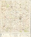
 Ordnance Survey One-Inch Sheet 104 Swindon & Cirencester, Published 1919.jpg 11,919 × 8,835; 9.81 MB
-
 Ordnance Survey One-Inch Sheet 157 Swindon, Published 1940.jpg 8,198 × 9,537; 10.75 MB
-
 Ordnance Survey One-Inch Sheet 157 Swindon, Published 1958.jpg 8,326 × 9,940; 10.27 MB
-
 Ordnance Survey One-Inch Sheet 157 Swindon, Published 1968.jpg 8,365 × 9,905; 10.54 MB
-
 Overley Ride, Cirencester Park - geograph.org.uk - 2743247.jpg 1,024 × 680; 273 KB

.jpg)


_(geograph_6844103).jpg)
_overbridge_-_geograph.org.uk_-_2089556.jpg)


_-_geograph.org.uk_-_6277391.jpg)
_-_geograph.org.uk_-_6277393.jpg)
_-_geograph.org.uk_-_6275433.jpg)


_-_geograph.org.uk_-_6275429.jpg)
_-_geograph.org.uk_-_6275430.jpg)
_-_geograph.org.uk_-_6275431.jpg)
_-_geograph.org.uk_-_6276543.jpg)


.jpg)


.jpg)


.jpg)


_Cirencester_Park,_Gloucestershire_-_geograph.org.uk_-_2489766.jpg)
_Cirencester_Park,_Gloucestershire_-_geograph.org.uk_-_2489768.jpg)
_Cirencester_Park,_Gloucestershire_-_geograph.org.uk_-_2489770.jpg)


_looking_east_-_geograph.org.uk_-_2775831.jpg)
_looking_north_-_geograph.org.uk_-_2775805.jpg)
_looking_south_-_geograph.org.uk_-_2775815.jpg)


_-_geograph.org.uk_-_3921953.jpg)


.jpg)


_dual_carriageway_-_geograph.org.uk_-_2775840.jpg)


