Category:Claddaghduff
Перейти к навигации
Перейти к поиску
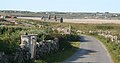
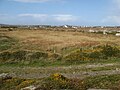
English: Claddaghduff (derived from the Irish An Cladach Dubh meaning the black shore) is a village in County Galway, in the province of Connacht, Ireland. It is located northwest of Clifden, the gateway to Omey Island, and like much of Connemara is noted for its beautiful seascapes.
| Медиафайл | |||||
| Это частный случай понятия | |||||
|---|---|---|---|---|---|
| Местонахождение |
| ||||
 | |||||
Файлы в категории «Claddaghduff»
Показано 32 файла из 32, находящихся в данной категории.
-
 Aughrus Point - geograph.org.uk - 1465842.jpg 640 × 480; 87 КБ
-
 Aughrus Point and Omey Island - geograph.org.uk - 1465755.jpg 640 × 480; 86 КБ
-

-

-
 Boulder beach - geograph.org.uk - 5951025.jpg 640 × 480; 78 КБ
-
 Bungalows at Claddaghduff - geograph.org.uk - 2436546.jpg 640 × 480; 96 КБ
-

-
 Church ruins on Omey Island - geograph.org.uk - 375493.jpg 640 × 338; 68 КБ
-
 Cillin above Sellerna Bay - geograph.org.uk - 2436553.jpg 640 × 480; 71 КБ
-
 Claddaghduff village - geograph.org.uk - 2436544.jpg 640 × 480; 149 КБ
-
 Currachs on the strand - geograph.org.uk - 1464209.jpg 640 × 480; 78 КБ
-
 Down to the sand - geograph.org.uk - 5526689.jpg 4320 × 3240; 3,06 МБ
-
 Eroding drumlin - geograph.org.uk - 5951040.jpg 640 × 480; 60 КБ
-
 Granite scenery - geograph.org.uk - 5937459.jpg 640 × 480; 80 КБ
-
 Information board - geograph.org.uk - 5526687.jpg 4320 × 3240; 3,18 МБ
-
 Information notice - geograph.org.uk - 5526688.jpg 4320 × 3240; 1,96 МБ
-
 Omey Island - geograph.org.uk - 4242143.jpg 1024 × 768; 118 КБ
-
 Omey Island on the Wild Atlantic Way - geograph.org.uk - 5526686.jpg 3240 × 4320; 1,8 МБ
-
 Omey Island, bay on western side - geograph.org.uk - 378535.jpg 640 × 427; 110 КБ
-
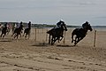 Omey Races 2008.jpg 1024 × 683; 270 КБ
-
 Omey Strand (1) - geograph.org.uk - 5526694.jpg 4320 × 3240; 2,18 МБ
-
 Omey Strand rush-hour - geograph.org.uk - 4601565.jpg 640 × 480; 40 КБ
-
 Pony-trekkers - geograph.org.uk - 1464188.jpg 640 × 480; 92 КБ
-
 Remnants of the bog - geograph.org.uk - 5958449.jpg 640 × 480; 64 КБ
-
 Rough Pasture west of Cleggan - geograph.org.uk - 1840258.jpg 1024 × 786; 161 КБ
-
 Sellerna bay - geograph.org.uk - 5951050.jpg 640 × 480; 51 КБ
-
 Swimming bay - geograph.org.uk - 1465737.jpg 640 × 479; 74 КБ
-
 Tidal pools and rock outcrops - geograph.org.uk - 4601592.jpg 640 × 480; 51 КБ
-
 Track to the east - geograph.org.uk - 5937466.jpg 640 × 480; 81 КБ
-
 Turf workings west of Cleggan - geograph.org.uk - 1840268.jpg 1024 × 680; 130 КБ
-
 View to Claddaghduff - geograph.org.uk - 5937472.jpg 640 × 480; 73 КБ
-
 Beach and island view - geograph.org.uk - 1425594.jpg 640 × 474; 91 КБ


_looking_north_east_-_geograph.org.uk_-_1840250.jpg)
_looking_north_west_-_geograph.org.uk_-_1840246.jpg)


_-_geograph.org.uk_-_5526694.jpg)


