Category:Claxton, North Yorkshire
Jump to navigation
Jump to search
village and civil parish in North Yorkshire, United Kingdom  | |||||
| Upload media | |||||
| Instance of | |||||
|---|---|---|---|---|---|
| Location | Ryedale, North Yorkshire, Yorkshire and the Humber, England | ||||
 | |||||
English: Claxton is a village and civil parish in the Ryedale district of North Yorkshire, England. It is near the A64 road and north east of York.
Subcategories
This category has only the following subcategory.
S
Media in category "Claxton, North Yorkshire"
The following 42 files are in this category, out of 42 total.
-
 A64 near Tanglewood - geograph.org.uk - 241532.jpg 640 × 480; 69 KB
-
 A64 towards York - geograph.org.uk - 2372240.jpg 1,600 × 1,200; 483 KB
-
 Approaching Bossall Lodge - geograph.org.uk - 3401139.jpg 640 × 427; 80 KB
-
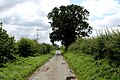
 Bridleway to Claxton - geograph.org.uk - 786856.jpg 640 × 478; 270 KB
-
 Claxton - geograph.org.uk - 3401136.jpg 640 × 427; 79 KB
-
 Claxton - geograph.org.uk - 787874.jpg 478 × 640; 235 KB
-
 Claxton Bridleway - geograph.org.uk - 787851.jpg 640 × 478; 235 KB
-
 Claxton Green - geograph.org.uk - 787878.jpg 640 × 478; 254 KB
-
 Claxton to Sand Hutton bridleway approaching Ox Closes - geograph.org.uk - 5773748.jpg 1,600 × 1,200; 652 KB
-
 Entering Claxton, North Yorkshire - geograph.org.uk - 2263971.jpg 800 × 600; 302 KB
-
 Farmland north of Claxton - geograph.org.uk - 2828810.jpg 1,024 × 768; 180 KB
-
 Farmland north of Kirk Balk Lane - geograph.org.uk - 2828853.jpg 1,024 × 768; 182 KB
-
 Farmland towards Claxton - geograph.org.uk - 787220.jpg 640 × 478; 213 KB
-
 Farmland with lots of pylons - geograph.org.uk - 2372209.jpg 640 × 480; 60 KB
-
 Farmland with molehills - geograph.org.uk - 2828873.jpg 1,024 × 768; 167 KB
-
 Gated farm track (Ings Lane) - geograph.org.uk - 2372223.jpg 1,600 × 1,200; 542 KB
-
 Ings Farm - geograph.org.uk - 2372230.jpg 1,600 × 1,200; 476 KB
-
 Ings Farm - geograph.org.uk - 787859.jpg 640 × 478; 248 KB
-
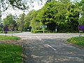 Junction of Whinny Lane with the A64 - geograph.org.uk - 2372235.jpg 1,600 × 1,200; 639 KB
-
 Kirk Balk Lane - geograph.org.uk - 2828858.jpg 1,024 × 768; 108 KB
-
 Kirk Balk Lane - geograph.org.uk - 3107550.jpg 1,024 × 768; 318 KB
-
 Narrow Lane heading South towards Sand Hutton - geograph.org.uk - 5493257.jpg 5,184 × 3,456; 6.58 MB
-
 Open field gate - geograph.org.uk - 2828801.jpg 1,024 × 768; 127 KB
-
 Primitive Methodist Chapel at Claxton - geograph.org.uk - 5773736.jpg 1,600 × 1,200; 640 KB
-
 Pylons near Claxton - geograph.org.uk - 787879.jpg 640 × 478; 229 KB
-
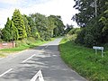
 Road to Claxton - geograph.org.uk - 787869.jpg 640 × 478; 242 KB
-
 Rough track leading to Gravel Pit Farm - geograph.org.uk - 280640.jpg 640 × 480; 130 KB
-
 Sand Hutton Light Railway - Claxton brickworks.jpg 585 × 414; 41 KB
-
 Sheep at Pasture Farm - geograph.org.uk - 778807.jpg 640 × 478; 264 KB
-
 Snowy Claxton Marshes - geograph.org.uk - 1659054.jpg 640 × 452; 106 KB
-
 Straw bales at Mill Hill - geograph.org.uk - 2828846.jpg 1,024 × 768; 122 KB
-
 The road to Claxton - geograph.org.uk - 2828794.jpg 1,024 × 768; 112 KB
-
 The road to Harton Lodge Plantation - geograph.org.uk - 2828814.jpg 1,024 × 768; 132 KB
-
 Track to Vicarage Farm, Claxton - geograph.org.uk - 2372214.jpg 1,600 × 1,200; 622 KB
-
 Track to Woodhouse Farm - geograph.org.uk - 778820.jpg 640 × 478; 278 KB
-
 Unmapped track south of Kirk Balk Lane - geograph.org.uk - 2828868.jpg 1,024 × 768; 136 KB
-
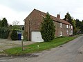
 Village Green, Claxton, North Yorkshire.jpg 640 × 479; 63 KB
-
 Whinney Lane at Ings Farm - geograph.org.uk - 5773741.jpg 1,600 × 1,200; 724 KB
-
 Whinny Lane, Claxton - geograph.org.uk - 3107553.jpg 1,024 × 768; 263 KB
-
 Winter tree hiding a pylon - geograph.org.uk - 2828828.jpg 1,024 × 768; 102 KB
-
 Winter trees near Harton Lodge Plantation - geograph.org.uk - 2828821.jpg 1,024 × 768; 180 KB
-


_-_geograph.org.uk_-_2372223.jpg)


