Category:Clickable images
ナビゲーションに移動
検索に移動
| Image maps on sister projects: | ||||||||||
|---|---|---|---|---|---|---|---|---|---|---|
| メディアをアップロード | |||||
| |||||
This category contains image maps that were made for use in the WikiAtlas and elsewhere.
The WikiAtlas still needs more clickable maps, and you can help.
Load the image you want to make into a clickable map in the Image map editor. Then click "Polygon" and click where you want the corners of the polygon to be. Add a title for the polygon and where you want the area to link to. Then click "Polygon" again to create another clickable area. When you're all done, copy the wikicode that appears near the bottom of the page, and paste it into a new template in WikiMedia Commons.
Resources:
カテゴリ「Clickable images」にあるページ
このカテゴリに属するページは次の1つのみです。
カテゴリ「Clickable images」にあるメディア
このカテゴリに属する 30 個のファイルのうち、 30 個を表示しています。
-
-
 BrunetAndTeam.jpg 1,200 × 838;610キロバイト
-
 Crux and neighboring stars.jpeg 1,640 × 1,230;18キロバイト
-
 Informações.png 542 × 85;14キロバイト
-
 Interseção azul.PNG 833 × 452;11キロバイト
-
 Icons 1e-6m to 1e5m squares 512pixel.png 2,048 × 1,536;3.57メガバイト
-
 Length one to ten scale.svg 512 × 512;4キロバイト
-
 Scale one to hundred no labels.svg 220 × 220;9キロバイト
-
 Scale one to hundred.svg 220 × 220;16キロバイト
-
 Scale one to thousand spheres no labels.svg 230 × 230;22キロバイト
-
 Scale one to thousand spheres.svg 240 × 231;35キロバイト
-
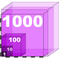
 Scale one to thousand volume no labels.svg 547 × 531;27キロバイト
-
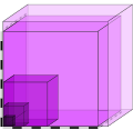
 Scale one to thousand volume.svg 547 × 531;40キロバイト
-

-
 Wide panorama 1e-15 to 1e-7.png 675 × 60;21キロバイト
-
 Wide panorama 1e-15 to 1e-8.png 600 × 60;21キロバイト
-
 Wide panorama 1e-8 to 1e-15.png 600 × 60;21キロバイト
-
-
 Wide panorama lengths 1e6m to 1e17m - Pluto globe to Messier 5.png 300 × 180;70キロバイト
-
 PolierMartinWombwellZoffany.jpg 1,582 × 1,188;893キロバイト
-
 RalphBartonExtract.jpg 678 × 851;241キロバイト
-
 Roman Forum from northwest 2.jpg 3,072 × 2,304;2.28メガバイト
-
 Roman Forum from northwest 3.jpg 3,072 × 2,304;2.35メガバイト
-
 Roman Forum from northwest.jpg 3,072 × 2,304;2.48メガバイト
-
 Russian Orbital Segment (blank).png 1,234 × 854;629キロバイト
-
 SkeletonsMagnifyingGlass.png 323 × 500;581キロバイト
-
 SkeletonsNumbers.png 700 × 1,083;620キロバイト
-
 Skeletons.png 323 × 500;566キロバイト
-
 View towards Brighton City Centre from Canfield Close, near Coombe Road (July 2010).JPG 2,400 × 1,400;744キロバイト
-
 Wildbunchlarge.jpg 899 × 712;480キロバイト


.JPG)

.png)