Category:Cliffsend
Vai alla navigazione
Vai alla ricerca
English: Cliffsend is a village and civil parish situated almost 2 miles (3km) west of Ramsgate, Kent, United Kingdom, in the Thanet local government district.
village in Kent, England, UK | |||||
| Carica un file multimediale | |||||
| Istanza di | |||||
|---|---|---|---|---|---|
| Luogo | Thanet, Kent, Sud Est dell'Inghilterra, Inghilterra | ||||
| Popolazione |
| ||||
 | |||||
Sottocategorie
Questa categoria contiene le 7 sottocategorie indicate di seguito, su un totale di 7.
C
- Cliffsend Beacon (4 F)
- Cliffsend Village Sign (5 F)
H
- Hugin (ship, 1949) (39 F)
O
- Oasts in Cliffsend (4 F)
P
T
- The Sportsman, Cliffsend (12 F)
File nella categoria "Cliffsend"
Questa categoria contiene 200 file, indicati di seguito, su un totale di 222.
(pagina precedente) (pagina successiva)-
 9th (last) green, Stonelees golf course. - geograph.org.uk - 302958.jpg 640 × 480; 138 KB
-
 A newly ploughed field - geograph.org.uk - 711617.jpg 640 × 428; 152 KB
-
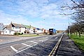
 Arundel Road, Cliffsend - geograph.org.uk - 4596720.jpg 2 272 × 1 704; 881 KB
-
 Ashford to Ramsgate line - geograph.org.uk - 3038073.jpg 640 × 480; 92 KB
-
 Bakers Field, Cliffs End Road - geograph.org.uk - 6429434.jpg 3 264 × 2 448; 2,39 MB
-
 Bare bushes on the Thanet Coast Path - geograph.org.uk - 6018870.jpg 5 202 × 3 465; 3,28 MB
-
 Bird watching hide on Thanet Coast Path - geograph.org.uk - 6018866.jpg 5 202 × 3 465; 2,96 MB
-
 Building site, Cliffs End Road - geograph.org.uk - 5506408.jpg 3 264 × 2 448; 3,83 MB
-
 Canterbury Road West - geograph.org.uk - 5581177.jpg 640 × 480; 117 KB
-
 Canterbury Road West, Cliffsend - geograph.org.uk - 2818895.jpg 4 320 × 3 240; 3,85 MB
-
 Canterbury Road West, Cliffsend - geograph.org.uk - 2818896.jpg 4 320 × 3 240; 3,37 MB
-
 Cliff View Road, Cliffsend - geograph.org.uk - 4596708.jpg 2 272 × 1 704; 827 KB
-
 Cliffs between Cliffsend and Ramsgate.jpg 3 748 × 2 648; 3,31 MB
-
 Cliffs End Grove - geograph.org.uk - 3097721.jpg 640 × 430; 64 KB
-
 Cliffs End Road - geograph.org.uk - 3036300.jpg 640 × 480; 48 KB
-
 Cliffs End, Cliffsend Point - geograph.org.uk - 2741639.jpg 3 648 × 2 736; 3,78 MB
-
 Cliffs End, Public Footpath No. TR33 - geograph.org.uk - 2741910.jpg 3 648 × 2 736; 3,12 MB
-

-
 Cliffsend - 2014 - geograph.org.uk - 4223989.jpg 3 648 × 2 736; 1,47 MB
-
 Cliffsend - 2014 - geograph.org.uk - 4223990.jpg 3 648 × 2 736; 1,73 MB
-
 Cliffsend - 2014 - geograph.org.uk - 4223991.jpg 3 648 × 2 736; 1,7 MB
-
 Cliffsend - 2014 - geograph.org.uk - 4223993.jpg 3 648 × 2 736; 2 MB
-
 Cliffsend - 2014 - geograph.org.uk - 4223996.jpg 3 648 × 2 736; 1,54 MB
-
 Cliffsend - 2014 - geograph.org.uk - 4223998.jpg 3 648 × 2 736; 1,74 MB
-
 Cliffsend - 2014 - geograph.org.uk - 4224001.jpg 3 648 × 2 736; 1,88 MB
-
 Cliffsend Grove, Cliffsend - geograph.org.uk - 4596743.jpg 2 272 × 1 704; 846 KB
-

-
 Cliffsend Level Crossing - geograph.org.uk - 4596731.jpg 2 272 × 1 704; 786 KB
-
 Cliffsend Road, Cliffsend - geograph.org.uk - 4596701.jpg 2 272 × 1 704; 806 KB
-
 Cliffsend, A256, car park near Viking Longboat 'Hugin' - geograph.org.uk - 2741642.jpg 3 648 × 2 736; 3,9 MB
-
 Cliffsend, NCN Signpost - geograph.org.uk - 2741647.jpg 3 648 × 2 736; 2,8 MB
-
 Cliffsend, NCN Signpost - geograph.org.uk - 2741716.jpg 3 648 × 2 736; 4,27 MB
-
 Clive Road, Cliffsend - geograph.org.uk - 4596707.jpg 2 272 × 1 704; 925 KB
-
 Coastal hinterland at Pegwell Bay - geograph.org.uk - 3091422.jpg 3 872 × 2 592; 5,77 MB
-
 Coastal Marshes, Pegwell Bay - geograph.org.uk - 3042006.jpg 640 × 430; 46 KB
-
 Container by the Thanet Coastal Path - geograph.org.uk - 3094663.jpg 640 × 430; 39 KB
-
 Cottington Road, Cliff's End - geograph.org.uk - 3092627.jpg 3 872 × 2 592; 5,69 MB
-
 Creek in the marshes - geograph.org.uk - 3041999.jpg 640 × 430; 42 KB
-
 Crumbling cliff, Cliffsend - geograph.org.uk - 5581214.jpg 640 × 480; 184 KB
-
 Cycle way alongside the Sandwich Road - geograph.org.uk - 6018893.jpg 5 202 × 3 465; 2,45 MB
-
 Daffodils, Sandwich Rd - geograph.org.uk - 3097722.jpg 640 × 430; 71 KB
-
 East Kent Access Road - geograph.org.uk - 3038039.jpg 640 × 480; 75 KB
-
 East Kent Access Road - geograph.org.uk - 3038047.jpg 640 × 480; 66 KB
-

-
 Ebbsfleet Lane - geograph.org.uk - 3040162.jpg 640 × 430; 66 KB
-
 England Coast leaves Sandwich Road - geograph.org.uk - 6395041.jpg 5 456 × 3 632; 3,68 MB
-
 England Coast Path at Pegwell Bay Country Park - geograph.org.uk - 6395468.jpg 5 456 × 3 632; 1,93 MB
-
 England Coast Path at Stonelees - geograph.org.uk - 6395045.jpg 5 456 × 3 632; 3,85 MB
-
 England Coast Path at Stonelees - geograph.org.uk - 6395046.jpg 5 456 × 3 632; 3,37 MB
-
 England Coast Path at Stonelees - geograph.org.uk - 6395464.jpg 5 456 × 3 632; 2,59 MB
-
 England Coast Path at Stonelees - geograph.org.uk - 6395467.jpg 5 456 × 3 632; 3,61 MB
-
 England Coast Path fingerpost at Cliffsend - geograph.org.uk - 6395575.jpg 4 855 × 3 364; 2 MB
-
 England Coast Path towards Cliffsend Point - geograph.org.uk - 6395532.jpg 4 213 × 2 875; 1,47 MB
-
 England Coast Path towards Cliffsend Point - geograph.org.uk - 6395534.jpg 5 456 × 3 632; 1,91 MB
-
 England Coast Path towards Cliffsend Point - geograph.org.uk - 6395535.jpg 4 152 × 2 864; 1,74 MB
-
 England Coast Path towards Ramsgate - geograph.org.uk - 6395549.jpg 4 333 × 3 146; 1,44 MB
-
 England Coast Path towards Ramsgate - geograph.org.uk - 6395557.jpg 4 932 × 3 363; 1,67 MB
-
 England Coast Path towards Ramsgate - geograph.org.uk - 6395577.jpg 5 456 × 3 632; 2,42 MB
-
 Farm buildings off Cottington Rd, Cliffs End - geograph.org.uk - 6018980.jpg 5 202 × 3 465; 3,19 MB
-
 Farmland near Cliffs End - geograph.org.uk - 3038010.jpg 640 × 480; 54 KB
-
 Farmland near Cliffs End - geograph.org.uk - 3040388.jpg 640 × 480; 63 KB
-
 Field by Sandwich Rd - geograph.org.uk - 3097717.jpg 640 × 430; 40 KB
-
 Flooded marshes - geograph.org.uk - 3094682.jpg 640 × 430; 42 KB
-
 Foads Hill, Cliffsend - geograph.org.uk - 4596705.jpg 2 272 × 1 704; 796 KB
-
 Foads Hill, Cliffsend - geograph.org.uk - 4596715.jpg 2 272 × 1 704; 805 KB
-
 Foads Lane - geograph.org.uk - 3097704.jpg 640 × 430; 54 KB
-
 Foads Lane, Cliffs End - geograph.org.uk - 6018897.jpg 5 202 × 3 465; 3,14 MB
-
 Foads Lane, Cliffsend - geograph.org.uk - 4596735.jpg 2 272 × 1 704; 810 KB
-
 Foads Lane, Cliffsend - geograph.org.uk - 4596739.jpg 2 272 × 1 704; 819 KB
-
 Foads Lane, Cliffsend - geograph.org.uk - 4596745.jpg 2 272 × 1 704; 775 KB
-
 Foads Lane, Cliffsend, Kent - geograph.org.uk - 727527.jpg 567 × 380; 226 KB
-
 Foads Lane, Cliffsend, Thanet, Kent - geograph.org.uk - 439216.jpg 640 × 429; 108 KB
-
 Foads Lane, Cottington Road junction. Cliffs End - geograph.org.uk - 6018905.jpg 5 202 × 3 465; 2,81 MB
-
 Footpath by Sandwich Road - geograph.org.uk - 3226539.jpg 1 500 × 1 000; 170 KB
-
 Footpath in Marjorie Chapman Meadow - geograph.org.uk - 2358486.jpg 3 072 × 2 304; 2,75 MB
-
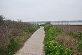
 Footpath in Stonelees Nature Reserve - geograph.org.uk - 2427892.jpg 3 072 × 2 304; 1,85 MB
-
 Footpath this way - geograph.org.uk - 3101631.jpg 640 × 430; 98 KB
-
 Former hovercraft pad in Pegwell Bay - geograph.org.uk - 3249945.jpg 1 500 × 1 000; 260 KB
-
 Future site of Thanet Parkway railway station - geograph.org.uk - 5506373.jpg 3 264 × 2 448; 2,44 MB
-
 Hengist Way approaching Ramsgate - geograph.org.uk - 5159904.jpg 2 048 × 1 536; 854 KB
-
 Hengist Way, Cliff's End - geograph.org.uk - 3723958.jpg 640 × 547; 308 KB
-
 Hengist Way, Cliffsend - geograph.org.uk - 5058626.jpg 2 048 × 1 536; 823 KB
-
 Highland Cattle - geograph.org.uk - 3041984.jpg 640 × 430; 62 KB
-
 Hollins Bottom - geograph.org.uk - 3038028.jpg 640 × 480; 54 KB
-

-
 Houses on Sandwich Rd - geograph.org.uk - 3101642.jpg 640 × 430; 38 KB
-
 Houses on Sandwich Road - geograph.org.uk - 3226538.jpg 1 500 × 989; 165 KB
-
 Information Board in Pegwell Bay Nature Reserve - geograph.org.uk - 2427876.jpg 3 072 × 2 304; 2,32 MB
-
 Information Boards in Pegwell Bay Nature Reserve - geograph.org.uk - 2427793.jpg 3 072 × 2 304; 1,93 MB
-
 Jet garage on Sandwich Road - geograph.org.uk - 6395536.jpg 5 456 × 3 632; 1,55 MB
-
 The "Jet" Petrol Station - geograph.org.uk - 690046.jpg 640 × 419; 72 KB
-
 King Arthur Road, Cliffsend - geograph.org.uk - 4596713.jpg 2 272 × 1 704; 889 KB
-
 Kissing gate into Pegwell Bay - geograph.org.uk - 2358338.jpg 3 072 × 2 304; 1,88 MB
-

-
 Lake at Stonelees Nature Reserve - geograph.org.uk - 3815341.jpg 4 000 × 3 000; 4,26 MB
-
 Lake at Stonelees Nature Reserve - geograph.org.uk - 3815376.jpg 4 000 × 3 000; 4,28 MB
-
 Lavender Lane, Cliffs End - geograph.org.uk - 6018975.jpg 5 202 × 3 465; 2,86 MB
-
 Looking N along the River Stour - geograph.org.uk - 456010.jpg 640 × 480; 44 KB
-
 Looking northeast from Sandwich Road - geograph.org.uk - 5186636.jpg 3 264 × 2 448; 1,66 MB
-

-

-
 Manston, Hengist Way - geograph.org.uk - 3723953.jpg 640 × 480; 246 KB
-
 Marsh Drain in Pegwell Bay - geograph.org.uk - 2427836.jpg 3 072 × 2 304; 1,89 MB
-
 Marshes, Cliffsend - geograph.org.uk - 3097705.jpg 640 × 430; 43 KB
-
 Marshes, Cliffsend - geograph.org.uk - 3097708.jpg 640 × 430; 38 KB
-
 Meverall Avenue, Cliffsend - geograph.org.uk - 4596699.jpg 2 272 × 1 704; 827 KB
-
 Millennium Milepost - geograph.org.uk - 2070778.jpg 480 × 640; 115 KB
-
 Mount Green Avenue - geograph.org.uk - 3097724.jpg 640 × 430; 69 KB
-
 National Cycle Network 15 - geograph.org.uk - 6395562.jpg 5 456 × 3 632; 2,16 MB
-
 National Cycle Network sign - geograph.org.uk - 772384.jpg 640 × 428; 408 KB
-
 National Cycle Route 1 - geograph.org.uk - 3040168.jpg 640 × 430; 79 KB
-
 National Cycle route 1 - geograph.org.uk - 3094690.jpg 640 × 430; 50 KB
-

-

-

-
 National Cycle route milepost - geograph.org.uk - 3101613.jpg 430 × 640; 46 KB
-
 Natural drainage channel in the Stour estuary - geograph.org.uk - 3091435.jpg 3 872 × 2 592; 5,59 MB
-

-
 Nicholas Drive, Cliffsend - geograph.org.uk - 4596736.jpg 2 272 × 1 704; 776 KB
-
 No entry in this direction - geograph.org.uk - 3091449.jpg 3 872 × 2 592; 6,25 MB
-
 Old Post Office, Foads Lane, Cliffs End - geograph.org.uk - 6018901.jpg 5 202 × 3 465; 2,43 MB
-
 Old transformer^ - geograph.org.uk - 727900.jpg 567 × 380; 289 KB
-
 Park in Cliffs End - geograph.org.uk - 6018909.jpg 5 202 × 3 465; 4,02 MB
-
 Path in Pegwell Bay Country Park - geograph.org.uk - 3094685.jpg 640 × 430; 87 KB
-
 Path in Pegwell Bay Nature Reserve - geograph.org.uk - 2427828.jpg 3 072 × 2 304; 2,17 MB
-
 Path in Stonelees Nature Reserve - geograph.org.uk - 3815379.jpg 4 000 × 3 000; 4,28 MB
-
 Path in Stonelees Nature Reserve - geograph.org.uk - 3815380.jpg 4 000 × 3 000; 4,29 MB
-
 Pillbox by Sandwich Road, near Ebbsfleet - geograph.org.uk - 4596776.jpg 2 272 × 1 704; 1,43 MB
-
 Railway bridge over Hengist Way, Cliffsend - geograph.org.uk - 5058652.jpg 2 014 × 1 490; 721 KB
-
 Railway Bridge, Cliffsend, Thanet - geograph.org.uk - 730133.jpg 567 × 303; 176 KB
-
 Railway Bridge, Cliffsend, Thanet, Kent - geograph.org.uk - 730149.jpg 567 × 380; 213 KB
-
 Ramp over pipe on Sandwich Road - geograph.org.uk - 6395555.jpg 5 456 × 3 632; 3,39 MB
-
 Ramsgate, West Cliff - geograph.org.uk - 2741636.jpg 3 648 × 2 736; 1,83 MB
-
 Ramsgate, West Cliff - geograph.org.uk - 2742308.jpg 3 648 × 2 736; 2,25 MB
-
 Ramsgate, West Cliff - geograph.org.uk - 2742311.jpg 3 648 × 2 736; 1,76 MB
-
-
 Regional Cycle Route 15 beside the A256 - geograph.org.uk - 2358390.jpg 3 072 × 2 304; 1,79 MB
-
 Regional Cycle Route 15 towards Pegwell Bay - geograph.org.uk - 2427736.jpg 3 072 × 2 304; 2,08 MB
-
 Rickety jetty and river Stour - geograph.org.uk - 305999.jpg 640 × 480; 113 KB
-

-
 Road marking to nowhere - geograph.org.uk - 727975.jpg 510 × 342; 168 KB
-
 Road to the beach, near Cliff End - geograph.org.uk - 6018099.jpg 5 202 × 3 465; 3,17 MB
-
 Row of trees and football field edge. - geograph.org.uk - 306004.jpg 640 × 480; 223 KB
-
 Salt marshes near Cliffs End - geograph.org.uk - 3094277.jpg 3 872 × 2 592; 5,78 MB
-
 Sandwich Rd - geograph.org.uk - 3097706.jpg 640 × 430; 40 KB
-
 Sandwich Rd - geograph.org.uk - 3097714.jpg 640 × 430; 53 KB
-
 Sandwich Rd ^ golf course - geograph.org.uk - 3094691.jpg 640 × 430; 52 KB
-
 Sandwich Road, Cliffs End - geograph.org.uk - 3121968.jpg 1 034 × 761; 171 KB
-
 Sandwich Road, Cliffsend - geograph.org.uk - 4596697.jpg 2 272 × 1 704; 825 KB
-
 Sandwich Road, Cliffsend - geograph.org.uk - 4596748.jpg 2 272 × 1 704; 788 KB
-
 Sandwich Road, Cliffsend - geograph.org.uk - 6018108.jpg 5 202 × 3 465; 2,91 MB
-
 Sandwich Road, near Ebbsfleet - geograph.org.uk - 4596766.jpg 2 272 × 1 704; 826 KB
-
 Sandwich to Ramsgate road. - geograph.org.uk - 728036.jpg 567 × 380; 225 KB
-
 Saxon Shore Way - geograph.org.uk - 3042005.jpg 640 × 430; 42 KB
-

-
 Sea View Road - geograph.org.uk - 3038037.jpg 640 × 480; 50 KB
-
 Sea View Road, Cliffsend - geograph.org.uk - 4596729.jpg 2 272 × 1 704; 759 KB
-
 Service Station, Sandwich Rd - geograph.org.uk - 3097687.jpg 640 × 430; 47 KB
-
 St Augustines Golf Course - geograph.org.uk - 3097676.jpg 640 × 430; 49 KB
-
 St Augustines Golf Course - geograph.org.uk - 3097683.jpg 640 × 430; 58 KB
-
 St. Mary the Virgin Chapel, Cliffs End - geograph.org.uk - 2358478.jpg 3 072 × 2 304; 1,86 MB
-
 Stour estuary marshland - geograph.org.uk - 6018874.jpg 5 202 × 3 465; 3,87 MB
-
 Thanet Coast Path - geograph.org.uk - 3101650.jpg 640 × 430; 74 KB
-
 Thanet Coast path - geograph.org.uk - 6018889.jpg 5 202 × 3 465; 3,4 MB
-
 Thanet Coast path looking northwards towards Cliffs End - geograph.org.uk - 6018860.jpg 5 202 × 3 465; 3,14 MB
-
 Thanet Coast path, south of Pegwell Country Park - geograph.org.uk - 6018881.jpg 5 202 × 3 465; 3,35 MB
-
 Thanet Coastal Path - geograph.org.uk - 3041980.jpg 640 × 430; 96 KB
-
 Thanet Coastal Path - geograph.org.uk - 3042004.jpg 640 × 430; 56 KB
-
 Thanet Coastal Path - geograph.org.uk - 3094669.jpg 640 × 430; 58 KB
-
 Thanet Coastal Path - geograph.org.uk - 3094673.jpg 640 × 430; 54 KB
-
 Thanet Coastal Path - geograph.org.uk - 3094676.jpg 640 × 430; 53 KB
-
 Thanet Coastal Path - geograph.org.uk - 4596783.jpg 2 272 × 1 704; 1,03 MB
-
 Thanet Coastal Path - Viking Trail - geograph.org.uk - 3041993.jpg 640 × 430; 58 KB
-

-
 The coastal path at Cliffs End - geograph.org.uk - 3092740.jpg 3 872 × 2 592; 5,36 MB
-
 The Dog Walker's Cafe - geograph.org.uk - 744529.jpg 640 × 487; 81 KB
-
 The old A299 at Lord of the Manor - geograph.org.uk - 2587653.jpg 640 × 480; 129 KB
-
 The old A299 Canterbury Road West - geograph.org.uk - 2587640.jpg 640 × 480; 142 KB
-

-
 The Old Post Office, Cliffsend - geograph.org.uk - 744564.jpg 640 × 428; 55 KB
-
 The River Stour - geograph.org.uk - 456047.jpg 640 × 480; 59 KB
-
 The River Stour from Sandwich Bay - geograph.org.uk - 2626850.jpg 640 × 480; 140 KB
-
 The Sandwich Rd - geograph.org.uk - 4371792.jpg 640 × 428; 60 KB
-

-
 The Viking Cafe - geograph.org.uk - 3101618.jpg 640 × 430; 55 KB
-
 The Viking Cafe by the Hugin - geograph.org.uk - 3249915.jpg 1 500 × 1 000; 245 KB
-
 The Viking Cafe, Cliffs End - geograph.org.uk - 6018101.jpg 5 202 × 3 465; 4,06 MB
-
 Track to Hovercraft Landing Site - geograph.org.uk - 2427715.jpg 3 072 × 2 304; 2,37 MB
-
 View across the mouth of the Stour - geograph.org.uk - 3091440.jpg 3 872 × 2 592; 5,82 MB
-

-

-

-
 View of Richborough Port from Manston Road - geograph.org.uk - 2027844.jpg 3 456 × 2 592; 2,57 MB
-
 View of Richborough Port from Manston Road ^2 - geograph.org.uk - 2027864.jpg 3 456 × 2 592; 2,77 MB
-
 Viking Coastal Trail - geograph.org.uk - 3042000.jpg 640 × 430; 60 KB
-

-
 Wall by the Thanet Coastal Path - geograph.org.uk - 3097692.jpg 640 × 430; 50 KB
-
 Wheat field on the edge of Cliff's End - geograph.org.uk - 3092646.jpg 3 872 × 2 592; 6,58 MB
-
 Wild flowers by the Thanet Coastal Path - geograph.org.uk - 3091416.jpg 3 872 × 2 592; 6,16 MB
-
 Being watched by the cows^ - geograph.org.uk - 454881.jpg 640 × 480; 50 KB
_green,_Stonelees_golf_course._-_geograph.org.uk_-_302958.jpg)


