Category:Clifton Reynes
Vai alla navigazione
Vai alla ricerca
Voce principale su Wikipedia: Clifton Reynes.
Nederlands: Clifton Reynes is een plaats in het bestuurlijke gebied Milton Keynes, in het Engelse graafschap Buckinghamshire. De plaats telt 138 inwoners.
Norsk bokmål: Clifton Reynes er en landsby i Buckinghamshire i England, omkring halvannen kilometer øst for Olney. Landsbyen utgjør et verdslig sogn i distriktet Milton Keynes, og har felles sogneråd med Newton Blossomville.
village and civil parish in Buckinghamshire, UK  | |||||
| Carica un file multimediale | |||||
| Istanza di | |||||
|---|---|---|---|---|---|
| Luogo | Milton Keynes, Buckinghamshire, Sud Est dell'Inghilterra, Inghilterra | ||||
| Popolazione |
| ||||
 | |||||
Sottocategorie
Questa categoria contiene un'unica sottocategoria, indicata di seguito.
M
File nella categoria "Clifton Reynes"
Questa categoria contiene 41 file, indicati di seguito, su un totale di 41.
-
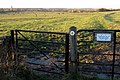
 Allotments in Clifton Reynes - geograph.org.uk - 3219949.jpg 1 600 × 1 068; 510 KB
-
 Bend with railings and an oak - geograph.org.uk - 5103459.jpg 640 × 480; 112 KB
-
 Bridleway to Clifton Spinney - geograph.org.uk - 324709.jpg 640 × 480; 121 KB
-
 Bridleway toward Clifton Spinney - geograph.org.uk - 3219965.jpg 1 600 × 1 069; 456 KB
-
 Clifton Reynes - geograph.org.uk - 2288054.jpg 800 × 563; 145 KB
-
-
 Clifton Reynes Village - geograph.org.uk - 285952.jpg 640 × 480; 127 KB
-
 Drain runs through stubble field - geograph.org.uk - 3219958.jpg 1 600 × 1 068; 454 KB
-
 Farmland Path - geograph.org.uk - 272282.jpg 640 × 480; 104 KB
-
 Foot path and Petsoe Manor wind farm in the distance - geograph.org.uk - 3534488.jpg 4 320 × 3 240; 4,94 MB
-
 Foot path through oil seed rape and wind turbines - geograph.org.uk - 3534500.jpg 4 320 × 3 240; 4,52 MB
-
 Footpath across the field toward the wind farm - geograph.org.uk - 3220145.jpg 1 600 × 1 067; 246 KB
-
 Footpath marker discs - geograph.org.uk - 1540205.jpg 640 × 480; 80 KB
-
 Footpath to Newton Wood - geograph.org.uk - 3220148.jpg 1 600 × 1 067; 406 KB
-
 Footpath to Olney from Clifton Pastures - geograph.org.uk - 324704.jpg 640 × 480; 114 KB
-
 Footpath to the Great Ouse in Clifton Reynes - geograph.org.uk - 3219945.jpg 1 200 × 1 600; 668 KB
-
 Footpaths by Newton Wood - geograph.org.uk - 3220144.jpg 1 600 × 1 067; 393 KB
-
 Former Railway Bridge at Clifton Reynes - geograph.org.uk - 294788.jpg 640 × 480; 137 KB
-
 Green Lane Near Clifton Reynes - geograph.org.uk - 324712.jpg 640 × 480; 118 KB
-
 Hedgerow by the drain - geograph.org.uk - 3219960.jpg 1 600 × 1 066; 492 KB
-
 Lane towards Clifton Reynes - geograph.org.uk - 1540192.jpg 640 × 480; 156 KB
-
 Milton Keynes Boundary Walk towards Turvey - geograph.org.uk - 3674843.jpg 1 600 × 1 069; 316 KB
-
 North of Petsoe Manor farm - geograph.org.uk - 680675.jpg 640 × 480; 63 KB
-
 Ouse foot bridge towards Clifton Reynes - geograph.org.uk - 1540129.jpg 640 × 480; 119 KB
-
 Path to the Great Ouse with Olney in the distance - geograph.org.uk - 3219936.jpg 1 600 × 1 066; 504 KB
-
 Public Footpath at Clifton Reynes - geograph.org.uk - 285954.jpg 640 × 480; 146 KB
-
 Pylon beyond the hedgerow by the drain - geograph.org.uk - 3220157.jpg 1 600 × 1 067; 266 KB
-
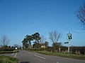
 Road junction and grass triangle - geograph.org.uk - 5250853.jpg 800 × 600; 120 KB
-
 Robin Hood PH, Clifton Reynes - geograph.org.uk - 728546.jpg 600 × 450; 28 KB
-
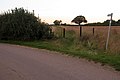
 Slippery when wet, Clifton Reynes - geograph.org.uk - 1530668.jpg 640 × 480; 153 KB
-
 St Mary, Clifton Reynes - East end - geograph.org.uk - 3265607.jpg 1 000 × 703; 236 KB
-
 St Mary, Clifton Reynes - Font - geograph.org.uk - 3265609.jpg 724 × 1 000; 225 KB
-
 St Mary, Clifton Reynes - geograph.org.uk - 3265605.jpg 1 000 × 666; 299 KB
-
 St. Mary the Virgin - geograph.org.uk - 2288037.jpg 800 × 562; 574 KB
-
 Stile and Footpath at Clifton Pastures - geograph.org.uk - 324705.jpg 640 × 480; 152 KB
-
 Stubble field with power line - geograph.org.uk - 5103445.jpg 640 × 480; 114 KB
-
 The Robin Hood - geograph.org.uk - 2288074.jpg 800 × 562; 505 KB
-

-
 Through the Hedge - geograph.org.uk - 272280.jpg 640 × 480; 140 KB
-
 Track through the fields to the Shepherd's Hovel - geograph.org.uk - 3219968.jpg 1 600 × 1 067; 494 KB
-
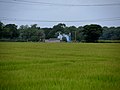 Wood Farm and wheat fields - geograph.org.uk - 3534480.jpg 4 320 × 3 240; 4,55 MB


