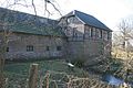
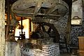
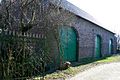
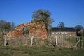
Category:Clörather Mühle
Jump to navigation
Jump to search
| Object location | | View all coordinates using: OpenStreetMap |
|---|
Watermill in Clörath | |||||
| Upload media | |||||
| Instance of | |||||
|---|---|---|---|---|---|
| Location | Viersen, Düsseldorf Government Region, North Rhine-Westphalia, Germany | ||||
 | |||||
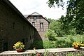
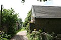
This is the category for an architectural monument.
It is on the list of cultural monuments of Viersen, no. 70.
It is on the list of cultural monuments of Viersen, no. 70.
Media in category "Clörather Mühle"
The following 27 files are in this category, out of 27 total.
-
 2022 06 23 Clörather Mühle (1).jpg 4,352 × 3,264; 5.22 MB
-
 2022 06 23 Clörather Mühle (2).jpg 4,352 × 3,264; 4.54 MB
-
 2022 06 23 Clörather Mühle (3).jpg 4,352 × 3,264; 3.74 MB
-
 70 Clörather Mühle, Clörather Mühle 36 Clörath).jpg 600 × 400; 77 KB
-
 Clörath, Clörather Mühle (1).jpg 3,968 × 2,976; 2.53 MB
-
 Clörath, Clörather Mühle (2).jpg 3,968 × 2,976; 2.42 MB
-
 Clörather Mühle 1.jpg 600 × 400; 65 KB
-
 Clörather Mühle 10.jpg 2,400 × 1,600; 353 KB
-
 Clörather Mühle 11.jpg 1,600 × 2,400; 476 KB
-
 Clörather Mühle 12.jpg 2,400 × 1,600; 457 KB
-
 Clörather Mühle 14.jpg 2,400 × 1,600; 383 KB
-
 Clörather Mühle 15.jpg 2,400 × 1,600; 341 KB
-
 Clörather Mühle 2.jpg 600 × 400; 52 KB
-
 Clörather Mühle 3.jpg 600 × 400; 60 KB
-
 Clörather Mühle 4.jpg 600 × 400; 63 KB
-
 Clörather Mühle 5.jpg 600 × 400; 42 KB
-
 Clörather Mühle 6.jpg 600 × 400; 65 KB
-
 Clörather Mühle 7.jpg 600 × 400; 53 KB
-
 ClöratherMühle 10092512c(800x450).jpg 800 × 450; 95 KB
-
 Karte Clörather Mühle.jpg 600 × 400; 50 KB
-
 Salbruch 10092117c(400x225).JPG 400 × 225; 8 KB
-
 Viersen - Clörather Mühle - Clörather Mühle 01 ies.jpg 3,888 × 2,592; 7.18 MB
-
 Viersen - Clörather Mühle - Clörather Mühle 02 ies.jpg 3,888 × 2,592; 6.66 MB
-
 Viersen - Clörather Mühle - Clörather Mühle 03 ies.jpg 3,888 × 2,592; 5.17 MB
-
 Viersen - Clörather Mühle - Clörather Mühle 04 ies.jpg 3,888 × 2,592; 4.91 MB
-
 Viersen - Clörather Mühle - Clörather Mühle 05 ies.jpg 3,888 × 2,592; 4.57 MB
-
 Viersen - Clörather Mühle - Clörather Mühle 06 ies.jpg 3,888 × 2,592; 6.02 MB
.jpg)
.jpg)
.jpg)
.jpg)
.jpg)
.jpg)


.jpg)

.JPG)


