Category:Coasts of New Zealand
Jump to navigation
Jump to search
| Upload media | |||||
| |||||
Subcategories
This category has the following 25 subcategories, out of 25 total.
Media in category "Coasts of New Zealand"
The following 200 files are in this category, out of 239 total.
(previous page) (next page)-
 080420-Kaikouras from Kaikoura.jpg 4,664 × 1,352; 1.38 MB
-
 A rugged coastline at Pancake Rocks, Paparoa National Park (52649016521).jpg 4,010 × 2,184; 6.34 MB
-
 A rugged coastline Kaikoura NZ (34362897020).jpg 4,790 × 2,366; 9.77 MB
-
 A rugged coastline. (52401192345).jpg 5,135 × 2,815; 8.37 MB
-
 Aerial view of Pencarrow Head, including both lighthouses.jpg 2,816 × 2,112; 4.18 MB
-
 Akaroa.jpg 2,272 × 1,704; 1.06 MB
-
 Antipodes South Bay.JPG 3,072 × 2,304; 753 KB
-
 Approaching Great Barrier Aerodrome.jpg 2,400 × 1,800; 2.13 MB
-
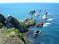
 Approaching the Nugget Point Lighthouse.jpg 3,900 × 2,613; 1.71 MB
-
 Beach at Punakaiki.jpg 1,472 × 987; 589 KB
-
 Beach east of Taupo Point.jpg 4,896 × 3,264; 4.48 MB
-
 Best of new zealand (5345122997).jpg 1,279 × 853; 207 KB
-
 Bluebridge Ferry entering Wellington Harbour.jpg 1,024 × 768; 250 KB
-
 Boulder Bank, Nelson, New Zealand.jpg 11,138 × 2,918; 23.24 MB
-
 Bubble and Toil (51697601784).jpg 5,986 × 3,997; 15.87 MB
-
 Calm Seas Today... (51333927135).jpg 6,144 × 4,096; 25.28 MB
-
 Canterbury At The Opua Quay.jpg 1,600 × 1,200; 1 MB
-
 Canterbury Northwester.jpg 3,264 × 2,176; 5.37 MB
-
 Cape Campbell sunrise.jpg 2,984 × 1,964; 6.32 MB
-
 Cape Palliser coast.jpg 804 × 603; 163 KB
-
 Cape Palliser Lighthouse NZ - stairs outside.jpg 768 × 1,024; 650 KB
-
 Cape Saunders Otago Peninsula.jpg 2,560 × 1,344; 787 KB
-
 Cape Terawhiti.jpg 3,264 × 2,176; 3.98 MB
-
 Castlepoint lighthouse from Jetty Road.jpg 3,264 × 2,448; 1.87 MB
-
 Cathedral Cove and Te Hoho Rock.jpg 1,024 × 768; 308 KB
-
 Channel Lower Harbour Port Chalmers.jpg 1,280 × 960; 279 KB
-
 Chelsea Sugar Refinery.JPG 2,394 × 1,147; 1.03 MB
-
 Christchurch coast.jpg 1,500 × 984; 353 KB
-
 ChristchurchScarborough1 gobeirne.jpg 2,048 × 1,536; 1.42 MB
-
 ChristchurchScarborough2 gobeirne.jpg 2,048 × 1,536; 1.46 MB
-
 Clarence River mouth.jpg 2,864 × 1,924; 5.24 MB
-
 Cliffs south of Punakaiki pancake rocks.jpg 4,896 × 3,264; 5.71 MB
-
 Coast of Wellington Region from Cook Strait.jpg 3,753 × 2,324; 4.24 MB
-
 Coast south of Wairaka Rock.jpg 4,896 × 3,264; 6.72 MB
-
 Coastal Pacific View - panoramio (4).jpg 2,048 × 1,367; 3.99 MB
-
 Coastal Road From Thames To Coromandel.jpg 1,600 × 1,200; 1.25 MB
-
 Coastline Kaikoura, New Zealand.JPG 640 × 480; 147 KB
-
 Coastline looking south from Titahi Bay - panoramio.jpg 2,816 × 1,880; 2.68 MB
-
 Codium fragile fragile (Suringar) Har. (AM AK295137-2).jpg 2,048 × 1,536; 734 KB
-
 Concretions. (51567120951).jpg 5,127 × 3,095; 12.11 MB
-
 Coromandel Peninsula Panorama.jpg 5,159 × 869; 3.36 MB
-
 Coromandel01.png 750 × 500; 507 KB
-
 Costa de Mangawhai.jpg 4,288 × 2,848; 9.68 MB
-
 Curio Bay Fossil Forrest.JPG 4,912 × 3,264; 6.56 MB
-

-
 Deliverance Cove and Castlepoint lighthouse.jpg 4,860 × 3,240; 5.35 MB
-
 Driftwood NZ.jpg 640 × 480; 101 KB
-
 Duffers Reef at Forsyth Island.jpg 1,024 × 768; 1.19 MB
-
 Eastern Beaches Of Auckland City.jpg 1,600 × 1,200; 1.29 MB
-
 Eric Armishaw Reserve Looking To West.jpg 1,600 × 1,200; 357 KB
-
 Eroded Road at Whatarangi Bluff, Palliser Bay-2.jpg 3,872 × 2,592; 2.31 MB
-
 Eroded Road at Whatarangi Bluff, Palliser Bay.jpg 3,872 × 2,592; 2.37 MB
-
 Excitor Heading Outbound.jpg 1,600 × 1,200; 414 KB
-
 Expl1816 - Flickr - NOAA Photo Library.jpg 1,600 × 1,200; 546 KB
-
 Expl1831 - Flickr - NOAA Photo Library.jpg 1,600 × 1,200; 361 KB
-
 Expl1834 - Flickr - NOAA Photo Library.jpg 1,600 × 1,200; 418 KB
-
 Expl1837 - Flickr - NOAA Photo Library.jpg 1,600 × 1,200; 485 KB
-
 Expl1846 - Flickr - NOAA Photo Library.jpg 1,600 × 1,200; 326 KB
-
 Farmland near Pukearuhe towards cliffs.jpg 1,024 × 768; 312 KB
-
 Flax-covered rock stack off beach at the end of Truman Track near Punakaiki.jpg 4,896 × 3,264; 4.72 MB
-
 Fragile River by Stuart Mackintosh.jpg 1,000 × 714; 372 KB
-
 Fur Seal at Flat Point Beach.jpg 2,048 × 1,536; 498 KB
-
 Fur seals at Wellington - panoramio (978).jpg 3,264 × 2,448; 3.33 MB
-
 Harbour Cone Otago Peninsula.jpg 2,560 × 1,152; 685 KB
-
Helicopter landing mason bay nz.ogv 23 s, 848 × 480; 4.41 MB
-
 Hokianga, tide out.jpg 4,180 × 1,472; 1.45 MB
-
 Hole In The Rock In Bay Of Islands.jpg 1,280 × 851; 1.22 MB
-
 Huia Dam in the Waitakere Ranges (12218048793).jpg 6,000 × 4,000; 10.14 MB
-
 Huia, Waitakere City, Auckland, New Zealand.jpg 2,560 × 1,920; 458 KB
-
 Iron Buoys Great Barrier Island.jpg 1,600 × 1,200; 418 KB
-
 Isla Gran Barerra 03.jpg 3,915 × 2,342; 8.85 MB
-
 Isla Gran Barerra 06.jpg 4,041 × 1,642; 5.05 MB
-
 Isla Gran Barerra 08.jpg 4,288 × 2,022; 5.88 MB
-
 Isla Gran Barerra 09.jpg 4,288 × 2,316; 7.94 MB
-
 Isla Gran Barerra 10.jpg 3,767 × 2,317; 6.96 MB
-
 Isla Gran Barerra 11.jpg 4,288 × 2,316; 7.55 MB
-
 IslandBayPICT4959.jpg 1,024 × 768; 201 KB
-
 Jaquemart1.jpg 2,048 × 1,536; 3.46 MB
-
 Kaikoura coastline.NZ FZ200 (14323904497).jpg 2,400 × 1,460; 2.53 MB
-
 Kaikoura Peninsula .FZ200 (14530449443).jpg 2,400 × 1,588; 3.11 MB
-
 Kaikoura seascape. FZ200 (14509793784).jpg 2,400 × 1,662; 3.28 MB
-
 Kaikoura seascape. FZ200 (14523636093).jpg 2,400 × 1,669; 3.04 MB
-
 Kaikoura seascape.NZ FZ200.jpg 2,400 × 1,595; 2.22 MB
-
 Kaikoura. In camera effects Lumix FZ200. (14317479507).jpg 2,400 × 1,667; 4.21 MB
-
 Kapiti Island from Hemi Matenga Park, Waikanae.jpg 1,024 × 768; 321 KB
-
 Kapiti Island from Mataihuka Track.jpg 1,024 × 768; 261 KB
-
 Karaka Bays Waves.jpg 3,264 × 2,448; 2.1 MB
-
 Karehana Bay at Sunset.jpg 3,900 × 2,613; 1.27 MB
-
 Kelp. (15272102411).jpg 2,400 × 1,466; 1.63 MB
-
 Lake Manapouri, South Island, New Zealand (6924537770).jpg 1,944 × 2,592; 1.34 MB
-
Leaving bluff harbour nz.ogv 9.0 s, 848 × 480; 5.29 MB
-
 Limestone landscape.FZ200 (14323756830).jpg 2,400 × 1,800; 4.89 MB
-
 Little Barrier Island From Above Great.jpg 1,600 × 1,200; 1.01 MB
-
 Little Barrier Island.jpg 4,200 × 2,728; 11.97 MB
-
 Little Barrier.JPG 2,048 × 1,360; 1.85 MB
-
 Little Huia Village, Waitakere Ranges.jpg 1,600 × 1,200; 1.08 MB
-
 Lockheed C-121J in flight 1965.jpg 789 × 622; 76 KB
-
 Looking Over Eastern Abel Tasman Park.jpg 1,600 × 1,200; 1.13 MB
-
 Looking south from Slope Point.jpg 2,048 × 1,536; 636 KB
-
 Looking West Towards Traherne Island.jpg 1,600 × 1,200; 1.05 MB
-
 Lyttelton panorama.jpg 3,536 × 1,304; 2.59 MB
-
 Man standing by a car on a hill overlooking landscape (AM 81496-1).jpg 1,275 × 949; 666 KB
-
 Manukau Harbour Heads 1960.jpg 900 × 600; 69 KB
-
 Maraenui Hill Lookout 2.jpg 600 × 900; 529 KB
-
 Marsden Point refinery, 2007.jpg 3,608 × 2,470; 5.74 MB
-
 Marsden Point.JPG 2,492 × 1,428; 1.07 MB
-
Mason bay stewart island nz.ogv 8.5 s, 848 × 480; 1.98 MB
-
 Medlands Beach From High Up West.jpg 1,600 × 1,200; 1.38 MB
-
 Moeraki Boulders Beach. Otago. (52116071709).jpg 5,472 × 3,648; 10.07 MB
-
 Moeraki Boulders Otago. NZ (37665998934).jpg 4,908 × 3,182; 9.33 MB
-
 Moon over south end of Rimutakas (Turakirae Head) at sunset.jpg 1,024 × 768; 232 KB
-
 Mount Maunganui main beach in Tauranga, New Zealand.jpg 1,632 × 1,224; 356 KB
-
 New Plymouth - Coastal Walkway.jpg 4,320 × 2,432; 7.4 MB
-
 New Plymouth NZ Waterfront.jpg 602 × 382; 59 KB
-
 New Zealand - Seascape scene - 9807.jpg 4,368 × 2,748; 4.28 MB
-
 New Zealand Beach of Haast.jpg 2,496 × 1,664; 2.1 MB
-
 New Zealand East Coast (6330191098).jpg 1,000 × 750; 829 KB
-
 New Zealand Fur seal.FZ200 (14502532505).jpg 2,400 × 1,824; 2.55 MB
-
 New Zealand landfall - Auckland West Coast, 16 Aug. 2010 - Flickr - PhillipC (1).jpg 3,695 × 2,279; 1.87 MB
-
 New Zealand landfall - Auckland West Coast, 16 Aug. 2010 - Flickr - PhillipC.jpg 2,154 × 3,590; 1.64 MB
-
 New Zealand South Island North Coast.jpg 3,264 × 2,448; 3.4 MB
-
 New Zealand, South Island, 1997.jpg 4,519 × 3,006; 596 KB
-
 New Zealand, Top of the South Island (Nelson), Skydiving.jpg 2,880 × 2,160; 1.12 MB
-
 Nicholas Chevalier - Near Paekakariki, Cook Strait - Google Art Project.jpg 5,089 × 3,451; 4.51 MB
-
 Niue Coastline.jpg 1,024 × 768; 419 KB
-
 Nugget point lighthouse otago coast.jpg 3,072 × 2,304; 1.6 MB
-
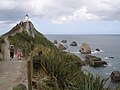
 Nugget-Point-3.jpg 1,382 × 1,037; 400 KB
-
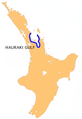 NZ-Hauraki G.png 405 × 590; 118 KB
-
 NZ-ShagPoint.jpg 539 × 387; 42 KB
-
 Oamaru Coast.jpg 6,523 × 1,743; 1.73 MB
-
 Oamaru.jpg 2,272 × 1,704; 873 KB
-
 Oblique view of Banks Peninsula.jpg 662 × 1,000; 321 KB
-
 Ocean (1) (2035725008).jpg 3,872 × 2,592; 5.92 MB
-
 Ocean (2) (2035718908).jpg 3,872 × 2,592; 5.24 MB
-
 OhamaBeach-Foredune.jpg 408 × 600; 125 KB
-
 Ohau Point Seal Colony. New Zealand.FZ200 (14315911510).jpg 2,400 × 1,800; 3.68 MB
-
 Old gun inplacements, Post Office Head - panoramio.jpg 1,024 × 768; 407 KB
-
 Onehunga Foreshore Western Side.jpg 1,600 × 1,200; 1.02 MB
-
 Onehunga Shoreline For Reclamation.jpg 1,600 × 1,200; 1.11 MB
-
 Orewa Beach.JPG 1,024 × 768; 100 KB
-
 Otago Harbour Lower Harbour.jpg 2,560 × 960; 552 KB
-
 Otago Harbour towards Aramoana.jpg 4,896 × 3,264; 4.66 MB
-
 Palliser Coast.jpg 9,088 × 2,208; 2.75 MB
-
 Pauanui Airfield Right Within The Village 02.jpg 1,600 × 1,200; 1.05 MB
-
 Pauatahanui Inlet-20070919.jpg 5,471 × 1,446; 2.3 MB
-
 Pegasus Bay, with New Brighton the spit in the foreground.jpg 3,649 × 2,432; 4.25 MB
-
 Pencarrow Head, Wellington, New Zealand from Santa Regina, 24 Feb. 2007.jpg 3,872 × 2,592; 6.56 MB
-
 Petrified forest at Curio Bay.jpg 3,900 × 2,613; 2.81 MB
-
 Petrified tree in Curio Bay.jpg 3,865 × 2,563; 2.79 MB
-
 Petrus van der Velden - Storm at Wellington Heads - Google Art Project.jpg 5,108 × 3,233; 8.16 MB
-
 Piha1b.jpg 448 × 336; 82 KB
-
 Piha2.jpg 448 × 336; 81 KB
-
 Piha5b.jpg 283 × 167; 46 KB
-
 Piripaua Neck connecting Kenny's Isle.jpg 1,024 × 768; 378 KB
-
 Plimmerton Entrance - panoramio.jpg 2,048 × 1,360; 1.05 MB
-
 Plimmerton panorama.jpg 5,748 × 1,727; 1.76 MB
-
 Point Elizabeth Lookout. (51993820620).jpg 5,472 × 3,648; 11.38 MB
-
 Porirua Harbour.jpg 3,748 × 2,499; 6.42 MB
-
 Porirua New Zealand harbour entrance.jpg 2,272 × 1,704; 361 KB
-
 Port Chalmers, Otago.jpg 772 × 535; 555 KB
-
 Port Fitzroy Seen From Mount Hobson.jpg 1,600 × 1,200; 1,000 KB
-
 PortobelloNZ.jpg 1,627 × 717; 396 KB
-
 Pt Halswell from Wellington Harbour Ferry.jpg 1,024 × 768; 379 KB
-
 Pukerua Bay beach towards Kapiti Coast.jpg 1,024 × 768; 321 KB
-
 Punakaiki, West Coast.jpg 6,000 × 4,000; 4.91 MB
-
 Queenstown — Haast.jpg 1,606 × 1,068; 519 KB
-
 RangitotoMotutapu.JPG 1,495 × 961; 1.54 MB
-
 Reflection (83701565).jpeg 2,048 × 1,365; 683 KB
-
 Rock pool at Granny's Bay.jpg 2,592 × 1,728; 2.81 MB
-
 Rocky shoreline at Opunake - Flickr - 111 Emergency (1).jpg 1,280 × 852; 144 KB
-
 Rocky shoreline at Opunake - Flickr - 111 Emergency (2).jpg 1,280 × 852; 163 KB
-
 Rocky shoreline at Opunake - Flickr - 111 Emergency (3).jpg 1,280 × 852; 157 KB
-
 Rocky shoreline at Opunake - Flickr - 111 Emergency.jpg 1,280 × 852; 158 KB
-
 Rosebank Peninsula Seen From The East.jpg 1,600 × 1,200; 1.07 MB
-
 Rosebank Peninsula Seen From The West.jpg 1,600 × 1,200; 1.04 MB
-
 Russell NZ.jpg 800 × 600; 79 KB
-
 Searching (52524352).jpeg 1,298 × 722; 141 KB
-
 Seascape Caley Hall.jpg 960 × 539; 104 KB
-
 Seatoun and Wellington Harbour entrance around Pt Halswell.jpg 1,024 × 768; 402 KB
-
 Seatoun from Wellington Harbour entrance.jpg 1,024 × 768; 386 KB
-
 Shoreline plaque Wellington.jpg 1,600 × 1,200; 601 KB
-
 Sky On Fire In The Auckland CBD.jpg 1,600 × 1,200; 1.1 MB
-
 Slope Point NZ.JPG 2,000 × 1,500; 3.65 MB
-
 Slope Point Sign.jpg 3,900 × 2,613; 1.95 MB
-
 Slopepointcliff.jpg 400 × 266; 56 KB
-
 South Island Tour 207.jpg 2,048 × 1,536; 838 KB
-
 South Island Tour 260.jpg 2,048 × 1,536; 754 KB
-
 Southern Coast of the North Island (26777936616).jpg 1,600 × 1,200; 417 KB
-
 Southland coast from Bluff Hill.jpg 507 × 365; 69 KB
-
 Southwest Coast NZ 27.jpg 1,004 × 647; 415 KB
-
 Stanley Point Near Devonport.jpg 1,200 × 600; 127 KB
-
 Stream at Pukearuhe.jpg 1,024 × 768; 325 KB
-
 Sunset, Porirua harbour entrance.jpg 5,230 × 1,903; 784 KB
-
 Surf at Brendan Beach after a winter storm.jpg 1,024 × 768; 311 KB
-
 Taiaroa Head 2.jpg 2,613 × 3,900; 3.66 MB
-
 Tauranga Coast (6044965460).jpg 750 × 1,000; 892 KB
-
 ThornesBay.4.jpg 2,302 × 1,302; 744 KB
-
 Tidal Flats Waitemata Harbour.jpg 1,600 × 1,200; 405 KB
-
 Titahi Bay 11.JPG 2,375 × 1,379; 823 KB
-
 Tongue-Point-by-John-Steedman-Flickr-edited.jpg 1,419 × 1,064; 679 KB
.jpg)
.jpg)
.jpg)


.jpg)

.jpg)
.jpg)


.jpg)


_Har._(AM_AK295137-2).jpg)
.jpg)


.jpg)


.jpg)


.jpg)


.jpg)
.jpg)
.jpg)
.jpg)

.jpg)


.jpg)
.jpg)
.jpg)


.jpg)


.jpg)
.jpg)
_at_sunset.jpg)


.jpg)
.jpg)
.jpg)


,_Skydiving.jpg)


_(2035725008).jpg)
_(2035718908).jpg)

.jpg)


.jpg)


.jpeg)

.jpg)
.jpg)
.jpg)


.jpeg)


.jpg)


.jpg)


