Category:Colchester
Jump to navigation
Jump to search
city in Essex, United Kingdom   | |||||
| Upload media | |||||
| Instance of |
| ||||
|---|---|---|---|---|---|
| Location | Colchester, Essex, East of England, Inglaterra | ||||
| Located in or next to body of water | |||||
| Significant event | |||||
| Population |
| ||||
| Follows | |||||
| Different from | |||||
| official website | |||||
 | |||||
Mga ubos-nga-kaarangay
Ini nga kaarangay mayda han mga nasunod nga 31 nga mga ubos-nga-kaarangay, tikang hin 31 nga kabug-osan.
B
- Bull Meadow (6 F)
- Bullock Wood (12 F)
C
- Coat of arms of Colchester (13 F)
- Colchester High School (2 F)
- Colchester-Anlage Wetzlar (2 F)
H
- Hilly Fields, Colchester (4 F)
L
M
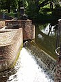
- Middlemill Weir Colchester (5 F)
N
- New Town (Colchester) (1 F)
P
R
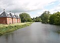
- River Colne, Colchester (15 F)
S
T
W
- Welsh Wood (10 F)
Mga pakli ha kaarangay nga "Colchester"
Ini nga kaarangay mayda han amo la nga nasunod nga pakli.
Media ha kaarangay nga "Colchester"
An mga nasunod nga 199 ka mga fayl aada han hini nga kaarangay, tikang hin 199 nga kabug-osan.
-
 A view of Friday Wood from the car park - geograph.org.uk - 812311.jpg 640 × 480; 78 nga KB
-
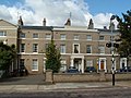
 AjM Colchester buildings North Hill 02.jpg 3,344 × 2,224; 4.51 nga MB
-
 AjM Colchester buildings North Hill 03.jpg 3,344 × 2,224; 3.56 nga MB
-
 AJM Essex River Colne Colchester Spring 01.jpg 2,528 × 1,876; 3.38 nga MB
-
 Alley between St Judes Close and St Monance Way Colchester - geograph.org.uk - 1714994.jpg 4,000 × 3,000; 3.5 nga MB
-
 Anne Schwegmann-Fielding, Balkerne Star, Colchester, 2006.jpg 1,657 × 1,861; 967 nga KB
-
 Anti Rabies Sign - geograph.org.uk - 446266.jpg 426 × 640; 109 nga KB
-
 Arcate a Colchester.JPG 2,112 × 2,816; 2.94 nga MB
-
 Back garden, Victor Road, Colchester - geograph.org.uk - 1134494.jpg 480 × 640; 73 nga KB
-
 Bales. - panoramio.jpg 4,000 × 3,000; 6.55 nga MB
-
 Baptist Church Colchester.jpg 2,558 × 1,747; 1.37 nga MB
-
 Boudica's Sprit^ Colchester - geograph.org.uk - 132842.jpg 480 × 640; 107 nga KB
-
 Brown beige.jpg 2,376 × 3,568; 1.26 nga MB
-
 Caloboletus roseipes 879281.jpg 2,000 × 1,376; 2.88 nga MB
-
 Car Park-Turner Rise Retail Park - geograph.org.uk - 1213916.jpg 640 × 480; 68 nga KB
-
 ChadGinsburgColchester2009 (cropped).jpg 408 × 653; 148 nga KB
-
 ChadGinsburgColchester2009.jpg 685 × 1,024; 308 nga KB
-
 Childwell Alley Public Footpath - geograph.org.uk - 1309113.jpg 640 × 480; 117 nga KB
-
 Colchester (25671904687).jpg 3,648 × 5,472; 5.05 nga MB
-
 Colchester - Dutch Quarter.jpg 3,000 × 1,430; 3.19 nga MB
-
 Colchester banner Bourne Mill.JPG 3,871 × 553; 950 nga KB
-
 Colchester Bridge Build, Sundays River.jpg 2,564 × 1,140; 468 nga KB
-
 Colchester Cemetery Mersea Road - geograph.org.uk - 1386022.jpg 4,000 × 3,000; 4.12 nga MB
-
 Colchester Dutch Quarter 1.png 3,888 × 2,588; 14.67 nga MB
-
 Colchester Dutch Quarter 2.png 3,888 × 2,588; 14.2 nga MB
-
 Colchester Dutch Quarter 3.png 3,888 × 2,588; 13.25 nga MB
-
 Colchester Holiday Park Facilities Block - geograph.org.uk - 1502114.jpg 640 × 480; 82 nga KB
-
 Colchester Holiday Park Reception and Shop - geograph.org.uk - 1502106.jpg 640 × 480; 105 nga KB
-
 Colchester Rugby Football Club - geograph.org.uk - 800206.jpg 640 × 440; 70 nga KB
-
 Colchester UK ward map 2024.svg 1,173 × 1,266; 723 nga KB
-
 Colchester, UK - panoramio (2).jpg 2,816 × 2,112; 1.75 nga MB
-
 Colchester. Helena.pdf 577 × 868; 1.52 nga MB
-
 Colchester.JPG 2,816 × 2,112; 2.95 nga MB
-
 Commonwealth War Graves Colchester Cemetery, Mersea Road - geograph.org.uk - 1386023.jpg 640 × 480; 107 nga KB
-
 Contemporarygarden1.jpg 2,596 × 1,968; 2.18 nga MB
-
 Crenulated Wall - geograph.org.uk - 718254.jpg 640 × 480; 120 nga KB
-
 Cruc of Mankind.jpg 624 × 845; 555 nga KB
-
 CRUK sliderider (26148478129).jpg 2,816 × 1,584; 2.27 nga MB
-
 CRUK sliderider (26148479599).jpg 2,816 × 1,584; 1.97 nga MB
-
 CRUK sliderider (26148480519).jpg 2,816 × 1,584; 2.46 nga MB
-
 CRUK sliderider (37214813294).jpg 1,584 × 2,816; 1.9 nga MB
-
 CRUK sliderider (37214813714).jpg 2,816 × 1,584; 1.94 nga MB
-
 Derelict warehouse at The Hythe - geograph.org.uk - 860438.jpg 640 × 427; 56 nga KB
-
 Dew drops in the fog.jpg 3,456 × 2,304; 4.39 nga MB
-
 Dovecot and residents - geograph.org.uk - 1141864.jpg 271 × 640; 44 nga KB
-
 Dried Up Pond in Friday Wood - geograph.org.uk - 1419064.jpg 640 × 428; 125 nga KB
-
 East Colchester Regeneration Project - geograph.org.uk - 446280.jpg 640 × 426; 84 nga KB
-
 Eastern Gray Squirrel 800.jpg 800 × 686; 178 nga KB
-
-

-
 Edward VII postbox, North Station Road, CO1 - geograph.org.uk - 4051475.jpg 360 × 640; 49 nga KB
-
-

-

-
-

-
En-uk-Colchester.ogg 0.3 s; 7 nga KB
-
 End of Moose Island - panoramio.jpg 2,048 × 1,536; 644 nga KB
-
 Essex River Colne Colchester Summer 06.jpg 3,344 × 2,224; 6.47 nga MB
-
 Essex River Colne Colchester the Autumn 03.jpg 2,560 × 1,920; 921 nga KB
-
 Fig31.gif 2,616 × 3,304; 125 nga KB
-
 Firesite in Colchester.jpg 3,488 × 2,616; 2.06 nga MB
-
 Five Islands Provincial Park from Moose Island - panoramio.jpg 2,048 × 1,536; 740 nga KB
-
 Flickr - law keven - A Winters tale....jpg 2,592 × 3,618; 379 nga KB
-
 Flickr - law keven - Don't let the sun go down on me....jpg 3,888 × 2,592; 951 nga KB
-
 Flickr - law keven - I'm Back..did you miss me..lol..-O).jpg 3,888 × 2,592; 293 nga KB
-
 Flickr - law keven - It was all yellow....jpg 3,888 × 2,592; 1.3 nga MB
-
 Flickr - law keven - Long Hot Summer.......jpg 3,888 × 2,592; 510 nga KB
-
 Flickr - law keven - Through the trees....jpg 3,888 × 2,592; 1.07 nga MB
-
 FLT M30 11.7 mi - Gerry Benedict Memorial Cairn - panoramio.jpg 1,600 × 1,200; 754 nga KB
-
 Footpath @ Higham. - panoramio.jpg 2,248 × 4,000; 4.12 nga MB
-
 Footpath Gate. - panoramio.jpg 4,000 × 2,248; 4.07 nga MB
-
 Footpath through the park, East Street, Colchester - geograph.org.uk - 1309148.jpg 640 × 480; 127 nga KB
-
 Freeman's Gate - panoramio.jpg 3,648 × 2,736; 5.98 nga MB
-
 Friday Wood - geograph.org.uk - 1419001.jpg 640 × 428; 68 nga KB
-
 Fyl's sunset. - panoramio.jpg 4,000 × 2,248; 3.35 nga MB
-
 Gilliland (11328375174).jpg 4,608 × 3,456; 2.74 nga MB
-
 Grants Meadow allotments, Colchester - geograph.org.uk - 1134470.jpg 480 × 640; 99 nga KB
-
 Grey Friars College Colchester (disused) - geograph.org.uk - 1103847.jpg 3,264 × 2,448; 2.48 nga MB
-
 H298EEU 240813 CPS (11715434195).jpg 4,592 × 3,056; 2.66 nga MB
-
 Henry & Joyce Collins concrete mural, St Boltoph's Circus underpass.jpg 3,264 × 2,448; 3.09 nga MB
-
 Hoverflies feasting on fennel - geograph.org.uk - 1435695.jpg 640 × 480; 197 nga KB
-
 Hyderbarad Barracks - geograph.org.uk - 1418952.jpg 640 × 428; 71 nga KB
-
 Iron kissing gate. - panoramio.jpg 2,992 × 2,992; 3.78 nga MB
-
 Just hanging about - panoramio.jpg 1,600 × 1,200; 705 nga KB
-
 King Edward Quay - geograph.org.uk - 446258.jpg 640 × 426; 93 nga KB
-
 Kingsland Church, Lexden - geograph.org.uk - 1502221.jpg 480 × 640; 63 nga KB
-
 Kissing gate ^ Higham Church. - panoramio.jpg 4,000 × 2,248; 4.13 nga MB
-

-
 Langham Oaks School Anti Bullying Work ( SABA ) with Prince William.jpg 1,502 × 952; 159 nga KB
-
 Langham Oaks School Anti Bullying Work ( SABA ).jpg 640 × 480; 75 nga KB
-
 Langham Oaks School at Facebook London with Diana Award.jpg 640 × 480; 218 nga KB
-
 Local railways lines - geograph.org.uk - 1321128.jpg 640 × 480; 59 nga KB
-
 Longridge Park from The Beehive - geograph.org.uk - 1201220.jpg 640 × 425; 59 nga KB
-
 Lucanus cervus pre-pupa.jpg 5,184 × 3,456; 7.24 nga MB
-
 Marriage's Mill - geograph.org.uk - 718283.jpg 640 × 426; 85 nga KB
-
 Maypole Green Colchester - geograph.org.uk - 63922.jpg 640 × 482; 100 nga KB
-
 Meeanee Baracks - geograph.org.uk - 1459081.jpg 640 × 428; 80 nga KB
-
 Metal sculpture in the Theme Garden, 2009 - geograph.org.uk - 1365982.jpg 640 × 334; 188 nga KB
-
 Middlebrough Mill Site - geograph.org.uk - 1459185.jpg 640 × 428; 89 nga KB
-
 Mill weir, Colchester - geograph.org.uk - 189292.jpg 480 × 640; 122 nga KB
-
 Motacilla flava flavissima, male, Colchester, Essex 1.jpg 1,608 × 1,010; 785 nga KB
-
 Mrs. Freda Cooper of the Canadian Red Cross playing cribbage.jpg 600 × 784; 126 nga KB
-
 NHS Street Dentist Sign - geograph.org.uk - 1141843.jpg 640 × 480; 47 nga KB
-
 North Prospect of Colchester 1768 01.png 2,085 × 1,234; 3.23 nga MB
-
 Obituary Death Metal.jpg 1,920 × 1,080; 485 nga KB
-
 Obituary Live.jpg 1,080 × 1,920; 545 nga KB
-
 Old cottages, Lexden - geograph.org.uk - 1502251.jpg 640 × 480; 76 nga KB
-
 Old Heath Logo.jpg 166 × 200; 13 nga KB
-
 Old tree stump - geograph.org.uk - 1141871.jpg 640 × 480; 143 nga KB
-
 Open Space by the play area, Longridge Park - geograph.org.uk - 1201226.jpg 640 × 425; 41 nga KB
-
 Ornate display in Theme Garden - geograph.org.uk - 1365949.jpg 640 × 423; 197 nga KB
-
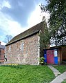 Outside of Saint Helen's Chapel.jpg 1,440 × 1,795; 976 nga KB
-
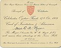 Oyster Feast Invitation.jpg 742 × 590; 106 nga KB
-
-

-
 Part of a Retail Park in Colchester - geograph.org.uk - 813350.jpg 640 × 480; 63 nga KB
-
 Part of Avignon Garden - geograph.org.uk - 1365917.jpg 640 × 480; 200 nga KB
-
 Part of Gatehouse Farm - geograph.org.uk - 720380.jpg 640 × 431; 65 nga KB
-
 Pasture near Park Farm - geograph.org.uk - 1419085.jpg 640 × 428; 102 nga KB
-
 Perpetual Motion.jpg 4,907 × 3,275; 1.08 nga MB
-
 Phoenix Aromas Europe.jpg 3,108 × 2,073; 1 nga MB
-
 Pillbox Camouflage^ - geograph.org.uk - 1432733.jpg 640 × 428; 105 nga KB
-
 Play area, Bradford Drive, Colchester - geograph.org.uk - 1752031.jpg 3,923 × 2,799; 2.48 nga MB
-
 Post Office and stores, Feering, Colchester Essex 1980s - Flickr - sludgegulper.jpg 1,504 × 1,025; 132 nga KB
-
 Rainbow behind house in St Jude Close Colchester - geograph.org.uk - 1626379.jpg 3,000 × 4,000; 2.14 nga MB
-
-
 Redundant quayside at The Hythe - geograph.org.uk - 860443.jpg 427 × 640; 70 nga KB
-
 River Colne from the new footbridge at the Mill - geograph.org.uk - 1309136.jpg 640 × 460; 61 nga KB
-
 River Colne, Essex.jpg 3,072 × 2,304; 3.16 nga MB
-
 River Colne, from East Street bridge, Colchester - geograph.org.uk - 1162295.jpg 640 × 426; 89 nga KB
-
 River Colne, looking north 2017.jpg 5,312 × 2,988; 2.49 nga MB
-
 Road to Harveys Farm - geograph.org.uk - 720367.jpg 640 × 456; 89 nga KB
-
 Road within Colchester Cemetery - geograph.org.uk - 1735928.jpg 2,942 × 2,995; 2.57 nga MB
-
 Roofscape of Roman Road - geograph.org.uk - 1084833.jpg 640 × 210; 156 nga KB
-
 Rovine di Colchester.JPG 2,816 × 2,112; 2.82 nga MB
-
 Rowhedge, Colchester CO5, UK - panoramio (1).jpg 2,730 × 3,080; 1.06 nga MB
-
 Rowhedge, Colchester CO5, UK - panoramio (2).jpg 2,096 × 3,036; 1,003 nga KB
-
 Rowhedge, Colchester CO5, UK - panoramio (3).jpg 4,032 × 3,024; 2.48 nga MB
-
 Rowhedge, Colchester CO5, UK - panoramio.jpg 2,923 × 2,840; 582 nga KB
-
 Ruins of Priory Church of St Botolph Colchester AJM 01.jpg 2,560 × 1,920; 979 nga KB
-
 Rye Gate - geograph.org.uk - 813319.jpg 640 × 480; 104 nga KB
-
 Severalls Hospital 207545.jpg 640 × 426; 121 nga KB
-
 Severalls Hospital, Colchester 2 (379463925).jpg 604 × 892; 457 nga KB
-
 Shopping in Matalan.jpg 4,470 × 3,233; 3.53 nga MB
-
 Snow-covered roofs of East Hill, Colchester - panoramio.jpg 2,816 × 2,112; 1.99 nga MB
-
 Speckled Wood Pararge aegeria (pa-RAH-jee ee-JEER-ee-uh) (Explored). - Flickr - pete. ^hwcp.jpg 1,600 × 900; 509 nga KB
-
 St Christopher Court St Christopher Road Colchester - geograph.org.uk - 1626307.jpg 640 × 480; 55 nga KB
-
 St Mary's Terrace, East - Lexden Road Colchester - geograph.org.uk - 1502186.jpg 640 × 480; 81 nga KB
-
 St Michael's School, Colchester - geograph.org.uk - 142646.jpg 640 × 480; 136 nga KB
-
 Stag Beetle - geograph.org.uk - 472244.jpg 640 × 426; 100 nga KB
-
 Statue in Wivenhoe Park, University of Essex - geograph.org.uk - 1753284.jpg 3,894 × 2,777; 1.18 nga MB
-
 StoneCross.jpg 1,604 × 1,676; 751 nga KB
-
 Sunset at Highwoods - geograph.org.uk - 5324106.jpg 1,600 × 1,200; 219 nga KB
-
 Sunset through Bulrushes.jpg 3,888 × 2,592; 1.28 nga MB
-
 Tank Traps - geograph.org.uk - 1459174.jpg 640 × 428; 95 nga KB
-
 Thatched pavilion - geograph.org.uk - 1459168.jpg 640 × 428; 90 nga KB
-
 The army assembled.jpg 2,272 × 1,704; 1.57 nga MB
-
 The Bristol-Felixstowe Freightliner service in the hands of 66 517 crosses Kelvedon viaduct.jpg 4,543 × 2,545; 1.75 nga MB
-
 The British Army in the United Kingdom 1939-45 H194.jpg 800 × 604; 66 nga KB
-
 The Mason Family of Colchester.jpg 1,196 × 1,638; 447 nga KB
-
 The Mill Hotel, Colchester HDR (376596138).jpg 604 × 893; 646 nga KB
-
 The University of Essex and the River Colne - geograph.org.uk - 724864.jpg 640 × 480; 212 nga KB
-
 Theme Garden and "Secret Garden" development - geograph.org.uk - 1365962.jpg 640 × 480; 189 nga KB
-
 UK Colchester City Council 2019.svg 360 × 185; 4 nga KB
-
 UK Colchester City Council 2021.svg 360 × 185; 4 nga KB
-
 UK Colchester City Council 2022.svg 360 × 185; 4 nga KB
-
 UK Colchester City Council 2023.svg 360 × 185; 4 nga KB
-
 UK Colchester City Council 2024.svg 360 × 185; 4 nga KB
-
 UnitedReformedChurchLionWalkColchesterAct1980Xlii.djvu 2,866 × 2,024, 4 mga pakli; 313 nga KB
-
 Untitled1 - panoramio (1346).jpg 2,112 × 2,816; 2.38 nga MB
-

-
-
 Victorian postbox, Magdalen Street, CO1 - geograph.org.uk - 4030366.jpg 360 × 640; 53 nga KB
-

-
 Visitors centre UK.jpg 662 × 440; 106 nga KB
-
Warning call of Eurasian wren (Troglodytes troglodytes).webm 35 s, 1,920 × 1,080; 39.24 nga MB
-
 Welcome to old heath.jpg 500 × 373; 103 nga KB
-
 Will Quince MP.jpg 640 × 640; 103 nga KB
-
 A view of Chippetts Lane from Chippetts Farm - geograph.org.uk - 708782.jpg 640 × 480; 80 nga KB
-
 Abbey Field Shooting Range - geograph.org.uk - 55372.jpg 640 × 482; 77 nga KB
-
 Bourne Valley Path - geograph.org.uk - 445208.jpg 640 × 426; 141 nga KB
-

-
 Building a Barracks - geograph.org.uk - 37809.jpg 640 × 482; 73 nga KB
-
 Caper Lane, also a public footpath - geograph.org.uk - 771986.jpg 640 × 480; 121 nga KB
-
 Children's playground, Colchester - geograph.org.uk - 189293.jpg 640 × 480; 129 nga KB
-
 Chinese State Circus - geograph.org.uk - 445267.jpg 640 × 426; 98 nga KB
-
 Colchester Institute, Sheepen Road, Colchester - geograph.org.uk - 58854.jpg 640 × 480; 96 nga KB
-
 Colchester Stop Line - geograph.org.uk - 718262.jpg 640 × 480; 131 nga KB
-
 Did the Romans have these problems, too^ - geograph.org.uk - 545341.jpg 640 × 480; 219 nga KB
-
 Distillery Pond - geograph.org.uk - 445245.jpg 640 × 271; 83 nga KB
-
 Footpath to Rows farm - geograph.org.uk - 425719.jpg 640 × 426; 92 nga KB
-
 Garden of Tymperleys museum, Colchester - geograph.org.uk - 189179.jpg 640 × 480; 170 nga KB
-
 Hythe in 1975 - geograph.org.uk - 69314.jpg 608 × 640; 66 nga KB
-
 Lion Walk shopping centre, Colchester - geograph.org.uk - 189183.jpg 640 × 480; 107 nga KB
-
 Middlewick Rifle Range - geograph.org.uk - 37819.jpg 640 × 482; 52 nga KB
-
 Nunns Road, Colchester looking towards North Hill - geograph.org.uk - 566178.jpg 640 × 480; 74 nga KB
-
 St Michales Estate, Colchester - geograph.org.uk - 142636.jpg 640 × 480; 87 nga KB
-
 Tossing Their Heads in Sprightly Dance - geograph.org.uk - 372286.jpg 426 × 640; 146 nga KB


.jpg)


.jpg)


.jpg)


.jpg)
.jpg)
.jpg)
.jpg)
.jpg)


_-_Fitzwalter_Road,_CO3_-_geograph.org.uk_-_4003892.jpg)
_-_Fitzwalter_Road,_CO3_-_royal_cipher_-_geograph.org.uk_-_4003897.jpg)


.jpg)


.jpg)

_-_geograph.org.uk_-_1103847.jpg)
.jpg)


_with_Prince_William_and_Diana_Award.jpg)
_with_Prince_William.jpg)
.jpg)


_(17135151359).jpg)
_(17319446122).jpg)


.jpg)


.jpg)
.jpg)
.jpg)


.jpg)


_(Explored)._-_Flickr_-_pete._%5Ehwcp.jpg)


.jpg)


.jpg)
_-_Beverley_Road,_CO3_-_geograph.org.uk_-_4006989.jpg)
_-_Beverley_Road,_CO3_-_royal_cipher_-_geograph.org.uk_-_4006993.jpg)


