Category:Essex
Jump to navigation
Jump to search
ceremonial county in England (use Q21272241 for administrative non-metropolitan county)  El pont Reina Elisabet II sobre el riu Tàmesi, que uneix Thurrock, (Essex), amb Dartford, (Kent)    | |||||
| Upload media | |||||
| Instance of | |||||
|---|---|---|---|---|---|
| Location |
| ||||
| Capital | |||||
| Population |
| ||||
| Area |
| ||||
| Different from | |||||
| Said to be the same as | Essex (historic county of England, ceremonial county of England, 1844), Essex (ceremonial county of England, non-metropolitan county, 1974–1998) | ||||
| official website | |||||
 | |||||


English: Essex is county in the East of England.
Català: Essex és un comtat de l' Est d'Anglaterra.
Cymraeg: Mae Essex yn sir yn nwyrain Lloegr.
Deutsch: Essex ist eine Grafschaft in England, im Vereinigten Königreiche.
Español: Essex es un condado y forma parte de la región oriental de Inglaterra.
Français : L'Essex un comté d'Angleterre, au Royaume Uni.
Italiano: L'Essex è una contea della regione dell'Est dell'Inghilterra.
Македонски: Есекс е грофовија во Источна Англија.
Nederlands: Essex is een graafschap in de Engelse regio East of England.
Polski: Essex jest hrabstwem niemetropolitarnym we wschodniej Anglii.
Português: Essex é um condado da Inglaterra
Svenska: Essex är ett grevskap i sydöstra England, Storbritannien.
Subcategories
This category has the following 33 subcategories, out of 33 total.
*
A
C
E
- Essex Country Show 2014 (220 F)
G
- Gallery pages of Essex (10 P)
H
- Hundreds of Essex (28 F)
I
N
O
P
S
T
U
V
- Vandalism in Essex (3 F)
~
- Audio files of Essex (27 F)
Media in category "Essex"
The following 194 files are in this category, out of 194 total.
-
 A clear warning - geograph.org.uk - 807627.jpg 640 × 480; 174 KB
-
 A frozen Lodge Lake - Hartford End (32477174926).jpg 4,368 × 2,912; 4.64 MB
-
 A watery way to go... (50971181527).jpg 3,648 × 4,753; 3.74 MB
-
 Abberton Reservoir.jpg 947 × 569; 48 KB
-
 Ancient Munduna (50562286691).jpg 4,000 × 4,997; 7.54 MB
-
 Angel valentine.png 336 × 442; 286 KB
-
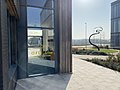 Anglia Ruskin University - Arise Innovation Hub in Harlow - Main Entrance.jpg 2,048 × 1,536; 474 KB
-
 Anglia Ruskin University - Arise Innovation Hub in Harlow.jpg 2,048 × 1,536; 800 KB
-
 Anglia Ruskin University - Graduation in Chelmsford.jpg 1,200 × 1,600; 120 KB
-
 Anglia Ruskin University - Lord Ashcroft Building in Chelmsford, Essex.jpg 1,638 × 2,048; 422 KB
-
 Anglia Ruskin University Chelmsford - Lord Ashcroft Building - Indoors.jpg 2,048 × 1,536; 354 KB
-
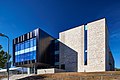
 Anglia Ruskin University Chelmsford - School of Medicine.jpg 4,096 × 3,190; 2.66 MB
-
 Anglia Ruskin University Chelmsford Medical Building.jpg 2,048 × 1,358; 683 KB
-

-
 Anglia Ruskin University in Chelmsford, Essex.jpg 2,048 × 1,535; 761 KB
-
 Anglia Ruskin University in Chelmsford.jpg 2,048 × 1,648; 518 KB
-
 Anglia Ruskin University's campus in Chelmsford.jpg 1,440 × 1,718; 325 KB
-
 ARU Chelmsford - Arise Innovation Hub.jpg 4,096 × 2,827; 1.84 MB
-
 ARU Chelmsford - Faculty of Business and Law.jpg 2,048 × 1,382; 569 KB
-
 ARU Chelmsford - Marconi Building - Winter 2022.jpg 1,440 × 1,800; 289 KB
-
 ARU Chelmsford - Marconi Building in summer.jpg 1,024 × 512; 137 KB
-
 ARU Chelmsford - Marconi Building.jpg 4,096 × 2,738; 1.99 MB
-
 ARU Chelmsford - School of Medicine - Winter 2022.jpg 1,034 × 1,293; 247 KB
-
 ARU Chelmsford - School of Medicine.jpg 4,096 × 2,592; 1.04 MB
-
 ARU Chelmsford - The Marconi Building.jpg 2,702 × 1,416; 760 KB
-
 ARU Chelmsford.jpg 2,048 × 1,698; 547 KB
-
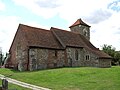
 Ashingdon, St Andrew's Church 01.jpg 2,848 × 2,136; 4.85 MB
-
 Ashingdon, St Andrew's Church 02.jpg 2,848 × 2,136; 3 MB
-
 Buttsbury Essex 2021.jpg 2,352 × 2,965; 1.63 MB
-
 Clearing in the Woods.jpg 2,683 × 2,012; 2.85 MB
-
 Close encounter.. (28746924630).jpg 11,348 × 6,654; 11.91 MB
-
 Cottage 5.jpg 3,648 × 2,736; 4.33 MB
-
 Countryside 2.jpg 3,648 × 2,736; 3.12 MB
-
 Dead tree on the Oak Trail.jpg 4,096 × 3,072; 3.22 MB
-
 Dedham Vale, Essex. 01.jpg 4,256 × 1,897; 1.39 MB
-
 Dedham Vale, Essex. 02.jpg 2,848 × 2,136; 3.04 MB
-
 Dedham Vale, Essex. 03.jpg 2,848 × 2,136; 3.1 MB
-
 Dedham Vale, Essex. 04.jpg 2,848 × 2,136; 3.06 MB
-
 Dedham Vale, Essex. 05.jpg 2,848 × 2,136; 3.08 MB
-
 Dedham Vale, Essex. 06.jpg 2,848 × 2,136; 3.01 MB
-
 Dedham Vale, Essex. 07.jpg 2,848 × 2,136; 3.09 MB
-
 Dedham Vale, Essex. 08.jpg 2,848 × 2,136; 3.11 MB
-
 Desire path in essex.jpg 3,000 × 4,000; 6 MB
-
 Emerging from the cutting - geograph.org.uk - 615550.jpg 640 × 480; 205 KB
-
 Essex (31339189801).jpg 2,866 × 1,665; 1.82 MB
-
 Essex (48998647427).jpg 2,872 × 1,706; 2.94 MB
-
 Essex (50953850811).jpg 3,574 × 5,422; 8.72 MB
-
 Essex Countryside.jpg 5,120 × 3,840; 6.4 MB
-
 Essex from the air - geograph.org.uk - 3141063.jpg 640 × 480; 89 KB
-
 Essex UK PFCC election 2024.svg 1,425 × 1,141; 1.41 MB
-
 EssexMonolith.jpg 1,687 × 2,679; 1.23 MB
-
 Fitzjohn's Grove Halstead (51317308308).jpg 4,000 × 2,250; 2.09 MB
-
 Fitzwalter manors in Essex.png 713 × 598; 157 KB
-
 Flitch Way Country Park (50369252166).jpg 3,970 × 5,240; 11.33 MB
-
 Frettons Danbury.jpg 6,000 × 4,000; 13.39 MB
-
 Garnetts Wood (49780615536).jpg 3,244 × 2,506; 2.64 MB
-
 GOC Cheshunt & Lee Valley 106 View (17439862668).jpg 4,288 × 3,216; 3.93 MB
-
 GOC Cheshunt & Lee Valley 143 Aimes Green (17669792955).jpg 4,288 × 3,216; 3.73 MB
-
 GOC Cheshunt & Lee Valley 152 Cornmill Meadows (17097737833).jpg 3,952 × 2,969; 3.15 MB
-
 GOC Cheshunt & Lee Valley 156 Cornmill Meadows (17531805319).jpg 4,288 × 3,216; 3.73 MB
-
 GOC Cheshunt & Lee Valley 157 Cornmill Stream (17576702638).jpg 4,288 × 3,216; 3.32 MB
-
 GOC Cheshunt & Lee Valley 162 Steel Lattice Bridge (17764477165).jpg 4,288 × 3,216; 3.88 MB
-
 GOC Cheshunt & Lee Valley 163 Footpath (17576712398).jpg 3,679 × 2,762; 2.98 MB
-
 GOC Cheshunt & Lee Valley 164 Cornmill Stream (17576977410).jpg 4,288 × 3,216; 3.59 MB
-
 GOC Cheshunt & Lee Valley 165 Cornmill Meadows (17761835452).jpg 4,288 × 3,216; 3.93 MB
-
 GOC Cheshunt & Lee Valley 169 Cornmill Stream (17780691926).jpg 4,288 × 3,216; 4.48 MB
-
 GOC Cheshunt & Lee Valley 171 Cornmill Stream (17807466961).jpg 4,288 × 3,216; 3.71 MB
-
 GOC Cheshunt & Lee Valley 175 Cornmill Stream (17620765089).jpg 3,216 × 4,288; 3.93 MB
-
 GOC Cheshunt & Lee Valley 176 Abbey Fish Ponds, Cornmill Meadows (17186674693).jpg 4,288 × 3,216; 3.92 MB
-
 GOC Cheshunt & Lee Valley 184 Cornmill Stream (17661709048).jpg 4,288 × 3,216; 3.89 MB
-
 GOC Cheshunt & Lee Valley 185 Cornmill Stream (17663253809).jpg 4,288 × 3,216; 4.5 MB
-
 GOC Cheshunt & Lee Valley 187 Ancestor (17701257279).jpg 3,216 × 4,288; 4.21 MB
-
 GOC Cheshunt & Lee Valley 189 Ancestor (17699944220).jpg 3,216 × 4,288; 3.64 MB
-
 GOC Cheshunt & Lee Valley 211 River Lee Flood Relief Channel (17774359069).jpg 4,288 × 3,216; 3.69 MB
-
 Graduation ceremony at ARU Chelmsford in 2022.jpg 1,440 × 1,800; 450 KB
-
 Gravel farm track.jpg 3,024 × 4,032; 9.4 MB
-
 Hare Hall by J. Grieg.tif 4,092 × 3,016; 29.71 MB
-
 Hare Hall by W. Bartlett & E. Young.tif 7,536 × 4,640; 80.05 MB
-
 Hay Bales 2.jpg 5,120 × 3,840; 7.29 MB
-
 Hiatus (31953618774).jpg 4,322 × 2,881; 5.7 MB
-
 Home for Beetles - geograph.org.uk - 1253561.jpg 640 × 428; 115 KB
-
 Horham-6-v2.jpg 5,184 × 3,456; 15.81 MB
-
 House for Essex (Wrabness).jpg 5,472 × 3,648; 7.76 MB
-
 In deepest Essex (49951230861).jpg 3,902 × 1,698; 5.49 MB
-
 Iris pseudacorus - geograph.org.uk - 1308340.jpg 428 × 640; 30 KB
-
 Just a bit further, another turn, or maybe the next one... (31295045346).jpg 4,368 × 2,912; 11.6 MB
-
 Lines going everywhere - geograph.org.uk - 1321131.jpg 640 × 480; 60 KB
-
 Lippitts Hill (geograph 2099848).jpg 640 × 480; 135 KB
-
 Lord Ashcroft Building at ARU Cambridge.jpg 1,440 × 1,800; 410 KB
-
 Lord Ashcroft Building at ARU Chelmsford.jpg 1,600 × 900; 349 KB
-
 M819.jpg 2,988 × 5,312; 5.27 MB
-
 Maldon overview.jpg 1,565 × 880; 230 KB
-
 Maldon Water.jpg 1,565 × 880; 157 KB
-
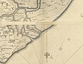 Map of Essex 1777 - Chapman and Andre (cropped).jpg 4,211 × 3,273; 4.85 MB
-
 Map of Essex 1777 - Chapman and Andre.jpg 30,208 × 23,808; 149.05 MB
-
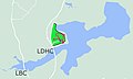
 Map showing the traditional, geographical county of Essex, England.png 4,967 × 4,967; 4.34 MB
-
 Meadow What Meadow^ - geograph.org.uk - 1250191.jpg 428 × 640; 116 KB
-
 Memorial Cross, Commemorating H F Johnson, D D Archdeacon Of Colchester (Q26434141).jpg 3,921 × 5,882; 5.74 MB
-
 MistyLakesideJanuary (32227490470).jpg 2,912 × 3,504; 8.53 MB
-
 Morning walk (24976006468).jpg 4,368 × 2,912; 6.92 MB
-
 N Weald - Flickr - satguru.jpg 2,048 × 1,536; 1.49 MB
-
 N weald1 - Flickr - satguru.jpg 2,048 × 1,536; 1.42 MB
-
 No more graves to be dug - geograph.org.uk - 1120001.jpg 480 × 640; 143 KB
-

-
 Old Jetty, Hadleigh Marshes - geograph.org.uk - 910560.jpg 640 × 425; 72 KB
-
 Old mooring posts, Alresford Creek - geograph.org.uk - 1141807.jpg 640 × 427; 72 KB
-
 P h o t o k e r a t i t i s (35547241186).jpg 3,877 × 1,249; 2.37 MB
-
 P1210563 - Flickr - satguru.jpg 1,990 × 1,454; 1.28 MB
-
 Paine's Manor - geograph.org.uk - 271021.jpg 640 × 409; 93 KB
-
 Palmers-College-2.jpg 640 × 299; 38 KB
-

-
 River Wid - August 2015 - panoramio (1).jpg 3,000 × 4,000; 2.12 MB
-
 River Wid - August 2015 - panoramio.jpg 4,000 × 3,000; 2.21 MB
-
 River Wid in Hylands Park - August 2012 - panoramio.jpg 3,000 × 4,000; 5.41 MB
-
 Romanticism (50015169921).jpg 5,321 × 3,199; 11.05 MB
-
 Roundwood Garden Centre - geograph.org.uk - 290426.jpg 640 × 480; 67 KB
-
 Scleroderma Verrucosum. - geograph.org.uk - 1425819.jpg 640 × 409; 109 KB
-

-
 Shinrin-Yoku (40167713373).jpg 2,718 × 3,501; 7.34 MB
-
 Snowshill Manor gardens 3.jpg 3,159 × 2,106; 6.11 MB
-
 Snowy Trees - panoramio.jpg 3,249 × 2,434; 3.79 MB
-
 Southend Rail (241434037).jpeg 2,048 × 1,365; 787 KB
-
 Spare stile. - panoramio.jpg 4,000 × 3,000; 4.92 MB
-
 SSI Data link, long distance terminal and signal modules.jpg 3,024 × 4,032; 4.62 MB
-
 Stratford stile. - panoramio.jpg 4,000 × 3,000; 4.86 MB
-
 Succulents 2.jpg 2,736 × 3,648; 2.77 MB
-
 Swan Resting - geograph.org.uk - 1198044.jpg 640 × 425; 74 KB
-
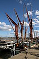
 Thames Sailing Barges moored at Malden Quay, Essex (51096860816).jpg 3,648 × 5,045; 2.27 MB
-
 Thames Sailing Barges moored at Malden Quay, Essex (51097401603).jpg 5,472 × 3,648; 2.32 MB
-
 Thames Sailing Barges moored at Malden Quay, Essex (51097401653).jpg 3,431 × 5,097; 2.3 MB
-
 The Boar Herongate Essex.jpg 3,072 × 4,096; 5.04 MB
-
 The Flitch Way (50727994631).jpg 4,348 × 3,467; 5.54 MB
-
 The Hidden Herd (49962039148).jpg 2,088 × 1,283; 2.29 MB
-
 Thorpe Bay Beach Huts at Sunset.jpg 3,024 × 4,032; 1.71 MB
-
 Tomb, Commemorating M A Woolmer, M E Eve And Mary Smith (Q26434139).jpg 4,870 × 3,896; 5.15 MB
-
 Toot Hill3.jpg 3,194 × 2,396; 856 KB
-
 Toot Hill4.jpg 3,264 × 2,448; 1.73 MB
-
 Track through Great Monk Wood (geograph 2118090).jpg 1,280 × 856; 292 KB
-
 Traipsing through the meadow.jpg 1,315 × 986; 506 KB
-
 Trek through the Bracken.jpg 1,077 × 807; 433 KB
-
 Tudor Croft September 2017.jpg 1,920 × 1,080; 462 KB
-
 United Kingdom Castle Point Borough Council 2024.svg 360 × 185; 3 KB
-
 Unloved bend in the track - geograph.org.uk - 615554.jpg 640 × 480; 179 KB
-
 View from my house - panoramio - Jynto.jpg 4,553 × 2,398; 3.7 MB
-
 View from my House - panoramio.jpg 3,264 × 1,840; 2.19 MB
-
 View from Pigeon Mount - geograph.org.uk - 1390104.jpg 640 × 428; 66 KB
-
 Waltham Abbey, United Kingdom (Unsplash phIDtKzQN8k).jpg 4,731 × 3,221; 10.19 MB
-
 Waltham Abbey, United Kingdom (Unsplash RmD-c6gAiv0).jpg 5,262 × 3,562; 12.16 MB
-
 Waltham Abbey, United Kingdom (Unsplash).jpg 5,219 × 3,626; 12.34 MB
-
 Birth of a Stadium - geograph.org.uk - 117475.jpg 640 × 426; 82 KB
-
 Cleanaway at Bowers Marsh - geograph.org.uk - 758914.jpg 640 × 426; 50 KB
-
 Cleanaway's Landfill - geograph.org.uk - 758876.jpg 640 × 426; 51 KB
-
 Clements Marsh Sluice. - geograph.org.uk - 172665.jpg 640 × 480; 99 KB
-
 Coryton Oil and Gas Tanks - geograph.org.uk - 98702.jpg 640 × 445; 39 KB
-
 Crop in field south of Dammer Wick - geograph.org.uk - 214525.jpg 480 × 640; 147 KB
-
 Deer Park, St Osyth - geograph.org.uk - 756530.jpg 640 × 416; 317 KB
-
 Dreary day over Corringham. - geograph.org.uk - 133780.jpg 640 × 480; 53 KB
-
 East Tilbury Marshes - geograph.org.uk - 226225.jpg 640 × 480; 110 KB
-
 Fishing Lake, A12 Chelmsford Bypass - geograph.org.uk - 585739.jpg 640 × 475; 88 KB
-
 Foundation Stone on the side of St.Mary the Virgin Church - geograph.org.uk - 1406734.jpg 2,304 × 3,072; 2.56 MB
-
 Further Meadow - geograph.org.uk - 176719.jpg 640 × 426; 137 KB
-
 Grange Farm, Thorpe-le-Soken - geograph.org.uk - 534919.jpg 640 × 480; 60 KB
-
 Henry's Moat - geograph.org.uk - 40690.jpg 640 × 482; 123 KB
-
 Household Waste Facility - geograph.org.uk - 626752.jpg 640 × 480; 87 KB
-
 Jetty to nowhere - geograph.org.uk - 750705.jpg 640 × 480; 334 KB
-
 Landfill by Cleanaway - geograph.org.uk - 758969.jpg 640 × 427; 82 KB
-
 Landfill Site in Bowers Marsh - geograph.org.uk - 758937.jpg 640 × 427; 70 KB
-
 Lawling Hall Event - geograph.org.uk - 550827.jpg 640 × 426; 101 KB
-
 Lifeboat Jetty - geograph.org.uk - 48167.jpg 640 × 482; 70 KB
-
 Little Pynchons. - geograph.org.uk - 588098.jpg 640 × 480; 90 KB
-
 Looking north-east across salt-marshes - geograph.org.uk - 603824.jpg 640 × 480; 163 KB
-
 Looking South from Bishopsfield. - geograph.org.uk - 137084.jpg 640 × 419; 48 KB
-
 Marina Entrance - geograph.org.uk - 334954.jpg 480 × 640; 51 KB
-

-
 Moor Farm Sluice - geograph.org.uk - 188402.jpg 640 × 426; 132 KB
-
 Old Pool outfall - geograph.org.uk - 169392.jpg 640 × 480; 82 KB
-

-
 OOPS^ - geograph.org.uk - 154576.jpg 640 × 290; 44 KB
-
 Perrywood Nurseries, Inworth, Essex - geograph.org.uk - 215050.jpg 640 × 406; 53 KB
-
 Retreat near West Wick Farm - geograph.org.uk - 376829.jpg 640 × 426; 81 KB
-
 Risden Training Centre - geograph.org.uk - 398800.jpg 640 × 400; 39 KB
-
 Scrambling - geograph.org.uk - 550814.jpg 640 × 426; 124 KB
-
 Seawall - Clements Marsh Sluice - geograph.org.uk - 172667.jpg 640 × 480; 72 KB
-
 South of Copt Hall - geograph.org.uk - 45961.jpg 640 × 482; 80 KB
-
 St Clare Hospice, Hastingwood - geograph.org.uk - 137107.jpg 640 × 426; 80 KB
-
 St Osyth Creek - geograph.org.uk - 534841.jpg 640 × 480; 63 KB
-
 Stokes Hall Sluice ^1 - geograph.org.uk - 154564.jpg 640 × 411; 87 KB
-
 Stubble, headland and autumn hedgerow - geograph.org.uk - 603885.jpg 480 × 640; 188 KB
-
 The Lodge - geograph.org.uk - 453197.jpg 640 × 426; 114 KB
-
 The Malthouse at Thorpe Maltings - geograph.org.uk - 424853.jpg 640 × 449; 59 KB
-
 The Old School House Messing - geograph.org.uk - 188377.jpg 640 × 426; 114 KB
-

-
 Wasted Winnowing Machine - geograph.org.uk - 390886.jpg 426 × 640; 173 KB
-
 Weymarks Sluice - geograph.org.uk - 242183.jpg 640 × 426; 95 KB
.jpg)
.jpg)

.jpg)


.jpg)


.jpg)
.jpg)
.jpg)


.jpg)

.jpg)

.jpg)
.jpg)
.jpg)
.jpg)
.jpg)
.jpg)
.jpg)
.jpg)
.jpg)
.jpg)
.jpg)
.jpg)
.jpg)
.jpg)
.jpg)
.jpg)
.jpg)
.jpg)
.jpg)


.jpg)


.jpg)
.jpg)

.jpg)

.jpg)


.jpg)


.jpg)
.jpg)
.jpg)


.jpg)


.jpg)


.jpg)


.jpeg)


.jpg)
.jpg)
.jpg)

.jpg)
.jpg)

.jpg)


.jpg)


.jpg)
.jpg)
.jpg)


.jpg)