Category:Colton, Leeds
Jump to navigation
Jump to search
area in Leeds, West Yorkshire, UK  | |||||
| Upload media | |||||
| Instance of | |||||
|---|---|---|---|---|---|
| Location | Leeds, West Yorkshire, Yorkshire and the Humber, England | ||||
 | |||||
English: Colton is an area of Leeds, situated in the East of the city, near Cross Gates.
Subcategories
This category has the following 5 subcategories, out of 5 total.
Media in category "Colton, Leeds"
The following 43 files are in this category, out of 43 total.
-
 Allotments - School Lane, Colton - geograph.org.uk - 961414.jpg 640 × 411; 187 KB
-
 An old quarry - geograph.org.uk - 4620411.jpg 640 × 426; 44 KB
-
 An ornamental Eryngium - geograph.org.uk - 2703792.jpg 3,872 × 2,592; 1.97 MB
-
 Bridge over the M1 - geograph.org.uk - 1998843.jpg 1,024 × 681; 179 KB
-
 Bridge over the motorway near Newsam Green - geograph.org.uk - 5356066.jpg 1,600 × 1,200; 630 KB
-
 Bridleway - Meynell Road - geograph.org.uk - 4624180.jpg 480 × 640; 123 KB
-
 Cattle by the M1 - geograph.org.uk - 30550.jpg 640 × 480; 133 KB
-
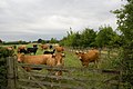 Cattle near the M1 - geograph.org.uk - 1998841.jpg 1,024 × 681; 175 KB
-
 Colton 1.jpg 3,648 × 2,736; 1.77 MB
-
 Colton 2.jpg 3,648 × 2,736; 2.84 MB
-

-
-

-
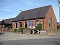 Colton Methodist Church March 2017.jpg 3,264 × 2,448; 2.37 MB
-
 Colton Mill - geograph.org.uk - 30540.jpg 640 × 480; 109 KB
-
 Colton Mill - Stile Hill Way - geograph.org.uk - 961399.jpg 640 × 382; 151 KB
-
 Colton Retail Park - geograph.org.uk - 2016222.jpg 1,280 × 960; 234 KB
-
 Footpath - Colton Lane - geograph.org.uk - 4464707.jpg 480 × 640; 87 KB
-
 Footpath - Colton Lane - geograph.org.uk - 4464709.jpg 487 × 640; 62 KB
-
 Footpath - Colton Lane - geograph.org.uk - 4464718.jpg 480 × 640; 88 KB
-
 Footpath - Colton Lane - geograph.org.uk - 4464770.jpg 640 × 480; 131 KB
-
 Footpath - Colton Road East - geograph.org.uk - 961409.jpg 640 × 453; 255 KB
-
-
 Gate at the end of Park Road, Colton - geograph.org.uk - 259451.jpg 640 × 480; 124 KB
-
 Houses in Colton Village Estate - geograph.org.uk - 30545.jpg 640 × 480; 105 KB
-
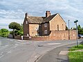
 Park Farm (Colton Farm on OS map), Colton - geograph.org.uk - 259447.jpg 640 × 476; 102 KB
-
 Park Farmhouse.jpg 1,328 × 1,992; 555 KB
-
 Park Road - Colton - geograph.org.uk - 961432.jpg 640 × 468; 254 KB
-
 Park Road Farm - Colton - geograph.org.uk - 961429.jpg 640 × 480; 242 KB
-
 Park Road Farmhouse, Colton - geograph.org.uk - 259464.jpg 640 × 470; 99 KB
-

-
 Pizza Hut, Colton - geograph.org.uk - 2016225.jpg 1,279 × 960; 196 KB
-
 Pizza Hut, Colton Common - geograph.org.uk - 4060182.jpg 640 × 481; 262 KB
-
 Sainsbury's, Colton Retail Park - geograph.org.uk - 151849.jpg 640 × 381; 196 KB
-

-

-
 The Hawthorns (1).jpg 1,752 × 1,168; 429 KB
-
 Track at Colton. - geograph.org.uk - 142553.jpg 640 × 480; 131 KB
-
 Tree stump, Temple Newsam Park, Colton - geograph.org.uk - 263675.jpg 640 × 480; 186 KB
-
 Whitkirk-Colton-Sunrinse-Leeds.jpg 604 × 453; 44 KB
-
 Yew Tree Cottage - Colton Road East - geograph.org.uk - 961411.jpg 640 × 480; 310 KB
-
 Yew Tree Farm - Colton Road East - geograph.org.uk - 4624197.jpg 640 × 480; 73 KB
-
 Yew Tree Lane - Colton Road East - geograph.org.uk - 961406.jpg 640 × 480; 162 KB


,_Colton_-_geograph.org.uk_-_259447.jpg)


.jpg)


