Category:Concepción del Bermejo
Jump to navigation
Jump to search
dead city in current Chaco province | |||||
| Upload media | |||||
| Instance of | |||||
|---|---|---|---|---|---|
| Location | Chaco Province, Argentina | ||||
| Heritage designation |
| ||||
 | |||||
Media in category "Concepción del Bermejo"
The following 34 files are in this category, out of 34 total.
-
Aerial view of Km 75 Ruins.jpg 916 × 546; 161 KB
-
Big entry sign to Km 75 ruins looking to the North.JPG 4,288 × 3,216; 2.54 MB
-
Big entry sign to Km 75 Ruins.JPG 4,288 × 3,216; 2.28 MB
-
Canyon on Nogueira River.JPG 4,288 × 3,216; 2.56 MB
-
Carbono 14 sign in Km 75 ruins.JPG 4,288 × 3,216; 2.59 MB
-
Church sign in Km 75 ruins.JPG 4,288 × 3,216; 2.26 MB
-
Dam sign in Km 75 ruins another view.JPG 4,288 × 3,216; 2.94 MB
-
Dam sign in Km 75 ruins.JPG 4,288 × 3,216; 2.59 MB
-
Excavations in sector M in km 75 Ruins.jpg 422 × 310; 48 KB
-
Floor level sign and little hills in Km 75 Ruins.JPG 4,288 × 3,216; 2.25 MB
-
Hispanic tinaja and church signs in Km 75 ruins.JPG 4,288 × 3,216; 2.83 MB
-
Human hills in Km 75 Ruins.JPG 4,288 × 3,216; 2.82 MB
-
Indian piece sign in Km 75 Ruins.JPG 4,288 × 3,216; 2.88 MB
-
Inside Km 75 Ruins.JPG 4,288 × 3,216; 2.53 MB
-
Jarrón Ruinas km 75.jpg 2,304 × 3,072; 985 KB
-
Map of Concepción del bermejo.png 855 × 528; 56 KB
-
MuseoRegionaldeAntropologia.jpg 672 × 445; 56 KB
-
Nogueira River another view.JPG 4,288 × 3,216; 2.54 MB
-
Panoramic view of lake near Km 75 ruins.JPG 5,200 × 1,456; 2.47 MB
-
Path from the forest in Km 75 ruins.JPG 4,288 × 3,216; 2.65 MB
-
Path into the forest in Km 75 Ruins.JPG 3,216 × 4,288; 2.81 MB
-
Pipes, dishes & other objects of Ruins of km 75.jpg 3,072 × 2,304; 1.05 MB
-
Plano Ruinas del km 75.png 1,072 × 1,104; 27 KB
-
Road 29 in Km 75 Ruins looking to South.JPG 4,288 × 3,216; 4.25 MB
-
Road 29 in Km 75 Ruins.JPG 4,288 × 3,216; 2.63 MB
-
Road 29 view to the North in Km 75 Ruins.JPG 4,288 × 3,216; 2.85 MB
-
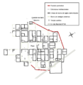
Ruinas del km 75 map.png 714 × 715; 38 KB
-
Sabana and forest in Km 75 Ruins.JPG 4,288 × 3,216; 2.85 MB
-
Sectors sign in forest in Km 75 Ruins.JPG 4,288 × 3,216; 3.23 MB
-
Sectors sign in Km 75 Ruins.JPG 3,216 × 4,288; 2.85 MB
-
Signs and trees in Km 75 ruins..JPG 4,288 × 3,216; 2.49 MB
-
Signs in Km 75 Ruins.JPG 4,288 × 3,216; 2.76 MB
-
Smalletre entry sign to Km 75 Ruins.JPG 4,288 × 3,216; 2.7 MB
-
Wall sign in Km 75 Ruins.JPG 4,288 × 3,216; 3.03 MB


