Category:Cookley, Suffolk
Jump to navigation
Jump to search
village and civil parish in Suffolk, UK | |||||
| Upload media | |||||
| Instance of | |||||
|---|---|---|---|---|---|
| Location |
| ||||
| Said to be the same as | Cookley (Wikimedia duplicated page, civil parish) | ||||
 | |||||
Subcategories
This category has the following 4 subcategories, out of 4 total.
Media in category "Cookley, Suffolk"
The following 200 files are in this category, out of 234 total.
(previous page) (next page)-
 1881 occupations.jpg 1,062 × 843; 88 KB
-
 About to go round the bend - geograph.org.uk - 1930051.jpg 640 × 480; 52 KB
-
 Access road to Hill Farm, Cookley - geograph.org.uk - 1930516.jpg 640 × 480; 79 KB
-

-
 B1117 Church Hill, Walpole - geograph.org.uk - 5211395.jpg 4,608 × 3,456; 2.58 MB
-
 B1117 Halesworth Road - geograph.org.uk - 2271520.jpg 3,072 × 2,304; 1.46 MB
-
 B1117 Halesworth Road - geograph.org.uk - 2271521.jpg 3,072 × 2,304; 1.34 MB
-
 B1117 Walpole Road - geograph.org.uk - 2537246.jpg 3,072 × 2,304; 1.29 MB
-
 B1117 Walpole Road junction - geograph.org.uk - 4296618.jpg 3,072 × 2,304; 2.57 MB
-
 B1123 Chediston Street - geograph.org.uk - 2537926.jpg 3,072 × 2,304; 1.2 MB
-
 Barn at Church Farm - geograph.org.uk - 2563885.jpg 3,072 × 2,304; 1.37 MB
-
 Bend And Entrance - geograph.org.uk - 4017920.jpg 1,024 × 768; 180 KB
-
 Bridleway to Hill Farm ^ the B1117 Chediston Street - geograph.org.uk - 2310955.jpg 3,072 × 2,304; 1.29 MB
-
 Bridleway to Rockstone Manor Farm ^ Cookley Street - geograph.org.uk - 2537923.jpg 3,072 × 2,304; 1.32 MB
-
 Bridleway to Rockstone Manor Farm ^ Cookley Street - geograph.org.uk - 2537924.jpg 3,072 × 2,304; 1.33 MB
-
 Bulrushes growing in the stream - geograph.org.uk - 3064879.jpg 2,304 × 3,072; 1.64 MB
-
 Bulrushes growing in the stream - geograph.org.uk - 3064880.jpg 2,304 × 3,072; 1.54 MB
-
 Bush Hill Farm, Cookley - geograph.org.uk - 2657464.jpg 3,072 × 2,304; 1.4 MB
-
 Bush Hill Farm, Cookley - geograph.org.uk - 2657468.jpg 3,072 × 2,304; 1.61 MB
-
 Bush Hill Farm, Cookley sign - geograph.org.uk - 2657461.jpg 2,304 × 3,072; 1.4 MB
-
 Bush Hill Farm, Cookley, Suffolk - geograph.org.uk - 1929747.jpg 640 × 480; 90 KB
-
 Church Farm, Cookley - geograph.org.uk - 1930533.jpg 640 × 453; 122 KB
-
 Clearly Marked Footpath - geograph.org.uk - 4017636.jpg 1,024 × 768; 286 KB
-
 Combining at Walpole - geograph.org.uk - 4581281.jpg 3,072 × 2,304; 1.87 MB
-
 Combining at Walpole - geograph.org.uk - 4581293.jpg 3,072 × 2,304; 1.97 MB
-
 Combining off the B1117 Walpole Road - geograph.org.uk - 3076714.jpg 2,304 × 3,072; 1.36 MB
-
 Communication Cabinet off Cookley Road - geograph.org.uk - 5735671.jpg 4,608 × 3,456; 2.56 MB
-
 Cookley and Walpole Community Room - geograph.org.uk - 1472695.jpg 3,072 × 2,304; 1.47 MB
-
 Cookley Bungalow - geograph.org.uk - 2657688.jpg 3,072 × 2,304; 1.49 MB
-
 Cookley Corner Postbox - geograph.org.uk - 1907692.jpg 2,304 × 3,072; 1.58 MB
-
 Cookley Corner Postbox - geograph.org.uk - 5736648.jpg 3,000 × 4,000; 4.24 MB
-
 Cookley Corner Postbox - geograph.org.uk - 5736655.jpg 2,075 × 3,456; 2.36 MB
-
 Cookley Ford - geograph.org.uk - 3189342.jpg 3,872 × 2,592; 2.39 MB
-
 Cookley Road - geograph.org.uk - 1472702.jpg 3,072 × 2,304; 1.5 MB
-
 Cookley Road - geograph.org.uk - 1472703.jpg 3,072 × 2,304; 1.63 MB
-
 Cookley Road - geograph.org.uk - 2563890.jpg 3,072 × 2,304; 1.32 MB
-
 Cookley Road - geograph.org.uk - 2563898.jpg 3,072 × 2,304; 1.28 MB
-
 Cookley Road - geograph.org.uk - 2564474.jpg 2,304 × 3,072; 1.24 MB
-
 Cookley Road - geograph.org.uk - 3064869.jpg 3,072 × 2,304; 1.28 MB
-
 Cookley Road ^ the footpath to Cookley Street - geograph.org.uk - 3064865.jpg 3,072 × 2,304; 1.3 MB
-
 Cookley Road, Cookley - geograph.org.uk - 5735664.jpg 4,608 × 3,456; 2.7 MB
-
 Cookley Road, Cookley - geograph.org.uk - 5735988.jpg 4,608 × 3,456; 2.55 MB
-
 Cookley Road, Cookley - geograph.org.uk - 5735995.jpg 4,608 × 3,456; 2.61 MB
-
 Cookley Road, Cookley - geograph.org.uk - 5736654.jpg 4,608 × 3,456; 2.51 MB
-
 Cookley Road, Cookley - geograph.org.uk - 6065089.jpg 4,032 × 2,268; 3.62 MB
-
 Cookley Road, Walpole - geograph.org.uk - 2271519.jpg 3,072 × 2,304; 1.37 MB
-
 Cookley Street - geograph.org.uk - 1907698.jpg 3,072 × 2,304; 1.32 MB
-
 Cookley Street - geograph.org.uk - 2310935.jpg 3,072 × 2,304; 1.26 MB
-
 Cookley Street - geograph.org.uk - 2310937.jpg 3,072 × 2,304; 1.3 MB
-
 Cookley Street - geograph.org.uk - 2310947.jpg 3,072 × 2,304; 1.52 MB
-
 Cookley Street - geograph.org.uk - 2310948.jpg 3,072 × 2,304; 1.38 MB
-
 Cookley Street - geograph.org.uk - 2310957.jpg 3,072 × 2,304; 1.29 MB
-
 Cookley Street - geograph.org.uk - 2310963.jpg 3,072 × 2,304; 1.36 MB
-
 Cookley Street - geograph.org.uk - 2310973.jpg 3,072 × 2,304; 1.29 MB
-
 Cookley Street ^ Cookley Corner Postbox - geograph.org.uk - 1907688.jpg 3,072 × 2,304; 1.3 MB
-
 Cookley Street ^ Cookley Corner Postbox - geograph.org.uk - 5736515.jpg 4,000 × 3,000; 3.54 MB
-
 Cookley Street, Cookley - geograph.org.uk - 5736510.jpg 4,000 × 2,800; 3.32 MB
-
 Cookley Telephone Box - geograph.org.uk - 3064907.jpg 2,304 × 3,072; 1.43 MB
-
 Cookley Telephone Box - geograph.org.uk - 3064908.jpg 2,304 × 3,072; 1.48 MB
-
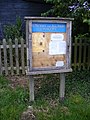
 Cookley Village Notice Board - geograph.org.uk - 1907690.jpg 2,304 × 3,072; 1.38 MB
-
 Cookley Village Notice Board - geograph.org.uk - 5736506.jpg 2,905 × 3,873; 5.51 MB
-
 Cookley Village Notice Board ^ Signpost - geograph.org.uk - 5736501.jpg 4,608 × 3,456; 2.46 MB
-
 Cookley Village Notice Board ^ Signpost - geograph.org.uk - 5736659.jpg 4,608 × 3,456; 2.63 MB
-
 Cookley Village sign - geograph.org.uk - 5736485.jpg 2,764 × 3,889; 4.72 MB
-
 Cookley village sign - geograph.org.uk - 6065083.jpg 4,032 × 2,268; 3.14 MB
-
 Cottages at Cookley Corner - geograph.org.uk - 1930522.jpg 640 × 480; 103 KB
-
 Cottages at Cookley Corner - geograph.org.uk - 1930524.jpg 640 × 480; 103 KB
-
 Country Road - geograph.org.uk - 4017916.jpg 1,024 × 768; 330 KB
-
 Country road at Cookley - geograph.org.uk - 1929752.jpg 640 × 480; 82 KB
-
 Cratfield Road, Cookley - geograph.org.uk - 2657443.jpg 3,072 × 2,304; 1.44 MB
-
 Cratfield Road, Cookley - geograph.org.uk - 2657445.jpg 2,304 × 3,072; 1.37 MB
-
 Cratfield Road, Cookley - geograph.org.uk - 2657699.jpg 2,640 × 1,892; 1.51 MB
-
 Cultivating off the B1117 Walpole Road - geograph.org.uk - 3091918.jpg 3,072 × 2,304; 1.25 MB
-
 Cultivating off the B1117 Walpole Road - geograph.org.uk - 3091925.jpg 3,072 × 2,304; 1.27 MB
-
 Cut Mark Cookley St Michaels Church - geograph.org.uk - 5699387.jpg 2,231 × 2,231; 3.31 MB
-
 Election Poster off the B1117 Walpole Road - geograph.org.uk - 4456802.jpg 2,304 × 3,072; 3.29 MB
-
 Election Poster ^ Manure Heap - geograph.org.uk - 4456799.jpg 3,072 × 2,304; 2.94 MB
-
 Entering Walpole on the B1117 - geograph.org.uk - 5211370.jpg 4,608 × 3,456; 2.63 MB
-
 Entrance to Bush Hill Farm - geograph.org.uk - 6104374.jpg 2,988 × 2,036; 4.25 MB
-
 Entrance to Rockstone Lodge - geograph.org.uk - 6104389.jpg 3,008 × 2,304; 3.43 MB
-
 Farm Buildings - geograph.org.uk - 4297823.jpg 1,024 × 768; 163 KB
-
 Farm buildings Linstead Road - geograph.org.uk - 5168015.jpg 640 × 480; 59 KB
-
 Field off the B1117 Walpole Road - geograph.org.uk - 3077182.jpg 3,072 × 2,304; 1.33 MB
-
 Field off the B1117 Walpole Road - geograph.org.uk - 3077187.jpg 3,072 × 2,304; 1.29 MB
-
 Field off the B1117 Walpole Road - geograph.org.uk - 3077190.jpg 3,072 × 2,304; 1.35 MB
-
 Footbridge near the River Blyth - geograph.org.uk - 3120168.jpg 2,304 × 3,072; 1.69 MB
-
 Footbridge near the River Blyth - geograph.org.uk - 3120171.jpg 3,072 × 2,304; 1.63 MB
-
 Footbridge on the footpath to Cookley Street - geograph.org.uk - 3064874.jpg 2,304 × 3,072; 1.63 MB
-
 Footbridge on the footpath to Cookley Street - geograph.org.uk - 3064900.jpg 2,304 × 3,072; 1.7 MB
-
 Footbridge over the River Blyth - geograph.org.uk - 3120181.jpg 2,304 × 3,072; 1.53 MB
-
 Footbridge over the River Blyth - geograph.org.uk - 3120231.jpg 2,304 × 3,072; 1.57 MB
-
 Footpath beside houses - geograph.org.uk - 1930086.jpg 640 × 480; 74 KB
-
 Footpath beside houses - geograph.org.uk - 1930093.jpg 640 × 480; 75 KB
-
 Footpath Gate - geograph.org.uk - 3120182.jpg 2,304 × 3,072; 1.28 MB
-
 Footpath Gate near Valley Farm - geograph.org.uk - 2310928.jpg 3,072 × 2,304; 1.32 MB
-
 Footpath next to Valley Farm - geograph.org.uk - 1930075.jpg 640 × 480; 80 KB
-
 Footpath off Linstead Road - geograph.org.uk - 2657404.jpg 3,072 × 2,304; 1.33 MB
-
 Footpath off Linstead Road - geograph.org.uk - 2657408.jpg 3,072 × 2,304; 1.38 MB
-
 Footpath off Linstead Road - geograph.org.uk - 2657411.jpg 3,072 × 2,304; 1.44 MB
-
 Footpath Sign - geograph.org.uk - 4017648.jpg 1,024 × 768; 261 KB
-
-

-
 Footpath to Cookley - geograph.org.uk - 2657947.jpg 3,072 × 2,304; 1.38 MB
-
 Footpath to Cookley - geograph.org.uk - 2657953.jpg 2,304 × 3,072; 1.66 MB
-
 Footpath to Cookley - geograph.org.uk - 2657954.jpg 3,072 × 2,304; 1.46 MB
-
 Footpath to Cookley Grange ^ the B1123 Chediston Road - geograph.org.uk - 2537974.jpg 3,072 × 2,304; 1.65 MB
-
 Footpath to Cookley Grange ^ the B1123 Chediston Road - geograph.org.uk - 2537976.jpg 3,072 × 2,304; 1.66 MB
-
 Footpath to Cookley Road - geograph.org.uk - 2310968.jpg 3,072 × 2,304; 1.3 MB
-
 Footpath to Cookley Road - geograph.org.uk - 2310970.jpg 3,072 × 2,304; 1.27 MB
-
 Footpath to Cookley Street - geograph.org.uk - 3064872.jpg 2,304 × 3,072; 1.31 MB
-
 Footpath to Cookley Street - geograph.org.uk - 3064884.jpg 3,072 × 2,304; 1.26 MB
-
 Footpath to Cookley ^ Linstead Roads - geograph.org.uk - 2564489.jpg 3,072 × 2,304; 1.4 MB
-
 Footpath to Cookley ^ Linstead Roads - geograph.org.uk - 2564495.jpg 3,072 × 2,304; 1.31 MB
-
 Footpath to Linstead Road - geograph.org.uk - 2564674.jpg 3,072 × 2,304; 1.43 MB
-
 Footpath to Linstead Road - geograph.org.uk - 2657435.jpg 2,304 × 3,072; 1.47 MB
-
 Footpath to Linstead Road - geograph.org.uk - 2657438.jpg 3,072 × 2,304; 1.41 MB
-
 Footpath to Linstead Road - geograph.org.uk - 2657675.jpg 3,072 × 2,304; 1.61 MB
-
 Footpath to Linstead Road - geograph.org.uk - 2657677.jpg 3,072 × 2,304; 1.28 MB
-
 Footpath to Old Hall - geograph.org.uk - 2310942.jpg 3,072 × 2,304; 1.48 MB
-
 Footpath to Old Hall - geograph.org.uk - 2310945.jpg 3,072 × 2,304; 1.43 MB
-
 Footpath to Old Hall - geograph.org.uk - 2310950.jpg 3,072 × 2,304; 1.27 MB
-
 Footpath to Rockstone Manor Farm ^ B1117 Chediston Road - geograph.org.uk - 2310953.jpg 2,304 × 3,072; 1.3 MB
-
 Footpath to the B1117 Halesworth Road - geograph.org.uk - 2310920.jpg 3,072 × 2,304; 1.28 MB
-
 Footpath to the B1117 Halesworth Road - geograph.org.uk - 2310924.jpg 3,072 × 2,304; 1.3 MB
-
 Footpath to the B1123 Chediston Street - geograph.org.uk - 2563877.jpg 3,072 × 2,304; 1.28 MB
-
 Footpath to the B1123 Chediston Street - geograph.org.uk - 2563902.jpg 3,072 × 2,304; 1.34 MB
-
 Footpath to Walpole - geograph.org.uk - 1930116.jpg 640 × 480; 65 KB
-
 Footpath to Walpole Old Hall ^ The Clink - geograph.org.uk - 2271517.jpg 2,304 × 3,072; 1.66 MB
-
 Footpath to Walpole Old Hall ^ The Clink - geograph.org.uk - 2271518.jpg 2,304 × 3,072; 1.62 MB
-
 Footpaths to the B1117 Halesworth Road - geograph.org.uk - 2310906.jpg 3,072 × 2,304; 1.35 MB
-
 Ford - geograph.org.uk - 4017692.jpg 1,024 × 768; 226 KB
-
 Ford at Cookley - geograph.org.uk - 3189351.jpg 3,872 × 2,592; 2.34 MB
-
 Ford at Cookley Street - geograph.org.uk - 240526.jpg 1,600 × 1,200; 463 KB
-
 Gate ^ sign at the entrance to Rockstone Lodge - geograph.org.uk - 2537968.jpg 3,072 × 2,304; 1.5 MB
-
 Gates of the Pumping Station off Rockstone Lane - geograph.org.uk - 2537281.jpg 3,072 × 2,304; 1.33 MB
-
 Gnome from home - geograph.org.uk - 1930102.jpg 640 × 480; 75 KB
-
 Grazing and hedgerow - geograph.org.uk - 5167980.jpg 640 × 480; 72 KB
-
 Grazing off Linstead Road - geograph.org.uk - 5168013.jpg 640 × 480; 50 KB
-
 Hay meadow by Green Farm, Cookley Green - geograph.org.uk - 1930577.jpg 640 × 480; 105 KB
-
 Hill Farm, Cookley - geograph.org.uk - 1930518.jpg 640 × 480; 87 KB
-
 Hill Farm, Cookley Street - geograph.org.uk - 3064885.jpg 3,072 × 2,304; 1.32 MB
-
 Hillside grazing - geograph.org.uk - 5167982.jpg 640 × 480; 49 KB
-
 Huntingfield Hall Farm sign - geograph.org.uk - 2563840.jpg 3,072 × 2,304; 1.66 MB
-
 Junction of the B1123 and Rockstone Lane - geograph.org.uk - 2205969.jpg 700 × 525; 110 KB
-
 Linstead Road - geograph.org.uk - 1725322.jpg 3,072 × 2,304; 1.49 MB
-
 Linstead Road - geograph.org.uk - 5168017.jpg 640 × 480; 91 KB
-
 Linstead Road Crossroad at Cookley Green - geograph.org.uk - 1725317.jpg 3,072 × 2,304; 1.43 MB
-
 Linstead Road ^ footpath to Bush Hill Farm - geograph.org.uk - 2657962.jpg 3,072 × 2,304; 1.45 MB
-
 Looking towards Cookley Street - geograph.org.uk - 3064897.jpg 3,072 × 2,304; 1.43 MB
-
 Looking towards Cookley Street - geograph.org.uk - 3172590.jpg 3,072 × 2,304; 1.29 MB
-
 Looking towards Halesworth - geograph.org.uk - 4296616.jpg 3,072 × 2,304; 1.97 MB
-
 Looking towards Halesworth - geograph.org.uk - 4296620.jpg 3,072 × 2,304; 1.28 MB
-
 Looking towards the B1117 Halesworth Road - geograph.org.uk - 3172361.jpg 3,072 × 2,304; 1.45 MB
-
 Looking towards The Old Manse - geograph.org.uk - 4296653.jpg 3,072 × 2,304; 1.2 MB
-
 Looking towards Valley Farm - geograph.org.uk - 3120224.jpg 3,072 × 2,304; 1.46 MB
-
 Manure Heap off the b1117 Walpole Road - geograph.org.uk - 4456805.jpg 3,072 × 2,304; 1.83 MB
-
 Map of cookley.PNG 559 × 266; 355 KB
-
 Minor Road - geograph.org.uk - 4017919.jpg 1,024 × 768; 218 KB
-
 Minor Road - geograph.org.uk - 4297820.jpg 1,024 × 768; 148 KB
-
 National Cycle Route 1 - geograph.org.uk - 5167985.jpg 640 × 480; 58 KB
-
 Nave of St Michael's church, Cookley - geograph.org.uk - 6065087.jpg 4,032 × 2,268; 2.8 MB
-
 Notice Board of St Michael and All Angels' Church - geograph.org.uk - 3064951.jpg 2,304 × 3,072; 1.47 MB
-
 Old railway goods van used for storage - geograph.org.uk - 2197198.jpg 700 × 525; 152 KB
-
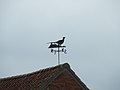 Pheasant Weather Vane - geograph.org.uk - 4297831.jpg 1,024 × 768; 55 KB
-
 Population 1811-2011.jpg 1,089 × 697; 76 KB
-
 Population increase.jpg 488 × 278; 24 KB
-
 Postbox in the hedge by Cookley Green - geograph.org.uk - 1930585.jpg 480 × 640; 229 KB
-
-
 Pumping Station off Rockstone Lane - geograph.org.uk - 2537272.jpg 2,640 × 1,907; 1.01 MB
-
 Pumping Station off Rockstone Lane - geograph.org.uk - 2537284.jpg 3,072 × 2,304; 1.36 MB
-
 River Blyth - geograph.org.uk - 3120195.jpg 2,304 × 3,072; 1.64 MB
-
 River Blyth - geograph.org.uk - 3120197.jpg 2,304 × 3,072; 1.45 MB
-
 Road to Cookley at Cookley Green - geograph.org.uk - 1725323.jpg 2,304 × 3,072; 1.41 MB
-
 Roadsign in Linstead Road - geograph.org.uk - 1725315.jpg 2,304 × 3,072; 1.66 MB
-
 Roadsign on the B1117 Halesworth Road - geograph.org.uk - 4053280.jpg 2,115 × 2,823; 592 KB
-
 Roadsign on the B1117 Walpole Road - geograph.org.uk - 3091923.jpg 2,304 × 3,072; 1,005 KB
-
 Rockstone Lane - geograph.org.uk - 2537251.jpg 3,072 × 2,304; 1.3 MB
-
 Rockstone Lane - geograph.org.uk - 2537269.jpg 3,072 × 2,304; 1.51 MB
-
 Rockstone Lane - geograph.org.uk - 2537285.jpg 3,072 × 2,304; 1.28 MB
-
 Rockstone Lane - geograph.org.uk - 2537288.jpg 3,072 × 2,304; 1.27 MB
-
 Rockstone Lane - geograph.org.uk - 2537290.jpg 3,072 × 2,304; 1.31 MB
-
 Rockstone Lane - geograph.org.uk - 2537981.jpg 3,072 × 2,304; 1.26 MB
-
 Rockstone Lane - geograph.org.uk - 4296611.jpg 3,072 × 2,304; 2 MB
-
 Rockstone Lane, Chediston - geograph.org.uk - 6065113.jpg 4,032 × 2,268; 3.12 MB
-
 Rockstone Lane, Cookley - geograph.org.uk - 2537954.jpg 3,072 × 2,304; 1.29 MB
-
 Rockstone Lane, Walpole - geograph.org.uk - 4296609.jpg 3,072 × 2,304; 2.3 MB
-
 Rockstone Lane, Walpole - geograph.org.uk - 4296613.jpg 3,072 × 2,304; 2.15 MB
-
 Rockstone Manor sign - geograph.org.uk - 2537960.jpg 2,304 × 3,072; 1.63 MB
-

-
 Rural lane north of Cookley Green - geograph.org.uk - 1930578.jpg 640 × 480; 135 KB
-
 Rural lane through Cookley Green - geograph.org.uk - 1930582.jpg 640 × 480; 166 KB
-

-
 Sheep at Bush Hill Farm - geograph.org.uk - 1929744.jpg 640 × 480; 88 KB
-
 St Michael's church, Cookley - geograph.org.uk - 6065085.jpg 4,032 × 2,268; 5.37 MB
-
 Staggered junction by Cookley Green - geograph.org.uk - 1930581.jpg 640 × 480; 126 KB
-
 Stream next to the footbridge - geograph.org.uk - 3064876.jpg 2,304 × 3,072; 1.52 MB
-
 Telegraph poles beside Cookley Road - geograph.org.uk - 1930521.jpg 480 × 640; 89 KB
-
 The Black House, Halesworth - geograph.org.uk - 4296599.jpg 3,072 × 2,304; 1.31 MB
-
 The entrance to Bush Hill Farm - geograph.org.uk - 2657450.jpg 3,072 × 2,304; 1.62 MB
-
 The entrance to Bush Hill Farm - geograph.org.uk - 2657452.jpg 3,072 × 2,304; 1.47 MB


_-_geograph.org.uk_-_5167988.jpg)


