Category:Coughton, Warwickshire
Jump to navigation
Jump to search
village and civil parish in Warwickshire, United Kingdom  | |||||
| Upload media | |||||
| Instance of | |||||
|---|---|---|---|---|---|
| Location | Stratford-on-Avon, Warwickshire, West Midlands, England | ||||
| Population |
| ||||
| Area |
| ||||
| Said to be the same as | Coughton (Wikimedia duplicated page, civil parish) | ||||
 | |||||
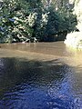
English: Coughton is a small village located between Studley and Alcester in the county of Warwickshire, England. It is located on Icknield Street, a Roman road which now forms the A435. The River Arrow passes close by.
Subcategories
This category has the following 4 subcategories, out of 4 total.
C
- Coughton Cross (5 F)
- Coughton Ford (12 F)
Media in category "Coughton, Warwickshire"
The following 90 files are in this category, out of 90 total.
-
 A safer crossing - geograph.org.uk - 5807496.jpg 1,024 × 768; 182 KB
-
 A435 Haydon Way - geograph.org.uk - 4277451.jpg 640 × 440; 39 KB
-
 Alcester Heath (B4090) - geograph.org.uk - 5348085.jpg 640 × 480; 80 KB
-
 Alcester Heath - geograph.org.uk - 51911.jpg 640 × 480; 69 KB
-
 Along the riverside towards Alcester - geograph.org.uk - 2876719.jpg 640 × 480; 84 KB
-
 Arable land at Alne End - geograph.org.uk - 1876777.jpg 640 × 426; 116 KB
-

-
 Below the old railway bridge near Coughton - geograph.org.uk - 51910.jpg 640 × 480; 134 KB
-
 Bridleway beside Coughton Park - geograph.org.uk - 2468775.jpg 1,024 × 680; 262 KB
-
 Bridleway crosses field of wheat - geograph.org.uk - 2550834.jpg 640 × 480; 71 KB
-
 Cain Brook below Pool House - geograph.org.uk - 2550820.jpg 640 × 480; 135 KB
-
 Canada Barn farm - geograph.org.uk - 59960.jpg 640 × 480; 89 KB
-

-
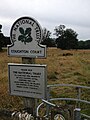
 Coughton Court - geograph.org.uk - 6276930.jpg 1,024 × 768; 140 KB
-
 Coughton Court NT near Alcester - view W from roof - geograph.org.uk - 6009499.jpg 5,184 × 2,920; 4.85 MB
-
 Coughton Court Park - geograph.org.uk - 3815871.jpg 800 × 600; 322 KB
-
 Coughton Field Farm - geograph.org.uk - 6275162.jpg 1,024 × 683; 264 KB
-
 Coughton Fields - geograph.org.uk - 132586.jpg 640 × 480; 61 KB
-
 Coughton Fields - geograph.org.uk - 1876767.jpg 640 × 426; 118 KB
-
 Coughton Fields from the footpath - geograph.org.uk - 2873682.jpg 640 × 480; 100 KB
-
 Coughton Fields Lane - geograph.org.uk - 3815886.jpg 800 × 600; 323 KB
-
 Coughton Nursery - geograph.org.uk - 4657749.jpg 640 × 480; 83 KB
-
 Coughton station geograph-3086655-by-Ben-Brooksbank.jpg 897 × 518; 444 KB
-
 Coughton view - geograph.org.uk - 4657746.jpg 480 × 640; 87 KB
-
 Duck pond - geograph.org.uk - 445602.jpg 640 × 512; 95 KB
-

-
 Farm buildings on Coughton Lane - geograph.org.uk - 2468778.jpg 1,024 × 680; 226 KB
-
 Farmland near Alne End - geograph.org.uk - 1875023.jpg 640 × 426; 93 KB
-
 Farmland, Coughton - geograph.org.uk - 163134.jpg 640 × 480; 202 KB
-
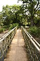
 Footbridge over the River Arrow - geograph.org.uk - 1918279.jpg 640 × 426; 94 KB
-
 Footpath along the River Arrow - geograph.org.uk - 4609020.jpg 480 × 640; 104 KB
-
 Footpath near Coughton - geograph.org.uk - 4657766.jpg 480 × 640; 78 KB
-
 Footpath near Coughton - geograph.org.uk - 4657768.jpg 480 × 640; 99 KB
-
 Footpath near Coughton Court - geograph.org.uk - 4609035.jpg 480 × 640; 76 KB
-
 Footpath near Lower Spernal - geograph.org.uk - 4657774.jpg 480 × 640; 75 KB
-
 Footpath towards Coughton Court - geograph.org.uk - 4609030.jpg 480 × 640; 73 KB
-
 Footpath view near Coughton - geograph.org.uk - 4657743.jpg 480 × 640; 61 KB
-
 Footpath view near Coughton - geograph.org.uk - 4657744.jpg 480 × 640; 75 KB
-
 Footpath view near Sambourne - geograph.org.uk - 4657740.jpg 480 × 640; 90 KB
-
 Footpath view near Sambourne - geograph.org.uk - 4657741.jpg 480 × 640; 86 KB
-
 From Coughton Court Roof towards the Birmingham Road - geograph.org.uk - 6175873.jpg 1,600 × 1,200; 346 KB
-
 Georgian house, Kings Coughton - geograph.org.uk - 3695368.jpg 1,600 × 1,154; 308 KB
-
 Haydon Way Wood - geograph.org.uk - 5660937.jpg 1,024 × 768; 312 KB
-
 Heading towards New End - geograph.org.uk - 4609036.jpg 480 × 640; 71 KB
-
 Heading towards New End - geograph.org.uk - 4609039.jpg 480 × 640; 69 KB
-
 Heading towards New End - geograph.org.uk - 4609040.jpg 640 × 480; 130 KB
-
 Heading towards New End - geograph.org.uk - 4609042.jpg 480 × 640; 70 KB
-
 Heading towards New End - geograph.org.uk - 4609044.jpg 480 × 640; 89 KB
-
 Houses on Haydon Way, Studley - geograph.org.uk - 5813458.jpg 1,998 × 1,468; 1.27 MB
-
 Leaving the woodland - geograph.org.uk - 2550831.jpg 640 × 480; 132 KB
-
 Little bridge on, over a 'ford' - geograph.org.uk - 3198632.jpg 1,600 × 870; 401 KB
-
 Looking northwest from Coughton Court roof (1) - geograph.org.uk - 6176101.jpg 1,600 × 1,200; 468 KB
-
 Looking northwest from Coughton Court roof (2) - geograph.org.uk - 6176106.jpg 1,600 × 1,200; 492 KB
-
 Lower Spernall Farm - geograph.org.uk - 1918276.jpg 640 × 426; 102 KB
-
 Medlar fruit - geograph.org.uk - 5153420.jpg 1,024 × 768; 272 KB
-
 Park by Birmingham Road, Coughton - geograph.org.uk - 5813465.jpg 2,048 × 1,536; 1.64 MB
-
 Parting of the ways - geograph.org.uk - 140304.jpg 640 × 480; 312 KB
-
 Path behind the houses - geograph.org.uk - 2550827.jpg 640 × 480; 137 KB
-
 Prickly - geograph.org.uk - 3816774.jpg 800 × 602; 202 KB
-
 Ready for work - geograph.org.uk - 2876716.jpg 640 × 480; 97 KB
-
 Residual ridge-and-furrow fields - geograph.org.uk - 2873705.jpg 640 × 480; 68 KB
-
 River Arrow at Coughton - geograph.org.uk - 4657763.jpg 480 × 640; 111 KB
-
 River Arrow at Coughton - geograph.org.uk - 4657764.jpg 480 × 640; 121 KB
-
 River Arrow below Lower Spernall Farm - geograph.org.uk - 6274531.jpg 1,024 × 768; 232 KB
-
 River Arrow footbridge - geograph.org.uk - 1362775.jpg 426 × 640; 101 KB
-
 River Arrow, Coughton - geograph.org.uk - 1918272.jpg 640 × 426; 124 KB
-
 Roadworks on Spernal Lane - geograph.org.uk - 5348509.jpg 640 × 480; 125 KB
-
 Roman road layby A435 - geograph.org.uk - 4626470.jpg 1,024 × 768; 134 KB
-
 Ryknild Street in Coughton - geograph.org.uk - 2054466.jpg 640 × 480; 64 KB
-

-

-
 Seat in Haydon Way Wood - geograph.org.uk - 5660950.jpg 1,024 × 768; 304 KB
-
 Speed camera on the A435 - geograph.org.uk - 2471634.jpg 1,024 × 680; 236 KB
-
 The Arden Way - geograph.org.uk - 1914587.jpg 640 × 426; 96 KB
-
 The Arden Way - geograph.org.uk - 1914588.jpg 426 × 640; 115 KB
-
 The Arden Way - geograph.org.uk - 4609017.jpg 480 × 640; 76 KB
-
 The Arden Way - geograph.org.uk - 4657770.jpg 480 × 640; 76 KB
-
 The Arden Way - geograph.org.uk - 4657771.jpg 480 × 640; 84 KB
-
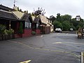 The Throckmorton Arms, Coughton - geograph.org.uk - 51906.jpg 640 × 480; 68 KB
-
 The White House - geograph.org.uk - 445582.jpg 640 × 492; 78 KB
-
 Through Coughton Park - geograph.org.uk - 2550829.jpg 480 × 640; 108 KB
-
 Tracks over crop field - geograph.org.uk - 5348081.jpg 640 × 480; 82 KB
-
 View across fields from Coughton Court carpark - geograph.org.uk - 6168908.jpg 1,600 × 1,200; 369 KB
-
 View to Throckmorton Arms - geograph.org.uk - 2550824.jpg 640 × 480; 76 KB
-
 Waymark post - geograph.org.uk - 2550854.jpg 640 × 480; 84 KB
-

-
 Windmill Hill - geograph.org.uk - 1914585.jpg 3,008 × 2,000; 1.48 MB
-
 Windmill Hill Barn - geograph.org.uk - 1914586.jpg 640 × 426; 95 KB
-
 Windmill Hill, Coughton - geograph.org.uk - 160693.jpg 640 × 480; 238 KB
-
 Woodside Court - geograph.org.uk - 439240.jpg 543 × 640; 81 KB


_-_geograph.org.uk_-_5348085.jpg)


_-_geograph.org.uk_-_6176101.jpg)
_-_geograph.org.uk_-_6176106.jpg)


