Category:Cressage
Aller à la navigation
Aller à la recherche
English: Cressage is a village in Shropshire, England, at . It lies on the junction of the A458 and B4380 and the River Severn flows around its northern boundary. The Royal Mail postcode begins SY5. The parish council is combined with the neighbouring parish of Sheinton, as of the 2001 census, has a population of 884.
village britannique  | |||||
| Téléverser des médias | |||||
| Nature de l’élément | |||||
|---|---|---|---|---|---|
| Lieu | Shropshire, Midlands de l'Ouest, Angleterre | ||||
| Baigné par | |||||
 | |||||
Sous-catégories
Cette catégorie comprend 2 sous-catégories, dont les 2 ci-dessous.
C
- Cressage War Memorial (3 F)
E
- The Eagles, Cressage (6 F)
Média dans la catégorie « Cressage »
Cette catégorie comprend 121 fichiers, dont les 121 ci-dessous.
-
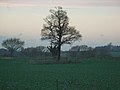 "Lady Oak" - geograph.org.uk - 288259.jpg 640 × 480 ; 84 kio
-
 A footpath on the SW side of Cressage - geograph.org.uk - 2954026.jpg 979 × 734 ; 452 kio
-
 A minor footbridge over the stream - geograph.org.uk - 2954021.jpg 1 142 × 857 ; 302 kio
-
 A narrow footpath in Park Coppice - geograph.org.uk - 2954005.jpg 734 × 979 ; 395 kio
-
 A small barn on the north side of Tudor's Plantation - geograph.org.uk - 2954016.jpg 1 142 × 857 ; 458 kio
-
 A458 in Cressage - geograph.org.uk - 2867238.jpg 640 × 480 ; 63 kio
-
 A458 Layby - geograph.org.uk - 669520.jpg 640 × 424 ; 57 kio
-
 A458 leaving Cressage for Shrewsbury - geograph.org.uk - 2867252.jpg 640 × 480 ; 51 kio
-
 A458 to Shrewsbury - geograph.org.uk - 695659.jpg 640 × 480 ; 68 kio
-
 A458 towards Shrewsbury - geograph.org.uk - 6108835.jpg 800 × 494 ; 80 kio
-
 A458 towards Shrewsbury - geograph.org.uk - 6110079.jpg 800 × 600 ; 173 kio
-
 Across the fields to Upper Dryton - geograph.org.uk - 723393.jpg 640 × 480 ; 72 kio
-
 Along Wood Lane towards Tudor's Plantation - geograph.org.uk - 2954009.jpg 1 142 × 857 ; 483 kio
-
 An Arriva Midlands bus at Cressage, Shropshire.jpg 3 081 × 2 125 ; 3,56 Mio
-
 Barns and paraphernalia at New Buildings Farm - geograph.org.uk - 2949585.jpg 1 142 × 857 ; 303 kio
-
 Bend in the A458 towards Shrewsbury - geograph.org.uk - 6110074.jpg 800 × 600 ; 131 kio
-
 Bridge over the Severn - Cressage - geograph.org.uk - 2414976.jpg 640 × 480 ; 80 kio
-
 Bridge View to Wrekin - geograph.org.uk - 4514196.jpg 800 × 600 ; 65 kio
-
 Bridleway from Belswardyne to Harley - geograph.org.uk - 2949601.jpg 1 142 × 857 ; 308 kio
-
 Christ Church, Cressage - geograph.org.uk - 6033727.jpg 1 800 × 2 517 ; 930 kio
-
 Christ Church, Cressage - geograph.org.uk - 6108842.jpg 800 × 527 ; 104 kio
-
 Christchurch, Cressage - geograph.org.uk - 6330952.jpg 4 000 × 3 000 ; 2,74 Mio
-
 Close up, Elizabeth II postbox, Cressage - geograph.org.uk - 6110765.jpg 1 778 × 3 283 ; 1,57 Mio
-
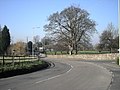
 Cressage - main crossroads and war memorial - geograph.org.uk - 2867246.jpg 640 × 480 ; 74 kio
-
 Cressage Bridge - geograph.org.uk - 3954873.jpg 1 600 × 1 200 ; 443 kio
-
 Cressage Bridge - geograph.org.uk - 5873081.jpg 1 024 × 680 ; 239 kio
-
 Cressage Pill box - geograph.org.uk - 362070.jpg 640 × 428 ; 103 kio
-
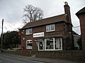 Cressage Post Office. - geograph.org.uk - 716330.jpg 640 × 480 ; 69 kio
-
 Cressage Social Club - geograph.org.uk - 6110061.jpg 800 × 600 ; 92 kio
-
 Cressage Social Club - geograph.org.uk - 6330961.jpg 4 000 × 3 000 ; 2,49 Mio
-
 Cressage station former geograph-3116234-by-Ben-Brooksbank.jpg 2 280 × 1 449 ; 3,36 Mio
-
 Cressage Village Hall - geograph.org.uk - 6110766.jpg 5 033 × 3 118 ; 4,3 Mio
-
 Cressage war memorial - geograph.org.uk - 5873141.jpg 680 × 1 024 ; 266 kio
-
 Crop field and hedgerow - geograph.org.uk - 6110078.jpg 800 × 600 ; 128 kio
-
 Crop field, Cressage - geograph.org.uk - 6110073.jpg 800 × 600 ; 147 kio
-
 Dead straight west of Cressage - geograph.org.uk - 2867256.jpg 640 × 480 ; 41 kio
-
 Dry moat at Moat Plantation - geograph.org.uk - 2390984.jpg 819 × 614 ; 346 kio
-
 Entering Cressage from the south - geograph.org.uk - 2867235.jpg 640 × 480 ; 62 kio
-
 Entrance to Park Farm - geograph.org.uk - 6108832.jpg 800 × 600 ; 145 kio
-
 Farm buildings at Belswardyne Hall - geograph.org.uk - 2390977.jpg 1 024 × 768 ; 313 kio
-

-
 Farm track south of the old railway - geograph.org.uk - 4313134.jpg 1 142 × 857 ; 377 kio
-
 Farmland east of Belswardyne Farm - geograph.org.uk - 2391996.jpg 1 152 × 864 ; 276 kio
-

-
 Footpath at the corner of Moat Plantation - geograph.org.uk - 2392170.jpg 1 024 × 768 ; 323 kio
-
 Footpath through Rabbit Warren Plantation - geograph.org.uk - 2392154.jpg 634 × 845 ; 320 kio
-
 Frost-dusted crops at Cressage - geograph.org.uk - 4303685.jpg 1 142 × 857 ; 422 kio
-
 Frosty morning at Cressage House Farm - geograph.org.uk - 4303613.jpg 1 142 × 857 ; 350 kio
-
 Grazing near Park Farm - geograph.org.uk - 6108830.jpg 800 × 600 ; 139 kio
-
 Half-timbered house at Cressage - geograph.org.uk - 695660.jpg 640 × 480 ; 96 kio
-
 Hawthorn Tunnel - geograph.org.uk - 47614.jpg 640 × 480 ; 169 kio
-
 Heading west from Cressage - geograph.org.uk - 2867250.jpg 640 × 480 ; 64 kio
-
 Hedgerow and crop field, Cressage - geograph.org.uk - 6110070.jpg 800 × 499 ; 101 kio
-
 Houses on Sheinton Road, Cressage - geograph.org.uk - 6110067.jpg 800 × 548 ; 111 kio
-
 Into the valley of the Sheinton Brook - geograph.org.uk - 2390992.jpg 947 × 710 ; 308 kio
-
 It's a steep hill to Belswardyne Hall. - geograph.org.uk - 716404.jpg 640 × 480 ; 69 kio
-
 KX100 telephone box, Cressage - geograph.org.uk - 6110062.jpg 800 × 600 ; 150 kio
-
 Lay-by on A458 south of Cressage - geograph.org.uk - 5998376.jpg 1 600 × 1 065 ; 873 kio
-
 Lay-by on the A458 - geograph.org.uk - 6330965.jpg 4 000 × 3 000 ; 2,29 Mio
-
 Lay-bys on the A458 - geograph.org.uk - 6090289.jpg 4 000 × 3 000 ; 2,73 Mio
-
 Looking south from a lay-by on the A458 - geograph.org.uk - 6090273.jpg 4 000 × 3 000 ; 2,27 Mio
-
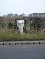 Milepost, Cressage.jpg 857 × 1 142 ; 446 kio
-
 Nearing Cressage. - geograph.org.uk - 711859.jpg 640 × 480 ; 104 kio
-
 New Buildings Farm - geograph.org.uk - 2949590.jpg 1 142 × 857 ; 272 kio
-

-
 New houses on Harley Road, Cressage - geograph.org.uk - 6108840.jpg 800 × 532 ; 105 kio
-
 Northbound layby on the A458 - geograph.org.uk - 2867226.jpg 640 × 480 ; 44 kio
-
 Old farm buildings near Moat Plantation - geograph.org.uk - 2392163.jpg 896 × 672 ; 309 kio
-

-
 OS benchmark - Cressage House Farm - geograph.org.uk - 4303623.jpg 857 × 1 142 ; 645 kio
-
 OS benchmark - Cressage Social Club - geograph.org.uk - 4280850.jpg 734 × 979 ; 429 kio
-
 OS benchmark - Cressage, 37 Harley Road - geograph.org.uk - 4281887.jpg 734 × 979 ; 355 kio
-
 OS benchmark - Cressage, the Old Bakery - geograph.org.uk - 4313147.jpg 857 × 1 142 ; 473 kio
-
 Passing Cressage House. - geograph.org.uk - 711854.jpg 640 × 480 ; 45 kio
-
 Pillbox at Cressage - geograph.org.uk - 5873119.jpg 1 024 × 680 ; 240 kio
-
 Pillbox surrounded by water - geograph.org.uk - 502892.jpg 630 × 432 ; 45 kio
-
 Rural scene - geograph.org.uk - 1934508.jpg 800 × 535 ; 150 kio
-
 Shrewsbury 8 Miles - geograph.org.uk - 6110072.jpg 800 × 600 ; 111 kio
-
 Shrewsbury Road (A458) - geograph.org.uk - 1934489.jpg 800 × 541 ; 149 kio
-
 Signpost by Park Coppice - geograph.org.uk - 740282.jpg 640 × 480 ; 123 kio
-
 Southbound layby on the A458 - geograph.org.uk - 2867230.jpg 640 × 480 ; 37 kio
-
 Stone House Farm - geograph.org.uk - 2952988.jpg 1 142 × 857 ; 244 kio
-
 The Eagles public house, Cressage - geograph.org.uk - 6110144.jpg 800 × 516 ; 81 kio
-
 The lane from Stone House Farm towards Broomcroft - geograph.org.uk - 2952980.jpg 1 142 × 857 ; 410 kio
-
 The Old Post Office, Cressage - geograph.org.uk - 6330959.jpg 4 000 × 3 000 ; 2,71 Mio
-
 The River Severn viewed from Cressage Bridge - geograph.org.uk - 5873106.jpg 1 024 × 680 ; 162 kio
-
 The Sheinton Brook - geograph.org.uk - 2390993.jpg 845 × 634 ; 333 kio
-
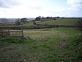
 The southern side of Cressage - geograph.org.uk - 2949578.jpg 1 142 × 857 ; 255 kio
-
 The Wrekin from the south-west - geograph.org.uk - 6090286.jpg 4 000 × 3 000 ; 2,49 Mio
-
 Traffic jam, Cressage - geograph.org.uk - 3722382.jpg 1 600 × 1 024 ; 377 kio
-
 Trees, fields and sheep - geograph.org.uk - 740850.jpg 640 × 480 ; 106 kio
-
 Twisting lane - geograph.org.uk - 740851.jpg 640 × 480 ; 70 kio
-
 War Memorial, Cressage - geograph.org.uk - 6110058.jpg 800 × 600 ; 177 kio
-
 Wheat and Oilseed rape in fields near Belswardyne Hall - geograph.org.uk - 2952970.jpg 1 142 × 857 ; 330 kio
-
 Winter crop at Park Cottage Farm - geograph.org.uk - 6090291.jpg 4 000 × 3 000 ; 2,87 Mio
-
 Wood Lane - geograph.org.uk - 6108839.jpg 800 × 600 ; 197 kio
-
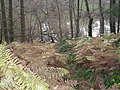
 Woodland beside stream near Cressage - geograph.org.uk - 6108838.jpg 800 × 600 ; 202 kio
-
 B4380 to Cressage. - geograph.org.uk - 711864.jpg 640 × 480 ; 81 kio
-
 Bridge at Cressage - geograph.org.uk - 47612.jpg 640 × 480 ; 142 kio
-
 Corner Lane and Grass Bank - geograph.org.uk - 352947.jpg 640 × 480 ; 114 kio
-
 Cottage at the junction with the A458. - geograph.org.uk - 711863.jpg 640 × 480 ; 78 kio
-
 Cressage Graveyard - geograph.org.uk - 352742.jpg 640 × 480 ; 119 kio
-
 Entering Cressage. - geograph.org.uk - 716326.jpg 640 × 480 ; 86 kio
-
 Farm buildings at Lower Dryton - geograph.org.uk - 723394.jpg 640 × 480 ; 74 kio
-
 Fields and trees - geograph.org.uk - 288087.jpg 640 × 480 ; 131 kio
-
 Flooding at Cressage - geograph.org.uk - 502426.jpg 640 × 427 ; 53 kio
-
 Flooding at Cressage 2 - geograph.org.uk - 503870.jpg 640 × 427 ; 40 kio
-
 Footpath to the Farm - geograph.org.uk - 352952.jpg 640 × 480 ; 93 kio
-
 Gate to the Park - geograph.org.uk - 352950.jpg 640 × 480 ; 119 kio
-

-
 Lane past Cressage House. - geograph.org.uk - 711852.jpg 640 × 480 ; 36 kio
-
 Lane through woodland - geograph.org.uk - 288235.jpg 640 × 480 ; 151 kio
-
 Leasowes - geograph.org.uk - 345892.jpg 640 × 480 ; 91 kio
-
 Old Railway Older Volcano - geograph.org.uk - 352945.jpg 640 × 480 ; 105 kio
-
 Path to Ranslett - geograph.org.uk - 345894.jpg 640 × 480 ; 106 kio
-
 Pond in Rabbit Warren Plantation - geograph.org.uk - 628149.jpg 640 × 480 ; 118 kio
-
 River Severn at Cressage - geograph.org.uk - 588887.jpg 640 × 373 ; 45 kio
-

-
 Teasels and The Wrekin from Cressage bridge - geograph.org.uk - 54533.jpg 640 × 480 ; 128 kio
-
 Track to Trees - geograph.org.uk - 322298.jpg 640 × 480 ; 98 kio
-
 Wood Lane - geograph.org.uk - 288241.jpg 640 × 480 ; 103 kio


_-_geograph.org.uk_-_1934489.jpg)


