Category:Creswell, Derbyshire
Jump to navigation
Jump to search
English: Creswell is a village located in Bolsover, near Worksop, Derbyshire, England, United Kingdom.
village in Derbyshire, UK | |||||
| Upload media | |||||
| Instance of | |||||
|---|---|---|---|---|---|
| Location | Elmton with Creswell, Bolsover, Derbyshire, East Midlands, England | ||||
 | |||||
Subcategories
This category has the following 6 subcategories, out of 6 total.
C
- Creswell Colliery (8 F)
- Creswell railway station (9 F)
E
- Elmton & Creswell junction (6 F)
M
W
- Wellbeck Colliery Junction (4 F)
Media in category "Creswell, Derbyshire"
The following 85 files are in this category, out of 85 total.
-
 56124 Creswell.jpg 2,048 × 1,319; 331 KB
-
 58040 Creswell.jpg 1,798 × 1,180; 851 KB
-
 A village street in Creswell - geograph.org.uk - 2659694.jpg 1,024 × 677; 349 KB
-
 A616 leaving Cresswell - geograph.org.uk - 3454955.jpg 2,936 × 1,648; 1.8 MB
-
 B6042 towards Creswell - geograph.org.uk - 4300213.jpg 640 × 480; 64 KB
-
 Bank House Farm, Creswell - geograph.org.uk - 4312938.jpg 4,939 × 3,561; 4.52 MB
-
 Bingo Hall and Convenience Store in Creswell - geograph.org.uk - 4102088.jpg 3,866 × 2,864; 2.38 MB
-
 Commemorative Bench - geograph.org.uk - 999296.jpg 640 × 426; 76 KB
-
 Cresswell & Welbeck station site geograph-3116277-by-Ben-Brooksbank.jpg 2,395 × 1,350; 2.56 MB
-
 Cresswell Schools, Creswell, Derbyshire - drawing - Brewill and Baily architects.png 1,958 × 1,196; 2.77 MB
-
 Creswell - Approach from Wood Lane - geograph.org.uk - 993674.jpg 640 × 480; 51 KB
-

-

-

-
 Creswell - Crags Industrial Park - geograph.org.uk - 996339.jpg 640 × 480; 66 KB
-
 Creswell - footpath to Frithwood Lane - geograph.org.uk - 2050175.jpg 1,200 × 1,600; 633 KB
-
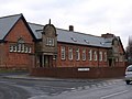
 Creswell - former infants school - geograph.org.uk - 2244159.jpg 1,600 × 1,169; 516 KB
-
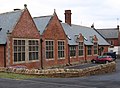
 Creswell - former secondary school - geograph.org.uk - 2244148.jpg 1,600 × 1,200; 339 KB
-
 Creswell - Leisure Centre.jpg 2,272 × 1,704; 761 KB
-

-
 Creswell - Station Hotel - geograph.org.uk - 1092941.jpg 640 × 480; 76 KB
-

-

-
 Creswell 113072 b019cb56.jpg 640 × 425; 61 KB
-
 Creswell Colliery (5522240023).jpg 2,830 × 1,791; 1.04 MB
-
 Creswell Colliery (5522830444).jpg 1,959 × 1,975; 1.05 MB
-
 Creswell Crags - geograph.org.uk - 2749504.jpg 640 × 427; 110 KB
-
 Creswell Crags and Crag Lake - geograph.org.uk - 1175949.jpg 640 × 480; 88 KB
-
 Creswell Leisure Centre - geograph.org.uk - 2659216.jpg 1,024 × 650; 332 KB
-
 Creswell Model Village - geograph.org.uk - 999260.jpg 640 × 426; 77 KB
-
 Creswell Model Village - geograph.org.uk - 999313.jpg 640 × 426; 80 KB
-
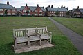 Creswell Model Village, The Green - geograph.org.uk - 999274.jpg 640 × 426; 88 KB
-
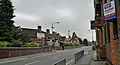
 Duchess Street, Creswell - geograph.org.uk - 2659385.jpg 1,024 × 647; 266 KB
-
 Elmton Road, Creswell - geograph.org.uk - 2659208.jpg 1,024 × 768; 366 KB
-
 Elmton Road, Creswell - geograph.org.uk - 2659706.jpg 1,024 × 713; 300 KB
-
 Elmton Road, Creswell - geograph.org.uk - 2659722.jpg 1,024 × 732; 278 KB
-
 Elmton Road, Creswell - geograph.org.uk - 4034845.jpg 800 × 492; 94 KB
-
 Farmland Adjoining Creswell Crags - geograph.org.uk - 4479896.jpg 4,000 × 3,000; 2.9 MB
-
 Flat farmland west of Creswell - geograph.org.uk - 4304119.jpg 640 × 480; 65 KB
-
 Frithwood Lane near Creswell - geograph.org.uk - 4102062.jpg 4,000 × 3,000; 2.64 MB
-
 Holbeck Street in Creswell - geograph.org.uk - 4102080.jpg 3,725 × 2,783; 2.87 MB
-
 Houses in Creswell - geograph.org.uk - 2659683.jpg 1,024 × 615; 318 KB
-
 Houses on Mansfield Road, Creswell - geograph.org.uk - 4300215.jpg 640 × 480; 70 KB
-
 Industrial area south of Creswell - geograph.org.uk - 2659616.jpg 1,024 × 700; 297 KB
-
 Industrial buildings by the railway at Creswell - geograph.org.uk - 2659401.jpg 1,024 × 664; 330 KB
-
 Leaving Creswell Crags - geograph.org.uk - 4313216.jpg 4,794 × 3,608; 4.2 MB
-
 Line of Disused Railway near Creswell - geograph.org.uk - 4102070.jpg 4,000 × 3,000; 3.25 MB
-
 Line of the disused railway towards Creswell - geograph.org.uk - 3584500.jpg 1,600 × 1,200; 545 KB
-
 Monro's, Creswell - geograph.org.uk - 113077.jpg 640 × 425; 94 KB
-
 Morven Street - geograph.org.uk - 2749761.jpg 640 × 427; 124 KB
-
 Morven Street, Creswell - geograph.org.uk - 2659394.jpg 1,024 × 757; 349 KB
-

-
 Norwood Level Crossing - geograph.org.uk - 126192.jpg 640 × 480; 95 KB
-
 Part of Landmarks at Upper Mill Farm, Creswell - geograph.org.uk - 3547831.jpg 4,000 × 2,248; 4.62 MB
-
 Railway bridge crossing river - geograph.org.uk - 1537497.jpg 640 × 480; 106 KB
-

-
 Remains of Creswell Colliery - geograph.org.uk - 999308.jpg 640 × 426; 82 KB
-
 Restaurant in Creswell - geograph.org.uk - 2659241.jpg 1,024 × 738; 347 KB
-
 Skinner Street, Creswell - geograph.org.uk - 3547841.jpg 4,000 × 2,248; 4.16 MB
-
 Station Hotel and Creswell Junior School - geograph.org.uk - 3547849.jpg 3,950 × 2,156; 4.48 MB
-
 The Station Hotel - geograph.org.uk - 2749748.jpg 640 × 427; 79 KB
-
 The Station Hotel - geograph.org.uk - 3551732.jpg 800 × 533; 88 KB
-
 The Station Hotel, closed, Creswell - geograph.org.uk - 2659728.jpg 1,024 × 707; 370 KB
-
 Towards Lower Mill Farm near Creswell - geograph.org.uk - 1540347.jpg 640 × 480; 148 KB
-
 View to Creswell - geograph.org.uk - 2749993.jpg 640 × 427; 93 KB
-
 Viva La Mamma, Creswell - geograph.org.uk - 3547862.jpg 4,000 × 1,703; 3.64 MB
-
 Viva la ^ on the corner - geograph.org.uk - 1433860.jpg 640 × 427; 77 KB
-
 War memorial, Creswell - geograph.org.uk - 2659715.jpg 805 × 1,024; 470 KB
-
 Welcome to Creswell - geograph.org.uk - 2659679.jpg 1,024 × 807; 346 KB
-
 Western entrance to Creswell Crags - geograph.org.uk - 4313221.jpg 5,184 × 3,888; 6.56 MB
-
 Whaley village - geograph.org.uk - 26853.jpg 640 × 481; 88 KB
-
 Approaching Creswell Crags - geograph.org.uk - 632956.jpg 640 × 480; 70 KB
-

-
 Approaching Whaley - geograph.org.uk - 645141.jpg 640 × 480; 61 KB
-
 Cottage on road to Creswell Crags - geograph.org.uk - 632966.jpg 640 × 480; 63 KB
-
 Cresswell Crags - geograph.org.uk - 559717.jpg 640 × 480; 100 KB
-
 Elmton Road Creswell - geograph.org.uk - 1433852.jpg 640 × 427; 81 KB
-

-
 Miners Welfare - geograph.org.uk - 117671.jpg 640 × 427; 85 KB
-
-
 Poulter Country Park - Viewpoint - geograph.org.uk - 487892.jpg 640 × 480; 102 KB
-
 Railway House Creswell - geograph.org.uk - 117660.jpg 640 × 481; 87 KB
-

-
 The northern edge of Poulter Country Park - geograph.org.uk - 240815.jpg 600 × 450; 260 KB
-
 Whaley Common - geograph.org.uk - 115286.jpg 640 × 427; 64 KB


_-_geograph.org.uk_-_1382728.jpg)

.jpg)
.jpg)


