Category:Crocodile Bridge
Jump to navigation
Jump to search
| Object location | | View all coordinates using: OpenStreetMap |
|---|
rest camp of the Kruger Park .jpg) | |||||
| Upload media | |||||
| Instance of | |||||
|---|---|---|---|---|---|
| Located in protected area | |||||
| Location | Ehlanzeni District Municipality, Mpumalanga, Transvaal region | ||||
 | |||||
Afrikaans: Ruskamp van die Krugerwildtuin, op die Gomondwanepad en op die oewer van die Krokodilrivier
English: Rest camp of the Kruger National Park, on the Gomondwane road and on the bank of the Crocodile River
Subcategories
This category has the following 2 subcategories, out of 2 total.
G
- Gezantfombi Dam (2 F)
Media in category "Crocodile Bridge"
The following 4 files are in this category, out of 4 total.
-
 Crocodile Bridge camp gate (393887670).jpg 2,822 × 1,881; 941 KB
-
 Happy as a pig in mud (393888385).jpg 3,264 × 2,448; 1.67 MB
-
 Little pigs (393887903).jpg 3,264 × 2,448; 1.54 MB
-
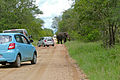 Roadblock (15891050413).jpg 5,472 × 3,648; 15.92 MB
.jpg)
.jpg)
.jpg)