Category:Crowmarsh Gifford
Jump to navigation
Jump to search
village in United Kingdom  | |||||
| Upload media | |||||
| Instance of | |||||
|---|---|---|---|---|---|
| Location | Crowmarsh, South Oxfordshire, Oxfordshire, South East England, England | ||||
| Located in or next to body of water | |||||
| official website | |||||
 | |||||
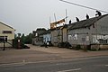
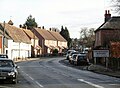
English: Crowmarsh Gifford is a village in the civil parish of Crowmarsh in South Oxfordshire. It is beside the River Thames opposite the market town of Wallingford, the two being linked via Wallingford Bridge. Crowmarsh parish also includes the hamlet of Newnham Murren, which is now merged with the village; the hamlet of Mongewell, and the village of North Stoke to the south.
Nederlands: Crowmarsh Gifford is een plaats in het bestuurlijke gebied South Oxfordshire, in het Engelse graafschap Oxfordshire. Het wordt door de Thames gescheiden van Wallingford in het westen.
Română: Crowmarsh Gifford este un sat în comitatul Oxfordshire, regiunea South East, Anglia. Oraşul se află în districtul South Oxfordshire a cărui reşedinţă este.
Subcategories
This category has the following 4 subcategories, out of 4 total.
C
H
Q
Media in category "Crowmarsh Gifford"
The following 107 files are in this category, out of 107 total.
-
 A look inside - geograph.org.uk - 1340104.jpg 640 × 480; 61 KB
-
 Back to Crowmarsh - geograph.org.uk - 830770.jpg 640 × 426; 62 KB
-
 Beech hedge past the Ministry - geograph.org.uk - 830164.jpg 640 × 426; 66 KB
-
 Bench mark by the gate - geograph.org.uk - 1729721.jpg 1,024 × 768; 318 KB
-
 Benchmark on 42 Park View, Crowmarsh Gifford - geograph.org.uk - 1867087.jpg 768 × 1,024; 198 KB
-
 Bend before the entrance - geograph.org.uk - 830672.jpg 640 × 426; 66 KB
-
 Blocked off gate - geograph.org.uk - 831251.jpg 640 × 426; 87 KB
-
 Bridge Villas - geograph.org.uk - 828785.jpg 640 × 426; 82 KB
-
 Bus stop, The Street, Crowmarsh Gifford - geograph.org.uk - 3773502.jpg 640 × 480; 113 KB
-
 Centre for Ecology and Hydrology - geograph.org.uk - 830156.jpg 640 × 426; 74 KB
-
 Cladding going on - geograph.org.uk - 1182578.jpg 400 × 600; 102 KB
-
 Cottages, Crowmarsh Gifford - geograph.org.uk - 72604.jpg 640 × 480; 89 KB
-

-
 Council Office Entrance - geograph.org.uk - 830064.jpg 640 × 426; 53 KB
-
 Council Offices - geograph.org.uk - 830068.jpg 640 × 426; 53 KB
-
 Cox's Lane - geograph.org.uk - 828633.jpg 640 × 426; 47 KB
-
 Cox's Lane, Crowmarsh Gifford - geograph.org.uk - 3773532.jpg 640 × 480; 80 KB
-
 Cromarsh sports field - geograph.org.uk - 831178.jpg 640 × 426; 29 KB
-
 Crossroads on Crowmarsh Hill east of Crowmarsh Gifford - geograph.org.uk - 5066961.jpg 2,032 × 1,514; 760 KB
-
 Across the field to Crowmarsh - geograph.org.uk - 1155439.jpg 640 × 426; 31 KB
-
 Frosty fence, Crowmarsh - geograph.org.uk - 1081796.jpg 480 × 640; 166 KB
-
 No Mooring - geograph.org.uk - 938139.jpg 640 × 426; 91 KB
-
 Blocked off door - geograph.org.uk - 1117258.jpg 640 × 426; 112 KB
-
 Crawl way by the door - geograph.org.uk - 1117299.jpg 426 × 640; 70 KB
-
 Rowing to the gates - geograph.org.uk - 1343694.jpg 640 × 426; 87 KB
-
 Crowmarsh Gifford - geograph.org.uk - 828777.jpg 640 × 426; 49 KB
-
 Crowmarsh Gifford from Port Way - geograph.org.uk - 3672596.jpg 640 × 500; 46 KB
-
-
 Crowmarsh Gifford, Benson Lane - geograph.org.uk - 6132203.jpg 1,024 × 767; 170 KB
-
 Crowmarsh Gifford, entrance to Jethro Tull Gardens - geograph.org.uk - 5585077.jpg 1,600 × 1,064; 476 KB
-
 Crowmarsh Hill east of Crowmarsh Gifford - geograph.org.uk - 5066959.jpg 2,048 × 1,536; 1.49 MB
-
 Crowmarsh Hill east of Crowmarsh Gifford - geograph.org.uk - 5066960.jpg 2,048 × 1,536; 1.49 MB
-
 Crowmarsh Hill east of Crowmarsh Gifford - geograph.org.uk - 5066962.jpg 2,048 × 1,536; 1.51 MB
-
 Crowmarsh Hill east of Crowmarsh Gifford - geograph.org.uk - 5067475.jpg 2,048 × 1,536; 1.5 MB
-
 Crowmarsh Hill, Crowmarsh Gifford - geograph.org.uk - 5066958.jpg 2,014 × 1,490; 854 KB
-
 Crowmarsh Recreation Hall - geograph.org.uk - 828737.jpg 640 × 426; 47 KB
-
 Crowmarsh roundabout from Meadow Lane - geograph.org.uk - 828651.jpg 640 × 426; 49 KB
-
 Crowmarsh school - geograph.org.uk - 1155506.jpg 640 × 426; 84 KB
-
 Crowmarsh sports ground - geograph.org.uk - 828745.jpg 640 × 426; 30 KB
-

-
 Crowmarsh tyres - geograph.org.uk - 828772.jpg 640 × 426; 47 KB
-
 Dangerous bends - geograph.org.uk - 830059.jpg 640 × 426; 60 KB
-
 Display by the river - geograph.org.uk - 1706788.jpg 1,024 × 768; 138 KB
-
 Ditch by the road - geograph.org.uk - 830797.jpg 426 × 640; 99 KB
-
 Duck on the roof - geograph.org.uk - 1058988.jpg 640 × 426; 63 KB
-
 End in Sight - geograph.org.uk - 830682.jpg 640 × 426; 68 KB
-
 Entering Crowmarsh Gifford - geograph.org.uk - 3773487.jpg 640 × 472; 61 KB
-
 Entering Crowmarsh Gifford on A4130, 1962 - geograph.org.uk - 4740204.jpg 2,441 × 1,208; 3.68 MB
-
 Eye Opener - geograph.org.uk - 830781.jpg 640 × 426; 81 KB
-
 Fenced off area - geograph.org.uk - 2353244.jpg 1,024 × 683; 226 KB
-
 Foundry was here - geograph.org.uk - 829915.jpg 640 × 426; 51 KB
-
 Frozen ditch - geograph.org.uk - 1117230.jpg 426 × 640; 113 KB
-
 Gates round the back - geograph.org.uk - 1343674.jpg 640 × 426; 93 KB
-
 Home Farm - geograph.org.uk - 831271.jpg 640 × 426; 65 KB
-
 Howbury Farm - geograph.org.uk - 830046.jpg 640 × 426; 54 KB
-
 Jethro Tull blue plaque at Crowmarsh Gifford, Oxfordshire.jpg 640 × 426; 47 KB
-
 Jewson Yard - geograph.org.uk - 831189.jpg 640 × 426; 40 KB
-
 Lane towards Crowmarsh Gifford - geograph.org.uk - 5513472.jpg 640 × 480; 111 KB
-
 Meadow Lane - geograph.org.uk - 828656.jpg 640 × 426; 74 KB
-
 Meadow Lane, Crowmarsh Gifford - geograph.org.uk - 3773515.jpg 640 × 479; 72 KB
-
 Mirror over the hedge - geograph.org.uk - 1182564.jpg 640 × 426; 101 KB
-
 My Gaf - geograph.org.uk - 831184.jpg 640 × 426; 95 KB
-
 Nearly done - geograph.org.uk - 1341882.jpg 640 × 426; 47 KB
-
 New building - geograph.org.uk - 830785.jpg 640 × 426; 73 KB
-
 New Gate - geograph.org.uk - 830679.jpg 640 × 426; 67 KB
-
 Newnam Manor Caravan site - geograph.org.uk - 831221.jpg 640 × 426; 87 KB
-
 Old Reading Road - geograph.org.uk - 831211.jpg 640 × 426; 58 KB
-
 Pilings in the trench - geograph.org.uk - 1182062.jpg 640 × 426; 88 KB
-
 Pillbox by the ditch - geograph.org.uk - 1117249.jpg 640 × 426; 119 KB
-
 Pillbox by the pool - geograph.org.uk - 938128.jpg 640 × 426; 102 KB
-
 Pillbox door - geograph.org.uk - 1117270.jpg 426 × 640; 96 KB
-
 Plaque on the memorial - geograph.org.uk - 1116474.jpg 426 × 640; 58 KB
-
 Private Road - geograph.org.uk - 829877.jpg 640 × 426; 48 KB
-
 Pub with no beer - geograph.org.uk - 830020.jpg 640 × 426; 50 KB
-
 Red Kite house - geograph.org.uk - 1341874.jpg 640 × 426; 49 KB
-
 Red kite in the mirror - geograph.org.uk - 1182556.jpg 640 × 426; 88 KB
-
 Restricted Byway - geograph.org.uk - 830169.jpg 640 × 426; 93 KB
-
 Riverside Meadows - geograph.org.uk - 1706784.jpg 1,024 × 768; 177 KB
-
 Road works on the culvert - geograph.org.uk - 1182056.jpg 640 × 426; 78 KB
-
 Seat by the box - geograph.org.uk - 938133.jpg 640 × 426; 99 KB
-
 Shower by the entrance - geograph.org.uk - 1059039.jpg 640 × 426; 50 KB
-
 South Oxfordshire District Council - geograph.org.uk - 1060630.jpg 640 × 426; 34 KB
-
 Thames Mead - geograph.org.uk - 829958.jpg 640 × 426; 47 KB
-
 Thames Valley Rental - geograph.org.uk - 828759.jpg 640 × 426; 73 KB
-
 The Bell - geograph.org.uk - 831197.jpg 640 × 426; 39 KB
-
 The gunslot - geograph.org.uk - 1059015.jpg 640 × 426; 95 KB
-
 The Limes - geograph.org.uk - 829962.jpg 640 × 426; 79 KB
-
 The Oasis cafe - geograph.org.uk - 829999.jpg 640 × 426; 57 KB
-
 The old Oxford road - geograph.org.uk - 830025.jpg 640 × 426; 55 KB
-
 The Street - geograph.org.uk - 831264.jpg 640 × 427; 70 KB
-
 They sell these - geograph.org.uk - 828793.jpg 640 × 426; 59 KB
-
 Up along the river bank - geograph.org.uk - 1059406.jpg 640 × 426; 56 KB
-
 Wallingford Bridge - geograph.org.uk - 1727164.jpg 640 × 466; 136 KB
-
 Wilders - geograph.org.uk - 828786.jpg 640 × 426; 46 KB
-
 Winters Field - geograph.org.uk - 830055.jpg 640 × 426; 48 KB
-
 Coldharbour Farm - geograph.org.uk - 51598.jpg 640 × 481; 44 KB
-
 Crowmarsh Hill - geograph.org.uk - 45872.jpg 640 × 481; 41 KB
-
 Drunken Bottom - geograph.org.uk - 51499.jpg 640 × 481; 54 KB
-
 End of the Runway - geograph.org.uk - 51596.jpg 640 × 481; 43 KB
-
 Farmland - geograph.org.uk - 42764.jpg 640 × 481; 56 KB
-
 Farmland, Crowmarsh - geograph.org.uk - 769771.jpg 640 × 480; 96 KB
-
 Looking south from Portway - geograph.org.uk - 45870.jpg 640 × 481; 48 KB
-
 Pig Trough Bottom - geograph.org.uk - 51496.jpg 640 × 481; 62 KB
-
 Ridgeway Trigpoint - geograph.org.uk - 184417.jpg 640 × 445; 91 KB
-
 The Ridgeway Path - geograph.org.uk - 51502.jpg 640 × 481; 77 KB
-
 The Ridgeway to Nuffield - geograph.org.uk - 51775.jpg 640 × 481; 78 KB
-
 The Road to Coldharbour Farm - geograph.org.uk - 51600.jpg 640 × 481; 50 KB


