Category:Cuddington Heath
Aller à la navigation
Aller à la recherche
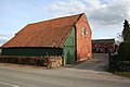
English: Cuddington Heath is a village in the civil parish of Cuddington in the unitary authority of Cheshire West and Chester and the ceremonial county of Cheshire, England. The village is close to the border with Wales (the parish touches the Welsh community of Willington Worthernbury), and the nearest large town is Wrexham in Wales, about ten miles west. Other nearby villages are Threapwood, Malpas, and Chorlton Lane. At the 2001 Census, the parish had a population of 180.
village britannique  | |||||
| Téléverser des médias | |||||
| Nature de l’élément | |||||
|---|---|---|---|---|---|
| Lieu | Cuddington, Malpas, Cheshire West and Chester, Cheshire, Angleterre du Nord-Ouest, Angleterre | ||||
 | |||||
Média dans la catégorie « Cuddington Heath »
Cette catégorie comprend 11 fichiers, dont les 11 ci-dessous.
-
 B5069 (Wrexham Road) at Cuddington Heath - geograph.org.uk - 4392116.jpg 2 500 × 1 875 ; 1,76 Mio
-
 Bishop Bennet Way - geograph.org.uk - 1244364.jpg 640 × 426 ; 74 kio
-
 Bishop Bennet Way, Cuddington Heath - geograph.org.uk - 1244358.jpg 640 × 426 ; 61 kio
-
 Bishop Bennet Way, Cuddington Heath - geograph.org.uk - 1244360.jpg 640 × 426 ; 66 kio
-
 Cuddington (Broxton) - Gable Cottage.jpg 640 × 480 ; 70 kio
-
 Cuddington Heath - geograph.org.uk - 4392184.jpg 2 500 × 1 875 ; 1,9 Mio
-
 Heath Farm, Cuddington Heath - geograph.org.uk - 1244354.jpg 640 × 426 ; 40 kio
-
 Oak Villa and Heath Villa, Cuddington Heath - geograph.org.uk - 4393781.jpg 2 500 × 1 875 ; 1,46 Mio
-
 Straight road to Cuddington Heath - geograph.org.uk - 3928826.jpg 640 × 394 ; 61 kio
-
 Turning for Chorlton at Cuddington Heath - geograph.org.uk - 3928820.jpg 640 × 405 ; 84 kio
-
 Water Tower, Cuddington - geograph.org.uk - 174486.jpg 636 × 640 ; 79 kio
_at_Cuddington_Heath_-_geograph.org.uk_-_4392116.jpg)


_-_Gable_Cottage.jpg)


