Category:Cuillin
Zur Navigation springen
Zur Suche springen
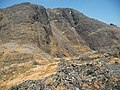
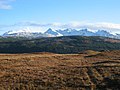
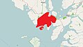
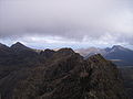
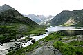
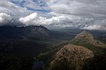
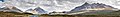
English: The Cuillin is a mountain range on Skye, Scotland.
Gebirgszug   | |||||
| Medium hochladen | |||||
| Ist ein(e) | |||||
|---|---|---|---|---|---|
| Material | |||||
| Ort | Highland, Highlands, Schottland | ||||
| Höchster Punkt | |||||
| Höhe über dem Meeresspiegel |
| ||||
 | |||||
Unterkategorien
Es werden 23 von insgesamt 23 Unterkategorien in dieser Kategorie angezeigt:
In Klammern die Anzahl der enthaltenen Kategorien (K), Seiten (S), Dateien (D)
A
- Am Basteir (31 D)
B
- Beinn a' Bhràghad (6 D)
- Beinn Dearg Mheadhonach (6 D)
- Beinn Dearg Mhòr (13 D)
- Blà Bheinn (80 D)
- Bruach na Frìthe (42 D)
C
- Clach Glas (13 D)
- Coire Lagan (11 D)
G
- Garbh Bheinn, Isle of Skye (14 D)
- Glamaig (58 D)
- Glas Bheinn Mhòr, Isle of Skye (10 D)
M
- Marsco (34 D)
S
- Sgurr a' Ghreadaidh (12 D)
- Sgurr a' Mhadaidh (12 D)
- Sgurr Mhic Choinnich (21 D)
- Sgurr nan Gillean (43 D)
- Sgurr nan Gobhar (4 D)
- Sgurr Thuilm, Isle of Skye (15 D)
- Sgùrr Dubh Mòr (10 D)
- Sgùrr nan Eag (19 D)
Medien in der Kategorie „Cuillin“
Folgende 121 Dateien sind in dieser Kategorie, von 121 insgesamt.
-
 A'Chioch - geograph.org.uk - 432909.jpg 444 × 640; 97 KB
-
 Above Glen Brittle - geograph.org.uk - 103525.jpg 640 × 480; 99 KB
-

-
-
 Bealach na Croiche - geograph.org.uk - 308547.jpg 640 × 480; 74 KB
-

-
 Black Cuillin - Flickr - Graham Grinner Lewis.jpg 3.648 × 2.736; 2,54 MB
-
 Black Cuillin from Sgùrr na Strì.jpg 3.000 × 1.996; 3,72 MB
-
 Black Cuillin Mountains Panorama from Blaven.jpg 2.800 × 723; 353 KB
-
 Camasunary - geograph.org.uk - 215457.jpg 640 × 480; 127 KB
-
 Camasunary bay.JPG 341 × 256; 25 KB
-
 Camasunary on isle of sky arp.jpg 2.858 × 1.900; 4,58 MB
-
 Camusnary Bothy - Flickr - Graham Grinner Lewis.jpg 4.000 × 3.000; 3,39 MB
-
 Chilling hills.png 1.440 × 510; 1,03 MB
-
 Chinn Uachdaraich - geograph.org.uk - 27608.jpg 640 × 374; 47 KB
-
 Clouds obscuring view from a mountain (Unsplash).jpg 3.872 × 2.592; 371 KB
-
 Coire a Bhasteir - geograph.org.uk - 293895.jpg 640 × 480; 81 KB
-

-
 Cuillin April.jpg 2.048 × 3.072; 3,55 MB
-
 Cuillin from Ladhar Bheinn - geograph.org.uk - 145449.jpg 640 × 368; 46 KB
-
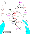
 Cuillin Hills Locator Map.jpg 580 × 327; 40 KB
-
 Cuillin Hills.JPG 1.024 × 768; 66 KB
-
 Cuillin Mist - geograph.org.uk - 47978.jpg 640 × 480; 33 KB
-
 Cuillin Ridge.jpg 1.280 × 960; 353 KB
-
 Cuillin ridgs, Scotland, sketch map.svg 1.028 × 1.138; 515 KB
-
 Cuillin view - geograph.org.uk - 1535044.jpg 640 × 480; 86 KB
-
 Cuillin views - Flickr - Graham Grinner Lewis.jpg 3.648 × 2.736; 2,59 MB
-
 Cuillin-mountains-scotland-backside.jpg 772 × 512; 133 KB
-
 Druim Nan Ramh Cuillin Hills geograph-3215423-by-Ben-Brooksbank.jpg 935 × 525; 426 KB
-
 Dunscaith Castle.png 1.401 × 455; 730 KB
-
 Elgol beach - geograph.org.uk - 391555.jpg 640 × 480; 89 KB
-
 Elgol Jetty - geograph.org.uk - 106990.jpg 640 × 480; 59 KB
-
 Entering Harta Corrie - geograph.org.uk - 950928.jpg 640 × 480; 216 KB
-
 From Coire na Creiche - geograph.org.uk - 1062525.jpg 640 × 427; 63 KB
-

-
 From Glen Brittle - panoramio.jpg 5.616 × 2.848; 4,11 MB
-
 From McQueen's Rock - geograph.org.uk - 930076.jpg 640 × 427; 46 KB
-
 Glen Sligachan in Summer.jpg 3.000 × 1.647; 3,15 MB
-
 Glen Sligachan.jpg 4.310 × 2.868; 1,25 MB
-
 Glenbrittle Bay - geograph.org.uk - 134152.jpg 308 × 464; 30 KB
-
 Glenbrittle,Skye - geograph.org.uk - 238043.jpg 640 × 377; 81 KB
-
 Highland, UK - panoramio (110).jpg 3.968 × 2.648; 2,15 MB
-
 Isle Of Skye A863 The Cuillins - Banner.jpg 3.840 × 549; 388 KB
-
 Isle Of Skye A863 The Cuillins.jpg 9.968 × 4.571; 28,58 MB
-
 JMCS Buttress, Bidean Druim nan Ramh - geograph.org.uk - 14693.jpg 640 × 426; 122 KB
-
 Last resting place, Elgol - geograph.org.uk - 136321.jpg 542 × 395; 39 KB
-
 Letters from England, Loch Coruisk and Cuillin Hills.jpg 951 × 631; 260 KB
-

-
 Loch Coir' a' Ghrunnda - geograph.org.uk - 2519622.jpg 2.000 × 1.314; 456 KB
-
 Loch Coruisk - Flickr - Graham Grinner Lewis.jpg 3.648 × 2.736; 2,54 MB
-
 Loch Coruisk Black Cuillin.JPG 3.648 × 2.432; 4,38 MB
-
 Loch Coruisk, Skye, Scotland, 1963 - Flickr - PhillipC.jpg 1.639 × 1.012; 779 KB
-
 Loch Scavaig, Skye - geograph.org.uk - 136324.jpg 548 × 403; 29 KB
-
 Looking across Loch Scavaig - geograph.org.uk - 182825.jpg 640 × 480; 76 KB
-

-
 Looking over to the Cuillin - Flickr - Graham Grinner Lewis.jpg 3.648 × 2.736; 2,62 MB
-
 Main ridge of the cuillin in skye arp.jpg 3.006 × 2.026; 4,26 MB
-
 Marsco from Bla Bheinn - geograph.org.uk - 1771555.jpg 3.456 × 1.911; 1,78 MB
-
 Mist lifted from the Cuillin from Elgol - geograph.org.uk - 2259418.jpg 1.190 × 786; 384 KB
-
 Moorland east of Loch Beag - geograph.org.uk - 126629.jpg 640 × 480; 43 KB
-
 North Cuillin from Portree.jpg 3.803 × 2.852; 1,56 MB
-
 Ordnance Survey One-Inch Sheet 33 Rhum and part of Skye, Published 1957.jpg 8.263 × 9.746; 6,63 MB
-
 Ordnance Survey One-Inch Sheet 34 The Cuillins, Rhum & Canna, Published 1947.jpg 8.724 × 12.904; 8,71 MB
-
 Ordnance Survey Sheet NG 42 52 Cuillin Hills, Published 1969.jpg 14.808 × 7.065; 46,13 MB
-
 Red Cuillin - Between Ardvasar and Raasay, Isle of Skye, Scotland, UK - May 19, 1989.jpg 2.085 × 3.000; 2,11 MB
-
 Red Cuillin on Skye in Scotland - 2008-05-05.jpg 3.456 × 2.304; 2,56 MB
-
 Ridge above Coir' a' Ghrunnda - geograph.org.uk - 2519608.jpg 2.000 × 1.313; 339 KB
-
 River Sligachan - geograph.org.uk - 1494425.jpg 640 × 486; 192 KB
-
 Rock and water - geograph.org.uk - 829282.jpg 640 × 482; 66 KB
-
 Rubha an Dùnain 2.jpg 900 × 582; 577 KB
-
 Schotland Loch Cill Chriosd 12-05-2010 11-52-00.JPG 2.144 × 1.424; 1,64 MB
-
 Scotland, Isle of Skye, Glamaig seen from Raasay.jpg 4.288 × 2.848; 3,58 MB
-
 Sgurr Dubh Beag via the Dubh Slabs - geograph.org.uk - 1635595.jpg 640 × 480; 50 KB
-
 Sgurr na Bhairnich and the Cuillin Ridge - geograph.org.uk - 904340.jpg 640 × 480; 139 KB
-
 Sgurr na Stri and Camasunary.JPG 3.648 × 2.736; 4,72 MB
-
 Sgùrr Thormaid 457854.jpg 640 × 478; 313 KB
-
 Shores of Loch Ainort - geograph.org.uk - 27610.jpg 640 × 411; 64 KB
-
 Skye Ridge.jpg 8.600 × 812; 3,12 MB
-
 Skye waterfall.jpg 2.048 × 1.536; 880 KB
-
 Skye-Bla Bheinn-paulspace.jpg 1.024 × 768; 175 KB
-
 Skye-Red Cuillins-paulspace.jpg 2.553 × 600; 534 KB
-
 Sligachan - geograph.org.uk - 2779.jpg 528 × 344; 112 KB
-
 Slopes of Bealach Cumhang - geograph.org.uk - 193300.jpg 640 × 480; 65 KB
-
 Soay and Rum - geograph.org.uk - 229065.jpg 640 × 321; 39 KB
-
 South ridge of Ben Tianavaig - geograph.org.uk - 201927.jpg 640 × 480; 35 KB
-
 Summit ridge of Ladhar Bheinn - geograph.org.uk - 1039506.jpg 640 × 415; 44 KB
-
 Sunset Cuilin from Sleat.jpg 560 × 312; 37 KB
-
 Tarskavaig Bay - geograph.org.uk - 39733.jpg 640 × 479; 127 KB
-
 Tarskavaig Bay - geograph.org.uk - 401153.jpg 640 × 480; 82 KB
-
 The Black Cuillin - Banner.jpg 2.655 × 358; 148 KB
-
 The Black Cuillin from Elgol - geograph.org.uk - 261257.jpg 640 × 480; 103 KB
-
 The Black Cuillin from Elgol - geograph.org.uk - 2784.jpg 528 × 348; 154 KB
-
 The Black Cuillin.jpg 3.000 × 1.688; 4,9 MB
-
 The Cioch.jpg 804 × 852; 230 KB
-

-
 The Cuillin - Flickr - Graham Grinner Lewis (1).jpg 4.000 × 3.000; 2,01 MB
-
 The Cuillin - Flickr - Graham Grinner Lewis (2).jpg 4.000 × 3.000; 2,88 MB
-
 The Cuillin - Flickr - Graham Grinner Lewis (3).jpg 3.648 × 2.736; 2,52 MB
-
 The Cuillin - Flickr - Graham Grinner Lewis.jpg 4.000 × 3.000; 2,62 MB
-
 The Cuillin and Loch Coruisk - Flickr - Graham Grinner Lewis.jpg 3.648 × 2.736; 2,51 MB
-
 The Cuillin from Bla Bheinn - geograph.org.uk - 771876.jpg 640 × 313; 33 KB
-
 The Cuillin from Glen Brittle campsite - geograph.org.uk - 12663.jpg 640 × 433; 70 KB
-
 The Cuillin from Tokavaig bay - geograph.org.uk - 6271277.jpg 1.024 × 768; 212 KB
-
 The Cuillin Mountains.JPG 4.752 × 3.168; 6,57 MB
-
 The Cuillin mountains.jpg 3.000 × 1.134; 3,68 MB
-
 The Cuillins on a still morning (9878281443).jpg 4.752 × 3.168; 4,63 MB
-
 The Cuillins on a still morning (9878281443)P-SCO Banner.jpg 4.752 × 681; 920 KB
-
 Tianavaig.jpg 500 × 375; 37 KB
-

-
 Trees, wind farm and Cuillin - geograph.org.uk - 1574064.jpg 640 × 353; 45 KB
-
 Tuath air Sgurr Alasdair.jpg 896 × 576; 524 KB
-
 Valley west of Loch Cill Chriosd - geograph.org.uk - 20536.jpg 640 × 480; 67 KB
-
-
 View north west from Am Màm - geograph.org.uk - 1770970.jpg 800 × 600; 186 KB
-
 View of Black Cuillin.jpg 2.075 × 3.000; 3,49 MB
-

-
 View south from The Storr - geograph.org.uk - 236723.jpg 640 × 480; 47 KB
-
 Warwick Goble - - Goble-98369-2.jpg 2.250 × 1.560; 823 KB
-
 An igneous intrusion - geograph.org.uk - 275133.jpg 640 × 449; 129 KB
-
 Bealach Brittle - geograph.org.uk - 509168.jpg 640 × 480; 275 KB
-
 Skye Ridge - geograph.org.uk - 103534.jpg 640 × 480; 48 KB


.jpg)


.jpg)


_from_Glen_Brittle_-_geograph.org.uk_-_29679.jpg)
.jpg)
.jpg)
.jpg)


.jpg)


P-SCO_Banner.jpg)
Kategorien:
- Mountains and hills of the Isle of Skye
- Volcanoes of Scotland
- Paleogene volcanism of Scotland
- Extinct volcanoes
- Mountain ranges of Scotland
- Sites of Special Scientific Interest in Highland council area
- National Scenic Areas in Scotland
- Granite formations in Scotland
- Gabbro formations in Scotland
- Paleocene magmatic systems of Scotland
- Geology of the Isle of Skye
- North Atlantic Moist Mixed Forests Ecoregion