Category:Darling Range
Zur Navigation springen
Zur Suche springen
English: Darling Range is known also as Darling Scarp in Western Australia
Gebirgszug  | |||||
| Medium hochladen | |||||
| Ist ein(e) | |||||
|---|---|---|---|---|---|
| Benannt nach | |||||
| Ort | Westaustralien, Australien | ||||
| Höchster Punkt |
| ||||
| Höhe über dem Meeresspiegel |
| ||||
 | |||||
Unterkategorien
Es werden 34 von insgesamt 34 Unterkategorien in dieser Kategorie angezeigt:
In Klammern die Anzahl der enthaltenen Kategorien (K), Seiten (S), Dateien (D)
B
- Bartons Mill (2 D)
- Bibbulmun track (41 D)
- Bickley Brook Reservoir (1 S, 2 D)
C
- Canning Contour Channel (9 D)
- Canning Dam (1 S, 12 D)
D
G
H
- Hudman Road Quarry (3 D)
J
K
- Kalamunda National Park (26 D)
- Kalamunda Zig Zag (21 D)
L
- Lake Moyanup (28 D)
- Lake Navarino (93 D)
- Logue Brook Dam (23 D)
M
- Mountain Quarry (11 D)
P
- Perth Observatory (1 D)
R
S
- Stathams Quarry (43 D)
- Strettle Road Reserve (36 D)
V
- Victoria Dam, Perth (7 D)
Medien in der Kategorie „Darling Range“
Folgende 39 Dateien sind in dieser Kategorie, von 39 insgesamt.
-
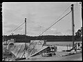
 Canning Dam, construction of dam wall, 1939 (cropped).jpg 4.552 × 3.302; 2,49 MB
-
 Canning Dam, construction of dam wall, 1939.jpg 4.799 × 3.595; 2,23 MB
-
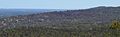 Darling Range Darling Scarp edge.jpg 2.494 × 766; 582 KB
-
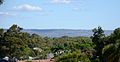 Darling Scarp from Bassendean.JPG 1.280 × 666; 271 KB
-
 Darling Scarp from Kings Park looking across Perth Water.jpg 2.324 × 740; 266 KB
-
 DarlingRange 2005 SMC.jpg 864 × 648; 120 KB
-
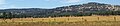
 DarlingScarp profile from south west highway.jpg 3.373 × 737; 400 KB
-
 DarlingScarp southern 2010.jpg 3.683 × 801; 430 KB
-
 DarlingScarp southern area.jpg 3.357 × 729; 367 KB
-
 Eastern Railway under Roe highway.jpg 2.048 × 1.536; 947 KB
-
 Gooseberry Hill from Bushmead.JPG 2.294 × 1.637; 1,67 MB
-
 Great eastern bypass 2008 .jpg 3.072 × 2.304; 2,61 MB
-
 Greenmount Hil l-6.JPG 3.072 × 2.304; 2,92 MB
-
 Greenmount Hill -1.JPG 3.072 × 2.304; 2,68 MB
-
 Greenmount Hill -2.JPG 3.072 × 2.304; 2,56 MB
-
 Greenmount Hill -3.JPG 3.072 × 2.304; 3,35 MB
-
 Greenmount Hill -5.JPG 3.072 × 2.304; 3,17 MB
-
 Helena Valley 1.JPG 3.072 × 2.304; 3,28 MB
-
 Helena Valley 2.JPG 3.072 × 2.304; 2,38 MB
-
 ISS006-E-40181 - View of Western Australia.jpg 3.032 × 2.064; 868 KB
-
 John Forrest NP view to Stratton and EllenBrook.jpg 4.928 × 3.264; 3,71 MB
-
 Kalamunda Road, Kalamunda.jpg 1.600 × 1.200; 539 KB
-
 Karragullen 02 gnangarra.jpg 2.576 × 1.932; 1,51 MB
-
 Looking from Paulls Valley Road across ridges to the north.jpg 2.352 × 1.333; 524 KB
-
 Mountain Quarry at left and Stathams Quarry behind rock at right.jpg 4.490 × 2.101; 1,76 MB
-
 Perth Water looking east with Darling Scarp in view .jpg 1.280 × 471; 165 KB
-
 Sikorsky S-64 Aircrane Erickson Inc. Water bomber Mount Solus PHS039 XI-2015.JPG 4.608 × 3.456; 2,68 MB
-
 Stathams 8.JPG 3.072 × 2.304; 2,4 MB
-
 STS097-712-37.jpg 4.127 × 4.096; 1,1 MB
-
 Swan Valley January 2012.jpg 1.110 × 434; 191 KB
-
 Swan View from Greenmount national park.jpg 3.872 × 2.592; 882 KB
-
 Swan View, JFNP looking north east from Greenmount Hill.jpg 3.872 × 2.592; 925 KB
-
 Tonkin hwy sth end gnangarra.JPG 3.008 × 2.000; 2,36 MB
-
 WTW 13 Nelly Barr 146.JPG 3.264 × 2.448; 2,61 MB
-
 WTW 13 Nelly Barr 147.JPG 3.264 × 2.448; 2,08 MB
-
 WTW 13 Nelly Barr 148.JPG 3.264 × 2.448; 1,96 MB
-
 WTW 13 Nelly Barr 149.JPG 3.264 × 2.448; 2,2 MB
-
 WTW 13 Nelly Barr 150.JPG 3.264 × 2.448; 1,65 MB
-
 WTW Nov 2013 Team Flower 010.JPG 6.016 × 4.000; 6,4 MB
.jpg)


