Category:Darrington, West Yorkshire
Aller à la navigation
Aller à la recherche
village britannique | |||||
| Téléverser des médias | |||||
| Nature de l’élément | |||||
|---|---|---|---|---|---|
| Lieu | cité de Wakefield, Yorkshire de l'Ouest, Yorkshire-et-Humber, Angleterre | ||||
 | |||||
English: Darrington is a small village and civil parish in the City of Wakefield in West Yorkshire, England. The village is split in two by the busy A1 trunk road which runs from London to Scotland. It has a population of 1,308.
Nederlands: Darrington is een dorp (village) en civil parish in het bestuurlijke gebied City of Wakefield, in het Engelse graafschap West Yorkshire. De civil parish telt
Sous-catégories
Cette catégorie comprend 6 sous-catégories, dont les 6 ci-dessous.
W
Média dans la catégorie « Darrington, West Yorkshire »
Cette catégorie comprend 322 fichiers, dont les 200 ci-dessous.
(page précédente) (page suivante)-
 A footpath for mountain goats - geograph.org.uk - 2355363.jpg 972 × 1 296 ; 1,48 Mio
-
 A former chapel at Darrington - geograph.org.uk - 3118903.jpg 800 × 600 ; 275 kio
-
 A1 - footbridge, West Park - geograph.org.uk - 2646183.jpg 640 × 428 ; 75 kio
-
 A1 - junction 40 in 1 mile - geograph.org.uk - 2646161.jpg 640 × 428 ; 74 kio
-
 A1 at start of A1(M) - geograph.org.uk - 2646425.jpg 640 × 428 ; 73 kio
-
 A1 bridge over Estcourt Road, Darrington - geograph.org.uk - 2476289.jpg 1 600 × 1 200 ; 362 kio
-
 A1 heading north - geograph.org.uk - 2476284.jpg 1 600 × 1 200 ; 351 kio
-
 A1 near Wentbridge - geograph.org.uk - 4792989.jpg 640 × 407 ; 36 kio
-
 A1 passing Darrington Services - geograph.org.uk - 5285036.jpg 1 024 × 683 ; 236 kio
-
 A1 South of Darrington Services - geograph.org.uk - 4830096.jpg 640 × 480 ; 371 kio
-
 A1 southbound, dropping down to Wentbridge Viaduct, sunset - geograph.org.uk - 3228761.jpg 1 600 × 1 001 ; 288 kio
-
 A1 Wentbridge bypass - geograph.org.uk - 2281054.jpg 1 280 × 959 ; 276 kio
-
 A1(M) - bridge at junction 40 - geograph.org.uk - 2646435.jpg 640 × 428 ; 70 kio
-
 A1(M) near Hodgewood Farm - geograph.org.uk - 2040730.jpg 640 × 480 ; 62 kio
-
 A1(M) northbound - geograph.org.uk - 4827593.jpg 640 × 428 ; 74 kio
-
 A1(M) northbound - geograph.org.uk - 4827598.jpg 640 × 428 ; 98 kio
-
 A1(M) Southbound, near to Darrington - geograph.org.uk - 4802488.jpg 640 × 427 ; 288 kio
-
 A1, approaching the A1(M) - geograph.org.uk - 4792993.jpg 640 × 426 ; 55 kio
-
 A1, Pontefract turning - geograph.org.uk - 4792996.jpg 640 × 455 ; 43 kio
-
 A1, southbound - geograph.org.uk - 4806319.jpg 640 × 426 ; 28 kio
-
 A162 overbridge, A1(M) - geograph.org.uk - 4806196.jpg 640 × 426 ; 40 kio
-
 A1M Emergency Service Road - geograph.org.uk - 3422737.jpg 4 608 × 3 456 ; 3,31 Mio
-
 Agricultural Machinery in the Little Went Valley - geograph.org.uk - 535646.jpg 640 × 480 ; 101 kio
-
 All quiet - geograph.org.uk - 1978083.jpg 800 × 600 ; 101 kio
-
 All Saints' Church lych gate, Darrington - geograph.org.uk - 6147991.jpg 3 072 × 4 608 ; 3,98 Mio
-
 An obviously unpopular notice - geograph.org.uk - 2355348.jpg 2 443 × 1 440 ; 3,61 Mio
-
 Applewood Gardens, off Estcourt Road - geograph.org.uk - 2175709.jpg 1 024 × 768 ; 105 kio
-
 Approaching Darrington Services, Southbound A1 - geograph.org.uk - 4830092.jpg 640 × 480 ; 340 kio
-
 Approaching the A1 - geograph.org.uk - 4822198.jpg 1 024 × 768 ; 367 kio
-
 Approaching turn-off to Darrington - geograph.org.uk - 3800795.jpg 3 621 × 2 414 ; 1,98 Mio
-
 Barley above Moor Lane - geograph.org.uk - 5260843.jpg 1 024 × 683 ; 272 kio
-
 BP garage on the A1, Darrington - geograph.org.uk - 5749405.jpg 2 004 × 1 476 ; 1,35 Mio
-
 Bridge carrying the A162 over the A1 - geograph.org.uk - 2040727.jpg 640 × 480 ; 55 kio
-
 Bus stop and phantom sleeping policemen on Valley Road - geograph.org.uk - 2175630.jpg 1 024 × 768 ; 152 kio
-
 Bus stop, bus shelter and post box - geograph.org.uk - 2175702.jpg 1 024 × 768 ; 114 kio
-
 Bus stops and bus shelter, Estcourt Road, Darrington - geograph.org.uk - 2175661.jpg 1 024 × 768 ; 198 kio
-

-
 Busy Bee Cafe - geograph.org.uk - 5285033.jpg 1 024 × 683 ; 335 kio
-
 Busy Bee's Diner, Darrington - geograph.org.uk - 5749396.jpg 2 048 × 1 536 ; 1,48 Mio
-
 Bypass-crossing bypass - geograph.org.uk - 2281064.jpg 1 280 × 959 ; 321 kio
-

-
 Car park, Darrington Services - geograph.org.uk - 5285035.jpg 1 024 × 683 ; 267 kio
-
 Carleton Road - geograph.org.uk - 5260863.jpg 1 024 × 683 ; 292 kio
-
 Carleton Road towards Carleton - geograph.org.uk - 3118957.jpg 800 × 600 ; 323 kio
-
 Carleton Road, looking towards Darrington - geograph.org.uk - 2197803.jpg 1 024 × 768 ; 100 kio
-
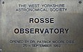 Carleton, Rosse Observatory - geograph.org.uk - 264906.jpg 640 × 408 ; 77 kio
-
 Church of St John the Evangelist in Wentbridge - geograph.org.uk - 4755788.jpg 4 608 × 3 456 ; 4 Mio
-
 Church of St. John the Evangelist from the south-east - geograph.org.uk - 4822140.jpg 1 024 × 768 ; 338 kio
-
 Church of St. Luke and All Saints from the north west - geograph.org.uk - 4828249.jpg 1 024 × 768 ; 132 kio
-
 Clubhouse, Mid Yorkshire Golf Club, Darrington - geograph.org.uk - 2476297.jpg 1 600 × 980 ; 350 kio
-
 Communication Mast by the A1 - geograph.org.uk - 4806325.jpg 640 × 426 ; 37 kio
-
 Communications mast beside the A1 - geograph.org.uk - 6303771.jpg 1 600 × 1 152 ; 230 kio
-
 Converted chapel on Valley Road - geograph.org.uk - 2175637.jpg 1 024 × 768 ; 134 kio
-
 Copper beech hedge in winter - geograph.org.uk - 2197858.jpg 1 024 × 768 ; 202 kio
-
 Dale Field - geograph.org.uk - 5899322.jpg 2 481 × 1 171 ; 634 kio
-
 Darrington All Saints Church - geograph.org.uk - 6147999.jpg 4 608 × 3 072 ; 3,63 Mio
-
 Darrington Church - geograph.org.uk - 6147988.jpg 4 608 × 3 072 ; 2,98 Mio
-
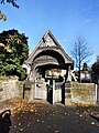 Darrington Church lytchgate - geograph.org.uk - 5652173.jpg 3 456 × 4 608 ; 3,6 Mio
-
 Darrington Church of England Primary School - geograph.org.uk - 4827626.jpg 1 024 × 768 ; 125 kio
-
 Darrington Church rear gate view - geograph.org.uk - 6147994.jpg 3 072 × 4 608 ; 3,61 Mio
-
 Darrington Hall - geograph.org.uk - 4827594.jpg 1 024 × 768 ; 179 kio
-
 Darrington Jubilee Church House, Date stone - geograph.org.uk - 1859696.jpg 640 × 480 ; 176 kio
-
 Darrington Services on the A1 - geograph.org.uk - 4616293.jpg 1 600 × 1 067 ; 932 kio
-
 Darrington traffic lights - geograph.org.uk - 2355311.jpg 1 728 × 1 296 ; 1,66 Mio
-
 Darrington War memorial - geograph.org.uk - 5652178.jpg 3 456 × 4 608 ; 4,38 Mio
-
 Darrington Windmill - geograph.org.uk - 2179334.jpg 1 024 × 768 ; 177 kio
-
 Darrington Windmill - geograph.org.uk - 2320336.jpg 1 152 × 864 ; 609 kio
-
 Datestone on Church House - geograph.org.uk - 4822202.jpg 1 024 × 768 ; 188 kio
-
 Delegates - geograph.org.uk - 5287268.jpg 4 896 × 3 672 ; 6,97 Mio
-
 Derelict bridge over the Little Went - geograph.org.uk - 2337609.jpg 1 152 × 864 ; 726 kio
-
 Distant power station - geograph.org.uk - 2642258.jpg 1 539 × 1 133 ; 377 kio
-
 Dumper truck on Leys Lane - geograph.org.uk - 5027520.jpg 1 200 × 799 ; 286 kio
-
 Electricity Sub Station - geograph.org.uk - 2355337.jpg 1 728 × 1 296 ; 2,19 Mio
-

-
 Entering Darrington - geograph.org.uk - 3118900.jpg 800 × 600 ; 340 kio
-
 Estcourt Road, Darrington - geograph.org.uk - 2175719.jpg 1 024 × 768 ; 104 kio
-
 Estcourt Road, Darrington - geograph.org.uk - 5260884.jpg 1 024 × 683 ; 265 kio
-

-
 Farm building on Estcourt Road, Darrington - geograph.org.uk - 3118922.jpg 800 × 600 ; 279 kio
-
 Farmland alongside Leys Quarry - geograph.org.uk - 4303517.jpg 1 024 × 768 ; 189 kio
-
 Farmland east of Darrington - geograph.org.uk - 2476291.jpg 1 600 × 1 200 ; 679 kio
-
 Farmland near Carleton - geograph.org.uk - 2602847.jpg 1 600 × 1 200 ; 393 kio
-
 Farmland north of the public footpath off Leys Lane - geograph.org.uk - 4303532.jpg 1 024 × 768 ; 243 kio
-
 Farmland north of Wenthill Plantation - geograph.org.uk - 2602814.jpg 1 600 × 1 200 ; 386 kio
-
 Farmland north-east of Hodgewood Farm - geograph.org.uk - 4303527.jpg 1 024 × 768 ; 192 kio
-
 Farmland off Moor Lane - geograph.org.uk - 2602837.jpg 1 600 × 1 200 ; 431 kio
-
 Farmland off Spitalgap Lane - geograph.org.uk - 2476277.jpg 1 600 × 1 200 ; 616 kio
-
 Farmland towards Wake Wood - geograph.org.uk - 2476305.jpg 1 600 × 1 200 ; 473 kio
-
 Farmland, Wentbridge Ings - geograph.org.uk - 2602819.jpg 1 600 × 1 200 ; 399 kio
-
 Field and field boundary, Dale Field - geograph.org.uk - 3832979.jpg 2 315 × 998 ; 427 kio
-
 Field edge below Went Hill - geograph.org.uk - 5245094.jpg 1 024 × 768 ; 220 kio
-
 Field north of Wenthill - geograph.org.uk - 4388397.jpg 640 × 480 ; 185 kio
-
 Field north-west of Wentbridge - geograph.org.uk - 2306620.jpg 1 500 × 1 125 ; 1,68 Mio
-
 Field of brassicas, off Havercroft Lane - geograph.org.uk - 2175614.jpg 1 024 × 768 ; 184 kio
-
 Field of oilseed rape - geograph.org.uk - 5248045.jpg 1 024 × 768 ; 230 kio
-
 Fields from Darrington Services - geograph.org.uk - 4733409.jpg 640 × 480 ; 67 kio
-
 Fields of corn below Went Hill - geograph.org.uk - 4022125.jpg 640 × 367 ; 41 kio
-
 Fingerpost on Leys Lane - geograph.org.uk - 5027584.jpg 1 200 × 799 ; 284 kio
-
 Flying the Flag - geograph.org.uk - 5287286.jpg 4 896 × 3 672 ; 6,77 Mio
-
 Flying the flag at the edge of the village - geograph.org.uk - 2197818.jpg 1 024 × 768 ; 150 kio
-
 Footbridge over A1 at Darrington Services - geograph.org.uk - 4616291.jpg 1 600 × 1 067 ; 1,2 Mio
-
 Footbridge over the A1 - geograph.org.uk - 2040720.jpg 640 × 480 ; 54 kio
-
 Footbridge over the A1 - geograph.org.uk - 2179395.jpg 1 024 × 768 ; 128 kio
-
 Footbridge over the A1 at West Park - geograph.org.uk - 2355289.jpg 2 322 × 1 296 ; 1,03 Mio
-
 Footbridge over the A1, Thorntree Closes - geograph.org.uk - 2515294.jpg 640 × 430 ; 41 kio
-
 Footbridge, A1 - geograph.org.uk - 4792992.jpg 640 × 390 ; 28 kio
-
 Footpath - Carleton Road - geograph.org.uk - 1894865.jpg 480 × 640 ; 67 kio
-
 Footpath above Wenthill Plantation - geograph.org.uk - 4388392.jpg 640 × 480 ; 363 kio
-
 Footpath at Wentbridge Plantation - geograph.org.uk - 2355367.jpg 1 728 × 1 296 ; 1,58 Mio
-
 Footpath by the side of the A1 - geograph.org.uk - 4825553.jpg 1 024 × 768 ; 257 kio
-
 Footpath on Went Hill - geograph.org.uk - 2355326.jpg 1 728 × 1 296 ; 1,34 Mio
-
 Footpath running south of Leys Road - geograph.org.uk - 2476303.jpg 1 600 × 1 200 ; 700 kio
-
 Footpath sign and the A1 - geograph.org.uk - 4822537.jpg 1 024 × 768 ; 137 kio
-
 Footpath steps at Wentbridge Viaduct - geograph.org.uk - 2281057.jpg 1 280 × 959 ; 526 kio
-
 Footpath through the wheat towards Grove Hall - geograph.org.uk - 3617953.jpg 1 600 × 1 200 ; 687 kio
-
 Footpath to Havercroft Lane - geograph.org.uk - 2175626.jpg 1 024 × 768 ; 114 kio
-
 Footpath to Leys Lane - geograph.org.uk - 4825611.jpg 1 024 × 768 ; 206 kio
-
 Footpath to Manor Park Drive - geograph.org.uk - 2175685.jpg 1 024 × 768 ; 129 kio
-
 Former limestone quarry, east of Leys Lane - geograph.org.uk - 4303558.jpg 1 024 × 768 ; 161 kio
-
 Grazing land towards Wake Wood - geograph.org.uk - 1588892.jpg 640 × 480 ; 100 kio
-
 Greening field - geograph.org.uk - 2197805.jpg 1 024 × 768 ; 129 kio
-
 Greening hillside - geograph.org.uk - 2197808.jpg 1 024 × 768 ; 121 kio
-
 Grove Hall Lane Bridge, A1(M) - geograph.org.uk - 2515388.jpg 640 × 341 ; 29 kio
-
 Hardwick Road - Carleton Road - geograph.org.uk - 1894857.jpg 640 × 480 ; 70 kio
-
 Hardwick Road - geograph.org.uk - 5260836.jpg 1 024 × 683 ; 279 kio
-
 Hardwick Road, looking from Moor Bridge. - geograph.org.uk - 534193.jpg 640 × 480 ; 55 kio
-
 Harrdwick Road - geograph.org.uk - 2602850.jpg 1 600 × 1 200 ; 362 kio
-
 Havercroft Lane - geograph.org.uk - 2175611.jpg 1 024 × 768 ; 144 kio
-
 Havercroft Lane - geograph.org.uk - 2175617.jpg 1 024 × 768 ; 176 kio
-
 Hedged field boundary, south of Leys Quarry - geograph.org.uk - 4303540.jpg 1 024 × 768 ; 208 kio
-
 Houses along the Old Great North Road - geograph.org.uk - 2175671.jpg 1 024 × 768 ; 150 kio
-
 Houses at West Park Terrace - geograph.org.uk - 5797166.jpg 1 500 × 983 ; 1,17 Mio
-
 Houses on Sotherton Croft - geograph.org.uk - 2175695.jpg 1 024 × 768 ; 112 kio
-
 Icy puddles on Westfield Lane - geograph.org.uk - 2179404.jpg 1 024 × 768 ; 110 kio
-
 Information board on the A1(M) - geograph.org.uk - 2040733.jpg 640 × 480 ; 54 kio
-
 Jackson's Hill - geograph.org.uk - 4822486.jpg 1 024 × 768 ; 237 kio
-
 Jackson's Lane - geograph.org.uk - 4822090.jpg 1 024 × 768 ; 324 kio
-
 Jackson's Lane - geograph.org.uk - 4822099.jpg 1 024 × 768 ; 247 kio
-
 Jackson's Lane, Wentbridge - geograph.org.uk - 2281044.jpg 1 280 × 959 ; 422 kio
-
 Junction of Leys Road and Havercroft Road - geograph.org.uk - 2164057.jpg 640 × 480 ; 122 kio
-
 Junction of public footpath with Leys Lane - geograph.org.uk - 4303554.jpg 1 024 × 768 ; 128 kio
-
 Kyte Hotel - geograph.org.uk - 1482109.jpg 640 × 480 ; 79 kio
-
 Large Field near Wentbridge - geograph.org.uk - 788080.jpg 640 × 427 ; 221 kio
-
 Large field, small pylon - geograph.org.uk - 2197814.jpg 1 024 × 768 ; 134 kio
-
 Late autumn shadows off Westfield Lane - geograph.org.uk - 2179326.jpg 1 024 × 768 ; 155 kio
-
 Leys Lane - geograph.org.uk - 3617942.jpg 1 600 × 1 200 ; 527 kio
-
 Leys Lane, heading north - geograph.org.uk - 4303503.jpg 1 024 × 768 ; 109 kio
-
 Leys Quarry, south of the M62 - geograph.org.uk - 4303508.jpg 1 024 × 768 ; 112 kio
-
 Leys Road towards Cridling Stubbs - geograph.org.uk - 2476299.jpg 1 600 × 1 200 ; 458 kio
-
 Leys Road towards Cridling Stubbs - geograph.org.uk - 2476308.jpg 1 600 × 1 200 ; 524 kio
-
 Leys Road, Darrington - geograph.org.uk - 4875764.jpg 1 024 × 682 ; 199 kio
-

-
 Load on the A1 - geograph.org.uk - 788085.jpg 427 × 640 ; 73 kio
-
 Looking south along the A1M from Grovehall Hall - geograph.org.uk - 3118763.jpg 800 × 600 ; 220 kio
-
 Looking towards Carleton - geograph.org.uk - 5245067.jpg 1 024 × 768 ; 179 kio
-
 Looking up to former A1 slip road - geograph.org.uk - 3118778.jpg 800 × 600 ; 255 kio
-
 Lush Green Fallow Field, Darrington - geograph.org.uk - 57716.jpg 640 × 479 ; 132 kio
-
 M1 southbound at Junction 40 - geograph.org.uk - 3030860.jpg 640 × 480 ; 36 kio
-
 M62, junction 33, A1 South - geograph.org.uk - 2118347.jpg 800 × 600 ; 142 kio
-
 Magnesian limestone ridge - geograph.org.uk - 5248057.jpg 1 024 × 768 ; 131 kio
-
 Manasseh - viewed from Hardwick Road - geograph.org.uk - 1894861.jpg 640 × 480 ; 84 kio
-
 Meadow and woodyard near Darrington - geograph.org.uk - 4828277.jpg 1 024 × 768 ; 132 kio
-
 Meandering footpath - geograph.org.uk - 2355384.jpg 1 728 × 1 296 ; 2,42 Mio
-
 Mid Yorkshire Golf Club - geograph.org.uk - 2476300.jpg 1 600 × 1 200 ; 432 kio
-

-
 Moor Lane - geograph.org.uk - 2602831.jpg 1 600 × 1 200 ; 642 kio
-
 Moor Lane towards Carleton - geograph.org.uk - 2602842.jpg 1 600 × 1 200 ; 310 kio
-
 Mortsafe - geograph.org.uk - 3351538.jpg 640 × 427 ; 142 kio
-
 Muddy entrance to field west of Westfield Lane - geograph.org.uk - 2179408.jpg 1 024 × 768 ; 179 kio
-
 New houses off Valley Road - geograph.org.uk - 2175642.jpg 1 024 × 768 ; 142 kio
-
 North Lodge Lane, Darrington - geograph.org.uk - 1588889.jpg 640 × 480 ; 78 kio
-
 North Lodge Lane, Darrington - geograph.org.uk - 2348067.jpg 4 320 × 3 240 ; 5,3 Mio
-
 North Lodge Lane, Darrington - geograph.org.uk - 274504.jpg 640 × 480 ; 132 kio
-
 Northwood - geograph.org.uk - 2642227.jpg 1 600 × 1 200 ; 321 kio
-
 Northwood - geograph.org.uk - 4388421.jpg 640 × 480 ; 183 kio
-
 Not the best view - geograph.org.uk - 5287252.jpg 4 896 × 3 672 ; 6,95 Mio
-
 Oh look, Snowdrops - geograph.org.uk - 5293342.jpg 4 896 × 3 672 ; 7,31 Mio
-
 Oilseed rape near Carleton - geograph.org.uk - 5260835.jpg 1 024 × 683 ; 479 kio
-
 Oilseed rape, Darrington - geograph.org.uk - 5260859.jpg 1 024 × 683 ; 238 kio
-
 Old and New - geograph.org.uk - 5287259.jpg 4 896 × 3 672 ; 6,81 Mio
-
 Old farm buildings (2) - geograph.org.uk - 4827601.jpg 1 024 × 768 ; 216 kio
-
 Old farm buildings (3) - geograph.org.uk - 4827608.jpg 1 024 × 768 ; 235 kio
-
 Old farm buildings - geograph.org.uk - 4825562.jpg 1 024 × 768 ; 249 kio
-
 Old quarry, Wentbridge - geograph.org.uk - 4822190.jpg 1 024 × 768 ; 371 kio
-
 Orchard View - geograph.org.uk - 2175699.jpg 1 024 × 768 ; 114 kio
-
 Ordnance Survey Cut Mark - geograph.org.uk - 3188464.jpg 3 264 × 2 448 ; 2,42 Mio
-
 Ordnance Survey Flush Bracket S9271 - geograph.org.uk - 3188499.jpg 3 264 × 2 448 ; 2,27 Mio
-
 Original Great North Road, Darrington - geograph.org.uk - 4864871.jpg 3 648 × 2 736 ; 3,55 Mio
-
 Overhead warning sign - geograph.org.uk - 2179412.jpg 1 024 × 768 ; 131 kio
-
 Parallel lines on a hillside - geograph.org.uk - 2175622.jpg 971 × 729 ; 409 kio
-
 Path from North Lodge Lane to Long Plantation - geograph.org.uk - 2348092.jpg 1 152 × 864 ; 1,13 Mio
-
 Pedestal and Cross Base, Darrington.jpg 1 024 × 768 ; 250 kio
-
 Pergola and Lawn - geograph.org.uk - 5293340.jpg 4 896 × 3 672 ; 7,14 Mio
-
 Philip's Lane, Darrington - geograph.org.uk - 4828211.jpg 1 024 × 768 ; 304 kio
-
 Power lines over the Little Went Valley. - geograph.org.uk - 535644.jpg 640 × 480 ; 81 kio
-
 Private drive off Valley Road - geograph.org.uk - 2175650.jpg 1 024 × 768 ; 132 kio
-
 Public Footpath - geograph.org.uk - 2337594.jpg 1 152 × 864 ; 824 kio
-
 Public footpath crossing farmland west of Leys Lane - geograph.org.uk - 4303547.jpg 1 024 × 768 ; 232 kio
-
 Ranch-style fencing within a field - geograph.org.uk - 2179328.jpg 1 024 × 768 ; 113 kio
-
 Rear entrance to Church farm from Spitalgap Lane - geograph.org.uk - 2320310.jpg 1 152 × 864 ; 989 kio


_-_geograph.org.uk_-_2646425.jpg)


_-_bridge_at_junction_40_-_geograph.org.uk_-_2646435.jpg)
_near_Hodgewood_Farm_-_geograph.org.uk_-_2040730.jpg)
_northbound_-_geograph.org.uk_-_4827593.jpg)
_northbound_-_geograph.org.uk_-_4827598.jpg)
_Southbound,_near_to_Darrington_-_geograph.org.uk_-_4802488.jpg)
_-_geograph.org.uk_-_4792993.jpg)


_-_geograph.org.uk_-_4806196.jpg)


_near_to_Darrington_-_geograph.org.uk_-_4802498.jpg)


_-_geograph.org.uk_-_2515388.jpg)


_-_geograph.org.uk_-_2040733.jpg)


_near_to_Darrington_-_geograph.org.uk_-_4802492.jpg)


_-_geograph.org.uk_-_4827601.jpg)
_-_geograph.org.uk_-_4827608.jpg)


