Category:City of Wakefield
Jump to navigation
Jump to search

local government district in West Yorkshire, England    | |||||
| Upload media | |||||
| Instance of |
| ||||
|---|---|---|---|---|---|
| Location | West Yorkshire, Yorkshire and the Humber, England | ||||
| Capital | |||||
| Legislative body |
| ||||
| Executive body |
| ||||
| Head of government |
| ||||
| Inception |
| ||||
| Population |
| ||||
| Area |
| ||||
| official website | |||||
 | |||||
English: The City of Wakefield is a local government district of West Yorkshire, England, with the status of a city and metropolitan borough. Wakefield is the district's administrative centre. The district includes the "Five Towns" of Normanton, Pontefract, Featherstone, Castleford and Knottingley. Other towns include Ossett, Hemsworth, South Kirkby and Moorthorpe and South Elmsall. Wakefield lies between Leeds and Sheffield and was ranked as the 89th largest city in the European Union in 2012. In 2010, Wakefield was named as the UK's third 'most musical' City by PRS for Music.
Subcategories
This category has the following 71 subcategories, out of 71 total.
Media in category "City of Wakefield"
The following 11 files are in this category, out of 11 total.
-
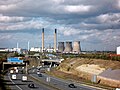 A1M motorway and derelict power station - geograph.org.uk - 6304140.jpg 4,288 × 3,216; 1.52 MB
-
 And then there were three - geograph.org.uk - 6304124.jpg 4,288 × 3,216; 1.26 MB
-
 Bringing in the harvest - geograph.org.uk - 6304159.jpg 4,608 × 3,072; 3.6 MB
-
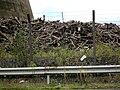 Cooling towers debris - geograph.org.uk - 6304129.jpg 4,288 × 3,216; 2.26 MB
-
 Cormorants resting on boom at Knottingley - geograph.org.uk - 6304185.jpg 4,608 × 3,072; 2.48 MB
-
 Crowds Gather for Demolition - geograph.org.uk - 6304133.jpg 640 × 480; 62 KB
-
 Crowds Gather for Demolition - geograph.org.uk - 6304135.jpg 4,608 × 3,072; 1.85 MB
-
 Eight minus five equals three - geograph.org.uk - 6304138.jpg 3,562 × 2,139; 875 KB
-
 Eskdale barge moored at Ferrybridge - geograph.org.uk - 6304180.jpg 4,608 × 3,072; 1.93 MB
-
 Ferrybridge power station viewed from golf course - geograph.org.uk - 6304162.jpg 4,608 × 3,072; 2.24 MB
-
 The three towers and Ferrybridge flood lock - geograph.org.uk - 6304146.jpg 4,288 × 3,216; 1.7 MB


