Category:De Arend, Coevorden
Jump to navigation
Jump to search
| Object location | | View all coordinates using: OpenStreetMap |
|---|
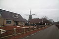
windmill in Coevorden, Netherlands  | |||||
| Upload media | |||||
| Instance of | |||||
|---|---|---|---|---|---|
| Location | Coevorden, Drenthe, Netherlands | ||||
| Street address |
| ||||
| Located on street |
| ||||
| Has use | |||||
| Heritage designation |
| ||||
| Source of energy | |||||
 | |||||
|
This is a category about rijksmonument number 11493
|
| Address |
|
Media in category "De Arend, Coevorden"
The following 19 files are in this category, out of 19 total.
-
 Coevorden molen De Arend.jpg 1,239 × 1,856; 1.09 MB
-
 Coevorden, nôtmûne De Earn (De Arend).jpg 2,000 × 1,334; 1.26 MB
-
 De Arend (Coevorden) 1.JPG 4,272 × 2,848; 4.19 MB
-
 De Arend (Coevorden) 2.JPG 2,848 × 4,272; 4.06 MB
-
 De Arend (Coevorden) 3.JPG 4,272 × 2,848; 4.3 MB
-
 De Arend (Coevorden) 4.JPG 2,848 × 4,272; 5.22 MB
-
 De Arend (Coevorden) 5.JPG 4,272 × 2,848; 4.18 MB
-
 De Arend (Coevorden) 6.JPG 2,848 × 4,272; 4.28 MB
-

-

-
 Korenmolen "De Arend" in restauratie - Coevorden - 20047082 - RCE.jpg 1,200 × 1,172; 240 KB
-
 Korenmolen "De Arend" in restauratie - Coevorden - 20047083 - RCE.jpg 1,200 × 1,172; 269 KB
-
 Korenmolen "De Arend", opening door Staatsecretaris - Coevorden - 20047084 - RCE.jpg 1,200 × 1,183; 282 KB
-
 Krimweg, Molen - Coevorden - 20047061 - RCE.jpg 1,200 × 1,195; 345 KB
-
 Molen Coevorden.jpg 320 × 436; 20 KB
-
 Molen de Arend juni 2013.JPG 3,240 × 4,320; 5.72 MB
-
 Molen, overzicht - Coevorden - 20047081 - RCE.jpg 1,200 × 1,190; 327 KB
-

-


.jpg)
_1.JPG)
_2.JPG)
_3.JPG)
_4.JPG)
_5.JPG)
_6.JPG)


