Category:De Doelen, Gorinchem
Jump to navigation
Jump to search
| Object location | | View all coordinates using: OpenStreetMap |
|---|
building in Gorinchem, Netherlands  | |||||
| Upload media | |||||
| Instance of | |||||
|---|---|---|---|---|---|
| Location | Gorinchem, South Holland, Netherlands | ||||
| Street address |
| ||||
| Heritage designation |
| ||||
 | |||||
|
This is a category about rijksmonument number 16663
|
| Address |
|
Media in category "De Doelen, Gorinchem"
The following 25 files are in this category, out of 25 total.
-
 Achtergevel - Gorinchem - 20080380 - RCE.jpg 953 × 1,200; 333 KB
-
 De Doelen - Gorinchem - 20081071 - RCE.jpg 933 × 1,200; 260 KB
-
 De Doelen - Gorinchem - 20081072 - RCE.jpg 1,200 × 949; 247 KB
-
 De Doelen - Gorinchem - 20081073 - RCE.jpg 1,200 × 955; 239 KB
-
 Deel van de zijgevel - Gorinchem - 20080385 - RCE.jpg 973 × 1,200; 287 KB
-
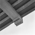
 Deel van natuurstenen gootlijst - Gorinchem - 20080382 - RCE.jpg 967 × 1,200; 247 KB
-
 Fundering traptorentje - Gorinchem - 20080383 - RCE.jpg 967 × 1,200; 302 KB
-
 Gang, interieur - Gorinchem - 20080394 - RCE.jpg 959 × 1,200; 109 KB
-

-
 Hoek deel van natuurstenen gootlijst - Gorinchem - 20080386 - RCE.jpg 1,200 × 965; 233 KB
-
 INTERIEUR, CONSOLE ( 1589 ) - Gorinchem - 20268877 - RCE.jpg 1,200 × 1,200; 168 KB
-
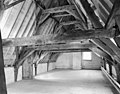
 Kap toren - Gorinchem - 20080397 - RCE.jpg 958 × 1,200; 192 KB
-

-
 Kap voorbouw (1589) naar het noorden ( boven gedeelte ) - Gorinchem - 20080390 - RCE.jpg 1,197 × 1,200; 251 KB
-
 Kap voorbouw (1589) naar het zuiden ( boven gedeelte ) - Gorinchem - 20080391 - RCE.jpg 1,196 × 1,200; 226 KB
-
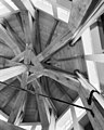
 Kapconstructie - Gorinchem - 20080387 - RCE.jpg 1,200 × 968; 237 KB
-
 Kapconstructie - Gorinchem - 20080388 - RCE.jpg 1,200 × 969; 225 KB
-
 Kapconstructie - Gorinchem - 20080396 - RCE.jpg 1,200 × 936; 231 KB
-
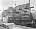
 Molenstr. 30-32 - Gorinchem - 20080381 - RCE.jpg 1,200 × 804; 169 KB
-

-
 Overzicht achtergevel - Gorinchem - 20080393 - RCE.jpg 958 × 1,200; 289 KB
-
 Overzicht voorgevel, ontpleisterd - Gorinchem - 20080392 - RCE.jpg 1,200 × 960; 229 KB
-
 Voorgevel - Gorinchem - 20080379 - RCE.jpg 1,200 × 955; 270 KB
-
 Zaal 1e etage - Gorinchem - 20080395 - RCE.jpg 1,200 × 961; 140 KB
-
 Zijgevel - Gorinchem - 20080384 - RCE.jpg 958 × 1,200; 322 KB


_-_Gorinchem_-_20268877_-_RCE.jpg)

_naar_het_noord-oosten_(_beneden_gedeelte_)_-_Gorinchem_-_20080389_-_RCE.jpg)
_naar_het_noorden_(_boven_gedeelte_)_-_Gorinchem_-_20080390_-_RCE.jpg)
_naar_het_zuiden_(_boven_gedeelte_)_-_Gorinchem_-_20080391_-_RCE.jpg)


