Category:De Horst (Groesbeek)
Jump to navigation
Jump to search
| Object location | | View all coordinates using: OpenStreetMap |
|---|
village in Berg en Dal, Netherlands _De_Horst,_voorm._pastorie_Ketelstraat_3.JPG)  | |||||
| Upload media | |||||
| Spoken text audio | |||||
|---|---|---|---|---|---|
| Instance of | |||||
| Location | Berg en Dal, Gelderland, Netherlands | ||||
 | |||||
Subcategories
This category has the following 2 subcategories, out of 2 total.
Media in category "De Horst (Groesbeek)"
The following 6 files are in this category, out of 6 total.
-
-
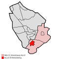
 Map - NL - Groesbeek - Wijk 01 Breedeweg-Horst - Buurt 01 Horst.svg 375 × 375; 17 KB
-
-

-
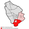
 Map - NL - Groesbeek - Wijk 01 Breedeweg-Horst.svg 625 × 575; 6 KB
-
Nl-De Horst (Groesbeek)-article.ogg 1 min 3 s; 620 KB


