Category:De Karmel, Woudsend
Jump to navigation
Jump to search
| Object location | | View all coordinates using: OpenStreetMap |
|---|
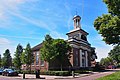
church building in Súdwest-Fryslân, Netherlands .JPG) | |||||
| Upload media | |||||
| Instance of | |||||
|---|---|---|---|---|---|
| Location | Woudsend, Friesland, Netherlands | ||||
| Street address |
| ||||
| Located on street |
| ||||
| Heritage designation |
| ||||
| Inception |
| ||||
| official website | |||||
 | |||||
|
This is a category about rijksmonument number 39824
|
| Address |
|
Media in category "De Karmel, Woudsend"
The following 12 files are in this category, out of 12 total.
-
 20190617 kerk de Karmel (detail) in Woudsend.jpg 5,184 × 3,456; 2.57 MB
-
 20190617 kerk de Karmel in Woudsend.jpg 3,456 × 5,184; 3.35 MB
-
 Ald Tsjerkhof - Woudsend - 20218104 - RCE.jpg 1,183 × 1,200; 365 KB
-
 De Karmel (PKN), Wâldsein.jpg 1,796 × 1,198; 1.2 MB
-
 De Karmel, Woudsend.JPG 4,217 × 2,812; 5.16 MB
-
 Interieur - Woudsend - 20218169 - RCE.jpg 1,200 × 952; 159 KB
-
 Kansel en orgel - Woudsend - 20218170 - RCE.jpg 1,200 × 961; 167 KB
-
 Kansel en orgel - Woudsend - 20218171 - RCE.jpg 1,200 × 963; 173 KB
-
 Karmeltsjerke, Wâldsein.jpg 2,312 × 1,598; 1.58 MB
-
 Voorgevel - Woudsend - 20218167 - RCE.jpg 964 × 1,200; 317 KB
-
 Woudsend De Karmel (7).JPG 1,920 × 2,342; 2.31 MB
-
 Zijgevel - Woudsend - 20218168 - RCE.jpg 1,200 × 942; 286 KB
_in_Woudsend.jpg)


,_W%C3%A2ldsein.jpg)


