Category:Delaware Bay
Aller à la navigation
Aller à la recherche
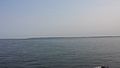
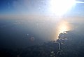
English: The Delaware Bay — a major estuary outlet of the Delaware River on the Northeast seaboard of the United States.
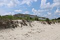
- A wetlands Ramsar site in the United States.
Español: Bahía de Delaware — del río Delaware, en Nueva Jersey y Delaware.
- Es una bahía del océano Atlántico.
bay on the east coast of the United States  | |||||
| Téléverser des médias | |||||
| Nature de l’élément | |||||
|---|---|---|---|---|---|
| Partie de | |||||
| Nommé(e) en référence à |
| ||||
| Lieu | |||||
| Découvert(e) ou inventé(e) par | |||||
| Statut patrimonial |
| ||||
| Date de découverte ou d'invention |
| ||||
| Superficie |
| ||||
| Se jette dans | |||||
| Alimentation |
| ||||
| Pays souverain sur le bassin versant | |||||
 | |||||
Sous-catégories
Cette catégorie comprend 8 sous-catégories, dont les 8 ci-dessous.
C
L
S
Média dans la catégorie « Delaware Bay »
Cette catégorie comprend 65 fichiers, dont les 65 ci-dessous.
-
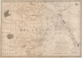
 A chart of Delawar Bay, with soundings and nautical observations. LOC 77692984.tif 6 525 × 8 980 ; 167,64 Mio
-

-
-
 Annual report of the New Jersey State Museum (1907) (18744790573).jpg 3 264 × 2 051 ; 721 kio
-
-
 Broadkill Beach 2009.jpg 800 × 600 ; 175 kio
-
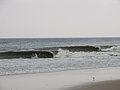 Bára ofurlítill í Delaware.jpg 2 592 × 1 944 ; 1,01 Mio
-
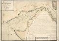
 Caert vande Svydt Rivier in Niew Nederland. LOC 2003623407.tif 8 423 × 5 971 ; 143,89 Mio
-
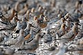
 Calidris pusilla flock, Slaughter Beach, Delaware.jpg 4 698 × 2 496 ; 3,16 Mio
-
 Cape Henelopen from the Cape May Lewes Ferry.jpg 4 128 × 2 322 ; 2,28 Mio
-
 Cape Henlopen tidal flat.jpg 6 744 × 1 374 ; 1,52 Mio
-
 Cape May NJ from airplane (August, 2022).jpg 6 000 × 4 000 ; 6,29 Mio
-
 CBHfromBeach.jpg 6 000 × 4 000 ; 9,71 Mio
-
 Community volunteers at Project PORTS (18394024311).jpg 960 × 720 ; 94 kio
-
 Delaware Bay Aerial.jpg 2 896 × 1 944 ; 959 kio
-
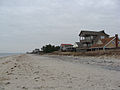
 Delaware Bay Villas NJ.JPG 2 592 × 1 944 ; 2,3 Mio
-
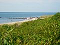
 Dune grass at the Delaware Bay.jpg 1 188 × 1 568 ; 793 kio
-
 Eroded peat at low tide (15572651857).jpg 3 008 × 2 000 ; 2,92 Mio
-

-
 Flooding at Prime Hook National Wildlife Refuge (DE) (8147588921).jpg 2 848 × 2 136 ; 1,42 Mio
-
 Fortescue Beach, NJ (1), July 2021.jpg 3 648 × 2 736 ; 1,85 Mio
-
 Fortescue Beach, NJ (2), July 2021.jpg 3 648 × 2 736 ; 1,94 Mio
-
 Higbee Beach overview, July 2021.jpg 3 648 × 2 736 ; 1,91 Mio
-
 Hope Creek-Salem Nuclear.jpg 1 600 × 1 200 ; 298 kio
-
 Horseshoe crab eggs in hand (4035580656).jpg 2 327 × 1 810 ; 1,89 Mio
-
 Horseshoe crab with shells 2.JPG 2 578 × 3 438 ; 4,02 Mio
-
 Horseshoe crab with shells.JPG 3 901 × 2 925 ; 4,25 Mio
-
 Kimbles Beach, New Jersey (during restoration) (13468649714).jpg 3 008 × 2 000 ; 2,22 Mio
-
 Kimbles Beach, New Jersey (post-restoration) (14336094936).jpg 1 800 × 1 192 ; 693 kio
-
 Kimbles Beach, New Jersey (pre-restoration) (14172568658).jpg 3 696 × 2 448 ; 2,61 Mio
-
 Lewes Beach from Savannah Road May 2021.jpeg 4 032 × 3 024 ; 2,44 Mio
-
 Lewes Beach from Savannah Road.JPG 3 072 × 2 304 ; 391 kio
-
 Miami Beach, New Jersey looking south from Miami St.jpg 4 320 × 3 240 ; 3,75 Mio
-
 Mispillion Harbor, Delaware. Credit- Gregory Breese-USFWS (4034569587).jpg 3 008 × 2 000 ; 3,43 Mio
-
 Mispillion Harbor, Delaware. Credit- Gregory Breese-USFWS (4034810255).jpg 1 280 × 850 ; 980 kio
-
 Mispillion Harbor, Delaware. Credit- Gregory Breese-USFWS (4034821221).jpg 4 288 × 2 848 ; 5,67 Mio
-
 Mispillion Harbor, Delaware. Credit- Gregory Breese-USFWS (4034824167).jpg 4 288 × 2 848 ; 6,06 Mio
-
 Mispillion Harbor, Delaware. Credit- Gregory Breese-USFWS (4034825543).jpg 3 008 × 2 000 ; 4,44 Mio
-
 Mispillion Harbor, Delaware. Credit- Gregory Breese-USFWS (4035270308).jpg 3 008 × 2 000 ; 4,15 Mio
-
 Mispillion Harbor, Delaware. Credit- Gregory Breese-USFWS (4035543608).jpg 4 288 × 2 848 ; 7,49 Mio
-
 Mispillion Harbor, Delaware. Credit- Gregory Breese-USFWS (4035558928).jpg 3 872 × 2 592 ; 4,48 Mio
-
 Moore's Beach, New Jersey (before and after) (14042703726).jpg 2 046 × 668 ; 345 kio
-
 Mouth of the Delaware by Thomas Birch, 1828.jpg 3 000 × 1 981 ; 3,73 Mio
-
 North Cape May NJ DBay beach near Browning.jpg 4 208 × 3 156 ; 2,98 Mio
-
 PDE 2016 MAIN LOGO FullColor RGB FFF.png 2 228 × 787 ; 85 kio
-
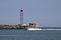 PilotBoatLewes.jpg 6 000 × 4 000 ; 6,07 Mio
-
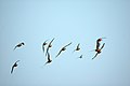 Red Knot in Flight (4034783591).jpg 3 008 × 2 000 ; 4,09 Mio
-
 Red Knot in Flight (4035536962).jpg 3 008 × 2 000 ; 3,81 Mio
-
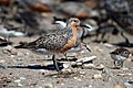
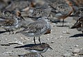 Red Knot Winter Plumage (4034804913).jpg 1 600 × 1 108 ; 1 006 kio
-
 Reeds Beach Restoration (14102919983).jpg 1 600 × 1 200 ; 115 kio
-
 Reedy Point Bridge, April 2021 (3).jpg 3 378 × 2 572 ; 1,72 Mio
-
 Roosevelt Inlet near Lewes, Delaware USA.jpg 4 032 × 3 024 ; 1,64 Mio
-
 Roosevelt Inlet.JPG 3 264 × 2 448 ; 2,42 Mio
-
 Rubber-tracked dump truck hauls sand at Kimbles Beach. (13468652904).jpg 3 008 × 2 000 ; 2,59 Mio
-
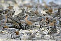
 Rufa red knot (Calidris canutus rufa) in Delaware Bay, New Jersey.jpg 4 914 × 3 276 ; 9 Mio
-
 SBDowitcher Wading.png 3 443 × 2 296 ; 34,12 Mio
-

-
 Sunset over the Delaware Bay.jpg 3 024 × 4 032 ; 730 kio
-
 Tagged Red Knot (4034580885).jpg 1 654 × 1 335 ; 871 kio
-
 Tagged Red Knot (4034604777).jpg 3 008 × 2 000 ; 3,25 Mio
-
 The Delaware Bay (58921424).jpeg 2 048 × 1 357 ; 978 kio
-
 Two U.S. Coast Guard patrol boats at Coast Guard Station Indian River.jpg 1 858 × 926 ; 391 kio
-
 US Coast Guard Patrol Boat in Deleware Bay in Deleware Waters.jpg 4 128 × 2 266 ; 2,98 Mio
-
 Wetlands delaware bay cape henlopen.jpg 1 512 × 1 002 ; 145 kio
-
 Wetlands delaware bay.jpg 1 512 × 1 017 ; 80 kio
_(18744790573).jpg)


.jpg)

.jpg)


.jpg)
.jpg)
_(8147588921).jpg)
,_July_2021.jpg)
,_July_2021.jpg)

.jpg)


_(13468649714).jpg)
_(14336094936).jpg)
_(14172568658).jpg)


.jpg)
.jpg)
.jpg)
.jpg)
.jpg)
.jpg)
.jpg)
.jpg)


.jpg)
.jpg)
.jpg)
.jpg)
.jpg)


.jpg)
_in_Delaware_Bay,_New_Jersey.jpg)


.jpg)
.jpg)
.jpeg)


_(14042703726).jpg)