Category:Bays of the United States
Jump to navigation
Jump to search
Countries of the Americas: Argentina · The Bahamas · Barbados · Belize · Brazil · Canada · Chile · Colombia · Costa Rica · Cuba · Dominica · Dominican Republic · Ecuador · El Salvador · Guatemala · Jamaica · Mexico · Nicaragua · Panama · Peru · Saint Lucia · Trinidad and Tobago · United States of America · Uruguay · Venezuela
Other areas: Aruba · Bermuda · Falkland Islands · Greenland · Guadeloupe · Martinique · Puerto Rico · United States Virgin Islands
Other areas: Aruba · Bermuda · Falkland Islands · Greenland · Guadeloupe · Martinique · Puerto Rico · United States Virgin Islands
Wikimedia category | |||||
| Upload media | |||||
| Instance of | |||||
|---|---|---|---|---|---|
| Category combines topics | |||||
 | |||||
Subcategories
This category has the following 13 subcategories, out of 13 total.
*
+
A
B
- Bay Jimmy, Louisiana (11 F)
C
D
M
Y
- Yellowstone Lake (Mary Bay) (12 F)
- Yellowstone Lake (Southeast Arm) (21 F)
Media in category "Bays of the United States"
The following 43 files are in this category, out of 43 total.
-
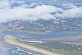 Aerial View of Netarts Bay.JPG 6,016 × 4,000; 7.8 MB
-
 Aransas Bay from space.jpg 3,032 × 2,008; 1.26 MB
-
 Toll Bridge" at Red Bank, N.J (NYPL b11707653-G90F459 015ZF).tiff 2,964 × 2,019; 17.12 MB
-
 Big and Small (39464921).jpg 1,280 × 871; 932 KB
-
 Carancahua Bay Beach.jpg 576 × 768; 138 KB
-
 Carancahua Bayfront.jpg 1,024 × 768; 222 KB
-
 Chatham Harbour Bay Sunrise-14July09-10.JPG 3,984 × 2,656; 4.7 MB
-
 Coo's Cove.jpg 3,888 × 2,592; 3.34 MB
-
 Corpus christi far skyline.jpg 254 × 190; 18 KB
-
 Cottonwood Bay (Portland, Oregon).jpg 1,704 × 2,272; 1.29 MB
-
 Delaware and Chesapeake Bays satellite image.jpg 600 × 750; 218 KB
-
 Depoe Bay entrance sign P1905.jpeg 2,694 × 1,946; 1.23 MB
-
 Harbor of Depoe Bay Harbor, Oregon.jpg 2,592 × 1,944; 2.38 MB
-
 Haverstraw Bay.jpg 3,072 × 2,304; 3.02 MB
-
 Highway 146 Bridges over Clear Creek, Kemah, Texas, May, 1985 (13428821615).jpg 1,733 × 2,468; 3.38 MB
-
 ISS-55 Chesapeake Bay, Delaware.jpg 5,568 × 3,712; 2.14 MB
-
 ISS-59 East Coast of the United States.jpg 5,568 × 3,712; 2.59 MB
-
 Lincoln City Banner.JPG 3,775 × 539; 871 KB
-
 LittleTraverseBayHistoricalMarkerPetoskey.JPG 1,330 × 1,039; 116 KB
-
 FMIB 41410 Fungasa, or Massacre Bay.jpeg 806 × 567; 127 KB
-

-

-

-
 Netarts Bay (6934997540).jpg 1,719 × 1,185; 1,010 KB
-
 Netarts Bay.jpg 1,024 × 683; 373 KB
-
 New York - Beachbend - 20191211164008.jpg 4,608 × 3,456; 5.02 MB
-
 Newburgh Bay.jpg 800 × 403; 94 KB
-
 Nissequogue River.jpg 2,591 × 1,522; 683 KB
-
 North Bend aerial.jpg 2,589 × 1,784; 975 KB
-
 Nueces Bay.png 780 × 556; 57 KB
-
 Oso bay, from SPID.jpg 2,816 × 2,112; 1.13 MB
-
 Part of Cayo del Oso Creek which empties into Corpus Christi Bay.jpg 1,784 × 1,152; 1.21 MB
-
 Sagadahoc Bay from Indian Point, Georgetown, ME.jpg 817 × 515; 74 KB
-
 Sedge Bay, Yellowstone Lake (44365242505).jpg 9,015 × 5,475; 33.2 MB
-
 Setauket Harbor.jpg 2,588 × 1,209; 414 KB
-
 Siletz Bay Oregon.JPG 3,872 × 2,592; 4.03 MB
-
 Stony Brook Harbor Inlet.jpg 2,591 × 781; 276 KB
-
 Stony Brook Harbor.jpg 2,591 × 1,669; 621 KB
-
 SturgeonBayWisconsinBay.jpg 2,304 × 1,728; 841 KB
-
 TresPalaciosBayFromPorch.jpg 3,072 × 2,304; 1.65 MB
-
 WHITE FOAM ON BAY IS FROM PULPING WASTE - NARA - 552195.jpg 3,000 × 2,031; 815 KB
-
 WHITE FOAM ON BAY IS FROM PULPING WASTE - NARA - 552195.tif 3,000 × 2,031; 17.43 MB
-
 Wildstyle graffiti from cali.jpg 2,703 × 1,641; 3.03 MB


.jpg)


.jpg)


.jpg)


.jpg)


.jpg)