Category:Devil's Bridge, Ceredigion
Jump to navigation
Jump to search
Cymraeg: Codwyd tair pont, un ar ben y llall, dros Afon Mynach, nepell o'i haber ag Afon Rheidol, ym mhentref Pontarfynach (Saesneg: Devil's Bridge), Ceredigion, gorllewin Cymru.
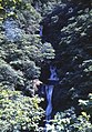
English: Devil's Bridge (, lit. "The bridge on the Mynach") is a village in Ceredigion, Wales. Its main feature is the bridge of the same name which spans the Mynach, a tributary of the Rheidol. It consists of three bridges built above each other. The most recently built was an iron bridge in 1901 which was built over a stone bridge constructed in 1753 when the original bridge was thought to be unstable, using the original bridge built (1075 - 1200) to support the scaffolding.
village and community in Ceredigion, Wales, UK  | |||||
| Upload media | |||||
| Instance of | |||||
|---|---|---|---|---|---|
| Location | Ceredigion, Wales | ||||
| Population |
| ||||
| Area |
| ||||
 | |||||
Subcategories
This category has the following 8 subcategories, out of 8 total.
A
C
- Capel Salem, Pontarfynach (3 F)
D
- Devil's Bridge AA box 289 (18 F)
H
- Hafod Arms Hotel (12 F)
M
T
- Trisant (11 F)
Media in category "Devil's Bridge, Ceredigion"
The following 200 files are in this category, out of 1,753 total.
(previous page) (next page)-
 "Stand by me" - geograph.org.uk - 6246764.jpg 1,024 × 768; 528 KB
-
 "The Glen" - geograph.org.uk - 6250532.jpg 1,024 × 768; 632 KB
-
-
 'Llywelyn' Approaching Devil's Bridge - geograph.org.uk - 4606895.jpg 4,000 × 2,666; 7.3 MB
-
 'Prince of Wales' passes by - geograph.org.uk - 5511069.jpg 1,280 × 960; 597 KB
-
 'Prince of Wales' passes by - geograph.org.uk - 5531512.jpg 640 × 480; 114 KB
-
 'Prince of Wales' Passing Rhiwfron Station - geograph.org.uk - 4606814.jpg 4,000 × 2,666; 7.41 MB
-
 A bluebell glade at the entrance to Coed Rheidol - geograph.org.uk - 5405889.jpg 1,024 × 768; 804 KB
-
 A clear sky and a calm morning - geograph.org.uk - 5584635.jpg 1,704 × 2,304; 1.11 MB
-
 A cottage in the valley - geograph.org.uk - 2922883.jpg 640 × 480; 219 KB
-
 A critical appraisal - geograph.org.uk - 3740583.jpg 640 × 427; 142 KB
-

-
 A Cwm Rheidol view - geograph.org.uk - 5358443.jpg 640 × 480; 256 KB
-
 A damp March day over Cwmystwyth - geograph.org.uk - 4855578.jpg 1,000 × 750; 786 KB
-
 A deer on the road near Gelmast - geograph.org.uk - 6234782.jpg 1,024 × 576; 466 KB
-
 A family walk in Coed Rheidol - geograph.org.uk - 4901247.jpg 3,672 × 4,896; 6.01 MB
-
 A fine winter's light on Pen Lan-fawr - geograph.org.uk - 5214040.jpg 640 × 480; 435 KB
-
-

-
 A glimpse of No. 9 through the trees at Derwen - geograph.org.uk - 4422173.jpg 1,024 × 768; 783 KB
-

-
 A large area of lush pasture - geograph.org.uk - 5754556.jpg 480 × 640; 273 KB
-
 A lightly-dusted Pen Lan-fawr - geograph.org.uk - 4746061.jpg 1,024 × 768; 806 KB
-
 A misty day in Cwm Rheidol - geograph.org.uk - 5839152.jpg 1,024 × 768; 352 KB
-
 A murky Mynach valley - geograph.org.uk - 3280544.jpg 1,000 × 750; 369 KB
-

-
 A scarred landscape - geograph.org.uk - 4551281.jpg 1,024 × 680; 301 KB
-

-
 A steep climb^ - geograph.org.uk - 5754547.jpg 480 × 640; 318 KB
-
 A study in green and white - geograph.org.uk - 5681290.jpg 640 × 480; 171 KB
-
 A tractor convention (2) - geograph.org.uk - 5534268.jpg 640 × 427; 84 KB
-
 A tractor convention - geograph.org.uk - 5533652.jpg 640 × 427; 74 KB
-

-

-
 A train heading for Devil's Bridge - geograph.org.uk - 5631906.jpg 640 × 480; 134 KB
-
 A train passing by - geograph.org.uk - 5975670.jpg 1,024 × 769; 746 KB
-

-

-

-

-

-
 A Vale of Rheidol train approaching the horseshoe curve - geograph.org.uk - 4636293.jpg 4,896 × 3,672; 6.13 MB
-
 A Vale of Rheidol train passes by - geograph.org.uk - 5824099.jpg 1,024 × 768; 492 KB
-

-
 A view across Cwm Rheidol - geograph.org.uk - 5531495.jpg 1,280 × 960; 244 KB
-
 A view across Cwm Rheidol - geograph.org.uk - 5629201.jpg 640 × 480; 114 KB
-
 A view across Cwm Rheidol - geograph.org.uk - 5651273.jpg 640 × 480; 59 KB
-
 A view across Cwm Rheidol - geograph.org.uk - 5852858.jpg 1,024 × 768; 523 KB
-

-
 A view across the forestry - geograph.org.uk - 6233050.jpg 1,024 × 576; 272 KB
-
 A view along Cwm Rheidol - geograph.org.uk - 5856856.jpg 1,024 × 768; 400 KB
-
 A view along Cwm Rheidol - geograph.org.uk - 5977205.jpg 1,024 × 576; 397 KB
-
 A view along Cwm Ystwyth - geograph.org.uk - 6246652.jpg 1,024 × 768; 371 KB
-
 A view down the path - geograph.org.uk - 5175301.jpg 640 × 480; 288 KB
-

-
 A view into the gloom - geograph.org.uk - 5514541.jpg 2,592 × 1,944; 2.19 MB
-
 A view over Cwm Gorlan and Cwm Ystwyth - geograph.org.uk - 6234400.jpg 1,024 × 576; 296 KB
-
-
 A view over Cwm Ystwyth - geograph.org.uk - 6234752.jpg 1,024 × 576; 284 KB
-
 A view over Gelmast Farm - geograph.org.uk - 6233080.jpg 1,024 × 576; 264 KB
-
-
 A view towards Cae-cynon mine - geograph.org.uk - 5717609.jpg 640 × 480; 239 KB
-
 A view towards Cefn Croes windfarm - geograph.org.uk - 2830633.jpg 640 × 480; 170 KB
-

-

-
 A view towards Erwtomau - geograph.org.uk - 5630577.jpg 640 × 480; 84 KB
-

-

-

-
 A winter view of Cwm Rheidol mine - 2001 - geograph.org.uk - 5540423.jpg 640 × 480; 157 KB
-
 A4120 Near Devil's Bridge - geograph.org.uk - 4606786.jpg 4,000 × 2,666; 7.36 MB
-

-
 Aberddaunant (house) - geograph.org.uk - 5691320.jpg 640 × 480; 260 KB
-
 Above Blaen-Myherin - geograph.org.uk - 3448234.jpg 640 × 480; 139 KB
-
 Above Coed Rheidol - geograph.org.uk - 5547396.jpg 640 × 427; 66 KB
-
 Above Cwm Rheidol - geograph.org.uk - 5355934.jpg 640 × 480; 201 KB
-
 Above Rhiwfron halt - geograph.org.uk - 5900479.jpg 1,280 × 960; 815 KB
-
 Above Rhiwfron station - geograph.org.uk - 5955975.jpg 1,024 × 769; 282 KB
-
 Above the railway - geograph.org.uk - 5659153.jpg 640 × 480; 120 KB
-

-
 Above the Vale of Rheidol Railway - geograph.org.uk - 4783337.jpg 640 × 480; 238 KB
-
 Above the Vale of Rheidol Railway - geograph.org.uk - 5977190.jpg 1,024 × 769; 704 KB
-
 Access to a footpath leading to Gelmast Farm - geograph.org.uk - 6234759.jpg 1,024 × 576; 462 KB
-
 Access to a green lane - geograph.org.uk - 6233044.jpg 1,024 × 576; 310 KB
-
 Across Cwm Ystwyth - geograph.org.uk - 3576739.jpg 640 × 480; 214 KB
-
 Across the Rheidol Valley - geograph.org.uk - 4606832.jpg 4,000 × 2,666; 7.92 MB
-
 Across the Three Bridges, Devil's Bridge - geograph.org.uk - 3084402.jpg 640 × 480; 102 KB
-
 Afon Diliw - geograph.org.uk - 4250521.jpg 1,024 × 688; 145 KB
-
 Afon Mynach - geograph.org.uk - 4609315.jpg 4,000 × 2,666; 7.3 MB
-
 Afon Mynach in full flow - geograph.org.uk - 5535403.jpg 427 × 640; 136 KB
-
 Afon Rheidol - defying the rules^ - geograph.org.uk - 5703402.jpg 480 × 640; 202 KB
-
 Afon Rheidol - geograph.org.uk - 4546580.jpg 1,500 × 2,250; 1.43 MB
-
 Afon Rheidol - geograph.org.uk - 4546621.jpg 1,500 × 2,250; 1.44 MB
-
 Afon Rheidol - geograph.org.uk - 4613434.jpg 480 × 640; 148 KB
-
 Afon Rheidol - geograph.org.uk - 4614689.jpg 480 × 640; 451 KB
-
 Afon Rheidol - geograph.org.uk - 4614695.jpg 640 × 480; 461 KB
-
 Afon Rheidol - geograph.org.uk - 4912934.jpg 640 × 480; 595 KB
-
 Afon Rheidol - geograph.org.uk - 4913617.jpg 640 × 480; 576 KB
-
 Afon Rheidol - geograph.org.uk - 5544495.jpg 640 × 480; 83 KB
-
 Afon Rheidol - geograph.org.uk - 5545663.jpg 410 × 640; 89 KB
-
 Afon Rheidol - geograph.org.uk - 5609017.jpg 640 × 480; 143 KB
-
 Afon Rheidol - geograph.org.uk - 5615794.jpg 640 × 480; 75 KB
-
 Afon Rheidol - geograph.org.uk - 5615798.jpg 640 × 480; 143 KB
-
 Afon Rheidol - geograph.org.uk - 5620335.jpg 640 × 480; 263 KB
-
 Afon Rheidol - geograph.org.uk - 5636315.jpg 640 × 480; 96 KB
-
 Afon Rheidol - geograph.org.uk - 5659186.jpg 640 × 480; 146 KB
-
 Afon Rheidol - geograph.org.uk - 5879791.jpg 3,000 × 4,000; 6.01 MB
-
 Afon Rheidol - geograph.org.uk - 5879829.jpg 3,000 × 4,000; 6.31 MB
-
 Afon Rheidol - geograph.org.uk - 5977210.jpg 1,024 × 769; 560 KB
-
-
 Afon Rheidol in upper Cwmrheidol - geograph.org.uk - 5846960.jpg 1,024 × 768; 493 KB
-
 Afon Rheidol looking downstream - geograph.org.uk - 5545688.jpg 640 × 406; 80 KB
-

-

-
 Afon Ystwyth - geograph.org.uk - 2726352.jpg 800 × 533; 147 KB
-
 Afon Ystwyth - geograph.org.uk - 3575456.jpg 640 × 480; 135 KB
-
 Afon Ystwyth - geograph.org.uk - 4098400.jpg 3,600 × 2,400; 4.05 MB
-
 Afon Ystwyth - geograph.org.uk - 4550290.jpg 800 × 531; 123 KB
-
 Afon Ystwyth - geograph.org.uk - 6246687.jpg 1,024 × 768; 723 KB
-
 Afon Ystwyth and Cwm Ystwyth - geograph.org.uk - 4551303.jpg 800 × 531; 143 KB
-
 Afon Ystwyth and Graig Ddu - geograph.org.uk - 5879464.jpg 4,000 × 3,000; 5.14 MB
-
 Afon Ystwyth from the Hafod viewpoint - geograph.org.uk - 3575606.jpg 640 × 480; 165 KB
-
 Afon Ystwyth, above the mines - geograph.org.uk - 3212083.jpg 1,000 × 687; 505 KB
-
 Afon Ystwyth, Hafod Uchtryd - geograph.org.uk - 3575531.jpg 640 × 480; 232 KB
-
 Afon Ystwyth, near to Cwmystwyth - geograph.org.uk - 5008792.jpg 640 × 480; 495 KB
-
 Allt Boeth viewed from Coed Rheidol - geograph.org.uk - 5657685.jpg 640 × 480; 68 KB
-
 Almost lost in the trees - geograph.org.uk - 4335319.jpg 1,024 × 768; 569 KB
-
 Almost ready for the off on the Vale of Rheidol - geograph.org.uk - 3994303.jpg 1,232 × 820; 664 KB
-

-

-
 Anchor at Woodland caravan park (2) - geograph.org.uk - 6031699.jpg 1,024 × 683; 242 KB
-
 Anchor at Woodland caravan park - geograph.org.uk - 6031698.jpg 1,024 × 683; 237 KB
-
 Ancient roadway in Coed Ty'n-y-castell - geograph.org.uk - 5175498.jpg 640 × 480; 259 KB
-
 Ancient tree, Hafod estate - geograph.org.uk - 3576641.jpg 480 × 640; 284 KB
-
 Angry Rheidol - geograph.org.uk - 4783425.jpg 640 × 480; 228 KB
-
 Angry Rheidol - geograph.org.uk - 5531589.jpg 1,280 × 960; 279 KB
-
 Approach to the Vale of Rheidol Railway - geograph.org.uk - 5608088.jpg 640 × 480; 134 KB
-

-
 Approaching Cwmystwyth - geograph.org.uk - 4550259.jpg 800 × 531; 117 KB
-

-
 Approaching Rhiwfron station - geograph.org.uk - 5955972.jpg 1,024 × 769; 811 KB
-
-
 Approaching the new Ty'n-y-castell foot crossing - geograph.org.uk - 5531580.jpg 1,280 × 960; 293 KB
-
 Approaching the public road - at last^ - geograph.org.uk - 6234369.jpg 1,024 × 576; 484 KB
-
 Approaching the railway - geograph.org.uk - 5636317.jpg 640 × 480; 110 KB
-
 Approaching the railway at Rhiwfron Station - geograph.org.uk - 6162893.jpg 1,024 × 769; 640 KB
-

-

-
-
 Approaching Tyllwyd - geograph.org.uk - 4551787.jpg 800 × 531; 134 KB
-
 Array of Colourful Trees - panoramio.jpg 5,184 × 3,456; 6.92 MB
-
 Ascending Bryn-llwyd - geograph.org.uk - 3154964.jpg 2,288 × 1,712; 801 KB
-
 At Devil's Bridge, Aberystwith, Wales-LCCN2001703408.jpg 2,500 × 3,379; 2.85 MB
-
 At Devils Bridge Aberystwith Wales.jpg 775 × 995; 156 KB
-
-
 Avenue of Trees, Esgair-Wen - geograph.org.uk - 5007182.jpg 640 × 480; 535 KB
-
 B4343 above Dolgors - geograph.org.uk - 3121887.jpg 512 × 640; 98 KB
-
 B4343 at Rhostyddin-fach - geograph.org.uk - 3245792.jpg 640 × 478; 52 KB
-
 B4343 at track entrance to Dolgors - geograph.org.uk - 3121893.jpg 640 × 414; 120 KB
-
 B4343 south of Glangorslwyd - geograph.org.uk - 3121855.jpg 640 × 409; 56 KB
-
 B4574 - geograph.org.uk - 5884309.jpg 3,737 × 2,492; 7.66 MB
-
 B4574 - geograph.org.uk - 5884317.jpg 3,816 × 2,545; 7.61 MB
-
 B4574 - geograph.org.uk - 5884325.jpg 3,498 × 2,333; 7.55 MB
-
 B4574 approaching The Arch - geograph.org.uk - 5009965.jpg 640 × 480; 432 KB
-
-

-

-
 B4574 from Hafod track - geograph.org.uk - 3554551.jpg 640 × 440; 90 KB
-
 B4574 junction at Devils Bridge - geograph.org.uk - 3121696.jpg 640 × 473; 123 KB
-
 B4574 towards Devil's Bridge - geograph.org.uk - 5009817.jpg 640 × 480; 520 KB
-
 B4574 Towards Devil's Bridge - geograph.org.uk - 5883789.jpg 3,260 × 2,174; 7.75 MB
-
 B4574 Towards Devil's Bridge - geograph.org.uk - 5883792.jpg 3,657 × 2,439; 7.53 MB
-
 B4574, Turn Off for Hafod - geograph.org.uk - 5009822.jpg 640 × 427; 369 KB
-
 Back along the Road - geograph.org.uk - 4264100.jpg 1,024 × 768; 116 KB
-
 Back down into Cwm Rheidol - geograph.org.uk - 4783409.jpg 640 × 480; 276 KB
-
 Bar and hotel, Devil's Bridge - geograph.org.uk - 3084285.jpg 640 × 560; 83 KB
-
 Beech trees by the track - geograph.org.uk - 4233749.jpg 640 × 480; 568 KB
-
 Beech woodland above Rhos y Cŵn - geograph.org.uk - 4233790.jpg 640 × 480; 532 KB
-
 Behind the pinnacles of Graig y Ddalfa - geograph.org.uk - 6052600.jpg 1,920 × 1,080; 1.28 MB
-
 Bench with a view - geograph.org.uk - 4612095.jpg 640 × 480; 229 KB
-
 Bend in the Road near Cwmystwyth - geograph.org.uk - 5009700.jpg 640 × 480; 523 KB
-
 Bends in B4343 approaching Pantycraf - geograph.org.uk - 3121906.jpg 640 × 447; 97 KB
-
 Beside the Vale of Rheidol Railway - geograph.org.uk - 5510294.jpg 1,280 × 960; 235 KB
-
 Beside the Vale of Rheidol Railway - geograph.org.uk - 5514555.jpg 2,592 × 1,944; 2.14 MB
-
 Beside the Vale of Rheidol Railway - geograph.org.uk - 5576889.jpg 640 × 480; 91 KB
-
 Beside the Vale of Rheidol Railway - geograph.org.uk - 5650069.jpg 640 × 480; 236 KB
-
 Beside the Vale of Rheidol Railway - geograph.org.uk - 5729557.jpg 640 × 480; 232 KB
-
 Beside the Vale of Rheidol Railway - geograph.org.uk - 5975494.jpg 1,024 × 769; 545 KB
-

-
-
 Bilberries in Cwm Rheidol - geograph.org.uk - 5510516.jpg 1,280 × 960; 313 KB
-
 Bitter Vetchling (Lathyrus linifolius) - geograph.org.uk - 4614668.jpg 640 × 531; 342 KB
-

-
 Blaen Myherin Farm - geograph.org.uk - 6010263.jpg 1,024 × 768; 240 KB
-
 Bluebells beside the path - geograph.org.uk - 5773629.jpg 640 × 480; 363 KB
-
 Bluebells in Coed Rheidol - geograph.org.uk - 5626307.jpg 640 × 480; 171 KB
-
 Bodcol farm near Devil's Bridge - geograph.org.uk - 2995154.jpg 640 × 480; 65 KB
-
 Bodcoll - geograph.org.uk - 3561462.jpg 3,872 × 2,592; 4.44 MB
-
 Bodcoll - geograph.org.uk - 5883730.jpg 3,260 × 2,174; 7.53 MB
-
 Bodcoll - geograph.org.uk - 5884497.jpg 3,419 × 2,280; 7.81 MB


_-_geograph.org.uk_-_5534268.jpg)


_-_geograph.org.uk_-_5691320.jpg)


_-_geograph.org.uk_-_6031699.jpg)


,_Cwmystwyth_-_geograph.org.uk_-_2726424.jpg)


_-_geograph.org.uk_-_5009810.jpg)

_-_geograph.org.uk_-_5009970.jpg)


_-_geograph.org.uk_-_4614668.jpg)


