Category:Dierikweg 1, Oudelande
Jump to navigation
Jump to search
| Object location | | View all coordinates using: OpenStreetMap |
|---|
building in Borsele, Netherlands  | |||||
| Upload media | |||||
| Instance of | |||||
|---|---|---|---|---|---|
| Part of | |||||
| Location | Oudelande, Zeeland, Netherlands | ||||
| Street address |
| ||||
| Located on street |
| ||||
| Architect | |||||
| Heritage designation |
| ||||
 | |||||
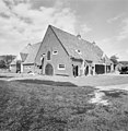
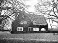
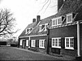
Nederlands: De Dierik
|
This is a category about rijksmonumentcomplex number 509130
|
Landhuis
|
This is a category about rijksmonument number 509131
|
Schuur
|
This is a category about rijksmonument number 509132
|
Varkenshok
|
This is a category about rijksmonument number 509133
|
Schuur
|
This is a category about rijksmonument number 509134
|
Kippenren
|
This is a category about rijksmonument number 509135
|
Garage
|
This is a category about rijksmonument number 509136
|
Erfinrichting
|
This is a category about rijksmonument number 509137
|
| Address |
|
Media in category "Dierikweg 1, Oudelande"
The following 22 files are in this category, out of 22 total.
-
 Achter- en zijgevel - Oudelande - 20467522 - RCE.jpg 1,200 × 900; 225 KB
-
 Achter- en zijgevel - Oudelande - 20467523 - RCE.jpg 1,200 × 900; 225 KB
-
 Erf - Oudelande - 20467521 - RCE.jpg 1,200 × 900; 160 KB
-
 Kop- en zijgevel - Oudelande - 20467536 - RCE.jpg 1,200 × 900; 164 KB
-
 Kopgevel - Oudelande - 20467533 - RCE.jpg 1,200 × 900; 141 KB
-
 Kopgevel - Oudelande - 20467537 - RCE.jpg 1,200 × 900; 128 KB
-
 Mestvaal, varkensstal en schuur - Oudelande - 20467535 - RCE.jpg 1,200 × 900; 134 KB
-
 Oudelande Hof de Dierik schuur.jpg 1,174 × 1,200; 365 KB
-
 Oudelande Hof de Dierik.jpg 1,167 × 1,200; 317 KB
-
 Schuur en oprit - Oudelande - 20467526 - RCE.jpg 1,200 × 900; 251 KB
-
 Schuur op erf - Oudelande - 20467539 - RCE.jpg 1,200 × 900; 212 KB
-
 Schuur op het erf - Oudelande - 20467528 - RCE.jpg 1,200 × 900; 176 KB
-
 Schuur, oprit, garage en woning - Oudelande - 20467520 - RCE.jpg 1,200 × 900; 229 KB
-
 Voorgevel - Oudelande - 20467525 - RCE.jpg 1,200 × 900; 239 KB
-
 Voorgevel - Oudelande - 20467530 - RCE.jpg 1,200 × 900; 248 KB
-
 Zij- en kopgevel - Oudelande - 20467524 - RCE.jpg 1,200 × 900; 214 KB
-
 Zij- en kopgevel - Oudelande - 20467534 - RCE.jpg 1,200 × 900; 180 KB
-
 Zij- en voorgevel - Oudelande - 20467529 - RCE.jpg 1,200 × 900; 227 KB
-
 Zijgevel - Oudelande - 20467527 - RCE.jpg 1,200 × 900; 181 KB
-
 Zijgevel - Oudelande - 20467531 - RCE.jpg 1,200 × 900; 164 KB
-
 Zijgevel - Oudelande - 20467532 - RCE.jpg 1,200 × 900; 180 KB
-
 Zijgevel - Oudelande - 20467538 - RCE.jpg 1,200 × 900; 151 KB


