Category:Doddington, Kent
Vai alla navigazione
Vai alla ricerca
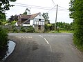
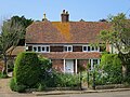
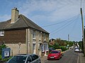
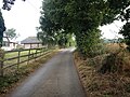
English: Doddington is a rural English village, in the south eastern county of Kent, within the borough of Swale. A picturesque village nestling in the Syndale Valley with neighbouring village Newnham (half a mile to the east of Doddington) and is in the Kent Downs, designated as an 'area of outstanding natural beauty'.
village and civil parish in Kent, UK  | |||||
| Carica un file multimediale | |||||
| Istanza di | |||||
|---|---|---|---|---|---|
| Luogo | Swale, Kent, Sud Est dell'Inghilterra, Inghilterra | ||||
| Considerato essere uguale a | Doddington (pagina Wikimedia duplicata, parrocchia civile dell'Inghilterra) | ||||
 | |||||
Sottocategorie
Questa categoria contiene le 3 sottocategorie indicate di seguito, su un totale di 3.
O
- Oasts in Doddington (3 F)
S
- Sharsted Court (10 F)
File nella categoria "Doddington, Kent"
Questa categoria contiene 200 file, indicati di seguito, su un totale di 212.
(pagina precedente) (pagina successiva)-
 002osd00000027au00428000.jpg 4 000 × 2 695; 5,47 MB
-

-

-
 Aerial Picture Westend.jpg 567 × 387; 48 KB
-
 Autumn colour at Doddington - geograph.org.uk - 5604602.jpg 640 × 480; 132 KB
-
-

-
 Azaleas - Doddington Place Gardens - geograph.org.uk - 2961111.jpg 1 600 × 1 200; 856 KB
-

-
 Birchwood Cottage - geograph.org.uk - 1297941.jpg 640 × 480; 106 KB
-
 Boxes ready for fruit-picking at Homestall Farm - geograph.org.uk - 5808063.jpg 4 000 × 3 000; 5,02 MB
-
 Boxes ready for fruit-picking at Homestall Farm - geograph.org.uk - 5808067.jpg 4 000 × 3 000; 4,92 MB
-
 Boxes ready for fruit-picking at Homestall Farm - geograph.org.uk - 5808076.jpg 4 000 × 3 000; 4,69 MB
-
 Brewster Road, Doddington - geograph.org.uk - 5110440.jpg 3 264 × 2 448; 2,55 MB
-
 Bridge over M2 - geograph.org.uk - 2565688.jpg 640 × 480; 171 KB
-
 Bridge over the M2 - geograph.org.uk - 5808020.jpg 4 000 × 3 000; 4,95 MB
-
 Bridge over the M2 near Erriottwood - geograph.org.uk - 3721313.jpg 640 × 480; 243 KB
-
 Cafe - Doddington Place Gardens - geograph.org.uk - 2961708.jpg 1 600 × 1 200; 494 KB
-
 Chequers Hill Road - geograph.org.uk - 2565610.jpg 640 × 480; 104 KB
-
 Chequers Hill Road - geograph.org.uk - 2565678.jpg 640 × 480; 150 KB
-
 Chequers Hill Road bridge over the M2 Motorway - geograph.org.uk - 2063923.jpg 3 072 × 2 304; 1,74 MB
-
 Chequers Hill Road, Doddington - geograph.org.uk - 5110436.jpg 3 264 × 2 448; 1,76 MB
-
 Chequers Hill Road, Doddington - geograph.org.uk - 5110437.jpg 3 264 × 2 448; 1,72 MB
-
 Chequers Hill Road, Doddington - geograph.org.uk - 5110438.jpg 3 264 × 2 448; 1,96 MB
-
 Chequers Hill Road, Doddington - geograph.org.uk - 5110596.jpg 3 264 × 2 448; 2,03 MB
-
 Chequers Inn sign - geograph.org.uk - 2563919.jpg 480 × 640; 141 KB
-
 Chequers Inn, Doddington - geograph.org.uk - 5110638.jpg 3 264 × 2 448; 2,34 MB
-
 Church Hill - geograph.org.uk - 3842625.jpg 640 × 480; 169 KB
-
 Church Hill, Doddington - geograph.org.uk - 5029178.jpg 4 608 × 3 456; 3,37 MB
-
 Church Lane, Doddington - geograph.org.uk - 5110599.jpg 3 264 × 2 448; 2,81 MB
-

-
 Crossing over the M2 - geograph.org.uk - 5808013.jpg 4 000 × 3 000; 4,7 MB
-

-
 Doddington Church - geograph.org.uk - 5604577.jpg 640 × 470; 84 KB
-
 Doddington open gardens - geograph.org.uk - 4989186.jpg 4 000 × 3 000; 3,09 MB
-
 Doddington Place Farm - geograph.org.uk - 2961515.jpg 1 600 × 1 200; 467 KB
-
 Doddington Place Gardens - geograph.org.uk - 2962188.jpg 1 600 × 1 200; 713 KB
-
 Doddington Place Gardens - geograph.org.uk - 5010981.jpg 4 608 × 3 456; 3,35 MB
-
 Doddington Place Gardens - geograph.org.uk - 5011063.jpg 4 608 × 3 456; 3,39 MB
-
 Doddington Place Mansion - geograph.org.uk - 2961725.jpg 1 600 × 1 200; 594 KB
-
 Doddington Place Mansion - geograph.org.uk - 2961729.jpg 1 600 × 1 032; 520 KB
-
 Doddington Place, Doddington - geograph.org.uk - 2958848.jpg 640 × 480; 94 KB
-
 Doddington Place, near Faversham - geograph.org.uk - 6105751.jpg 640 × 477; 109 KB
-
 Doddington Service Station - geograph.org.uk - 4981984.jpg 3 848 × 2 886; 3,68 MB
-
 Doddington village hall, The Street - geograph.org.uk - 6317260.jpg 3 264 × 2 448; 3,72 MB
-
 Doddington Village Sign - geograph.org.uk - 1223144.jpg 480 × 640; 107 KB
-
 Doddington Village Sign - geograph.org.uk - 1223158.jpg 480 × 640; 85 KB
-

-
 Doughty's butcher shop, Doddington - geograph.org.uk - 183698.jpg 640 × 480; 111 KB
-
 Down Court Farm, Doddington - geograph.org.uk - 5604550.jpg 640 × 443; 91 KB
-
 Down Court Farm, Doddington - geograph.org.uk - 5604555.jpg 395 × 640; 75 KB
-
 Dully Hill, Doddington - geograph.org.uk - 5110694.jpg 3 264 × 2 448; 2,16 MB
-
 Dunelm House - geograph.org.uk - 4989177.jpg 4 000 × 3 000; 3,36 MB
-
 Eastbound M2 with chevrons - geograph.org.uk - 5828070.jpg 1 024 × 684; 198 KB
-
 Entering Doddington - geograph.org.uk - 1421194.jpg 640 × 427; 100 KB
-
 Entrance to Sharsted Wood - geograph.org.uk - 1431785.jpg 480 × 640; 94 KB
-
 EP garage sign - geograph.org.uk - 4982037.jpg 3 000 × 4 000; 2,76 MB
-
 Field south of Doddington - geograph.org.uk - 2565587.jpg 640 × 480; 120 KB
-
 Field south of Doddington - geograph.org.uk - 2565591.jpg 640 × 480; 137 KB
-
 Fields south of Doddington - geograph.org.uk - 2563987.jpg 640 × 480; 146 KB
-

-
 Folly Walk, Doddington Place Gardens - geograph.org.uk - 2961513.jpg 1 600 × 1 200; 767 KB
-
 Folly Walk, Doddington Place Gardens - geograph.org.uk - 2961521.jpg 1 600 × 1 200; 692 KB
-
 Footbridge, M2 - geograph.org.uk - 5208022.jpg 640 × 426; 52 KB
-
 Footpath seen from Chequers Hill - geograph.org.uk - 5807218.jpg 4 000 × 3 000; 4,64 MB
-
 Footpath to Down Court - geograph.org.uk - 1223153.jpg 640 × 480; 96 KB
-
 Formal terrace in Doddington Place Gardens - geograph.org.uk - 5011199.jpg 4 608 × 3 456; 3,39 MB
-
 Fruit boxes at Homestall Farm - geograph.org.uk - 2565706.jpg 640 × 480; 167 KB
-
 Geese and a gosling - geograph.org.uk - 183694.jpg 640 × 480; 146 KB
-
 Glass Obelisk, Doddington Place Gardens - geograph.org.uk - 2961528.jpg 1 068 × 1 600; 360 KB
-
 Grey Gates - geograph.org.uk - 4989175.jpg 4 000 × 3 000; 3,85 MB
-
 Harvested field off Chequers Hill Road - geograph.org.uk - 2565681.jpg 640 × 480; 123 KB
-

-
 Homestall Road - geograph.org.uk - 6151360.jpg 1 024 × 684; 470 KB
-
 Homestall Road, near Lynsted - geograph.org.uk - 5110422.jpg 3 264 × 2 448; 3,21 MB
-
 Homestall Road, near Newnham - geograph.org.uk - 5111943.jpg 3 264 × 2 448; 2,08 MB
-
 Hopes Hill, Doddington - geograph.org.uk - 5110643.jpg 2 448 × 2 448; 1,31 MB
-
 Houses on The Street, Doddington - geograph.org.uk - 1421197.jpg 640 × 427; 77 KB
-
 Hydrangeas on Tickham Lane, Erriotwood - geograph.org.uk - 5043075.jpg 2 304 × 1 728; 799 KB
-
 Hydrangeas on Tickham Lane, Erriotwood - geograph.org.uk - 5043077.jpg 2 304 × 1 728; 1,73 MB
-
 In the Sunk Garden at Doddington Place Gardens - geograph.org.uk - 5011220.jpg 4 608 × 3 456; 3,38 MB
-
 Keep apart 2 chevrons - geograph.org.uk - 5980564.jpg 1 024 × 576; 90 KB
-
 Lady Margaret Manor Road, near Doddington - geograph.org.uk - 5110665.jpg 3 264 × 2 448; 2,58 MB
-
 Lady Margaret Manor Road, near Doddington - geograph.org.uk - 5112786.jpg 3 264 × 2 448; 1,99 MB
-
 Lady Margaret Manor Road, near Doddington - geograph.org.uk - 5112794.jpg 2 448 × 2 448; 1,48 MB
-
 Lane from Temple Farm to Seed Road - geograph.org.uk - 4692315.jpg 640 × 480; 108 KB
-
 Lane near Pembles Wence - geograph.org.uk - 1421288.jpg 640 × 480; 84 KB
-
 Lane towards Lady Margaret Manor - geograph.org.uk - 5666156.jpg 640 × 480; 217 KB
-
 Limekiln Cottage - geograph.org.uk - 1223137.jpg 640 × 480; 76 KB
-
 Little Higham - geograph.org.uk - 1223163.jpg 640 × 480; 92 KB
-
 Looking across Chequers Hill - geograph.org.uk - 5807221.jpg 4 000 × 3 000; 5,03 MB
-
 M2 Motorway - geograph.org.uk - 5110434.jpg 3 264 × 2 448; 1,61 MB
-
 M2 Motorway - geograph.org.uk - 5808049.jpg 4 000 × 3 000; 5,02 MB
-
 M2 Motorway heading towards Faversham - geograph.org.uk - 2063928.jpg 3 072 × 2 304; 2,15 MB
-
 M2 Motorway near Erriottwood - geograph.org.uk - 2973338.jpg 2 256 × 1 496; 809 KB
-
 M2 westbound - geograph.org.uk - 5862974.jpg 1 024 × 684; 230 KB
-
 M2 with chevrons - geograph.org.uk - 3842645.jpg 640 × 480; 104 KB
-

-
 M2, overbridge near Erriottwood - geograph.org.uk - 2495236.jpg 640 × 428; 46 KB
-
 M2, westbound - geograph.org.uk - 5208021.jpg 640 × 426; 48 KB
-

-

-
 Motorway to Sittingbourne - geograph.org.uk - 2063934.jpg 3 072 × 2 304; 1,84 MB
-
 New housing development, Chequers Hill - geograph.org.uk - 4989131.jpg 3 900 × 2 928; 3,08 MB
-
 New housing development, Chequers Hill - geograph.org.uk - 4989133.jpg 3 908 × 2 934; 3,49 MB
-
 New housing development, Chequers Hill - geograph.org.uk - 4989134.jpg 3 740 × 2 808; 3,05 MB
-
 Old Lenham Road, Doddington - geograph.org.uk - 5110671.jpg 3 264 × 2 448; 1,85 MB
-
 Old Lenham Road, near Doddington - geograph.org.uk - 5110651.jpg 2 448 × 2 448; 1,76 MB
-
 Old Lenham Road, near Doddington - geograph.org.uk - 5110657.jpg 3 264 × 2 448; 1,95 MB
-
 Open garden, Doddington - geograph.org.uk - 4982040.jpg 3 000 × 4 000; 4,57 MB
-
 Open garden, Doddington - geograph.org.uk - 4982044.jpg 3 000 × 4 000; 4,89 MB
-
 Open garden, Doddington - geograph.org.uk - 4982056.jpg 3 000 × 4 000; 3,99 MB
-
 Open garden, Doddington - geograph.org.uk - 4982070.jpg 4 000 × 3 000; 4,57 MB
-
 Open garden, Doddington - geograph.org.uk - 4982072.jpg 4 000 × 3 000; 4,65 MB
-
 Open garden, Doddington - geograph.org.uk - 4982075.jpg 4 000 × 3 000; 4,3 MB
-
 Open garden, Doddington - geograph.org.uk - 4982320.jpg 3 000 × 4 000; 4,2 MB
-
 Open garden, Doddington - geograph.org.uk - 4982323.jpg 4 000 × 3 000; 4,36 MB
-
 Open garden, Doddington - geograph.org.uk - 4982501.jpg 4 000 × 3 000; 4,37 MB
-
 Open garden, Doddington - geograph.org.uk - 4982504.jpg 4 000 × 3 000; 5,91 MB
-
 Palace Farm - geograph.org.uk - 1223146.jpg 640 × 480; 92 KB
-
 Path in the Rock Garden at Doddington Place Gardens - geograph.org.uk - 5012087.jpg 4 608 × 3 456; 3,36 MB
-
 Pineapple mayweed (Chamomilla suaveolens) - geograph.org.uk - 183956.jpg 640 × 485; 188 KB
-
 Pinetrees Farm - geograph.org.uk - 1223134.jpg 640 × 480; 138 KB
-
 Pond in Doddington Place Gardens - geograph.org.uk - 2962179.jpg 1 600 × 1 200; 735 KB
-
 Poplar windbreak - geograph.org.uk - 3842639.jpg 480 × 640; 157 KB
-
 Post Office Cottage ^ The Old Post Office, The Street - geograph.org.uk - 4989185.jpg 4 000 × 3 000; 2,93 MB
-
 Puddle near Moonfield Farm - geograph.org.uk - 3842650.jpg 640 × 480; 179 KB
-
 Rapsons, The Street - geograph.org.uk - 4989184.jpg 4 000 × 3 000; 3,13 MB
-
 Removals lorries by Chequers Hill - geograph.org.uk - 2565606.jpg 480 × 640; 137 KB
-

-
 Rhododendrons in Doddington Place gardens - geograph.org.uk - 2961073.jpg 1 600 × 1 200; 821 KB
-
 Ringlestone Road, near Doddington - geograph.org.uk - 5110710.jpg 3 264 × 2 448; 2,84 MB
-
 Road south of Doddington - geograph.org.uk - 2565580.jpg 640 × 480; 104 KB
-
 Roadside daisies - geograph.org.uk - 183757.jpg 480 × 640; 161 KB
-
 S.W.Doughty, family butcher - geograph.org.uk - 736416.jpg 640 × 480; 93 KB
-
 Sculpture - Doddington Place gardens - geograph.org.uk - 2962202.jpg 1 600 × 996; 596 KB
-
 Seed Bungalow - geograph.org.uk - 1223248.jpg 640 × 480; 102 KB
-
 Seed Road, near Otterden - geograph.org.uk - 5112733.jpg 3 055 × 2 291; 1,82 MB
-
 Seed Road, near Otterden - geograph.org.uk - 5112775.jpg 3 264 × 2 448; 2,03 MB
-
 Sharsted Court, Newnham - geograph.org.uk - 5604456.jpg 640 × 462; 77 KB
-
 Sharsted Court, wall and topiary - geograph.org.uk - 5604460.jpg 640 × 453; 61 KB
-
 Sharsted Lodge - geograph.org.uk - 1223312.jpg 640 × 480; 129 KB
-
 Sheep on Sprats Hill - geograph.org.uk - 4692306.jpg 640 × 480; 79 KB
-
 Slips Cottage, Doddington - geograph.org.uk - 5604490.jpg 640 × 478; 70 KB
-
 Small building on Old Lenham Road - geograph.org.uk - 183925.jpg 640 × 480; 128 KB
-
 Spring Gardens -Doddington Place - geograph.org.uk - 2961523.jpg 1 600 × 1 200; 692 KB
-
 Stables at Homestall Farm, Doddington - geograph.org.uk - 1450573.jpg 640 × 480; 103 KB
-
 Steps in Doddington Place Gardens - geograph.org.uk - 5011174.jpg 4 608 × 3 456; 3,4 MB
-
 Stuppington Cottages, Norton Road, Norton - geograph.org.uk - 5111940.jpg 3 264 × 2 448; 1,89 MB
-
 Sunken Garden - Doddington Place - geograph.org.uk - 2961718.jpg 1 600 × 1 200; 448 KB
-
 Tawnyhill open garden - geograph.org.uk - 6172352.jpg 3 456 × 5 184; 1,59 MB
-
 Tawnyhill open garden - geograph.org.uk - 6172354.jpg 5 184 × 3 456; 1,85 MB
-
 The Beheading of St John the Baptist Church, Doddington - geograph.org.uk - 5029171.jpg 4 608 × 3 456; 3,33 MB
-
 The Beheading of St John the Baptist Church, Doddington - geograph.org.uk - 5029172.jpg 4 608 × 3 456; 3,35 MB
-
 The Beheading of St John the Baptist Churchyard, Doddington - geograph.org.uk - 5029174.jpg 4 608 × 3 456; 3,39 MB
-
 The Beheading of St.John the Baptist, Doddington - geograph.org.uk - 3755041.jpg 1 024 × 577; 175 KB
-
 The Chequers Inn sign - geograph.org.uk - 6248922.jpg 3 180 × 4 240; 477 KB
-
 The Chequers Inn, Doddington - geograph.org.uk - 1908880.jpg 3 488 × 2 616; 2,18 MB
-
 The Chequers Inn, Doddington - geograph.org.uk - 3203991.jpg 2 560 × 1 920; 1,13 MB
-
 The Chequers Inn, Doddington - geograph.org.uk - 6248925.jpg 5 184 × 3 456; 1,54 MB
-
 The Foam Factory, Doddington - geograph.org.uk - 4707.jpg 640 × 480; 123 KB
-
 The M2 - geograph.org.uk - 5208023.jpg 640 × 426; 45 KB
-
 The Old School House, Doddington - geograph.org.uk - 1240131.jpg 640 × 480; 93 KB
-
 The Rock Garden at Doddington Place Gardens - geograph.org.uk - 5011086.jpg 4 608 × 3 456; 3,35 MB
-
 The Rock Garden at Doddington Place Gardens - geograph.org.uk - 5011089.jpg 4 608 × 3 456; 3,36 MB
-
 The Rock Garden at Doddington Place Gardens - geograph.org.uk - 5011165.jpg 4 608 × 3 456; 3,4 MB
-
 The Rock Garden at Doddington Place Gardens - geograph.org.uk - 5011169.jpg 4 608 × 3 456; 3,41 MB
-
 The Rock Garden at Doddington Place Gardens - geograph.org.uk - 5012071.jpg 4 608 × 3 456; 3,38 MB
-
 The Rock Garden at Doddington Place Gardens - geograph.org.uk - 5012076.jpg 4 608 × 3 456; 3,4 MB
-
 The Rock Garden at Doddington Place Gardens - geograph.org.uk - 5012080.jpg 4 608 × 3 456; 3,39 MB
-
 The Street, Doddington - geograph.org.uk - 1421224.jpg 640 × 480; 126 KB
-
 The Street, Doddington - geograph.org.uk - 5110601.jpg 3 264 × 2 448; 1,99 MB
-
 The Street, Doddington - geograph.org.uk - 5110602.jpg 3 264 × 2 448; 1,95 MB
-
 The Street, Doddington - geograph.org.uk - 5110634.jpg 3 264 × 2 448; 1,85 MB
-
 The Street, Doddington - geograph.org.uk - 5110646.jpg 3 264 × 2 448; 1,89 MB
-
 The Street, Doddington - geograph.org.uk - 5110691.jpg 3 264 × 2 448; 2,17 MB
-
 The Street, Doddington - geograph.org.uk - 5110698.jpg 3 264 × 2 448; 1,68 MB
-
 The Street, Frinsted - geograph.org.uk - 3203983.jpg 2 560 × 1 920; 2,3 MB
-
 The Sunk Garden and Doddington Place - geograph.org.uk - 5011066.jpg 4 608 × 3 456; 3,39 MB
-
 The Sunk Garden at Doddington Place Gardens - geograph.org.uk - 5011051.jpg 4 608 × 3 456; 3,38 MB
-
 The Sunk Garden at Doddington Place Gardens - geograph.org.uk - 5011056.jpg 4 608 × 3 456; 3,35 MB
-
 The Sunk Garden at Doddington Place Gardens - geograph.org.uk - 5011070.jpg 4 608 × 3 456; 3,41 MB
-
 The Sunk Garden at Doddington Place Gardens - geograph.org.uk - 5011074.jpg 4 608 × 3 456; 3,4 MB
-
 The Wellingtonia Walk at Doddington Place Gardens - geograph.org.uk - 5011601.jpg 4 608 × 3 456; 3,38 MB
-
 Tickham Lane - geograph.org.uk - 5808031.jpg 4 000 × 3 000; 4,54 MB
-
 Tickham Lane - geograph.org.uk - 5808042.jpg 4 000 × 3 000; 4,75 MB
-
 Tickham Lane, Erriotwood - geograph.org.uk - 5043073.jpg 2 304 × 1 728; 1,33 MB
-
 Tickham Lane, Lynsted - geograph.org.uk - 5110432.jpg 3 264 × 2 448; 3,17 MB
-

-
 Track into Kingsdown Wood - geograph.org.uk - 1221742.jpg 640 × 480; 117 KB
-
 Track into Kingsdown Wood - geograph.org.uk - 1221747.jpg 640 × 480; 123 KB
-
 Track through Sharsted Wood, Newnham - geograph.org.uk - 5604504.jpg 640 × 472; 172 KB
-
 Track through Sharsted Wood, Newnham - geograph.org.uk - 5604514.jpg 475 × 640; 160 KB
-
 Track to Little Sharsted Farm - geograph.org.uk - 2565689.jpg 640 × 480; 179 KB
-

-

-

-

-
 View from the Rock Garden at Doddington Place Gardens - geograph.org.uk - 5012095.jpg 4 608 × 3 456; 3,35 MB
-
 View from the Rock Garden at Doddington Place Gardens - geograph.org.uk - 5012099.jpg 4 608 × 3 456; 3,39 MB


_-_geograph.org.uk_-_183956.jpg)


