Category:Dorfhain
Jump to navigation
Jump to search
Urban municipalities:
Dippoldiswalde · Freital · Pirna · Sebnitz · Altenberg · Bad Gottleuba-Berggießhübel · Bad Schandau · Dohna · Glashütte · Heidenau · Hohnstein · Königstein · Liebstadt · Neustadt · Rabenau · Stolpen · Tharandt · Wehlen · Wilsdruff
Rural municipalities:
Former municipalities:
municipality in the Sächsische Schweiz-Osterzgebirge district, in Saxony, Germany neu.JPG)   | |||||
| Upload media | |||||
| Instance of |
| ||||
|---|---|---|---|---|---|
| Location |
| ||||
| Located in or next to body of water | |||||
| Population |
| ||||
| Area |
| ||||
| Elevation above sea level |
| ||||
| official website | |||||
 | |||||

Subcategories
This category has the following 8 subcategories, out of 8 total.
B
E
N
S
🖃
Media in category "Dorfhain"
The following 39 files are in this category, out of 39 total.
-
 20070721050DR Dorfhain Stollen Reicher Silbersegen.jpg 2,495 × 1,845; 5.51 MB
-
 20070721055DR Dorfhain Stollen Reicher Silbersegen.jpg 1,920 × 2,556; 4.85 MB
-
 20140618170DR Tharandter Wald Tunnel unter Eisenbahn.jpg 3,181 × 2,373; 5.42 MB
-
 20140618180DR Tharandter Wald Tunnel unter Eisenbahn.jpg 3,168 × 2,313; 5.69 MB
-
 20180824600DR Dorfhain Hunt am Parkplatz zum Aurora Stolln.jpg 3,076 × 2,448; 5.96 MB
-
 20180824610DR Dorfhain Tiefer Neujahrswechselstolln.jpg 2,736 × 3,311; 7.47 MB
-
 20180824620DR Dorfhain Tiefer Neujahrswechselstolln.jpg 2,736 × 3,647; 7.05 MB
-
 20180824635DR Dorfhain Getrost Mut Erbstolln.jpg 2,736 × 3,629; 6.48 MB
-
 20180824640DR Dorfhain Getrost Mut Erbstolln.jpg 3,380 × 2,732; 6.64 MB
-
 20180824650DR Dorfhain Aurora Erbstolln Schaubergwerk.jpg 3,648 × 2,728; 7.01 MB
-
 20180824655DR Dorfhain Aurora Erbstolln Schaubergwerk.jpg 3,648 × 2,732; 7.74 MB
-
 20180824660DR Dorfhain Aurora Erbstolln Schaubergwerk Grubenhunte.jpg 3,456 × 2,608; 6.79 MB
-
 20180824680DR Dorfhain Neuer Silbersegen Erbstolln.jpg 3,580 × 2,651; 6.41 MB
-
 20180826200MDR Dorfhain Wasserkraftwerk.jpg 6,164 × 2,683; 11.13 MB
-
 20180826205DR Dorfhain Wasserkraftwerk.jpg 3,648 × 2,727; 7 MB
-
 20180826210DR Dorfhain Wasserkraftwerk.jpg 3,514 × 2,682; 6.39 MB
-
 20180826220DR Dorfhain Betonwerk Mende Am Wasserkraftwerk.jpg 3,648 × 2,728; 6.89 MB
-
 Dorfhain in PIR.svg 1,593 × 978; 326 KB
-
 Dorfhain-Bahnbrücke-EdleKrone.jpg 3,453 × 2,302; 1.82 MB
-
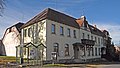
 Dorfhain-Bergstr-06.jpg 3,099 × 2,324; 1.66 MB
-
 Dorfhain-Bergstr-19.jpg 2,972 × 2,229; 1.42 MB
-
 Dorfhain-Brücke-2.jpg 3,593 × 2,395; 1.63 MB
-
 Dorfhain-Schulstr-2-Dorfmühle.jpg 3,497 × 2,623; 1.65 MB
-
 Dorfhain-Stolln-Silbersegen.jpg 2,624 × 3,499; 1.54 MB
-
 Dorfhain-Talstr-Grenzstein-Kläranlage.jpg 3,573 × 2,134; 1.5 MB
-
 Dorfhain-Wildschütz.jpg 3,596 × 2,023; 1.53 MB
-
 Fotothek df rp-c 0740000 Dorfhain. Oberreit, Sect. Dresden, 1821-22.jpg 800 × 515; 242 KB
-
 Fotothek df rp-c 0740001 Dorfhain. Oberreit, Sect. Dresden, 1821-22.jpg 800 × 514; 241 KB
-
 Fotothek df rp-c 0740003 Dorfhain. Oberreit, Sect. Dresden, 1821-22.jpg 800 × 525; 245 KB
-
 Grillenburg-Bahndurchlass-1.jpg 3,630 × 2,324; 1.35 MB
-
 Grillenburg-Bahndurchlass-2.jpg 3,299 × 2,502; 1.78 MB
-
 Grillenburg-Baumpilz.jpg 3,648 × 2,432; 1.4 MB
-
 Meilenblatt B 259 Dorfhain.jpg 9,000 × 9,040; 32.36 MB
-
 Siegelmarke Gemeinde Dorfhain Amtsh. Dresden-Altstadt W0314435.jpg 270 × 187; 13 KB
-
 Siegelmarke Gemeinde Dorfhain W0344478.jpg 270 × 191; 10 KB
-
 Siegelmarke Schulvorstand zu Dorfhain W0262223.jpg 270 × 187; 11 KB
-
 Wappen dorfhain.png 119 × 144; 40 KB
-
 Wilde Weißeritz 2.jpg 6,000 × 4,000; 9.44 MB
-
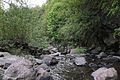 Wilde Weißeritz.jpg 6,000 × 4,000; 8.21 MB


